Hawthorn Corner

Settlement in Kent Canterbury

England

Hawthorn Corner

Direction Sign – Signpost on Old Tree Road, Boyden Gate Located at Boyden Gate on the northwest side of the junction of Boyden Gate Hill, Old Tree Road and Church Lane in Hoath parish. 3 arms and pyramid finial. See also <a title="https://www.geograph.org.uk/photo/373289" href="https://www.geograph.org.uk/photo/373289">Link</a>.

Milestone Society National ID: KE_TR2265
Direction Sign – Signpost on Old Tree Road, Boyden Gate Credit: John V Nicholls

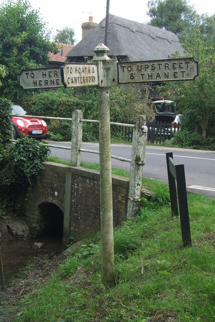
Hawthorn Corner is a small village located in the county of Kent, England. Situated in the southeastern part of the country, it is nestled amidst picturesque landscapes and rolling hills. The village is known for its tranquil and serene atmosphere, making it an ideal escape from the hustle and bustle of city life.

The village is characterized by its charming cottages, many of which date back to the 18th and 19th centuries, giving it a distinct historic feel. The local architecture is a mix of traditional and modern styles, creating a unique blend of old-world charm and contemporary design.

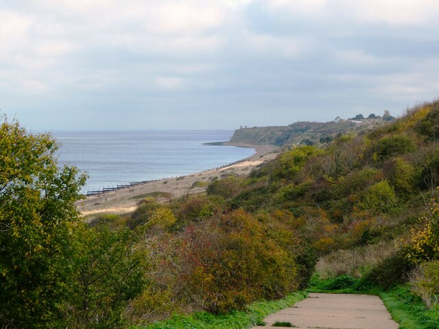
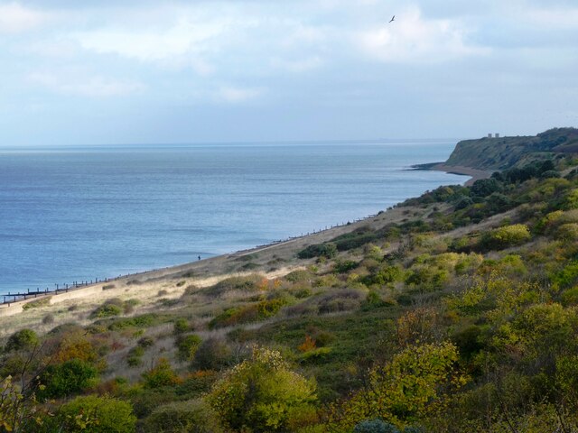
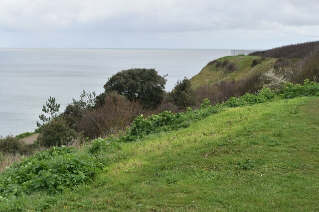
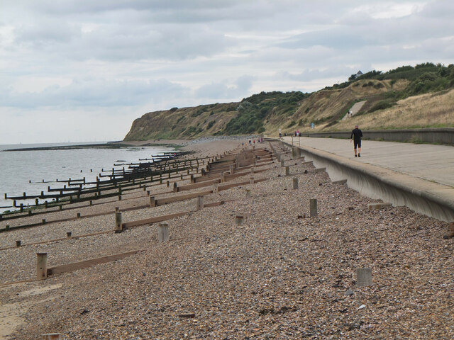
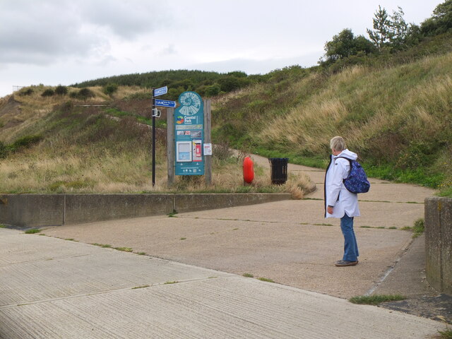
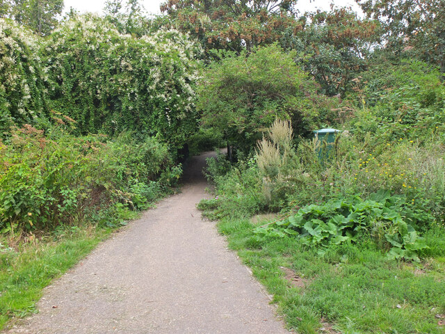
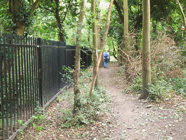
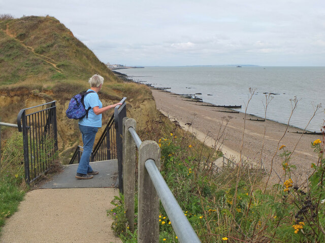
Hawthorn Corner is surrounded by lush green fields and meadows, making it a popular destination for nature enthusiasts. The village is a haven for walkers and hikers, with a number of scenic trails and footpaths crisscrossing the surrounding countryside. These trails offer breathtaking views of the countryside, including rolling hills, meandering rivers, and vibrant wildflowers.

Despite its small size, Hawthorn Corner boasts a close-knit community and a range of amenities. The village has a local pub, a village hall, and a small convenience store, providing residents with the essentials. It also hosts a variety of community events throughout the year, fostering a sense of camaraderie among its residents.

Overall, Hawthorn Corner is a hidden gem in the heart of Kent, offering a peaceful and idyllic retreat for those seeking a slower pace of life and a connection with nature.

If you have any feedback on the listing, please let us know in the comments section below.

Hawthorn Corner Images

Images are sourced within 2km of 51.360747/1.174579 or Grid Reference TR2167. Thanks to Geograph Open Source API. All images are credited.

Direction Sign – Signpost on Old Tree Road, Boyden Gate Located at Boyden Gate on the northwest side of the junction of Boyden Gate Hill, Old Tree Road and Church Lane in Hoath parish. 3 arms and pyramid finial. See also <a title="https://www.geograph.org.uk/photo/373289" href="https://www.geograph.org.uk/photo/373289">Link</a>.

Milestone Society National ID: KE_TR2265
Direction Sign – Signpost on Old Tree Road, Boyden Gate
Located at Boyden Gate on the northwest side of the junction of Boyden Gate Hill, Old Tree Road and Church Lane in Hoath parish. 3 arms and pyramid finial. See also Link. Milestone Society National ID: KE_TR2265
Hillborough buildings [1] The church of St Mary the Virgin in Reculver Lane was built in 1878. Constructed, as a Gothic Revival church in the Early English style, of knapped flint with limestone dressings under a tile roof. The south doorway is a 13th century one reused from the ancient church at Reculver as are a few stones at the junction of the nave and chancel. Listed, grade II, with details at: <span class="nowrap"><a title="https://historicengland.org.uk/listing/the-list/list-entry/1318906" rel="nofollow ugc noopener" href="https://historicengland.org.uk/listing/the-list/list-entry/1318906">Link</a><img style="margin-left:2px;" alt="External link" title="External link - shift click to open in new window" src="https://s1.geograph.org.uk/img/external.png" width="10" height="10"/></span>
Hillborough is a suburb of the town of Herne Bay, a seaside town on the Thames Estuary, some 6 miles north of Canterbury and about 4 miles east of Whitstable. It neighbours the ancient villages of Herne and Reculver.
Hillborough buildings [1]
The church of St Mary the Virgin in Reculver Lane was built in 1878. Constructed, as a Gothic Revival church in the Early English style, of knapped flint with limestone dressings under a tile roof. The south doorway is a 13th century one reused from the ancient church at Reculver as are a few stones at the junction of the nave and chancel. Listed, grade II, with details at: LinkExternal link Hillborough is a suburb of the town of Herne Bay, a seaside town on the Thames Estuary, some 6 miles north of Canterbury and about 4 miles east of Whitstable. It neighbours the ancient villages of Herne and Reculver.
War memorial The Reculver war memorial is in the churchyard of the church of St Mary. Erected in 1919, it is a stone remembrance of rough-hewn granite. Listed, grade II, with details at: <span class="nowrap"><a title="https://historicengland.org.uk/listing/the-list/list-entry/1393473" rel="nofollow ugc noopener" href="https://historicengland.org.uk/listing/the-list/list-entry/1393473">Link</a><img style="margin-left:2px;" alt="External link" title="External link - shift click to open in new window" src="https://s1.geograph.org.uk/img/external.png" width="10" height="10"/></span>
Hillborough is a suburb of the town of Herne Bay, a seaside town on the Thames Estuary, some 6 miles north of Canterbury and about 4 miles east of Whitstable. It neighbours the ancient villages of Herne and Reculver.
War memorial
The Reculver war memorial is in the churchyard of the church of St Mary. Erected in 1919, it is a stone remembrance of rough-hewn granite. Listed, grade II, with details at: LinkExternal link Hillborough is a suburb of the town of Herne Bay, a seaside town on the Thames Estuary, some 6 miles north of Canterbury and about 4 miles east of Whitstable. It neighbours the ancient villages of Herne and Reculver.
Hillborough buildings [2] Part of the churchyard.
The church of St Mary the Virgin in Reculver Lane was built in 1878. Constructed, as a Gothic Revival church in the Early English style, of knapped flint with limestone dressings under a tile roof. The south doorway is a 13th century one reused from the ancient church at Reculver as are a few stones at the junction of the nave and chancel. Listed, grade II, with details at: <span class="nowrap"><a title="https://historicengland.org.uk/listing/the-list/list-entry/1318906" rel="nofollow ugc noopener" href="https://historicengland.org.uk/listing/the-list/list-entry/1318906">Link</a><img style="margin-left:2px;" alt="External link" title="External link - shift click to open in new window" src="https://s1.geograph.org.uk/img/external.png" width="10" height="10"/></span>
Hillborough is a suburb of the town of Herne Bay, a seaside town on the Thames Estuary, some 6 miles north of Canterbury and about 4 miles east of Whitstable. It neighbours the ancient villages of Herne and Reculver.
Hillborough buildings [2]
Part of the churchyard. The church of St Mary the Virgin in Reculver Lane was built in 1878. Constructed, as a Gothic Revival church in the Early English style, of knapped flint with limestone dressings under a tile roof. The south doorway is a 13th century one reused from the ancient church at Reculver as are a few stones at the junction of the nave and chancel. Listed, grade II, with details at: LinkExternal link Hillborough is a suburb of the town of Herne Bay, a seaside town on the Thames Estuary, some 6 miles north of Canterbury and about 4 miles east of Whitstable. It neighbours the ancient villages of Herne and Reculver.
Hillborough buildings [3] The Reculver Church of England Primary School in Reculver Lane.
Hillborough is a suburb of the town of Herne Bay, a seaside town on the Thames Estuary, some 6 miles north of Canterbury and about 4 miles east of Whitstable. It neighbours the ancient villages of Herne and Reculver.
Hillborough buildings [3]
The Reculver Church of England Primary School in Reculver Lane. Hillborough is a suburb of the town of Herne Bay, a seaside town on the Thames Estuary, some 6 miles north of Canterbury and about 4 miles east of Whitstable. It neighbours the ancient villages of Herne and Reculver.
Hillborough buildings [4] St Mary's Cottage is, probably, 17th century. Now partly stuccoed and partly pebbledashed, all under a thatch roof. Listed, grade II, with details at: <span class="nowrap"><a title="https://historicengland.org.uk/listing/the-list/list-entry/1336864" rel="nofollow ugc noopener" href="https://historicengland.org.uk/listing/the-list/list-entry/1336864">Link</a><img style="margin-left:2px;" alt="External link" title="External link - shift click to open in new window" src="https://s1.geograph.org.uk/img/external.png" width="10" height="10"/></span>
Hillborough is a suburb of the town of Herne Bay, a seaside town on the Thames Estuary, some 6 miles north of Canterbury and about 4 miles east of Whitstable. It neighbours the ancient villages of Herne and Reculver.
Hillborough buildings [4]
St Mary's Cottage is, probably, 17th century. Now partly stuccoed and partly pebbledashed, all under a thatch roof. Listed, grade II, with details at: LinkExternal link Hillborough is a suburb of the town of Herne Bay, a seaside town on the Thames Estuary, some 6 miles north of Canterbury and about 4 miles east of Whitstable. It neighbours the ancient villages of Herne and Reculver.
Hillborough buildings [5] Forge House, Reculver Lane, is an 18th century building. Constructed of rendered brick under a tile roof. There is a modern extension on the right. Listed, grade II, with details at: <span class="nowrap"><a title="https://historicengland.org.uk/listing/the-list/list-entry/1084988" rel="nofollow ugc noopener" href="https://historicengland.org.uk/listing/the-list/list-entry/1084988">Link</a><img style="margin-left:2px;" alt="External link" title="External link - shift click to open in new window" src="https://s1.geograph.org.uk/img/external.png" width="10" height="10"/></span>
Hillborough is a suburb of the town of Herne Bay, a seaside town on the Thames Estuary, some 6 miles north of Canterbury and about 4 miles east of Whitstable. It neighbours the ancient villages of Herne and Reculver.
Hillborough buildings [5]
Forge House, Reculver Lane, is an 18th century building. Constructed of rendered brick under a tile roof. There is a modern extension on the right. Listed, grade II, with details at: LinkExternal link Hillborough is a suburb of the town of Herne Bay, a seaside town on the Thames Estuary, some 6 miles north of Canterbury and about 4 miles east of Whitstable. It neighbours the ancient villages of Herne and Reculver.
227, Reculver Road In May 2019, the location was a <a href="https://www.geograph.org.uk/photo/6178362">TR2068 : Building site, 227, Reculver Road</a>.
227, Reculver Road
In May 2019, the location was a TR2068 : Building site, 227, Reculver Road.
208, Reculver Road Planning permission has been approved by Canterbury City Council under application number CA/21/02321 for a “detached dwelling with associated external works following demolition of existing bungalow”. 

The view shows the bungalow during demolition.
208, Reculver Road
Planning permission has been approved by Canterbury City Council under application number CA/21/02321 for a “detached dwelling with associated external works following demolition of existing bungalow”. The view shows the bungalow during demolition.
Coast north of Bishopsboiurne Herne Bay Viewed from Ocean View and looking towards Reculver.
Coast north of Bishopsboiurne Herne Bay
Viewed from Ocean View and looking towards Reculver.
Coast north of Bishopsboiurne Herne Bay Looking eastwards towards Reculver.
Coast north of Bishopsboiurne Herne Bay
Looking eastwards towards Reculver.
Coast below Ocean View Car Park
Shingle beach, Herne Bay Wooden groynes to keep in check mass transport of the shingle by wave action.
Shingle beach, Herne Bay
Wooden groynes to keep in check mass transport of the shingle by wave action.
Junction for the path to Reculver The Oyster Bay Trail heads up the slope to cross the Bishopstone Glen, also known as the Oldhaven Gap, a gap between two sand cliffs. Drainage work has helped to stabilise the slope of London Clay (information from the nearby board).
Junction for the path to Reculver
The Oyster Bay Trail heads up the slope to cross the Bishopstone Glen, also known as the Oldhaven Gap, a gap between two sand cliffs. Drainage work has helped to stabilise the slope of London Clay (information from the nearby board).
Path in Bishopstone Glen, Herne Bay The coastal path swings inland around the short valley of Bishopstone Glen, formed by a gap between two sand cliffs.
Path in Bishopstone Glen, Herne Bay
The coastal path swings inland around the short valley of Bishopstone Glen, formed by a gap between two sand cliffs.
Path above Bishopstone Glen, Herne Bay The railings fence off the steep bank of the stream below.
Path above Bishopstone Glen, Herne Bay
The railings fence off the steep bank of the stream below.
Wooden sculpture, Bishopstone Glen Formerly the path here crossed through 'Fairy Woods' where local resident James Robinson had turned the bottom of his garden into an attraction with fairy houses, gnomes and crazy paving (from the information board on the coastal path).
Wooden sculpture, Bishopstone Glen
Formerly the path here crossed through 'Fairy Woods' where local resident James Robinson had turned the bottom of his garden into an attraction with fairy houses, gnomes and crazy paving (from the information board on the coastal path).
Top of the 100 steps, Bishopstone Glen, Herne Bay Steps up from the eastern side of the glen, a gap formed between two sand cliffs.
Top of the 100 steps, Bishopstone Glen, Herne Bay
Steps up from the eastern side of the glen, a gap formed between two sand cliffs.
Show me another place!

Hawthorn Corner is located at Grid Ref: TR2167 (Lat: 51.360747, Lng: 1.174579)

Administrative County: Kent

District: Canterbury

Police Authority: Kent

What 3 Words

///limits.oppose.elevates. Near Herne Bay, Kent

Related Wikis

Hawthorn Corner

Hawthorn Corner is a hamlet near Herne Bay in Kent, England. It is part of the Herne and Broomfield civil parish and consists of a few houses and a sewage...

Hillborough

Hillborough is an area of eastern Herne Bay in Kent, England. The population is included in the Reculver ward of Herne Bay. == External links == Media...

Church of St Mary the Virgin, Reculver

The Church of St Mary the Virgin, Reculver, is an Anglican church on Reculver Lane in the village of Hillborough, in the parish of Reculver, in north-eastern...

Highstead

Highstead is a village near Chislet, off the A299 road, in the Canterbury District, in the English county of Kent. It is near the town of Herne Bay. Highstead...

Broomfield, Herne Bay

Broomfield is a village in Kent, England, divided by the Thanet Way from the seaside town of Herne Bay. It is part of the Herne and Broomfield civil parish...

Chislet Windmill

Chislet windmill was a Grade II listed smock mill in Chislet, Kent, England. It was built in 1744 and burnt down on 15 October 2005. == History == The...

A299 road

The A299, better known as the Thanet Way, is a major road of 22 miles (35 km) in the county of Kent, England, and runs from Brenley Corner near Faversham...

Ford Palace

Ford Palace was a residence of the Archbishops of Canterbury at Ford, about 6.6 miles (10.6 km) north-east of Canterbury and 2.6 miles (4.2 km) south-east...

Nearby Amenities

Located within 500m of 51.360747,1.174579
Motorway Junction
Lat/Long: 51.3599525/1.1704339
Bus Stop
May Street Cross
Local Ref: S-bound
Naptan AtcoCode: 2400A041460A
Naptan Bearing: S
Naptan BusStopType: MKD
Naptan CommonName: May Street Cross
Naptan Indicator: S-bound
Naptan Landmark: May Street
Naptan NaptanCode: kntdtdmd
Naptan PlusbusZoneRef: HRNEBAY
Naptan RevisionNumber: 6
Naptan Status: act
Naptan Street: Sweechbridge Road
Naptan Verified: yes
Public Transport: platform
Ref: kntdtdmd
Shelter: no
Source: naptan_import
Source Date: 2018-05-22
Lat/Long: 51.3626904/1.170815
Bus Stop
May Street Cross
Local Ref: N-bound
Naptan AtcoCode: 2400A041470A
Naptan Bearing: N
Naptan BusStopType: MKD
Naptan CommonName: May Street Cross
Naptan Indicator: N-bound
Naptan Landmark: May Street
Naptan NaptanCode: kntdtdmg
Naptan PlusbusZoneRef: HRNEBAY
Naptan RevisionNumber: 6
Naptan Status: act
Naptan Street: Heart in Hand Road
Naptan Verified: no
Public Transport: platform
Ref: kntdtdmg
Source: naptan_import
Source Date: 2018-05-22
Lat/Long: 51.3617488/1.1700459
Turning Circle
Lat/Long: 51.3600068/1.1740437
Post Box
Brand: Royal Mail
Brand Wikidata: Q638098
Brand Wikipedia: en:Royal Mail
Collection Times: Mo-Fr 09:00; Sa 07:00
Operator: Royal Mail
Operator Wikidata: Q638098
Post Box Mounting: metal_post
Post Box Type: lamp
Postal Code: CT6
Ref: CT6 293
Royal Cypher: EIIR
Royal Cypher Wikidata: Q33102113
Source: survey
Lat/Long: 51.3608862/1.1740252
Parking
Parking: lane
Lat/Long: 51.3607755/1.1787402
Give Way
Direction: forward
Lat/Long: 51.3599899/1.1698003
Parking
Parking: lane
Lat/Long: 51.3601491/1.1782038
Crossing
Crossing Island: no
Lat/Long: 51.3602321/1.1706255
Crossing
Crossing Island: no
Lat/Long: 51.3602172/1.1708079
Barrier: stile
Foot: yes
Lat/Long: 51.3608892/1.1751892
Communication Microwave: yes
Communication Mobile Phone: yes
Man Made: mast
Tower Type: communication
Lat/Long: 51.3617989/1.1719534
Communication Microwave: no
Communication Mobile Phone: yes
Man Made: mast
Tower Type: communication
Lat/Long: 51.3617711/1.1725501
Hawthorn Corner
Place: hamlet
Wikidata: Q5685470
Wikipedia: en:Hawthorn Corner
Lat/Long: 51.3605467/1.1750983
Hawthorn Corner
Information: guidepost
Tourism: information
Lat/Long: 51.361829/1.1709916
Give Way
Direction: forward
Lat/Long: 51.3601795/1.1708367
The data included in this document is from www.openstreetmap.org. The data is made available under ODbL.

Have you been to Hawthorn Corner?

Leave your review of Hawthorn Corner below (or comments, questions and feedback).