Acomb Moor

Downs, Moorland in Yorkshire

England

Acomb Moor

Railway Line Railway line and Askham bogs, taken from  A1036.
Railway Line Credit: DS Pugh

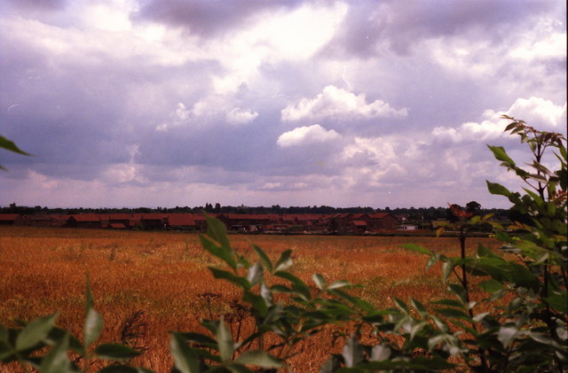
Acomb Moor, located in Yorkshire, England, is a vast expanse of moorland and downs that stretches across a serene and picturesque landscape. Covering an area of approximately 1,000 acres, it is situated near the village of Acomb and is a popular destination for nature enthusiasts and hikers.

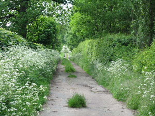
The moorland is characterized by its undulating terrain, dotted with heathers, gorse, and grasses, creating a beautiful mosaic of colors throughout the year. The area is also home to various species of wildlife, including birds, such as skylarks and curlews, as well as hares and rabbits.

Walking trails crisscross the moor, allowing visitors to explore its natural beauty and take in the breathtaking views of the surrounding countryside. The paths lead visitors through open grasslands, heathlands, and small woodlands, providing a diverse and immersive experience.

Acomb Moor is also known for its historical significance, with traces of Bronze Age settlements and burial mounds still visible today. These ancient remnants offer a glimpse into the area's rich heritage and provide an intriguing backdrop to the natural landscape.

The moorland is easily accessible, with car parks and designated entrances available for visitors. Additionally, there are information boards placed strategically along the trails, providing insights into the flora, fauna, and history of the area.

Whether it is the tranquility, the stunning vistas, or the opportunity to connect with nature, Acomb Moor offers a captivating experience for all who venture to explore its beauty.

If you have any feedback on the listing, please let us know in the comments section below.

Acomb Moor Images

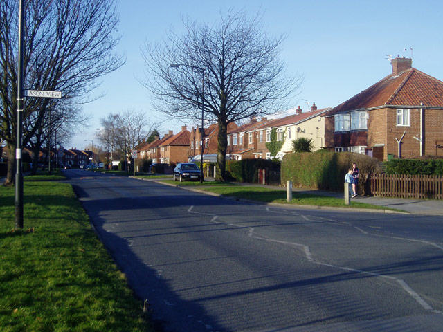
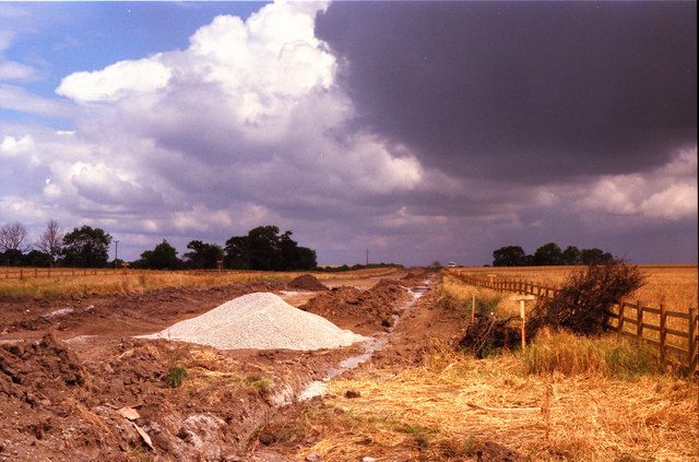
Images are sourced within 2km of 53.93995/-1.1430827 or Grid Reference SE5649. Thanks to Geograph Open Source API. All images are credited.

Railway Line Railway line and Askham bogs, taken from  A1036.
Railway Line
Railway line and Askham bogs, taken from A1036.
Chaloners Road, York This grid square is almost empty on the 1940s map, but has now been filled with late-20th Century housing developments.
Chaloners Road, York
This grid square is almost empty on the 1940s map, but has now been filled with late-20th Century housing developments.
Nags Head at Askham Bryan
Askham Bryan Parish Church of St. Nicholas.
Askham Bryan
Parish Church of St. Nicholas.
Lorrenger Lane Beautiful lane that ends in a field.
Lorrenger Lane
Beautiful lane that ends in a field.
Askham Lane This section is no longer used as the main route for traffic as it now terminates at the side of the A1237 Ring Road with access for pedestrians & cyclists only
Askham Lane
This section is no longer used as the main route for traffic as it now terminates at the side of the A1237 Ring Road with access for pedestrians & cyclists only
Eastfield Farm, Woodthorpe, York Eastfield Farm has paddocks, horses and stabling and is very close to a significant edge-of-greenbelt housing development to the North side of Woodthorpe Lane, from which this photograph was taken.
Eastfield Farm, Woodthorpe, York
Eastfield Farm has paddocks, horses and stabling and is very close to a significant edge-of-greenbelt housing development to the North side of Woodthorpe Lane, from which this photograph was taken.
A1237 York Outer Ring Road from Moor Lane Woodthorpe Picture is looking approximately South towards the A64 Junction from the Moor Lane Junction. (the Moor lane Junction has been changed again recently to incorporate a roundabout)
A1237 York Outer Ring Road from Moor Lane Woodthorpe
Picture is looking approximately South towards the A64 Junction from the Moor Lane Junction. (the Moor lane Junction has been changed again recently to incorporate a roundabout)
A1237 York outer ring road during construction Looking northwards
A1237 York outer ring road during construction
Looking northwards
Field overlooking Woodthorpe Taken from the current position of the York Outer Ring Road
Field overlooking Woodthorpe
Taken from the current position of the York Outer Ring Road
Nacreous Clouds Sometimes also called Mother of Pearl Clouds. 
Nacreous clouds resemble pale cirrus or lenticular altocumulus and show very marked irisation, the most brilliant colours occurring when the sun is just below the horizon (before dawn or after sunset). They can still be distinguished up to about two hours after sunset as thin grey clouds standing out against the starry sky. In moonlight they may be visible throughout the night. These clouds occur at an altitude between 21 and 30 km and require a temperature approaching -90°C to form.
Source: Meteorological Office
Nacreous Clouds
Sometimes also called Mother of Pearl Clouds. Nacreous clouds resemble pale cirrus or lenticular altocumulus and show very marked irisation, the most brilliant colours occurring when the sun is just below the horizon (before dawn or after sunset). They can still be distinguished up to about two hours after sunset as thin grey clouds standing out against the starry sky. In moonlight they may be visible throughout the night. These clouds occur at an altitude between 21 and 30 km and require a temperature approaching -90°C to form. Source: Meteorological Office
Lorrenger Lane This lane runs from the new roundabout on the A1237 near Askham Bryan to the middle of some fields.
Lorrenger Lane
This lane runs from the new roundabout on the A1237 near Askham Bryan to the middle of some fields.
Askham Fields Lane Coming into Askham Bryan from the agricultural college direction.
Askham Fields Lane
Coming into Askham Bryan from the agricultural college direction.
Askham Bryan Junction of Askham Fields Lane with Main Street in Askham Bryan.
Askham Bryan
Junction of Askham Fields Lane with Main Street in Askham Bryan.
Nags Head Inn The Nags Head in Askham Bryan. This direction is to the village only.
Nags Head Inn
The Nags Head in Askham Bryan. This direction is to the village only.
Main Street Main Street in the village of Askham Bryan. The road ahead leads to a few farms.
Main Street
Main Street in the village of Askham Bryan. The road ahead leads to a few farms.
Askham Bryan Heading towards the ring road (A1237) from Askham Bryan.
Askham Bryan
Heading towards the ring road (A1237) from Askham Bryan.
Along Lorrenger Lane This track gives access to several fields from next to the roundabout on the ring road at the Askham Bryan turning.
Along Lorrenger Lane
This track gives access to several fields from next to the roundabout on the ring road at the Askham Bryan turning.
Show me another place!

Acomb Moor is located at Grid Ref: SE5649 (Lat: 53.93995, Lng: -1.1430827)

Division: West Riding

Unitary Authority: York

Police Authority: North Yorkshire

What 3 Words

///moons.curiosity.dose. Near Copmanthorpe, East Yorkshire

Nearby Locations

Acomb Wood Acomb Moor

Related Wikis

Woodthorpe, North Yorkshire

Woodthorpe is a suburb in the south west of the city of York, in the ceremonial county of North Yorkshire, England. The surrounding areas are Dringhouses...

York High School, York

York High School is a mixed secondary school in York, North Yorkshire, England. It has a comprehensive admissions policy, and in 2016 had an enrolment...

St Nicholas' Church, Askham Bryan

St Nicholas' Church is the parish church of Askham Bryan, near York in England, and is a Grade I listed building. The church was constructed in the 12th...

Askham Bryan

Askham Bryan is a village and civil parish in the unitary authority area of City of York in the north of England, 6 miles (10 km) south-west of York, west...

Nearby Amenities

Located within 500m of 53.93995,-1.1430827
Traffic Calming: cushion
Lat/Long: 53.9431245/-1.1392875
Turning Circle
Lat/Long: 53.9394619/-1.1368746
Turning Circle
Lat/Long: 53.9399988/-1.1355897
Turning Circle
Lat/Long: 53.939066/-1.1358228
Turning Circle
Lat/Long: 53.9381151/-1.1375439
Turning Circle
Lat/Long: 53.9377499/-1.1384651
Turning Circle
Lat/Long: 53.9372122/-1.138734
Turning Circle
Lat/Long: 53.9361777/-1.1389451
Crossing
Bicycle: yes
Crossing: unmarked
Crossing Island: no
Tactile Paving: yes
Lat/Long: 53.9376032/-1.1448668
Bus Stop
Bus: yes
Departures Board: timetable
Public Transport: platform
Website: http://deps.at/?32900069
Lat/Long: 53.9435627/-1.1405422
Traffic Calming: cushion
Lat/Long: 53.9431136/-1.1382571
Bus Stop
Bus: yes
Departures Board: timetable
Naptan AtcoCode: 3290YYA00070
Naptan NaptanCode: 32900070
Public Transport: platform
Website: http://deps.at/?32900070
Lat/Long: 53.943858/-1.1405583
Traffic Calming: cushion
Lat/Long: 53.9433885/-1.140158
Traffic Calming: choker
Lat/Long: 53.9382789/-1.1368738
Disused Place: Great Knoll
Note: Clearly not a peak. As a local, I have never heard the name. It has gone from OS OpemMaps Local. historical evidence can possibly be found at one of the sources for https://epns.nottingham.ac.uk/browse/id/532881d8b47fc40c8100007f-Great+Knoll (that sec
Lat/Long: 53.9411034/-1.1389059
Turning Circle
Lat/Long: 53.9403429/-1.1354866
Parking
Parking: layby
Lat/Long: 53.9396735/-1.1438898
Parking
Parking: layby
Lat/Long: 53.9402845/-1.1439086
Parking
Parking: layby
Lat/Long: 53.9420558/-1.142361
Barrier: cycle_barrier
Bicycle: yes
Cycle Barrier: chicane
Foot: yes
Horse: no
Motor Vehicle: no
Lat/Long: 53.937649/-1.1446246
Barrier: cycle_barrier
Bicycle: yes
Cycle Barrier: chicane
Foot: yes
Horse: no
Motor Vehicle: no
Lat/Long: 53.9376624/-1.1441887
Barrier: cycle_barrier
Bicycle: yes
Cycle Barrier: chicane
Foot: yes
Horse: no
Motor Vehicle: no
Lat/Long: 53.9375993/-1.1449622
Generator Method: photovoltaic
Generator Output Electricity: yes
Generator Source: solar
Generator Type: solar_photovoltaic_panel
Location: roof
Power: generator
Lat/Long: 53.9403256/-1.1357385
Generator Method: photovoltaic
Generator Output Electricity: yes
Generator Source: solar
Generator Type: solar_photovoltaic_panel
Location: roof
Power: generator
Lat/Long: 53.9400698/-1.1359236
Generator Method: photovoltaic
Generator Output Electricity: yes
Generator Source: solar
Generator Type: solar_photovoltaic_panel
Location: roof
Power: generator
Lat/Long: 53.9402111/-1.1358189
Generator Method: photovoltaic
Generator Output Electricity: yes
Generator Source: solar
Generator Type: solar_photovoltaic_panel
Location: roof
Power: generator
Lat/Long: 53.9402143/-1.1357585
Generator Method: photovoltaic
Generator Output Electricity: yes
Generator Source: solar
Generator Type: solar_photovoltaic_panel
Location: roof
Power: generator
Lat/Long: 53.9400129/-1.1368302
Generator Method: photovoltaic
Generator Output Electricity: yes
Generator Source: solar
Generator Type: solar_photovoltaic_panel
Location: roof
Power: generator
Lat/Long: 53.9399435/-1.1365351
Generator Method: photovoltaic
Generator Output Electricity: yes
Generator Source: solar
Generator Type: solar_photovoltaic_panel
Location: roof
Power: generator
Lat/Long: 53.9393577/-1.1363044
Generator Method: photovoltaic
Generator Output Electricity: yes
Generator Source: solar
Generator Type: solar_photovoltaic_panel
Location: roof
Power: generator
Lat/Long: 53.9393577/-1.136224
Generator Method: photovoltaic
Generator Output Electricity: yes
Generator Source: solar
Generator Type: solar_photovoltaic_panel
Location: roof
Power: generator
Lat/Long: 53.9419328/-1.1366102
Generator Method: photovoltaic
Generator Output Electricity: yes
Generator Source: solar
Generator Type: solar_photovoltaic_panel
Location: roof
Power: generator
Lat/Long: 53.9369483/-1.1380693
Generator Method: photovoltaic
Generator Output Electricity: yes
Generator Source: solar
Generator Type: solar_photovoltaic_panel
Location: roof
Power: generator
Lat/Long: 53.9370383/-1.1387506
Generator Method: photovoltaic
Generator Output Electricity: yes
Generator Source: solar
Generator Type: solar_photovoltaic_panel
Location: roof
Power: generator
Lat/Long: 53.9370604/-1.1388767
Generator Method: photovoltaic
Generator Output Electricity: yes
Generator Source: solar
Generator Type: solar_photovoltaic_panel
Location: roof
Power: generator
Lat/Long: 53.9373367/-1.1387506
Generator Method: photovoltaic
Generator Output Electricity: yes
Generator Source: solar
Generator Type: solar_photovoltaic_panel
Location: roof
Power: generator
Lat/Long: 53.9374899/-1.1380881
Generator Method: photovoltaic
Generator Output Electricity: yes
Generator Source: solar
Generator Type: solar_photovoltaic_panel
Location: roof
Power: generator
Lat/Long: 53.9377078/-1.1377448
Generator Method: photovoltaic
Generator Output Electricity: yes
Generator Source: solar
Generator Type: solar_photovoltaic_panel
Location: roof
Power: generator
Lat/Long: 53.9373083/-1.1389518
Generator Method: photovoltaic
Generator Output Electricity: yes
Generator Source: solar
Generator Type: solar_photovoltaic_panel
Location: roof
Power: generator
Lat/Long: 53.9367288/-1.1388096
Crossing
Bicycle: yes
Crossing: unmarked
Crossing Island: no
Tactile Paving: yes
Lat/Long: 53.9376432/-1.1447755
The data included in this document is from www.openstreetmap.org. The data is made available under ODbL.

Have you been to Acomb Moor?

Leave your review of Acomb Moor below (or comments, questions and feedback).