Hawkshaw

Settlement in Lancashire

England

Hawkshaw

Path in Redisher Wood Enhanced by low autumn afternoon sun.
Path in Redisher Wood Credit: Bill Boaden

Hawkshaw is a small village located in the county of Lancashire, in the northwest region of England. Situated approximately 12 miles north of Manchester, Hawkshaw is part of the Bury metropolitan borough and falls within the Ramsbottom ward.

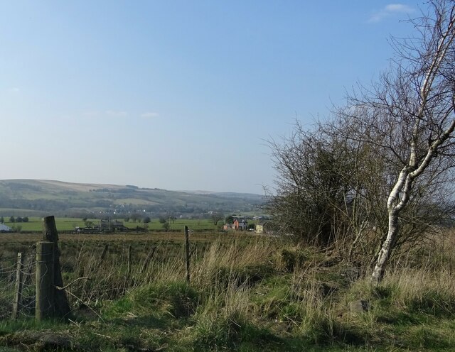
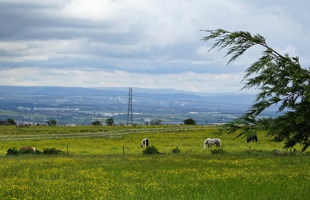
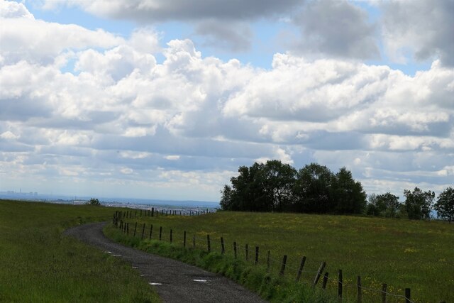
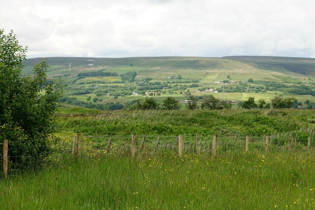
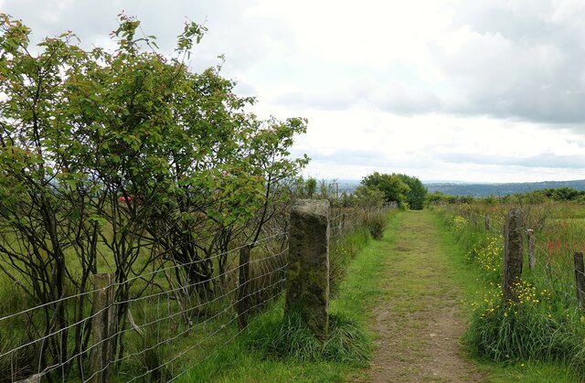
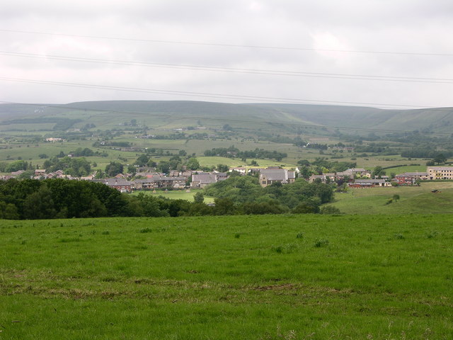
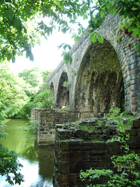
The village is nestled within a picturesque rural landscape, surrounded by rolling hills and scenic countryside. It is characterized by its quaint charm and peaceful atmosphere, making it an ideal destination for those seeking a tranquil retreat from the hustle and bustle of urban life.

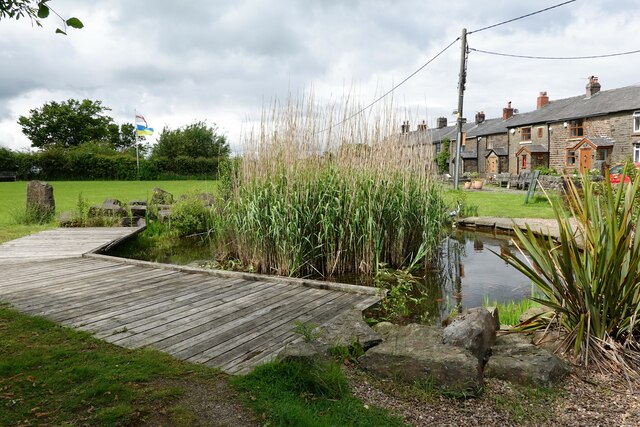
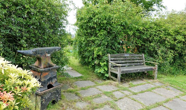
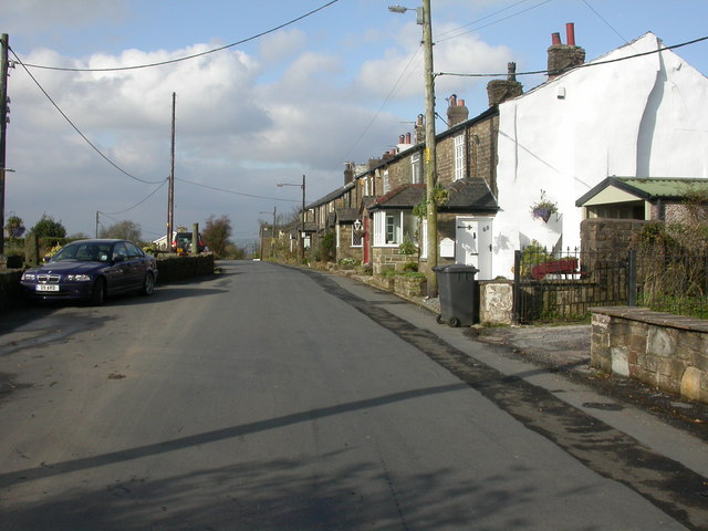
Hawkshaw is home to a close-knit community, with a population of around 1,200 residents. The village boasts a range of amenities to cater to the needs of its inhabitants, including a local primary school, a village hall, and a few shops and pubs.

One of the prominent features of Hawkshaw is its beautiful parish church, St. Mary's, which dates back to the 19th century. The church is known for its stunning architecture and serves as a focal point for religious and community events.

The village also offers excellent opportunities for outdoor activities, with numerous walking trails and countryside paths in the surrounding areas. These allow residents and visitors to explore the natural beauty of the region and enjoy leisurely strolls or more challenging hikes.

Overall, Hawkshaw is a charming and idyllic village that offers a peaceful lifestyle, natural beauty, and a strong sense of community for its residents.

If you have any feedback on the listing, please let us know in the comments section below.

Hawkshaw Images

Images are sourced within 2km of 53.631587/-2.3656729 or Grid Reference SD7515. Thanks to Geograph Open Source API. All images are credited.

Path in Redisher Wood Enhanced by low autumn afternoon sun.
Path in Redisher Wood
Enhanced by low autumn afternoon sun.
New hedge being laid The hedge will segregate the footpath from the rest of the field. The landowner is entitled to do this but it is likely to leave the path rather muddier than it used to be.
New hedge being laid
The hedge will segregate the footpath from the rest of the field. The landowner is entitled to do this but it is likely to leave the path rather muddier than it used to be.
Looking North West from Roman Road North of Affetside village.
Looking North West from Roman Road
North of Affetside village.
Spring trees in Redisher Wood In the valley of Red Brook.
Spring trees in Redisher Wood
In the valley of Red Brook.
Horses and buttercups A spring meadow in Affetside.
Horses and buttercups
A spring meadow in Affetside.
Koi carp in a village pond On Affetside village green. Several tadpoles seem to be hitching a ride.
Koi carp in a village pond
On Affetside village green. Several tadpoles seem to be hitching a ride.
Tadpoles galore In Affetside village pond.
Tadpoles galore
In Affetside village pond.
Slack Lane in Affetside Leading to No.3 Bungalow and then via a footpath to Top o' th' Knotts and on to Harwood.
Slack Lane in Affetside
Leading to No.3 Bungalow and then via a footpath to Top o' th' Knotts and on to Harwood.
Overgrown footpath The path leads by the fence from Affetside to Tottington Road, but seems to be impassable at least while the grass is growing high.
Overgrown footpath
The path leads by the fence from Affetside to Tottington Road, but seems to be impassable at least while the grass is growing high.
Affetside village green The pond is stocked with koi carp, goldfish and, at the moment, tadpoles.
Affetside village green
The pond is stocked with koi carp, goldfish and, at the moment, tadpoles.
Potato patch On Affetside allotments.
Potato patch
On Affetside allotments.
Footpath in Affetside Leading from the village to Harwood Lee.
Footpath in Affetside
Leading from the village to Harwood Lee.
Anvil and bench On the village green.
Anvil and bench
On the village green.
Affetside Cross A restored wayside cross shaft shaped like a Roman column to reflect perhaps it sits beside Watling Street
Affetside Cross
A restored wayside cross shaft shaped like a Roman column to reflect perhaps it sits beside Watling Street
Affetside
Affetside
Millennium Green, Affetside A hilltop garden
Millennium Green, Affetside
A hilltop garden
Millennium Green, Affetside The top of the hill, where a path passes through a hedge to allotments. A delightful spot.
Millennium Green, Affetside
The top of the hill, where a path passes through a hedge to allotments. A delightful spot.
The Cross, Affetside
Show me another place!

Hawkshaw is located at Grid Ref: SD7515 (Lat: 53.631587, Lng: -2.3656729)

Unitary Authority: Bury

Police Authority: Greater Manchester

What 3 Words

///directs.blend.universal. Near Edgworth, Lancashire

Nearby Locations

Hawkshaw Wood Hawkshaw

Related Wikis

Hawkshaw, Greater Manchester

Hawkshaw is a village in the Metropolitan Borough of Bury, in Greater Manchester, England. Historically a part of Lancashire, it has a population of around...

Greater Manchester Army Cadet Force

The Greater Manchester Army Cadet Force (GMACF) is the county cadet force for Greater Manchester, which forms part of the wider Army Cadet Force, a youth...

Affetside

Affetside is a village in Greater Manchester, England. Historically in Lancashire, it is in the Tottington ward of Bury Metropolitan Borough Council and...

Kirklees Brook

Kirklees Brook is a minor river in Greater Manchester, England. It is 6.56 miles (10.556 km) long and including tributaries has a catchment area of 5.23...

Nearby Amenities

Located within 500m of 53.631587,-2.3656729
Created By: YahooApplet 1.0
Lat/Long: 53.6307586/-2.361084
Created By: YahooApplet 1.0
Lat/Long: 53.6308222/-2.3618028
Created By: YahooApplet 1.0
Lat/Long: 53.6309074/-2.3627775
Hawkshaw
Alt Name: Hawkshaw Lane End
Is In: Bury, Greater Manchester, England, UK
Place: hamlet
Source: npe
Wikidata: Q5685263
Lat/Long: 53.631687/-2.3658188
Bus Stop
Ramsbottom Road/Red Lion
Bus: yes
Naptan AtcoCode: 1800NC34651
Naptan Bearing: E
Naptan CommonName: Ramsbottom Road/Red Lion
Naptan Indicator: O/s House 72
Naptan Landmark: HOUSE 72
Naptan NaptanCode: mandtgwj
Naptan PlusbusZoneRef: MNCRPIC
Naptan ShortCommonName: Red Lion
Naptan Street: BOLTON ROAD WES
Naptan Verified: no
Network: TfGM
Public Transport: platform
Source: naptan_import
Lat/Long: 53.6313167/-2.3716165
Bus Stop
Ramsbottom Road/Red Lion
Bus: yes
Naptan AtcoCode: 1800NC34661
Naptan Bearing: W
Naptan CommonName: Ramsbottom Road/Red Lion
Naptan Indicator: Red Lion Pub
Naptan Landmark: RED LION PUB
Naptan NaptanCode: mandtgwm
Naptan PlusbusZoneRef: MNCRPIC
Naptan ShortCommonName: Red Lion
Naptan Street: RAMSBOTTOM ROAD
Naptan Verified: no
Network: TfGM
Public Transport: platform
Source: naptan_import
Lat/Long: 53.6312565/-2.3707388
Bus Stop
Bolton Road/Waggon and Horses
Bus: yes
Naptan AtcoCode: 1800NC34671
Naptan Bearing: E
Naptan CommonName: Bolton Road/Waggon and Horses
Naptan Indicator: Opp House 380
Naptan Landmark: HOUSE 376
Naptan NaptanCode: mandtgwp
Naptan Notes: INDICATOR AMENDED
Naptan PlusbusZoneRef: MNCRPIC
Naptan ShortCommonName: Waggon and Horses
Naptan Street: BOLTON ROAD
Naptan Verified: no
Network: TfGM
Public Transport: platform
Source: naptan_import
Lat/Long: 53.6311782/-2.3669576
Bus Stop
Bolton Road/Waggon and Horses
Bus: yes
Naptan AtcoCode: 1800NC34681
Naptan Bearing: W
Naptan CommonName: Bolton Road/Waggon and Horses
Naptan Indicator: O/s House 247
Naptan Landmark: HOUSE 247
Naptan NaptanCode: mandtgwt
Naptan Notes: MAIN ROAD AMENDED
Naptan PlusbusZoneRef: MNCRPIC
Naptan ShortCommonName: Waggon and Horses
Naptan Street: BOLTON ROAD
Naptan Verified: no
Network: TfGM
Public Transport: platform
Source: naptan_import
Lat/Long: 53.6310381/-2.3657466
Bus Stop
Bolton Road/Holly House
Bus: yes
Naptan AtcoCode: 1800NC34691
Naptan Bearing: E
Naptan CommonName: Bolton Road/Holly House
Naptan Indicator: O/s House 286
Naptan Landmark: HOUSE 280
Naptan NaptanCode: mandtjad
Naptan PlusbusZoneRef: MNCRPIC
Naptan ShortCommonName: Holly House
Naptan Street: BOLTON ROAD
Naptan Verified: no
Network: TfGM
Public Transport: platform
Source: naptan_import
Lat/Long: 53.6307939/-2.3603307
Bus Stop
Bolton Road/Holly House
Bus: yes
Naptan AtcoCode: 1800NC34701
Naptan Bearing: W
Naptan CommonName: Bolton Road/Holly House
Naptan Indicator: Opp House 274
Naptan Landmark: OPP HOUSE 274
Naptan NaptanCode: mandtjag
Naptan PlusbusZoneRef: MNCRPIC
Naptan ShortCommonName: Holly House
Naptan Street: BOLTON ROAD
Naptan Verified: no
Network: TfGM
Public Transport: platform
Source: naptan_import
Lat/Long: 53.6307144/-2.3598461
Barrier: stile
Material: wood
Step Count: 2
Stile: stepover
Lat/Long: 53.6275953/-2.363239
Waterway: weir
Lat/Long: 53.627459/-2.3646801
Barrier: stile
Lat/Long: 53.6334321/-2.3598763
Barrier: stile
Lat/Long: 53.6324178/-2.3582852
Waterway: waterfall
Lat/Long: 53.6271236/-2.3658688
Ford: yes
Note: previously mapped as a culvert; no culvert here as of January 2024
Lat/Long: 53.6271585/-2.3658153
Barrier: stile
Material: wood
Step Count: 1
Stile: stepover
Lat/Long: 53.6340289/-2.369896
Ford: yes
Note: previously mapped as a culvert; no culvert here as of January 2024
Lat/Long: 53.6275087/-2.3646765
The data included in this document is from www.openstreetmap.org. The data is made available under ODbL.

Have you been to Hawkshaw?

Leave your review of Hawkshaw below (or comments, questions and feedback).