Town's Pasture

Downs, Moorland in Yorkshire Hambleton

England

Town's Pasture

North End of Oulston Village Small village which is closely connected to the Newburgh Estate with several of the cottages bearing its crest.
North End of Oulston Village Credit: Jonathan Clitheroe

Town's Pasture is a picturesque piece of land located in Yorkshire, England. Nestled amidst the scenic beauty of the Yorkshire Downs and Moorland, this area is renowned for its natural charm and diverse ecosystem. Covering an expansive area, Town's Pasture offers a unique blend of grasslands, rolling hills, and stunning vistas that are a treat for both locals and visitors alike.

The Pasture is home to a variety of flora and fauna, including wildflowers, heather, and grasses that create a vibrant and colorful landscape throughout the year. It is also a haven for numerous bird species, such as skylarks, meadow pipits, and curlews, making it a paradise for birdwatchers and nature enthusiasts.

The area's rich history is evident in the presence of several ancient monuments and archaeological sites, including burial mounds and stone circles, which offer a glimpse into the past civilizations that once inhabited the region. Additionally, the Pasture has witnessed human settlement for centuries, with evidence of traditional farming practices and quaint stone cottages scattered across the landscape.

Visitors to Town's Pasture can enjoy a range of outdoor activities, including hiking, cycling, and horseback riding, with well-maintained trails providing access to the breathtaking scenery and panoramic views. The area is also popular for picnics and nature walks, allowing individuals to immerse themselves in the tranquility and natural splendor of the surroundings.

In summary, Town's Pasture in Yorkshire is a captivating destination that combines the rugged beauty of the Yorkshire Downs and Moorland with a rich cultural and historical heritage. Its diverse ecosystem, ancient monuments, and recreational opportunities make it a must-visit location for nature lovers and history enthusiasts alike.

If you have any feedback on the listing, please let us know in the comments section below.

Town's Pasture Images

Images are sourced within 2km of 54.159232/-1.1564318 or Grid Reference SE5574. Thanks to Geograph Open Source API. All images are credited.
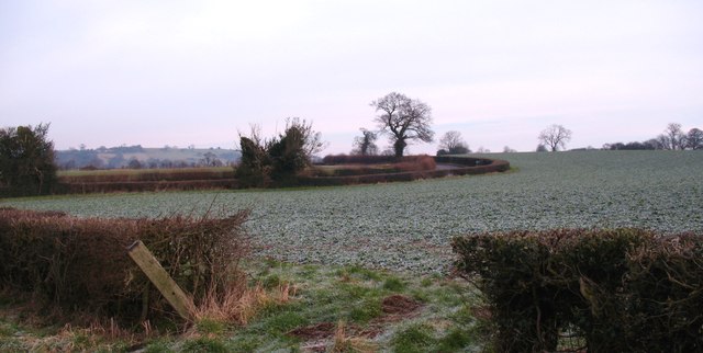
North End of Oulston Village Small village which is closely connected to the Newburgh Estate with several of the cottages bearing its crest.
North End of Oulston Village
Small village which is closely connected to the Newburgh Estate with several of the cottages bearing its crest.
Myra Bank Lane, towards Myra Bank Farm
Crossroads on Crayke Lane
Crayke lane at Adams Field Lane
The village of Oulston
Heading north towards Newburgh Priory
Manor Farm, Oulston
Manor Farm, Oulston
A path leading to Hardy Bank
Adam's Hall Farm
Adam's Hall Farm
A path leading to Crayke
Oulston Reservoir
Oulston Reservoir
Nearing the top of the hill Thornton Lane as it nears the top of the low hill above Thornton Hill Farm.
Nearing the top of the hill
Thornton Lane as it nears the top of the low hill above Thornton Hill Farm.
Lane to Oulston Unnamed lane heading east past Yeoman Course House towards Oulston.
Lane to Oulston
Unnamed lane heading east past Yeoman Course House towards Oulston.
Malton Street Country road that runs along the westernmost ridge of the Howardian Hills. The name suggests an ancient [medieval?] route, maybe connecting Malton with Boroughbridge or Ripon. Shown as Malton Street on first edition OS maps of the 1850's.
Malton Street
Country road that runs along the westernmost ridge of the Howardian Hills. The name suggests an ancient [medieval?] route, maybe connecting Malton with Boroughbridge or Ripon. Shown as Malton Street on first edition OS maps of the 1850's.
Freezing February Frosted pastures to the south of Oulston. This area has several springs which occur at the base of the limestone forming the Howardian Hills.
Freezing February
Frosted pastures to the south of Oulston. This area has several springs which occur at the base of the limestone forming the Howardian Hills.
Adam's Field Lane Adam's Field Lane leads to Adam's Hall farm and also provides a through route for walkers and cyclists to the Yearsley road.
Adam's Field Lane
Adam's Field Lane leads to Adam's Hall farm and also provides a through route for walkers and cyclists to the Yearsley road.
Beggar's Bed Unexciting agricultural land with a meandering road around the edge of the field. The name is most unusual and is used on all OS maps back to the mid 19th century, but there are no clues as to its origin.
Beggar's Bed
Unexciting agricultural land with a meandering road around the edge of the field. The name is most unusual and is used on all OS maps back to the mid 19th century, but there are no clues as to its origin.
Show me another place!

Town's Pasture is located at Grid Ref: SE5574 (Lat: 54.159232, Lng: -1.1564318)

Division: North Riding

Administrative County: North Yorkshire

District: Hambleton

Police Authority: North Yorkshire

What 3 Words

///combining.older.vegetable. Near Easingwold, North Yorkshire

Nearby Locations

Town's Pasture

Related Wikis

Oulston

Oulston is a village and civil parish in Hambleton district of North Yorkshire, England. It lies about 3 miles (5 km) north-east of Easingwold. Remains...

Thornton-on-the-Hill

Thornton-on-the-Hill (also called Thornton Hill) is a small dispersed village and civil parish in the Hambleton district of North Yorkshire, England, about...

Newburgh, North Yorkshire

Newburgh is a village and civil parish located in the Hambleton district of North Yorkshire, England. The population at the 2011 Census was less than 100...

Newburgh Priory

Newburgh Priory is a Grade 1 listed Tudor building near Coxwold, North Yorkshire, England. Originally a house of Augustinian canons, it was founded in...

Nearby Amenities

Located within 500m of 54.159232,-1.1564318
Barrier: stile
Step Count: 2
Stile: stepover
Lat/Long: 54.1566243/-1.1531671
Barrier: stile
Steps: 2
Stile: stepover
Lat/Long: 54.1590641/-1.1625822
Information: guidepost
Tourism: information
Lat/Long: 54.1596952/-1.1629198
Barrier: stile
Step Count: 2
Stile: stepover
Lat/Long: 54.1570897/-1.1547042
Barrier: stile
Step Count: 2
Stile: stepover
Lat/Long: 54.1586442/-1.156967
Barrier: stile
Step Count: 1
Style: stepover
Lat/Long: 54.1600295/-1.1572925
Barrier: stile
Step Count: 2
Stile: stepover
Lat/Long: 54.1610959/-1.1576271
Bench
Bench Type: log
Inscription: Howardian Hills Area of Outstanding Natural Beauty 25th Anniversary 19.10.2012
Lat/Long: 54.1571107/-1.1548707
Barrier: stile
Step Count: 2
Stile: stepover
Lat/Long: 54.1571528/-1.1548236
Barrier: stile
Dog Gate: yes
Step Count: 1
Stile: stepover
Lat/Long: 54.1597254/-1.1629557
The data included in this document is from www.openstreetmap.org. The data is made available under ODbL.

Have you been to Town's Pasture?

Leave your review of Town's Pasture below (or comments, questions and feedback).