Frith Common

Downs, Moorland in Hampshire Basingstoke and Deane

England

Frith Common

Knowl Hill Farm Buildings This picture was taken from the private road that intersects with the road running diagonally from north to south across the grid square, looking north.
Knowl Hill Farm Buildings Credit: Pam Brophy

Frith Common is a picturesque area located in the county of Hampshire, England. Nestled between the villages of Froxfield and Privett, the common covers a vast expanse of land, encompassing both downs and moorland.

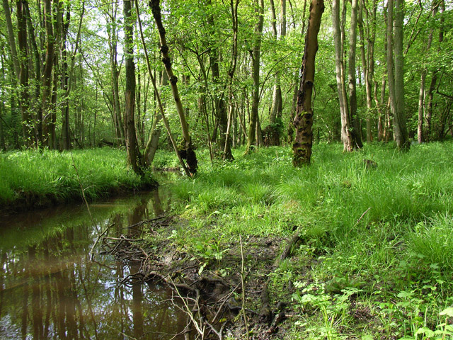
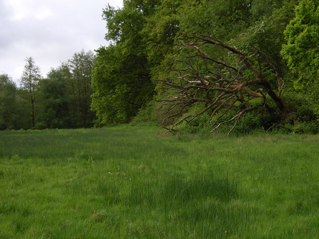
The common is characterized by its diverse and rich natural beauty. The downs, with their gently rolling hills, are covered in lush green grasses and dotted with wildflowers during the spring and summer months. These open spaces provide breathtaking panoramic views of the surrounding countryside, making it a popular destination for nature lovers and hikers.

In contrast, the moorland areas of Frith Common are more rugged and wild. Here, visitors can find heather-covered hillsides and dense areas of gorse bushes, creating a unique and vibrant landscape. This habitat is home to a variety of wildlife, including birds such as skylarks and stonechats, as well as rare species like the Dartford warbler.

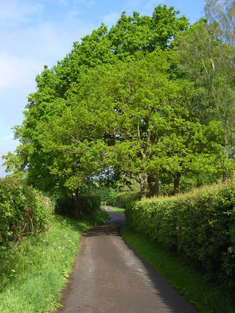
Frith Common also boasts a rich cultural and historical significance. The area has been inhabited for centuries, with evidence of Bronze Age settlements and Roman activity. Today, the common is crisscrossed with ancient pathways and bridleways, providing opportunities for exploration and discovery.

Overall, Frith Common offers a diverse and enchanting experience for visitors. Whether it be the sweeping views from the downs or the untamed beauty of the moorland, this Hampshire gem is a must-visit destination for those seeking a connection with nature and a glimpse into the region's history.

If you have any feedback on the listing, please let us know in the comments section below.
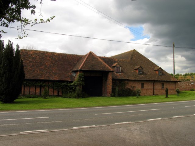
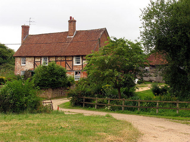
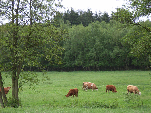
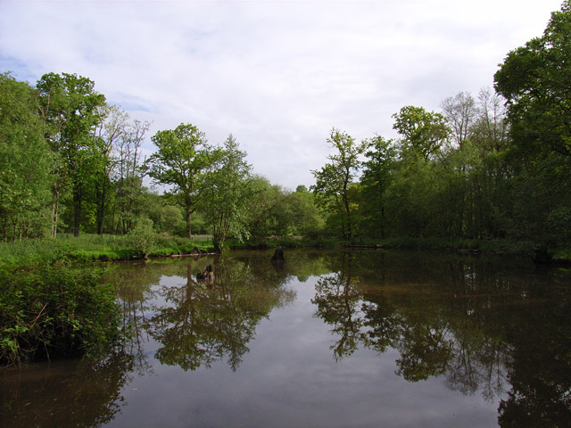
Frith Common Images

Images are sourced within 2km of 51.331257/-1.2169058 or Grid Reference SU5459. Thanks to Geograph Open Source API. All images are credited.

Knowl Hill Farm Buildings This picture was taken from the private road that intersects with the road running diagonally from north to south across the grid square, looking north.
Knowl Hill Farm Buildings
This picture was taken from the private road that intersects with the road running diagonally from north to south across the grid square, looking north.
Farm near Ashford Hill At this point, the footpath splits and goes of at right angles to each other. This is the view at the split (Harriden's Farm).
Farm near Ashford Hill
At this point, the footpath splits and goes of at right angles to each other. This is the view at the split (Harriden's Farm).
Sandford Springs Golf Club This picture of Sanford Springs golf course was taken from the club entrance, just off the A339, looking over the greens in a north westerly direction
Sandford Springs Golf Club
This picture of Sanford Springs golf course was taken from the club entrance, just off the A339, looking over the greens in a north westerly direction
Country house This picture was taken from approx 545582 and looks due north to a house just across the main A339
Country house
This picture was taken from approx 545582 and looks due north to a house just across the main A339
Shed on Legs! This old grain store was built on stone pillars to prevent rats from getting into the store. It is in the middle of a farm yard at 544576
Shed on Legs!
This old grain store was built on stone pillars to prevent rats from getting into the store. It is in the middle of a farm yard at 544576
The Wolverton Road The section of the road opposite Wolverton Wood in the south eastern section of the grid square. It runs diagonally across this section of the square and the field on the western side of the road is just visible. The picture was taken looking north east along the road.
The Wolverton Road
The section of the road opposite Wolverton Wood in the south eastern section of the grid square. It runs diagonally across this section of the square and the field on the western side of the road is just visible. The picture was taken looking north east along the road.
The George & Dragon Inn, Towns End
Towns End
Towns End
St. Catherine's Church, Crabbs Hill, Wolverton
Wolverton Common
Wolverton Common
Frith Common Looking across to Sandford Wood.
Frith Common
Looking across to Sandford Wood.
Pond near Frith Common One of two ponds in the vicinity that are not shown by the Ordnance Survey.
Pond near Frith Common
One of two ponds in the vicinity that are not shown by the Ordnance Survey.
Woodland stream, Frith Common The stream emanates from Sandford Springs, which give their name to the nearby golf club.
Woodland stream, Frith Common
The stream emanates from Sandford Springs, which give their name to the nearby golf club.
Lane at Frith Common Farm A public footpath on a private road.
Lane at Frith Common Farm
A public footpath on a private road.
Clinker's Copse The fringe of the wood where it meets a rather boggy meadow.
Clinker's Copse
The fringe of the wood where it meets a rather boggy meadow.
Bridleway junction near Kingsclere Choice of two routes into Kingsclere, a well surfaced bridleway straight on or a muddy footpath to the left.
Bridleway junction near Kingsclere
Choice of two routes into Kingsclere, a well surfaced bridleway straight on or a muddy footpath to the left.
Above Kingsclere The bridleway from Kingsclere quickly reaches open country.  This view south-west, across the south-western corner of the square, is in farmland to start with but also shows the start of the downs scenery.
Above Kingsclere
The bridleway from Kingsclere quickly reaches open country. This view south-west, across the south-western corner of the square, is in farmland to start with but also shows the start of the downs scenery.
Towards the downs Two bridleways join, then immediately separate again.  The one to the left continues to Plantation Farm.  The other goes through the hedge and straight up to the downs across open farmland.  Coronation Plantation on the skyline (right).
Towards the downs
Two bridleways join, then immediately separate again. The one to the left continues to Plantation Farm. The other goes through the hedge and straight up to the downs across open farmland. Coronation Plantation on the skyline (right).
Show me another place!

Frith Common is located at Grid Ref: SU5459 (Lat: 51.331257, Lng: -1.2169058)

Administrative County: Hampshire

District: Basingstoke and Deane

Police Authority: Hampshire

What 3 Words

///foreheads.canine.lights. Near Kingsclere, Hampshire

Related Wikis

Wolverton, Hampshire

Wolverton is a village in north Hampshire, England. It is within the civil parish of Baughurst, and located approximately 7 miles (11 km) from both Newbury...

Wolverton Common

Wolverton Common is a hamlet in north Hampshire, England. Its nearest town is Tadley, which lies approximately 2.5 miles (4 km) east from the hamlet....

Kingsclere

Kingsclere is a large village and civil parish in Hampshire, England. == Geography == Kingsclere is approximately equidistant 13 kilometres (8.1 mi) from...

Axmansford

Axmansford is a village in Hampshire, England. It is in the civil parish of Baughurst. == External links == Media related to Axmansford at Wikimedia Commons

Kingsclere and Whitchurch Rural District

Kingsclere and Whitchurch Rural District was a rural district between 1932 and 1974 in Hampshire, England. The district was formed as a merger of the abolished...

Ashford Hill

Ashford Hill is a village in Basingstoke and Deane, Hampshire, England. == Governance == The village of Ashford Hill is part of the civil parish of Ashford...

Plastow Green

Plastow Green is a hamlet in north Hampshire, England. == Governance == The hamlet is part of the civil parish of Ashford Hill with Headley, and is part...

Ashford Hill Woods and Meadows

Ashford Hill Woods and Meadows is a 141.5-hectare (350-acre) biological Site of Special Scientific Interest near Ashford Hill in Hampshire. An area of...

Nearby Amenities

Located within 500m of 51.331257,-1.2169058
Barrier: stile
Lat/Long: 51.3322399/-1.2128501
Barrier: stile
Lat/Long: 51.3326834/-1.2161858
Barrier: stile
Lat/Long: 51.3342951/-1.2168
Turning Loop
Lat/Long: 51.3320993/-1.2217307
The data included in this document is from www.openstreetmap.org. The data is made available under ODbL.

Have you been to Frith Common?

Leave your review of Frith Common below (or comments, questions and feedback).