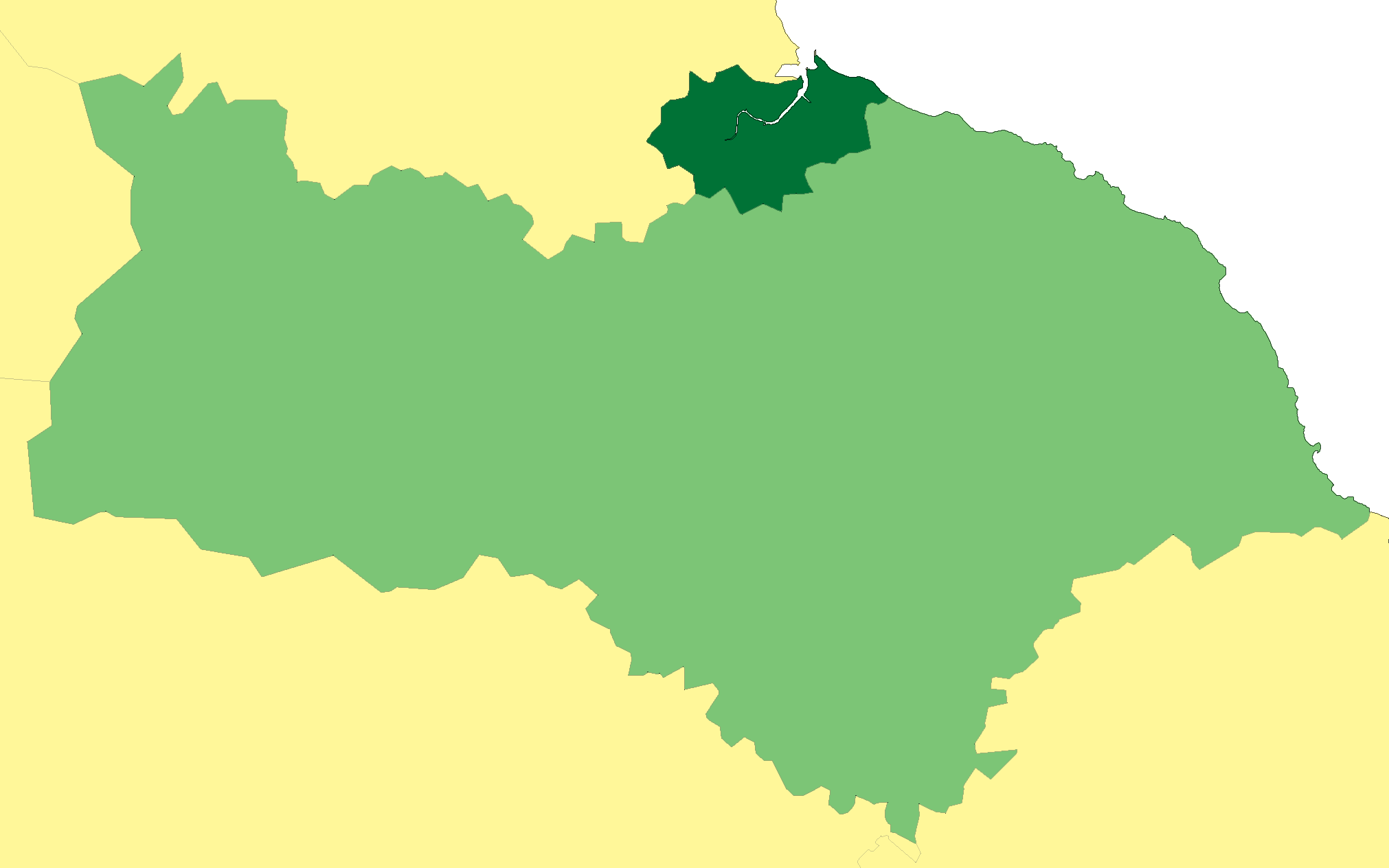
Brine Field

Downs, Moorland in Durham

England

Brine Field

Path at RSPB reserve, Saltholme The grit and gravel-surfaced path connects the main area of the reserve, ahead in the image, with the more remote parts around Haverton Pools and Allotment Pool. The RSPB maintains a number of habitat types on the site, the main one being wetland, with pools and reedbeds, but grassed areas too as seen in the image.
Path at RSPB reserve, Saltholme Credit: Trevor Littlewood

Brine Field, Durham (Downs, Moorland) is a vast expanse of brine-impregnated peatland located in the northeastern region of England. It stretches over an area of approximately 4,000 acres, offering a unique and captivating landscape to visitors.

The field is characterized by its distinctive terrain, consisting of low-lying moorland, undulating downs, and expansive salt marshes. This diverse ecosystem supports a wide range of plant and animal species, making it an important habitat for biodiversity conservation.

One of the most remarkable features of Brine Field is its high salt content, resulting from the slow evaporation of brine deposits over thousands of years. This unique quality has given rise to the growth of halophytic vegetation, which thrives in high-salt environments. Visitors can witness the stunning sight of salt-tolerant plants, such as thrift, sea lavender, and sea aster, adding vibrant colors to the landscape.

The field is also home to several species of birds, including curlews, lapwings, and redshanks, which are attracted to the rich feeding grounds provided by the brine-infused soil. Ornithologists and birdwatching enthusiasts often flock to Brine Field to observe these avian species in their natural habitat.

In addition to its ecological significance, Brine Field holds historical importance. The field was once utilized for salt production, with evidence of medieval salt pans scattered across its expanse. These remnants serve as a reminder of the region's industrial past.

Overall, Brine Field, Durham (Downs, Moorland) offers a captivating blend of natural beauty, ecological diversity, and historical significance, making it an ideal destination for nature enthusiasts and history buffs alike.

If you have any feedback on the listing, please let us know in the comments section below.

Brine Field Images

Images are sourced within 2km of 54.609321/-1.208496 or Grid Reference NZ5124. Thanks to Geograph Open Source API. All images are credited.

Path at RSPB reserve, Saltholme The grit and gravel-surfaced path connects the main area of the reserve, ahead in the image, with the more remote parts around Haverton Pools and Allotment Pool. The RSPB maintains a number of habitat types on the site, the main one being wetland, with pools and reedbeds, but grassed areas too as seen in the image.
Path at RSPB reserve, Saltholme
The grit and gravel-surfaced path connects the main area of the reserve, ahead in the image, with the more remote parts around Haverton Pools and Allotment Pool. The RSPB maintains a number of habitat types on the site, the main one being wetland, with pools and reedbeds, but grassed areas too as seen in the image.
Saltholme Hide at RSPB reserve The Saltholme Hide is one of those at the RSPB nature reserve at the site of the same name. The hide has been rebuilt, at least in part, with an upper storey being added in recent times. Oliver Dixon's image from January 2014 shows it as it was previously - <a title="https://www.geograph.org.uk/photo/3824543" href="https://www.geograph.org.uk/photo/3824543">Link</a> .
Saltholme Hide at RSPB reserve
The Saltholme Hide is one of those at the RSPB nature reserve at the site of the same name. The hide has been rebuilt, at least in part, with an upper storey being added in recent times. Oliver Dixon's image from January 2014 shows it as it was previously - Link .
Car park at RSPB reserve The car park is at the RSPB's reserve at Saltholme. The grey vehicle to the right and a number of others are parked beneath a canopy which was thought to be simply a form of sheltering but its roof is actually covered with electricity-generating solar panels. There are two such structures in the car park.
Car park at RSPB reserve
The car park is at the RSPB's reserve at Saltholme. The grey vehicle to the right and a number of others are parked beneath a canopy which was thought to be simply a form of sheltering but its roof is actually covered with electricity-generating solar panels. There are two such structures in the car park.
Moving the tern rafts At the RSPB reserve at Saltholme the raft is being moved to the edge of the lake by the hand over hand hauling of a rope by the two individuals upon it. It had been moored out in the water as a platform for the nesting of terns and with the breeding season being past it no longer needed to be exposed there.
Moving the tern rafts
At the RSPB reserve at Saltholme the raft is being moved to the edge of the lake by the hand over hand hauling of a rope by the two individuals upon it. It had been moored out in the water as a platform for the nesting of terns and with the breeding season being past it no longer needed to be exposed there.
Oil storage depot, Port Clarence
Billingham Community Fire Station Set among the marshes and sprawling petro-chemical industries of Billingham.
Billingham Community Fire Station
Set among the marshes and sprawling petro-chemical industries of Billingham.
Pipelines, Saltholme, Billingham
Cowpen Marsh Wetland nature reserve sharing north Teesside with the sprawling chemical industries.
Cowpen Marsh
Wetland nature reserve sharing north Teesside with the sprawling chemical industries.
Pipeline near Cowpen Marsh
Abandoned, single railway track crossing roadway The road at the left side of the image is the main route into the huge extent of chemical industries on Teesside; it enters the complex at a roundabout where the A1185 and A178 meet. For much of that route a disused and overgrown single-track railway runs parallel to the road. Here the track crosses a side road where the rails are embedded and polished; generally they are heavily rusted as in this image from nearby - 
<a title="https://www.geograph.org.uk/photo/5321017" href="https://www.geograph.org.uk/photo/5321017">Link</a> .
Abandoned, single railway track crossing roadway
The road at the left side of the image is the main route into the huge extent of chemical industries on Teesside; it enters the complex at a roundabout where the A1185 and A178 meet. For much of that route a disused and overgrown single-track railway runs parallel to the road. Here the track crosses a side road where the rails are embedded and polished; generally they are heavily rusted as in this image from nearby - Link .
RSPB Saltholme Nature Reserve One of several ponds overlooked by a bird hide.  Not much about today.
RSPB Saltholme Nature Reserve
One of several ponds overlooked by a bird hide. Not much about today.
Stock Dove at RSPB Saltholme
Little Egret flies off RSPB Saltholme
Little Egret Hunting at RSPB Saltholme
Avocet Takes Flight  near Greatham Creek
Avocet Takes Flight near Greatham Creek
Avocets and Canadian Geese near Greatham Creek
Birdwatchers on the move At the RSPB Saltholme bird reserve.
Birdwatchers on the move
At the RSPB Saltholme bird reserve.
A corner of Haverton Hole Pools On the RSPB Saltholme Bird Reserve. The dreaming spires of Billingham can be seen on the skyline.
A corner of Haverton Hole Pools
On the RSPB Saltholme Bird Reserve. The dreaming spires of Billingham can be seen on the skyline.
Show me another place!

Brine Field is located at Grid Ref: NZ5124 (Lat: 54.609321, Lng: -1.208496)

Unitary Authority: Stockton-on-Tees

Police Authority: Cleveland

What 3 Words

///hats.simply.newest. Near Middlesbrough, North Yorkshire

Nearby Locations

Brine Field

Related Wikis

Seal Sands Power Station

Seal Sands Power Station (also known as Viking Power Station) is a gas-fired gas turbine power station situated on the River Tees at Seal Sands near Billingham...

Thor Cogeneration Power Station

Thor Cogeneration is a planned, but undeveloped, gas-fired cogeneration plant, which was to be built on Seal Sands near Billingham, in County Durham, North...

Cowpen Marsh

Cowpen Marsh (grid reference NZ500529) is a 116.8 hectare biological Site of Special Scientific Interest in County Durham, England, notified in 1966. SSSIs...

A178 road

The A178 is a road that runs from Hartlepool in County Durham to Middlesbrough in North Yorkshire, England. == Route == The route of the A178 starts at...

County Borough of Teesside

The County Borough of Teesside was a short lived county borough and civil parish in the North Riding of Yorkshire (Northern England) geographical county...

Teesside

Teesside () is a built-up area around the River Tees in North East England, split between County Durham and North Yorkshire. The area contains the towns...

Seal Sands

Seal Sands (grid reference NZ529260) is a 294.37 hectare biological Site of Special Scientific Interest in County Durham, England, notified in 1966. Situated...

Port Clarence

Port Clarence is a small village in the borough of Stockton-on-Tees, County Durham, England. It is on the north bank of the River Tees, and near the northern...

Nearby Amenities

Located within 500m of 54.609321,-1.208496
Railway: switch
Lat/Long: 54.6072658/-1.2113906
Railway: buffer_stop
Lat/Long: 54.6109204/-1.2123411
Railway: level_crossing
Lat/Long: 54.6055425/-1.2109594
Design: three-level
Line Attachment: anchor
Material: metal
Power: tower
Source: Bing
Structure: lattice
Lat/Long: 54.6053301/-1.2113702
Power: tower
Source: Bing
Lat/Long: 54.6052107/-1.2065808
Power: tower
Source: Bing
Lat/Long: 54.6051877/-1.2093459
Power: tower
Lat/Long: 54.6062635/-1.2113677
Design: barrel
Line Attachment: anchor
Material: metal
Power: tower
Structure: lattice
Lat/Long: 54.6074832/-1.2124877
Power: tower
Lat/Long: 54.6058311/-1.2096747
Power: tower
Source: Bing
Lat/Long: 54.6059862/-1.2036652
Line Management: termination
Power: tower
Source: Bing
Structure: lattice
Lat/Long: 54.6067155/-1.2026164
Railway: level_crossing
Lat/Long: 54.6058811/-1.2088943
Power: portal
Lat/Long: 54.606966/-1.2022628
Power: portal
Lat/Long: 54.6069875/-1.2026652
Frequency: 50
Power: transformer
Voltage-high: 132000
Voltage-low: 66000
Voltage Primary: 132000
Voltage Secondary: 66000
Lat/Long: 54.6071115/-1.2026662
Frequency: 50
Power: transformer
Voltage-high: 132000
Voltage-low: 66000
Voltage Primary: 132000
Voltage Secondary: 66000
Lat/Long: 54.6071134/-1.2022755
Power: tower
Lat/Long: 54.6071937/-1.2026429
Power: tower
Lat/Long: 54.6072026/-1.2025072
Power: tower
Lat/Long: 54.6072056/-1.2022075
Power: tower
Lat/Long: 54.6072086/-1.2021076
Railway: switch
Lat/Long: 54.6104691/-1.2122468
Railway: switch
Lat/Long: 54.6074198/-1.2114297
Turning Circle
Lat/Long: 54.6111/-1.2049931
Turning Circle
Lat/Long: 54.6110643/-1.2122592
The data included in this document is from www.openstreetmap.org. The data is made available under ODbL.

Have you been to Brine Field?

Leave your review of Brine Field below (or comments, questions and feedback).