Arden Great Moor

Downs, Moorland in Yorkshire Ryedale

England

Arden Great Moor

Moorland at edge of Arden Great Moor Arden Great Moor is a large area of heather moorland to the west of Ryedale. The view is from an estate road which follows the rim of its plateau, looking across the Rye valley with Rievaulx Moor at the centre.
Moorland at edge of Arden Great Moor Credit: Trevor Littlewood

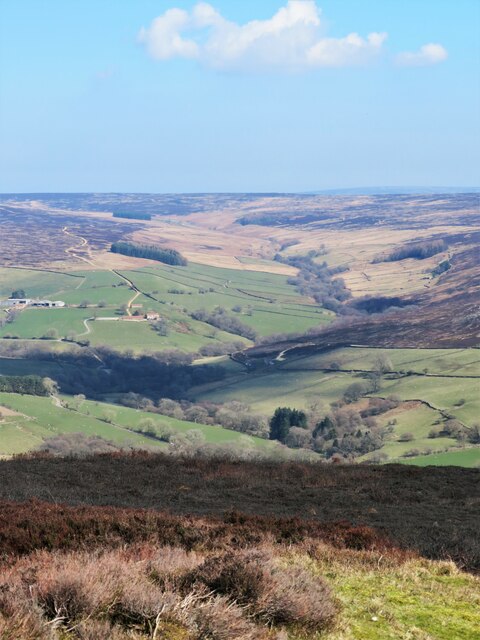
Arden Great Moor is a picturesque region situated in Yorkshire, England. Nestled amidst the rolling hills of the Yorkshire Downs, this area is renowned for its stunning natural beauty and expansive moorland landscapes. Spanning approximately 2,500 acres, Arden Great Moor offers visitors an idyllic escape from the hustle and bustle of city life.

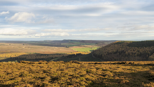
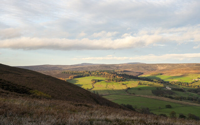
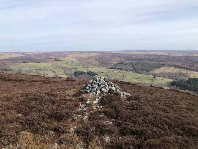
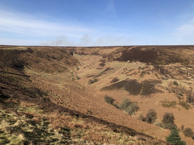
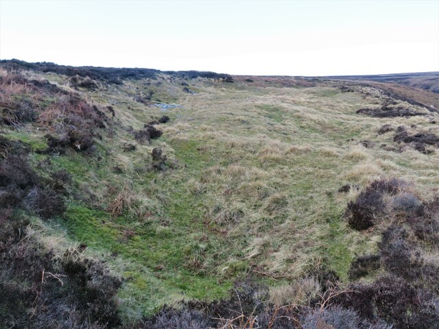
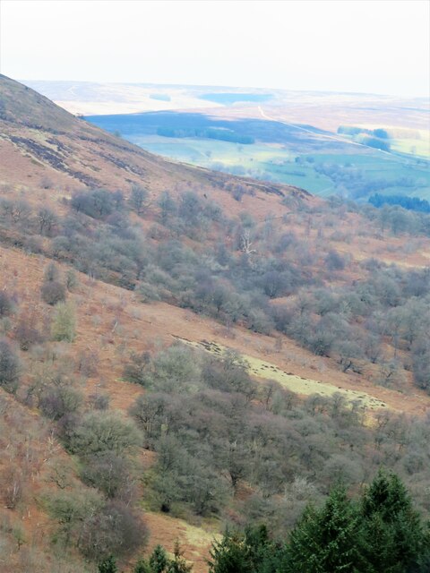
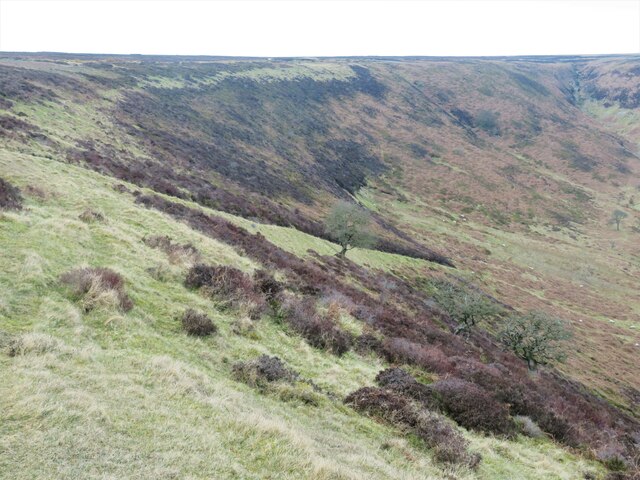
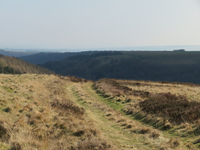
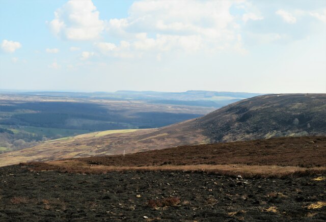
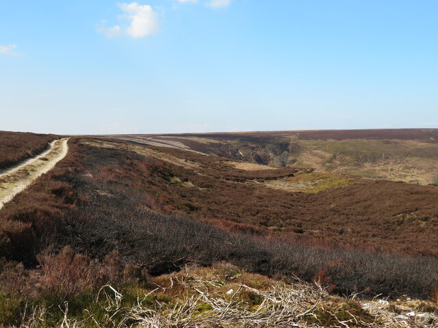
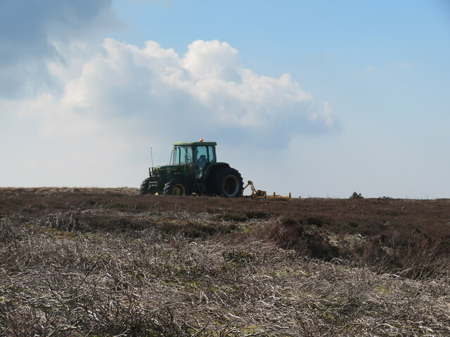
The moorland of Arden Great Moor is characterized by its vast open spaces, heather-covered hills, and scattered woodland areas. It provides a habitat for a diverse range of flora and fauna, making it a popular destination for nature enthusiasts and wildlife photographers. Visitors can expect to see an array of bird species, such as curlews, lapwings, and grouse, as well as various small mammals and reptiles.

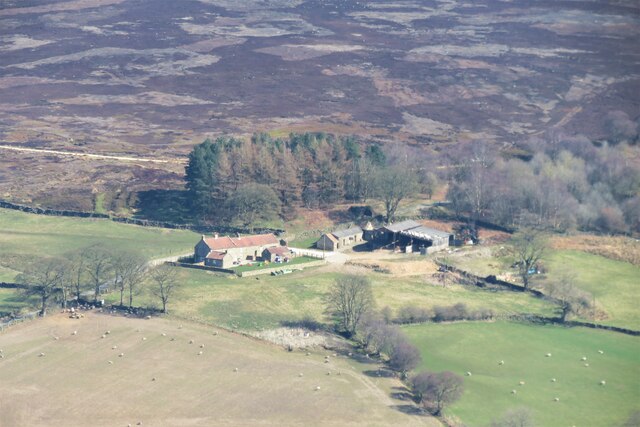
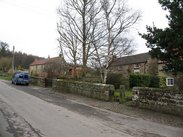
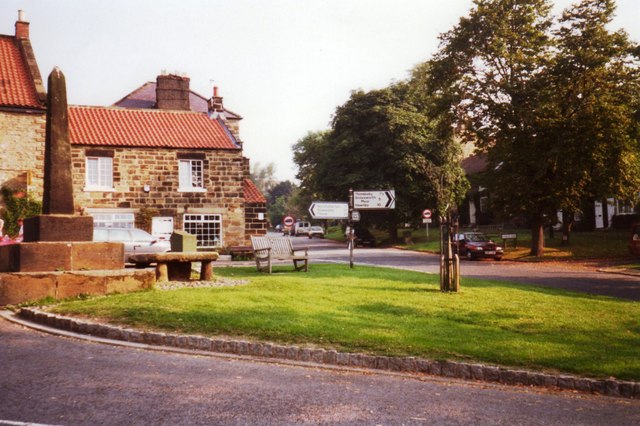
The region also boasts a rich cultural heritage, with evidence of human habitation dating back thousands of years. Ruins of ancient settlements and burial mounds can be found throughout the moorland, offering a glimpse into the area's historical significance. Additionally, Arden Great Moor is home to several picturesque villages, each with their own distinct charm and character.

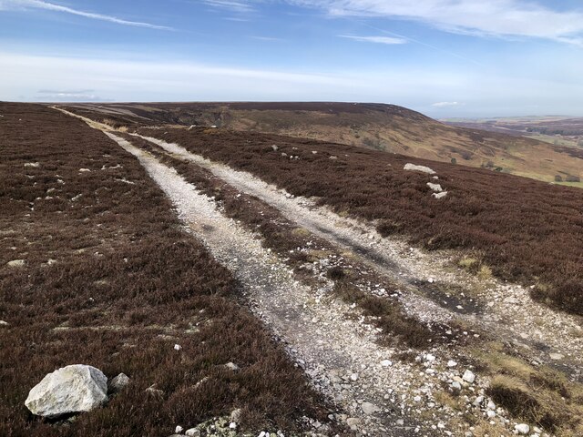
Outdoor activities are a highlight of Arden Great Moor, with opportunities for hiking, cycling, and horseback riding available. The well-maintained trails provide breathtaking views of the surrounding countryside, making it an ideal location for outdoor enthusiasts and nature lovers alike.

Whether it is exploring the rugged moorland, immersing oneself in the area's rich history, or simply enjoying the tranquility of the countryside, Arden Great Moor offers a truly unforgettable experience for visitors seeking a slice of Yorkshire's natural beauty.

If you have any feedback on the listing, please let us know in the comments section below.

Arden Great Moor Images

Images are sourced within 2km of 54.32899/-1.2319241 or Grid Reference SE5092. Thanks to Geograph Open Source API. All images are credited.

Moorland at edge of Arden Great Moor Arden Great Moor is a large area of heather moorland to the west of Ryedale. The view is from an estate road which follows the rim of its plateau, looking across the Rye valley with Rievaulx Moor at the centre.
Moorland at edge of Arden Great Moor
Arden Great Moor is a large area of heather moorland to the west of Ryedale. The view is from an estate road which follows the rim of its plateau, looking across the Rye valley with Rievaulx Moor at the centre.
Shadowed moorland at edge of Arden Great Moor A view from the estate road at the northern rim of Arden Great Moor. Beyond the immediate heather is the valley of the River Rye.
Cringle Moor is part of the distant high ground.
Shadowed moorland at edge of Arden Great Moor
A view from the estate road at the northern rim of Arden Great Moor. Beyond the immediate heather is the valley of the River Rye. Cringle Moor is part of the distant high ground.
Track Along The Edge Of Arden Great Moor
Thorodale from Arden Moor Looking down the path towards Thorodale from the footpath that weaves down the side of the valley.
Thorodale from Arden Moor
Looking down the path towards Thorodale from the footpath that weaves down the side of the valley.
Cairn Above Ryedale
Cairn Above Ryedale
View Of Upper Reaches Of Esklerdale The head of Eskerdale beck, a minor stream that runs into Ryedale, can be seen coming off the top of the moor, centre-left distance.
View Of Upper Reaches Of Esklerdale
The head of Eskerdale beck, a minor stream that runs into Ryedale, can be seen coming off the top of the moor, centre-left distance.
Lone Gnarled Tree Above Thorodale
Old quarries on the edge of the moor Shown on first edition OS maps as limestone quarries with a limekiln to one side. The kiln has long since disappeared whilst the shallow quarries are grassed over.
The geology is confusing here as there are several places on the moor that were once quarried for limestone, yet the ground vegetation is largely heather, which is associated with acid soils. The geological map shows the surface geology as mostly limestone of the Hambleton Oolite Member, but close by is the Lower Calcareous Grit, which is a more acid sandstone.
Old quarries on the edge of the moor
Shown on first edition OS maps as limestone quarries with a limekiln to one side. The kiln has long since disappeared whilst the shallow quarries are grassed over. The geology is confusing here as there are several places on the moor that were once quarried for limestone, yet the ground vegetation is largely heather, which is associated with acid soils. The geological map shows the surface geology as mostly limestone of the Hambleton Oolite Member, but close by is the Lower Calcareous Grit, which is a more acid sandstone.
Slopes of Eskerdale Steep slopes on the NW side of Eskerdale, an area neglected for agriculture and much colonised by birch and oak. At one time this must have been farmed and old maps show Eskerdale House which would have been somewhere within this shot. I took several photos here and by magnifying the results I believe the house must have been left of centre above a patch of pale grassland. A few traces of old walls appear around a mature tree in this patch.
Slopes of Eskerdale
Steep slopes on the NW side of Eskerdale, an area neglected for agriculture and much colonised by birch and oak. At one time this must have been farmed and old maps show Eskerdale House which would have been somewhere within this shot. I took several photos here and by magnifying the results I believe the house must have been left of centre above a patch of pale grassland. A few traces of old walls appear around a mature tree in this patch.
Steep path into Eskerdale The line of an old path dropping into Eskerdale can be seen crossing the photo diagonally left to right. The path is within access land but ends up in woodland outside the access area. Still worthy of exploration at some time.
Steep path into Eskerdale
The line of an old path dropping into Eskerdale can be seen crossing the photo diagonally left to right. The path is within access land but ends up in woodland outside the access area. Still worthy of exploration at some time.
Towards the head of Eskerdale A patch of sunlight highlights the steep little ravine at the head of Eskerdale.
Towards the head of Eskerdale
A patch of sunlight highlights the steep little ravine at the head of Eskerdale.
Path into Thorodale Looking south east from the junction of this path with a moor edge track. The junction now bears a FP marker, although the actual line on the map is a few metres off to the right across heathery ground. No one appears to use the definitive line when there is a clear track to follow instead.
Path into Thorodale
Looking south east from the junction of this path with a moor edge track. The junction now bears a FP marker, although the actual line on the map is a few metres off to the right across heathery ground. No one appears to use the definitive line when there is a clear track to follow instead.
Moorland track A fine day on the track along the side of Harker Yates Ridge. Skylarks are singing, meadow pipits are bouncing across the heather and grouse grumble at passing walkers.
Moorland track
A fine day on the track along the side of Harker Yates Ridge. Skylarks are singing, meadow pipits are bouncing across the heather and grouse grumble at passing walkers.
Plane Tree Farm A distant view of the farm taken from the top of Locker Bank just over a mile away. The old roadside lime kiln can be seen above the buildings to the right of the farmhouse. Improved pastures around the farm in the dale bottom, but heather moorland on the slopes beyond.
Plane Tree Farm
A distant view of the farm taken from the top of Locker Bank just over a mile away. The old roadside lime kiln can be seen above the buildings to the right of the farmhouse. Improved pastures around the farm in the dale bottom, but heather moorland on the slopes beyond.
View from Locker Bank Looking east of north from the plateau edge. Some recently burnt heather in the foreground, and with a view across upper Ryedale towards the headwaters of that little river.
View from Locker Bank
Looking east of north from the plateau edge. Some recently burnt heather in the foreground, and with a view across upper Ryedale towards the headwaters of that little river.
Eastward view from Locker Bank Along the curve of Arden Great Moor towards the distant scarp edges of Roppa Edge and beyond. The small white post, left of centre, is one of many scattered across the moor and marks the site of a grit tray for grouse.
Eastward view from Locker Bank
Along the curve of Arden Great Moor towards the distant scarp edges of Roppa Edge and beyond. The small white post, left of centre, is one of many scattered across the moor and marks the site of a grit tray for grouse.
Curious landform at the moor edge The moor edge track is to the left and the head of Locker Gill is ahead, but along the edge of the moor here is a distinct dip and bank immediately above the very steep drop to Locker Wood.  There's another example of this nearby and similar landforms around Rosedale and elsewhere on the moors. I suspect that this is an example of a rotational landslip due to unstable underlying Oxford Clays further down the hillside where there are a series of springs.
Curious landform at the moor edge
The moor edge track is to the left and the head of Locker Gill is ahead, but along the edge of the moor here is a distinct dip and bank immediately above the very steep drop to Locker Wood. There's another example of this nearby and similar landforms around Rosedale and elsewhere on the moors. I suspect that this is an example of a rotational landslip due to unstable underlying Oxford Clays further down the hillside where there are a series of springs.
Tractor at rest This isn't some 40 year old rusting machine, but a relatively modern tractor with an attachment for cutting heather, something that it has been used for recently for trimming areas around patches of heather that were to be burnt off as part of the grouse moor management.
Tractor at rest
This isn't some 40 year old rusting machine, but a relatively modern tractor with an attachment for cutting heather, something that it has been used for recently for trimming areas around patches of heather that were to be burnt off as part of the grouse moor management.
Show me another place!

Arden Great Moor is located at Grid Ref: SE5092 (Lat: 54.32899, Lng: -1.2319241)

Division: North Riding

Administrative County: North Yorkshire

District: Ryedale

Police Authority: North Yorkshire

What 3 Words

///hatch.ounce.lamppost. Near Bilsdale, North Yorkshire

Nearby Locations

Arden Great Moor

Related Wikis

Kepwick

Kepwick is a village and civil parish in the Hambleton district of North Yorkshire, England, on the North York Moors and near the A19. The population according...

Nether Silton

Nether Silton is a village and civil parish in the Hambleton District of North Yorkshire, England. It lies 6 miles (9.7 km) east of Northallerton, on...

Cowesby

Cowesby is a village and civil parish in the Hambleton District of North Yorkshire, England. Part of the village including The Cowesby Hall Estate is within...

Over Silton Manor

Over Silton Manor is in the middle of the village of Over Silton in North Yorkshire, England. "The village of Over silton, 1994;39" == History == There...

Over Silton

Over Silton is a village and civil parish in the Hambleton district of North Yorkshire, England, about 6 miles (9.7 km) east of Northallerton and on the...

Hawnby

Hawnby is a small crossroads village and civil parish in Ryedale in the North York Moors National Park, North Yorkshire, England. The village is about...

Thimbleby, North Yorkshire

Thimbleby is a small village and civil parish in the Hambleton District of North Yorkshire, England, it is in the North Yorks Moors and close to the village...

Osmotherley, North Yorkshire

Osmotherley is a village and civil parish in the Hambleton hills in North Yorkshire, six miles north-east of Northallerton. The village is at the western...

Nearby Amenities

Located within 500m of 54.32899,-1.2319241
Arden Great Moor
Place: locality
Lat/Long: 54.3276955/-1.2287507
The data included in this document is from www.openstreetmap.org. The data is made available under ODbL.

Have you been to Arden Great Moor?

Leave your review of Arden Great Moor below (or comments, questions and feedback).