Saxton Field
Downs, Moorland in Yorkshire Selby
England
Saxton Field

Saxton Field is a picturesque area located in the region of Yorkshire, England. Situated amidst the stunning Yorkshire Downs and Moorland, this tranquil setting offers visitors a unique blend of natural beauty and cultural heritage.
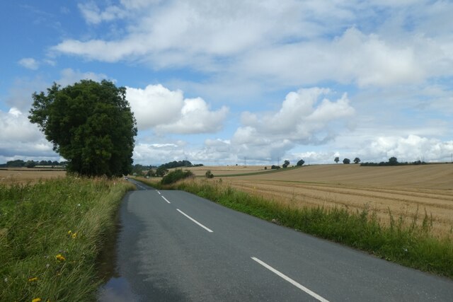
The field itself is vast, spanning over several acres, and is characterized by its lush green meadows and rolling hills. The landscape is dotted with vibrant wildflowers and scattered with ancient oak trees, providing a serene and idyllic atmosphere.
The Yorkshire Downs, which surround Saxton Field, are renowned for their expansive views and sweeping panoramas. Visitors can bask in the breathtaking scenery, taking in the undulating hills and valleys that stretch as far as the eye can see.
Adjacent to the field, the Moorland presents a distinct landscape. Here, visitors can explore heather-covered hillsides, interspersed with rocky outcrops and peat bogs. The Moorland is home to a diverse range of wildlife, including birds of prey such as hawks and falcons, as well as rare species like the black grouse.
Saxton Field is steeped in history, with evidence of human habitation dating back thousands of years. Archaeological finds unearthed in the area include ancient burial mounds, Roman artifacts, and remnants of medieval settlements. This rich history provides a fascinating backdrop for visitors interested in exploring the region's past.
Overall, Saxton Field offers a captivating blend of natural wonders and historical significance. Whether it's hiking along the Downs, admiring the Moorland's unique ecosystem, or delving into the area's rich heritage, this Yorkshire gem promises an unforgettable experience for all who venture here.
If you have any feedback on the listing, please let us know in the comments section below.
Saxton Field Images
Images are sourced within 2km of 53.823106/-1.2683352 or Grid Reference SE4836. Thanks to Geograph Open Source API. All images are credited.


Saxton Field is located at Grid Ref: SE4836 (Lat: 53.823106, Lng: -1.2683352)
Division: West Riding
Administrative County: North Yorkshire
District: Selby
Police Authority: North Yorkshire
What 3 Words
///reframe.strongman.warbler. Near Church Fenton, North Yorkshire
Nearby Locations
Related Wikis
Saxton, North Yorkshire
Saxton is a village in North Yorkshire, England, 14 miles (23 km) south-west of York and 12 miles (19 km) east of Leeds. The resident population is about...

Saxton with Scarthingwell
Saxton with Scarthingwell is a civil parish just south of Tadcaster in North Yorkshire, England. The parish contains the villages of Saxton and Scarthingwell...

Barkston Ash
Barkston Ash is a small village and civil parish close to Selby in North Yorkshire, England. It was formerly known as Barkston in the West Riding of Yorkshire...

Barkston Ash Wapentake
Barkston Ash was a wapentake of the West Riding of Yorkshire, named after the meeting-place at the village of Barkston. It included the parishes of Birkin...

Battle of Towton
The Battle of Towton took place on 29 March 1461 during the Wars of the Roses, near Towton in North Yorkshire, and "has the dubious distinction of being...
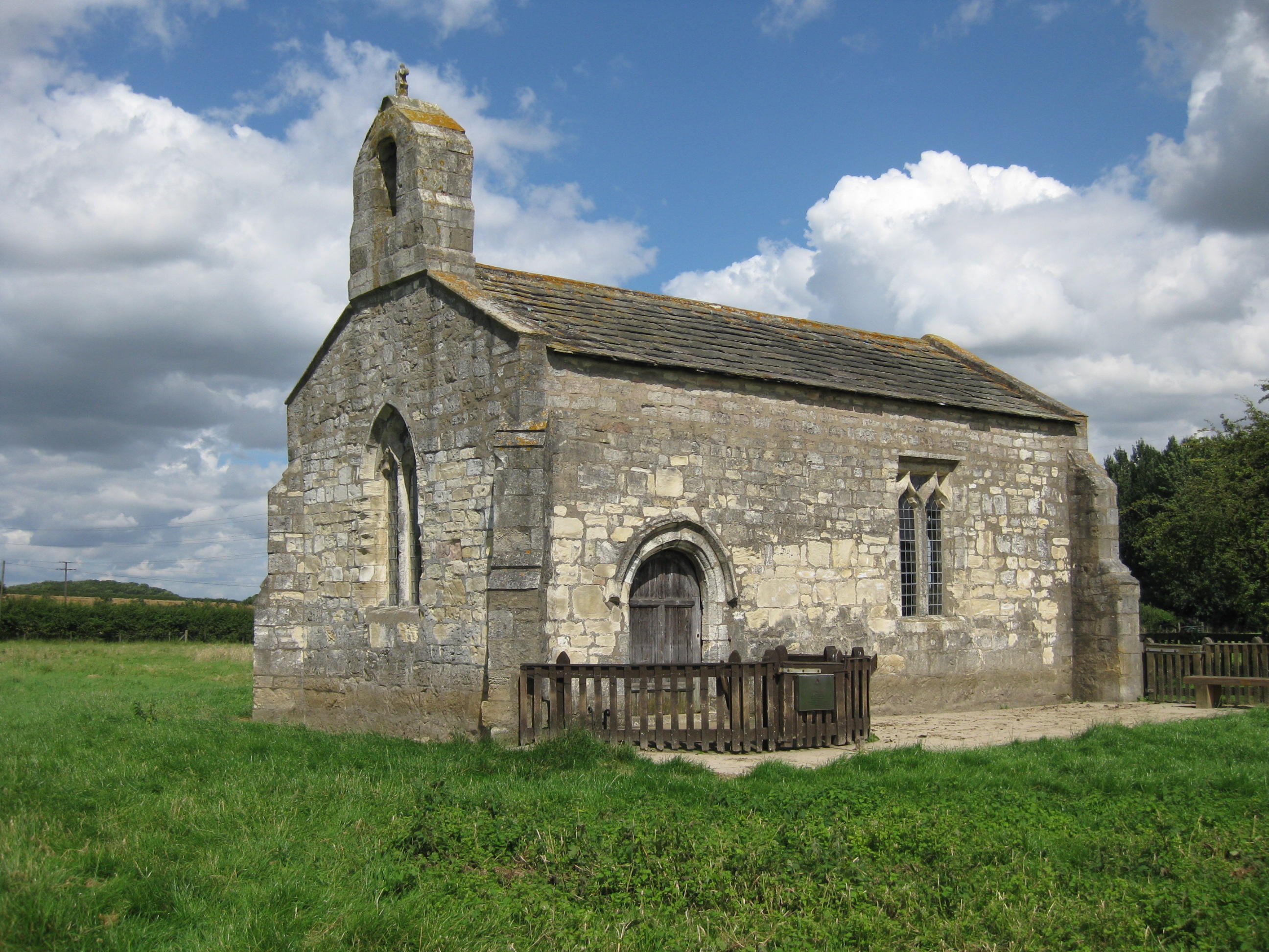
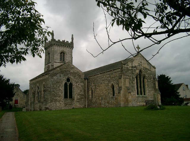
St Mary's Chapel, Lead
St Mary's Church, Lead, is a redundant Anglican chapel standing in an isolated position in fields some 0.75 miles (1.2 km) to the west of the village of...
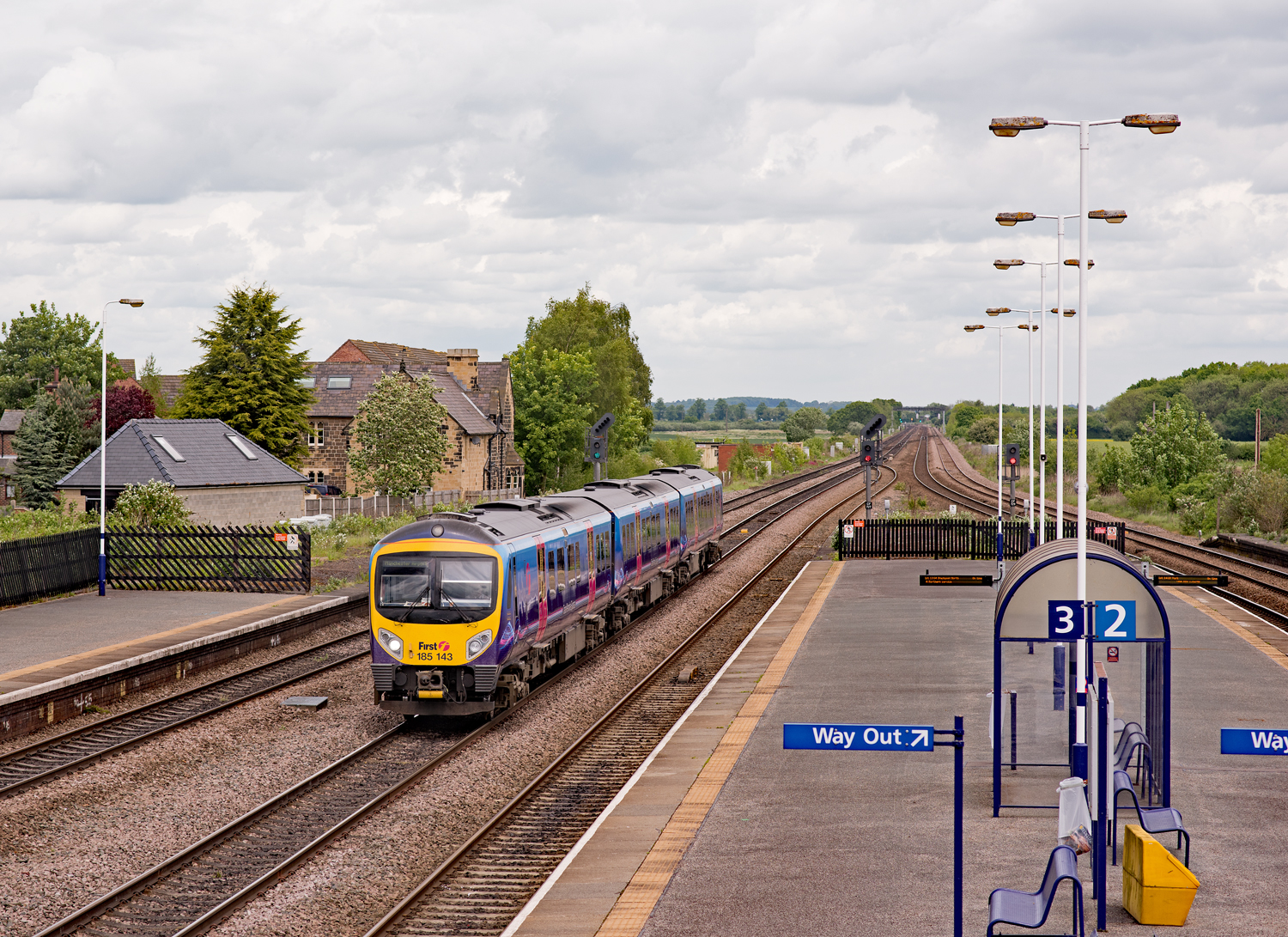
Church Fenton railway station
Church Fenton railway station serves the village of Church Fenton in North Yorkshire, England. It is situated where the Cross Country Route from Leeds...

Towton Hall
Towton Hall is a mansion, a home, near the village of Towton in North Yorkshire, England. The building, known to been built as a residence in the seventeenth...
Nearby Amenities
Located within 500m of 53.823106,-1.2683352Have you been to Saxton Field?
Leave your review of Saxton Field below (or comments, questions and feedback).