Clowne Common

Downs, Moorland in Derbyshire Bolsover

England

Clowne Common

Field path running south from Clowne to Oxcroft
Field path running south from Clowne to Oxcroft Credit: Colin Park

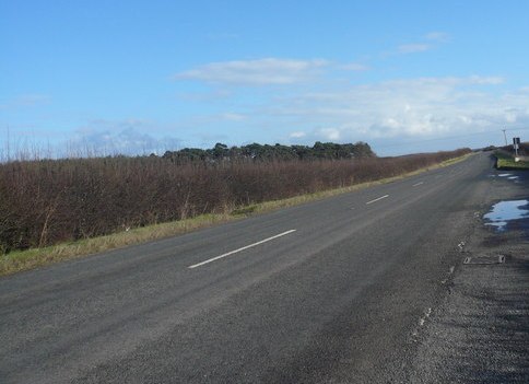
Clowne Common is a picturesque expanse of open land located in Derbyshire, England. Covering an area of approximately 100 hectares, it consists of a combination of downs and moorland, offering a diverse and captivating landscape. Situated near the town of Clowne, the common is easily accessible and attracts both locals and visitors alike.

The common is characterized by its gently rolling hills and heather-covered moors, which provide a habitat for a wide range of wildlife. Visitors can expect to encounter various species of birds, such as skylarks and meadow pipits, as well as rabbits and deer that roam freely across the open landscape.

The common is a popular destination for outdoor enthusiasts, offering ample opportunities for walking, hiking, and picnicking. Several well-marked footpaths crisscross the area, allowing visitors to explore its natural beauty at their own pace. The breathtaking views from the higher points of the common make it an ideal spot for photographers and nature lovers.

Clowne Common also holds historical significance, with evidence of prehistoric human activity discovered in the area. Archaeological finds, including flint tools and pottery fragments, suggest that the common was inhabited during the Neolithic and Bronze Age periods.

Overall, Clowne Common is a stunning natural landscape that offers a tranquil escape from the hustle and bustle of everyday life. With its diverse flora and fauna, rich history, and recreational opportunities, it is a must-visit destination for anyone seeking to immerse themselves in the beauty of Derbyshire's countryside.

If you have any feedback on the listing, please let us know in the comments section below.

Clowne Common Images

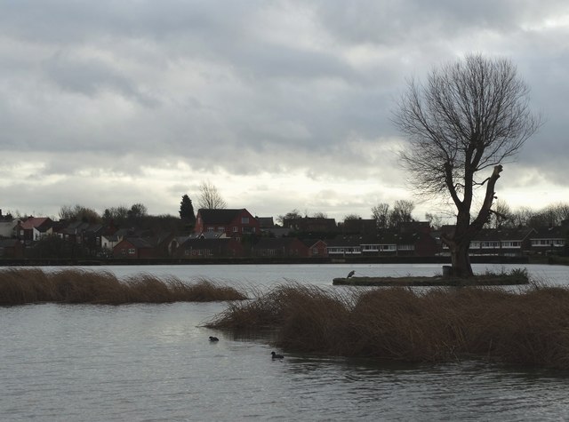
Images are sourced within 2km of 53.270743/-1.2847544 or Grid Reference SK4775. Thanks to Geograph Open Source API. All images are credited.

Field path running south from Clowne to Oxcroft
Field path north of Oxcoft looking towards Clowne
Derelict building by Woodhouse Lane
Road works on Chesterfield Road, Barlborough
Lay by on A619 above M1
M1 near Bank House Farm
M1 near Romley House Farm
Southgate Colliery memorial On Station Road in Clowne
Southgate Colliery memorial
On Station Road in Clowne
M1, J30 overbridges The M1 is a north–south motorway connecting London to Leeds, where it joins the A1(M) near Aberford. It was the first motorway to be completed in the United Kingdom.
The motorway is 193 miles long and was constructed in four phases. Most of the motorway was opened between 1959 and 1968 but the southern end was extended in 1977 and the northern end was extended in 1999.
M1, J30 overbridges
The M1 is a north–south motorway connecting London to Leeds, where it joins the A1(M) near Aberford. It was the first motorway to be completed in the United Kingdom. The motorway is 193 miles long and was constructed in four phases. Most of the motorway was opened between 1959 and 1968 but the southern end was extended in 1977 and the northern end was extended in 1999.
A619 Bridge, M1 The M1 is a north–south motorway connecting London to Leeds, where it joins the A1(M) near Aberford. It was the first motorway to be completed in the United Kingdom.
The motorway is 193 miles long and was constructed in four phases. Most of the motorway was opened between 1959 and 1968 but the southern end was extended in 1977 and the northern end was extended in 1999.
A619 Bridge, M1
The M1 is a north–south motorway connecting London to Leeds, where it joins the A1(M) near Aberford. It was the first motorway to be completed in the United Kingdom. The motorway is 193 miles long and was constructed in four phases. Most of the motorway was opened between 1959 and 1968 but the southern end was extended in 1977 and the northern end was extended in 1999.
Footbridge over the M1 The M1 is a north–south motorway connecting London to Leeds, where it joins the A1(M) near Aberford. It was the first motorway to be completed in the United Kingdom.
The motorway is 193 miles long and was constructed in four phases. Most of the motorway was opened between 1959 and 1968 but the southern end was extended in 1977 and the northern end was extended in 1999.
Footbridge over the M1
The M1 is a north–south motorway connecting London to Leeds, where it joins the A1(M) near Aberford. It was the first motorway to be completed in the United Kingdom. The motorway is 193 miles long and was constructed in four phases. Most of the motorway was opened between 1959 and 1968 but the southern end was extended in 1977 and the northern end was extended in 1999.
Dobbies Garden Centre near Barlborough
A view of Harlesthorpe Dam On the little island right of centre, a heron sits conserving energy and passing time.
A view of Harlesthorpe Dam
On the little island right of centre, a heron sits conserving energy and passing time.
Houses on Barlborough Road, New Barlborough
Houses on Worksop Road east of Mastin Moor
The old boathouse by Harlesthorpe Dam
Yew Farm, Stanfree On Church Road
Yew Farm, Stanfree
On Church Road
Pillar box at Oxcroft Looking down the hill to Stanfree
Pillar box at Oxcroft
Looking down the hill to Stanfree
Show me another place!

Clowne Common is located at Grid Ref: SK4775 (Lat: 53.270743, Lng: -1.2847544)

Administrative County: Derbyshire

District: Bolsover

Police Authority: Derbyshire

What 3 Words

///crossings.stood.clocks. Near Clowne, Derbyshire

Nearby Locations

Clowne Common

Related Wikis

Stanfree

Stanfree is a community/village in Bolsover (district), county of Derbyshire, consisting of a couple of rows of terraced cottages, lying halfway between...

Barlborough Common

Barlborough Common is an area in Derbyshire, England. It is located to the south of Barlborough. The land has undergone extensive open-cast mining and...

Heritage High School, Clowne

Heritage High School (formerly known as Heritage Community School) is a co-educational secondary school located in Clowne in the English county of Derbyshire...

A616 road

The A616 is a road that links Newark-on-Trent, Nottinghamshire, to the M1 motorway at Junction 30, then reappears at Junction 35A and goes on to Huddersfield...

Nearby Amenities

Located within 500m of 53.270743,-1.2847544
Barrier: stile
Steps: 1
Stile: stepover
Lat/Long: 53.2686717/-1.2819683
Power: tower
Source: Bing
Lat/Long: 53.2675493/-1.2860491
Power: tower
Source: Bing
Lat/Long: 53.2670918/-1.2887367
Bus Stop
Bus: yes
Public Transport: platform
Lat/Long: 53.2680041/-1.2831018
Bus Stop
Bus: yes
Public Transport: platform
Lat/Long: 53.2676672/-1.2833995
The data included in this document is from www.openstreetmap.org. The data is made available under ODbL.

Have you been to Clowne Common?

Leave your review of Clowne Common below (or comments, questions and feedback).