Hawcross

Settlement in Worcestershire Forest of Dean

England

Hawcross

Grazing near Round Bush Farm
Grazing near Round Bush Farm Credit: JThomas

Hawcross is a picturesque village located in the county of Worcestershire, England. Situated in the heart of the Malvern Hills, it offers breathtaking views of the surrounding countryside and is renowned for its natural beauty. With a population of approximately 500 residents, it maintains a close-knit community atmosphere.

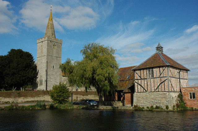
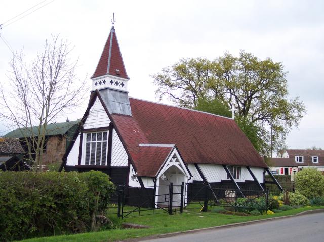
The village is characterized by its charming traditional architecture, with many buildings dating back several centuries. One of the most notable landmarks is St. Mary's Church, a stunning medieval structure that has been a focal point of the community for centuries.

Hawcross is also known for its thriving agricultural industry. The fertile land surrounding the village is home to numerous farms, which contribute to the local economy and provide fresh produce for the residents. The fields are a patchwork of vibrant greens and golden crops, creating a picturesque countryside scene.

The village offers a range of amenities to cater to its residents' needs. There is a local primary school, a post office, a pub, and a community center, where various events and activities take place throughout the year. The village also has excellent transport links, with regular bus services connecting it to nearby towns and cities.

For nature enthusiasts, Hawcross is a paradise. The Malvern Hills, with their stunning hiking trails, are just a stone's throw away, offering countless opportunities for outdoor activities such as walking, cycling, and birdwatching.

Overall, Hawcross is a peaceful and idyllic village that provides a tranquil escape from the bustling city life. Its natural beauty, strong sense of community, and proximity to the Malvern Hills make it a desirable place to live or visit.

If you have any feedback on the listing, please let us know in the comments section below.

Hawcross Images

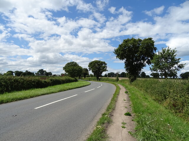
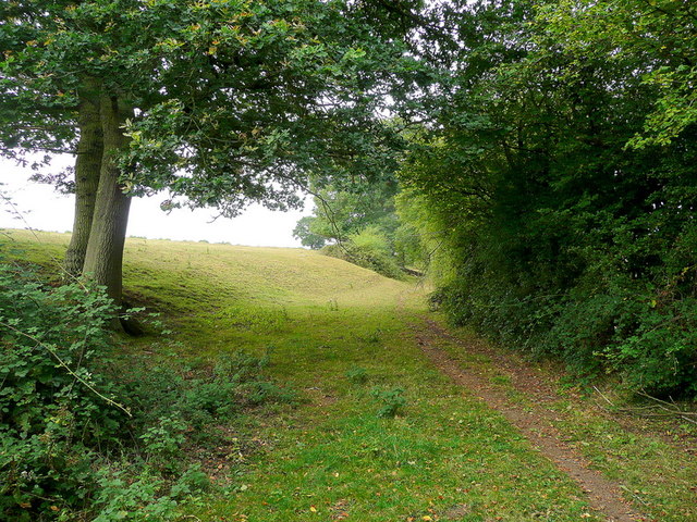
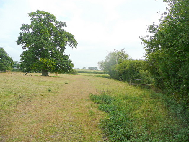
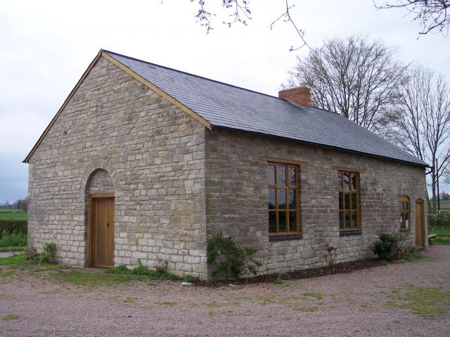
Images are sourced within 2km of 51.970379/-2.349754 or Grid Reference SO7630. Thanks to Geograph Open Source API. All images are credited.

Grazing near Round Bush Farm
Hawcross Lane Towards Hawcross.
Hawcross Lane
Towards Hawcross.
Old barn, Round Bush Farm
Bend in the A417 towards Ledbury
Cereal crop and track near Hethelpit Cross Off the A417.
Cereal crop and track near Hethelpit Cross
Off the A417.
Sladbrook, near Staunton Dates from c1750 to 1800 <span class="nowrap"><a title="https://historicengland.org.uk/listing/the-list/list-entry/1156761" rel="nofollow ugc noopener" href="https://historicengland.org.uk/listing/the-list/list-entry/1156761">Link</a><img style="margin-left:2px;" alt="External link" title="External link - shift click to open in new window" src="https://s1.geograph.org.uk/img/external.png" width="10" height="10"/></span>
Sladbrook, near Staunton
Dates from c1750 to 1800 LinkExternal link
Sladbrook Lane
Sladbrook Lane
Grass field near Hethelpit Cross
No through road to Sladbrook Cottage beside a no through road to Sladbrook to the west of Staunton.
No through road to Sladbrook
Cottage beside a no through road to Sladbrook to the west of Staunton.
Farmland at Staunton Farmland to the west of Staunton.
Farmland at Staunton
Farmland to the west of Staunton.
Field at Sladbrook Field at Sladbrook near Staunton.
Field at Sladbrook
Field at Sladbrook near Staunton.
Track approaching cottages Track and footpath approaching cottages near Staunton. The footpath passes in front of the cottage following the fencing to the right.
Track approaching cottages
Track and footpath approaching cottages near Staunton. The footpath passes in front of the cottage following the fencing to the right.
Barn at Sacksfield Farm A large new barn at Sacksfield Farm near Staunton.
Barn at Sacksfield Farm
A large new barn at Sacksfield Farm near Staunton.
Farmland near Staunton Farmland to the west of the village of Staunton.
Farmland near Staunton
Farmland to the west of the village of Staunton.
Edge of pasture The public footpath from the Leadon to Upleadon follows the field edge here.
Edge of pasture
The public footpath from the Leadon to Upleadon follows the field edge here.
Footpath junction ahead Looking north-east towards the Leadon Bridge just beyond the oak.
The path to Upleadon joins at the footbridge to the right.
Footpath junction ahead
Looking north-east towards the Leadon Bridge just beyond the oak. The path to Upleadon joins at the footbridge to the right.
Pastoral land To the east of Everes's Farm; the footpath to Witherdine follows the field edge.
Pastoral land
To the east of Everes's Farm; the footpath to Witherdine follows the field edge.
The Vale of Leadon Watermeadows south of Everes's Farm.
The Vale of Leadon
Watermeadows south of Everes's Farm.
Show me another place!

Hawcross is located at Grid Ref: SO7630 (Lat: 51.970379, Lng: -2.349754)

Administrative County: Gloucestershire

District: Forest of Dean

Police Authority: Gloucestershire

What 3 Words

///sushi.riverside.operating. Near Corse, Gloucestershire

Nearby Locations

Hawcross The Heath

Related Wikis

Redmarley D'Abitot

Redmarley D'Abitot is a civil parish and village in the Forest of Dean district, Gloucestershire, South West England. In addition to the village of Redmarley...

Collinpark Wood SSSI

Collinpark Wood (grid reference SO750278) is a 66.69-hectare (164.8-acre) biological Site of Special Scientific Interest in Gloucestershire, notified in...

Brand Green

Brand Green is a village in Gloucestershire, England. == References == == External links == Media related to Brand Green at Wikimedia Commons

Gadfield Elm Chapel

The Gadfield Elm Chapel near the village of Pendock in Worcestershire, England, is the oldest extant chapel of the Church of Jesus Christ of Latter-day...

Staunton (near Gloucester)

Staunton is a village that lies close to the village of Corse. Staunton is eight miles north of the city of Gloucester. To the south-west of Staunton is...

Pendock

Pendock is a village and civil parish in the Malvern Hills district in the county of Worcestershire, England, situated about halfway between the towns...

Upleadon

Upleadon is a village and civil parish situated 10.5 km north-west of Gloucester. Soon after the Norman conquest Upleadon became part of the estates of...

Ketford Bank

Ketford Bank (grid reference SO723308) is a 0.69-hectare (1.7-acre) nature reserve in Gloucestershire.The site is owned and managed by the Gloucestershire...

Nearby Amenities

Located within 500m of 51.970379,-2.349754
Post Box
Collection Times: Mo-Fr 16:00; Sa 11:15
Post Box Type: lamp
Ref: GL19 360
Royal Cypher: EIIR
Royal Cypher Wikidata: Q33102113
Source: survey
Lat/Long: 51.9706932/-2.3505594
Hawcross
Place: hamlet
Source Name: OS_OpenData_StreetView
Lat/Long: 51.9700301/-2.3494679
Defibrillator
Emergency: defibrillator
Lat/Long: 51.9686124/-2.3447134
Hawcross North
Power: pole
Transformer: distribution
Voltage Primary: 11000
Lat/Long: 51.9714945/-2.3521645
Power: pole
Lat/Long: 51.9712343/-2.3514618
Power: pole
Lat/Long: 51.9709575/-2.3507658
Power: pole
Lat/Long: 51.9708327/-2.3502977
Hawcross
Power: pole
Transformer: distribution
Voltage Primary: 11000
Lat/Long: 51.9706972/-2.3497854
Power: pole
Lat/Long: 51.9710029/-2.3485529
Power: pole
Lat/Long: 51.9712591/-2.3475833
Power: pole
Lat/Long: 51.9715135/-2.3465922
Power: pole
Lat/Long: 51.9664425/-2.3477503
Power: pole
Lat/Long: 51.9672857/-2.3476772
Power: pole
Lat/Long: 51.9673514/-2.3447026
Power: pole
Lat/Long: 51.9676257/-2.3459968
Power: pole
Lat/Long: 51.967919/-2.3472561
Power: pole
Lat/Long: 51.968283/-2.3476182
Power: pole
Lat/Long: 51.9687767/-2.3471414
Power: pole
Lat/Long: 51.9692939/-2.346666
Little Brangwells
Power: pole
Transformer: distribution
Voltage Primary: 11000
Lat/Long: 51.9690109/-2.3449025
Power: pole
Lat/Long: 51.9692968/-2.345522
Hawcross South
Power: pole
Transformer: distribution
Voltage Primary: 11000
Lat/Long: 51.9696678/-2.3464635
Power: pole
Lat/Long: 51.9695096/-2.3462027
Power: pole
Lat/Long: 51.9697401/-2.3458392
Power: pole
Lat/Long: 51.9703416/-2.3457789
Power: pole
Lat/Long: 51.9709521/-2.3457326
Power: pole
Lat/Long: 51.9717684/-2.3460585
Power: pole
Lat/Long: 51.9723719/-2.3447972
Power: pole
Lat/Long: 51.9727611/-2.3441085
The data included in this document is from www.openstreetmap.org. The data is made available under ODbL.

Have you been to Hawcross?

Leave your review of Hawcross below (or comments, questions and feedback).