Beedon Common
Downs, Moorland in Berkshire
England
Beedon Common

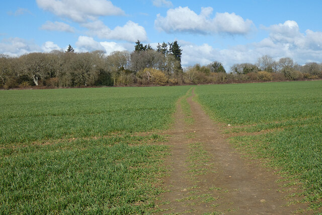
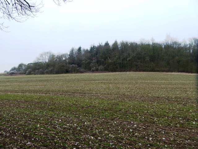
Beedon Common is a beautiful area located in the county of Berkshire in England. Situated on the edge of the North Wessex Downs, it covers approximately 100 acres of land. The common is known for its diverse landscape, consisting of both downs and moorland.
The downs of Beedon Common offer breathtaking views of the surrounding countryside, with rolling hills and expansive fields. These areas are characterized by their short grass and scattered patches of shrubs and trees. The downs provide a haven for various bird species, including skylarks and meadow pipits, which can be spotted soaring above the open landscape.
On the other hand, the moorland of Beedon Common offers a different experience. Here, visitors can find heather-covered expanses, interspersed with gorse bushes and scattered trees. The moorland provides a more rugged and wild atmosphere, attracting a range of wildlife, such as rabbits, foxes, and even the occasional deer.
Beedon Common is a popular destination for nature enthusiasts, walkers, and photographers alike. Its serene and unspoiled environment offers a peaceful retreat from the hustle and bustle of nearby towns and cities. The common is also home to several walking trails, allowing visitors to explore the area at their own pace.
Overall, Beedon Common in Berkshire is a stunning natural landscape, combining both downs and moorland in a harmonious way. It provides a unique opportunity to experience the diverse beauty of the English countryside and immerse oneself in nature.
If you have any feedback on the listing, please let us know in the comments section below.
Beedon Common Images
Images are sourced within 2km of 51.485863/-1.3178833 or Grid Reference SU4776. Thanks to Geograph Open Source API. All images are credited.


Beedon Common is located at Grid Ref: SU4776 (Lat: 51.485863, Lng: -1.3178833)
Unitary Authority: West Berkshire
Police Authority: Thames Valley
What 3 Words
///tint.pricing.convey. Near Hermitage, Berkshire
Nearby Locations
Related Wikis
Beedon
Beedon is a village and civil parish about 6+1⁄2 miles (10.5 km) north of Newbury in West Berkshire, England. == Geography == The village has outlying...

World's End, Berkshire
World's End is a hamlet in Berkshire, England. It is in the district of West Berkshire, near the A34 north of Newbury. To the north is the village of Beedon...

Peasemore
Peasemore is a village and civil parish in the English ceremonial and historic county of Berkshire in the West Berkshire unitary authority area, west of...

Stanmore, Berkshire
Stanmore is a hamlet in Berkshire, England. In the 2011 Census it was included in the civil parish of Beedon. It is situated west of the A34, 7 miles north...
Chieveley House
Chieveley House, on the High Street in the village of Chieveley, Berkshire is a country house dating from the early 18th century. It is a Grade II* listed...

Bothampstead
Bothampstead is a hamlet in the English county of Berkshire, and within the civil parish of Hampstead Norreys. It consists of several houses and a farm...
Chieveley
Chieveley is a village and large civil parish centred 3.5 miles (5.6 km) north of Newbury in Berkshire, close to the M4 motorway and A34 road. Chieveley...
Ashridge Wood
Ashridge Wood is a 15.9-hectare (39-acre) biological Site of Special Scientific Interest south-west of Compton in Berkshire. It is in the North Wessex...
Nearby Amenities
Located within 500m of 51.485863,-1.3178833Have you been to Beedon Common?
Leave your review of Beedon Common below (or comments, questions and feedback).