Hawbridge

Settlement in Worcestershire Wychavon

England

Hawbridge

Bridleway from Upper Wolverton Farm
Bridleway from Upper Wolverton Farm Credit: Liz Stone

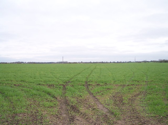
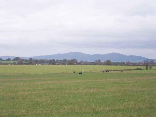
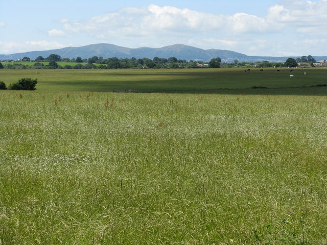
Hawbridge is a small village located in the county of Worcestershire, England. Situated near the River Severn, it is surrounded by picturesque countryside and offers a tranquil and idyllic setting for its residents and visitors.

The village is known for its rich history, with evidence of habitation dating back to Roman times. It is believed to have derived its name from the Old English words "haga" and "brycg," meaning "enclosure" and "bridge" respectively, indicating the presence of an ancient bridge in the area.

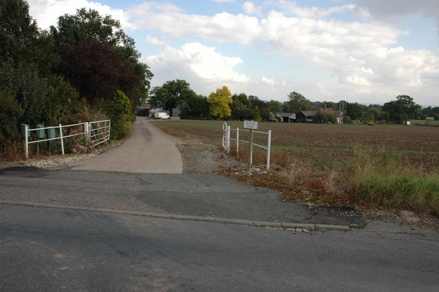
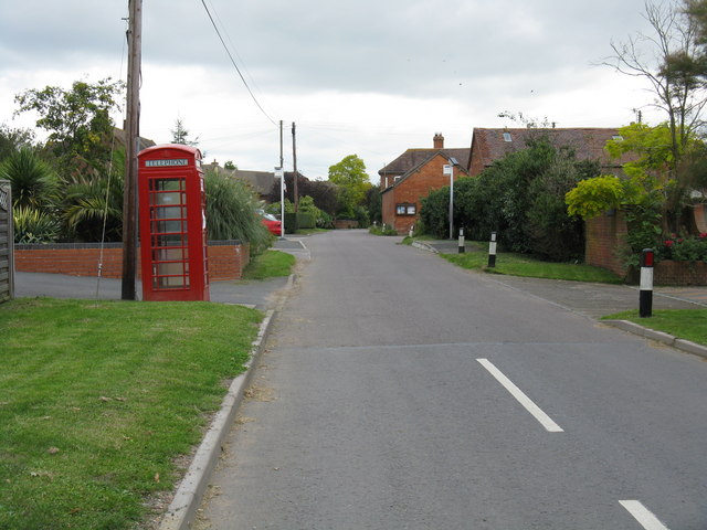
Today, Hawbridge is a close-knit community with a population of around 500 inhabitants. The village boasts a charming mix of traditional and modern architecture, with well-preserved cottages and farmhouses lining its streets. Its quaint village green is a focal point, providing a space for community gatherings and events throughout the year.

The village offers a range of amenities to its residents, including a local convenience store, a primary school, and a village hall that hosts various activities and social events. The nearby town of Worcester is easily accessible, providing additional shopping, educational, and recreational facilities.

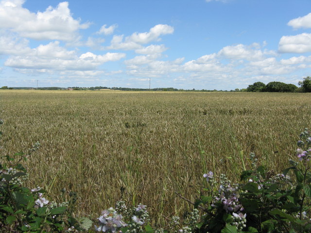
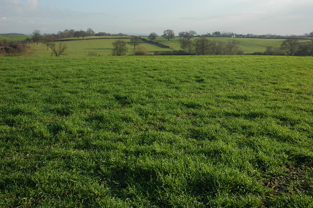
For nature enthusiasts, the surrounding countryside offers opportunities for outdoor pursuits such as walking, cycling, and birdwatching. The picturesque River Severn is also a popular spot for fishing and boating.

In conclusion, Hawbridge is a charming and historic village in Worcestershire, offering a peaceful and picturesque lifestyle for its residents, as well as a delightful destination for visitors seeking a taste of rural England.

If you have any feedback on the listing, please let us know in the comments section below.
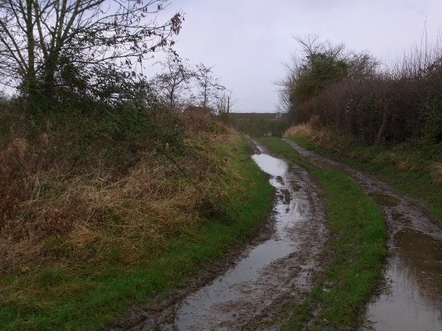
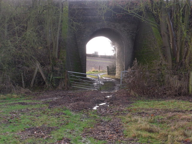
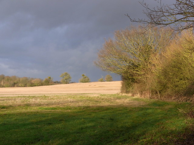
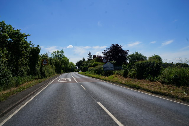
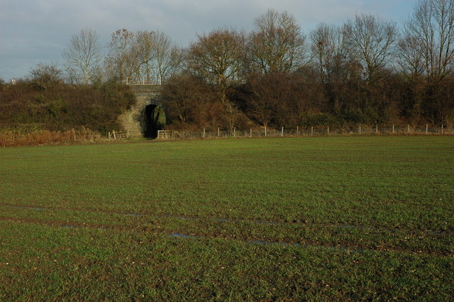
Hawbridge Images

Images are sourced within 2km of 52.141421/-2.14244 or Grid Reference SO9049. Thanks to Geograph Open Source API. All images are credited.

Bridleway from Upper Wolverton Farm
Through the railway bridge arch In the far distance, the tower of Stoulton church is visible.
Through the railway bridge arch
In the far distance, the tower of Stoulton church is visible.
Recent repairs to the railway bridge abutments Continuous, if slow, settlement in the area has resulted in many repairs being necessary. The horizontal markers are there to monitor any further movement. These are dated 17 and 18/12/12. Previous markers are still seen, some broken on the ground.
Recent repairs to the railway bridge abutments
Continuous, if slow, settlement in the area has resulted in many repairs being necessary. The horizontal markers are there to monitor any further movement. These are dated 17 and 18/12/12. Previous markers are still seen, some broken on the ground.
Field north of the footbridge Dramatic winter scene with low sun.
Field north of the footbridge
Dramatic winter scene with low sun.
The B4084 towards Stoulton
Egdon Lane Looking north along the B4084 at Upper Wolverton.
Egdon Lane
Looking north along the B4084 at Upper Wolverton.
Field near Stoulton Looking NE along what used to be a track over the ridge and under the railway. Recently ploughed up and re-sown pasture land.
Field near Stoulton
Looking NE along what used to be a track over the ridge and under the railway. Recently ploughed up and re-sown pasture land.
View from Stoulton of The Malvern Hills Supplementary. Worcestershire Beacon and North Hill with Sugarloaf in between.
View from Stoulton of The Malvern Hills
Supplementary. Worcestershire Beacon and North Hill with Sugarloaf in between.
Breach Farm Breach Farm viewed from the B4084
Breach Farm
Breach Farm viewed from the B4084
Fields before the Malvern Hills, near Stoulton
Fields near Stoulton
Large ploughed field near Egdon
Winter cereals at Stoulton Winter sun on a field of winter cereals near Stoulton. In silhouette on the horizon is Stoulton church.
Winter cereals at Stoulton
Winter sun on a field of winter cereals near Stoulton. In silhouette on the horizon is Stoulton church.
Arable land near Stoulton View across arable land to the east of Stoulton, on the right in the middle distance is Mucknell Farm, currently being redeveloped, and in the distance are industrial units at Norton.
Arable land near Stoulton
View across arable land to the east of Stoulton, on the right in the middle distance is Mucknell Farm, currently being redeveloped, and in the distance are industrial units at Norton.
Train near Stoulton A train on the Oxford to Worcester line near Stoulton.
Train near Stoulton
A train on the Oxford to Worcester line near Stoulton.
Railway Bridge near Stoulton This bridge carries the Oxford to Worcester railway over a footpath and farm access track to the north of Stoulton.
Railway Bridge near Stoulton
This bridge carries the Oxford to Worcester railway over a footpath and farm access track to the north of Stoulton.
Worcester to Oxford railway at Stoulton Viewed from the footpath from Stoulton.
Worcester to Oxford railway at Stoulton
Viewed from the footpath from Stoulton.
Farmland at Stoulton View across farmland between Stoulton and the railway line.
Farmland at Stoulton
View across farmland between Stoulton and the railway line.
Show me another place!

Hawbridge is located at Grid Ref: SO9049 (Lat: 52.141421, Lng: -2.14244)

Administrative County: Worcestershire

District: Wychavon

Police Authority: West Mercia

What 3 Words

///golden.foot.snipe. Near Kempsey, Worcestershire

Nearby Locations

Hawbridge Stoulton

Related Wikis

Hawbridge

Hawbridge is a village in Worcestershire, England. == References ==

Stoulton

Stoulton or Stoughton is a village and civil parish about 5 miles south west of Worcester, in the Wychavon district, in the county of Worcestershire, England...

Wadborough railway station

Wadborough railway station was located in Wadborough, Worcestershire. It opened in 1841 and closed in January 1965. It was situated to the west on the...

Abbots Wood Junction railway station

Abbots Wood Junction railway station was an early railway station in England, close to Worcester. The station, 68 miles 60 chains (68.75 miles, 110.64...

Wadborough

Wadborough is a small village 2 miles outside Pershore and 7 miles from Worcester. The village is in Worcestershire, England. The village is an old farming...

Stoulton railway station

Stoulton railway station was a station to the northwest of Drakes Broughton, Worcestershire, England. The station was opened in 1899 and closed in 1966...

Worcestershire Parkway railway station

Worcestershire Parkway is a split-level railway station where the Cotswold and Cross Country lines cross near Norton, Worcester, England. It opened on...

Mucknell Abbey

Mucknell Abbey is an Anglican Benedictine monastery in Worcestershire, England. The community, which formerly lived at Burford, has both male and female...

Nearby Amenities

Located within 500m of 52.141421,-2.14244
Bus Stop
The Bird in Hand
Bus: yes
Naptan AtcoCode: 2000G040001
Naptan Bearing: N
Naptan CommonName: The Bird in Hand
Naptan Indicator: Adj
Naptan NaptanCode: wocgjpdt
Naptan Street: Old Worcester Road
Naptan Verified: no
Public Transport: platform
Source: naptan_import
Lat/Long: 52.1418224/-2.138627
The Bird in Hand
Naptan AtcoCode: 2000G740001
Naptan Bearing: S
Naptan BusStopType: CUS
Naptan CommonName: The Bird in Hand
Naptan Indicator: opp
Naptan NaptanCode: wocgpgdt
Naptan Street: Old Worcester Road
Naptan Verified: no
Source: naptan_import
Lat/Long: 52.1422758/-2.1385856
Barrier: stile
Foot: yes
Lat/Long: 52.1413672/-2.1471392
Hawbridge
Place: hamlet
Wikidata: Q5684703
Lat/Long: 52.1407714/-2.1394822
Barrier: kissing_gate
Foot: yes
Lat/Long: 52.1413116/-2.1380853
Crossing
Crossing: unmarked
Crossing Island: yes
Lat/Long: 52.1406868/-2.135325
Post Box
Collection Times: Mo-Fr 17:15; Sa 08:45
Post Box Type: lamp
Ref: WR7 190
Royal Cypher: EIIR
Royal Cypher Wikidata: Q33102113
Lat/Long: 52.1417636/-2.1386216
Power: pole
Lat/Long: 52.1441149/-2.1382504
Material: wood
Power: pole
Lat/Long: 52.1420277/-2.1376094
Power: pole
Lat/Long: 52.1432992/-2.138005
Bird In Hand
Power: pole
Transformer: distribution
Voltage Primary: 11000
Lat/Long: 52.1416268/-2.1375195
Power: pole
Lat/Long: 52.1447406/-2.1384805
Material: wood
Power: pole
Lat/Long: 52.1427661/-2.1378498
The data included in this document is from www.openstreetmap.org. The data is made available under ODbL.

Have you been to Hawbridge?

Leave your review of Hawbridge below (or comments, questions and feedback).