West Field

Downs, Moorland in Yorkshire

England

West Field

Wetherby Race Course Main Stand
Wetherby Race Course Main Stand Credit: Martin Norman

West Field is a picturesque region located in the county of Yorkshire, England. Known for its diverse landscape, it encompasses both downs and moorland, offering visitors a unique and captivating experience.

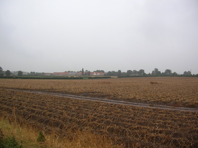
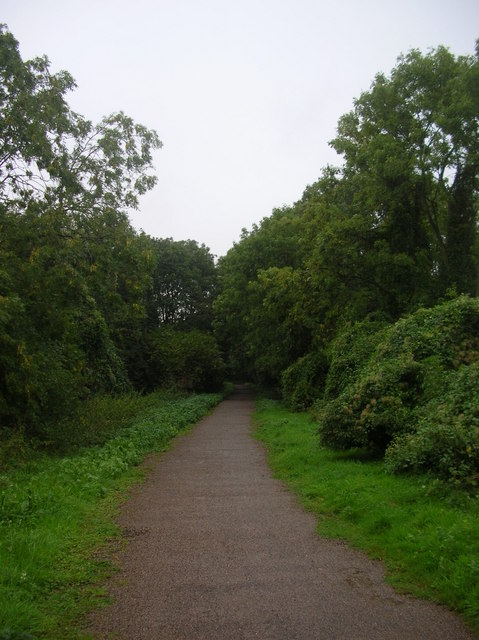
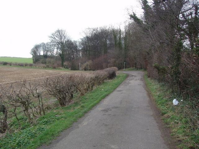
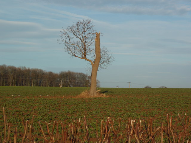
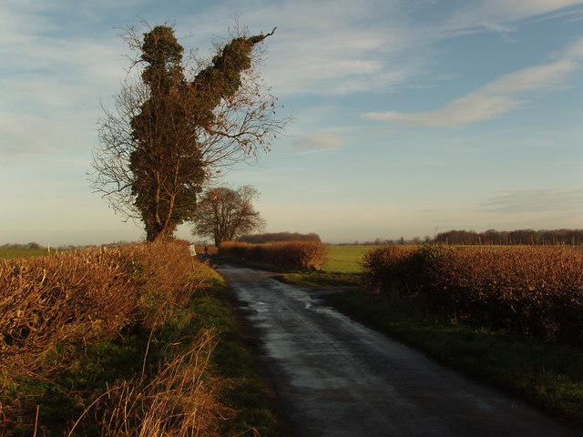
Stretching across a vast area, the downs of West Field showcase rolling hills and expansive fields, often adorned with vibrant wildflowers during the warmer months. The undulating landscape provides breathtaking panoramic views, making it a popular destination for nature enthusiasts and hikers alike. The downs are also home to a variety of wildlife, including rabbits, hares, and various bird species.

Adjacent to the downs, the moorland of West Field offers a rugged and untamed beauty. Characterized by its heather-clad hills and rocky outcrops, it provides a stark contrast to the gentle slopes of the downs. Moorland walks offer visitors the opportunity to explore the vast wilderness and immerse themselves in the tranquility of the surroundings. The moors are also known for their unique flora and fauna, with heather dominating the landscape and providing a beautiful purple hue during flowering season.

In addition to its natural wonders, West Field boasts a rich cultural heritage. The region is dotted with charming villages and historic landmarks, such as ancient stone circles and burial mounds, which offer a glimpse into the area's intriguing past. Visitors can also indulge in the local cuisine, as West Field is renowned for its traditional Yorkshire delicacies, including Yorkshire pudding and Wensleydale cheese.

Overall, West Field, with its combination of downs and moorland, offers visitors a captivating blend of natural beauty and cultural heritage, making it a must-visit destination for those seeking an authentic Yorkshire experience.

If you have any feedback on the listing, please let us know in the comments section below.

West Field Images

Images are sourced within 2km of 53.922492/-1.3520696 or Grid Reference SE4247. Thanks to Geograph Open Source API. All images are credited.

Wetherby Race Course Main Stand
The Church of St. Mary the Virgin, Boston Spa The parish church of Boston Spa.
The Church of St. Mary the Virgin, Boston Spa
The parish church of Boston Spa.
All Saints' Church, Thorp Arch The parish church of Thorp Arch.
All Saints' Church, Thorp Arch
The parish church of Thorp Arch.
Celtic Cross, Thorp Arch At the main crossroads in Thorp Arch village.
Celtic Cross, Thorp Arch
At the main crossroads in Thorp Arch village.
St. Peter's Church, Walton The parish church of Walton.
St. Peter's Church, Walton
The parish church of Walton.
Walton, Nr Thorpe Arch, St Peter's Church
British Library - Thorp Arch One of the British Libraries. This one is situated on an industrial estate between Wetherby & Tadcaster.
British Library - Thorp Arch
One of the British Libraries. This one is situated on an industrial estate between Wetherby & Tadcaster.
View towards HM Prison Looking across farmland from underneath overhead electric wires on the Walton to Wetherby road.
View towards HM Prison
Looking across farmland from underneath overhead electric wires on the Walton to Wetherby road.
Course of disused railway - Wetherby Between Thorp Arch and Wetherby stations, the railway used to cross the road at this point. A cycle route into Wetherby now starts here.
Course of disused railway - Wetherby
Between Thorp Arch and Wetherby stations, the railway used to cross the road at this point. A cycle route into Wetherby now starts here.
Route 66 - Walton Gates Part of the disused Harrogate to Tadcaster railway line. This is a section between Wetherby and Thorp Arch.
Route 66 - Walton Gates
Part of the disused Harrogate to Tadcaster railway line. This is a section between Wetherby and Thorp Arch.
Crossing cycle routes Straight ahead is to the racecourse. To the left is Wetherby. To the Right is Walton Gates.
Crossing cycle routes
Straight ahead is to the racecourse. To the left is Wetherby. To the Right is Walton Gates.
Wetherby racecourse Taken from the old racecourse railway station. The railway is now long since gone and forms part of Sustrans route 66. Taken on an extremely wet friday afternoon. The bridge over the A1 can be seen on the left.
Wetherby racecourse
Taken from the old racecourse railway station. The railway is now long since gone and forms part of Sustrans route 66. Taken on an extremely wet friday afternoon. The bridge over the A1 can be seen on the left.
Wetherby Waste Water Treatment Works Right next door is Wetherby Raw Water Pumping Station. But at least the pumping station is slightly upstream on the River Wharfe from the sewage works.
Wetherby Waste Water Treatment Works
Right next door is Wetherby Raw Water Pumping Station. But at least the pumping station is slightly upstream on the River Wharfe from the sewage works.
Farmhouse on Springs Lane,  Walton A modern farmhouse next to a collection of farm buildings, one of which is visible on the right.
Farmhouse on Springs Lane, Walton
A modern farmhouse next to a collection of farm buildings, one of which is visible on the right.
Lane leading to Footpaths to Jackdaw Crags, Boston Spa This narrow lane seems quiet and rural but is only two or three hundred metres from the busy A659 road and the urban environment of Boston Spa Village.  Where the lane turns sharp left (to the East) there two almost parallel footpaths, running North North-East, through woodland, to Jackdaw Crags and the River Wharfe.
Lane leading to Footpaths to Jackdaw Crags, Boston Spa
This narrow lane seems quiet and rural but is only two or three hundred metres from the busy A659 road and the urban environment of Boston Spa Village. Where the lane turns sharp left (to the East) there two almost parallel footpaths, running North North-East, through woodland, to Jackdaw Crags and the River Wharfe.
Solitary Tree in and Arable Field, Leys Lane, Boston Spa This storm/lightning damaged tree stands alone in a large arable field alongside which runs Leys Lane.  Gunter Wood is in the background
Solitary Tree in and Arable Field, Leys Lane, Boston Spa
This storm/lightning damaged tree stands alone in a large arable field alongside which runs Leys Lane. Gunter Wood is in the background
Leys Lane, Boston Spa, near Wetherby Leys Lane runs North from the A659 main road (which forms Boston Spa's main street) to the River Wharfe, past Wray Wood.  Off to the right, by the forked tree, runs Deepdale Lane, which eventually leads to footpaths that run towards Jackdaw Crags and the River Wharfe.
Leys Lane, Boston Spa, near Wetherby
Leys Lane runs North from the A659 main road (which forms Boston Spa's main street) to the River Wharfe, past Wray Wood. Off to the right, by the forked tree, runs Deepdale Lane, which eventually leads to footpaths that run towards Jackdaw Crags and the River Wharfe.
River Wharfe nr Wetherby
Show me another place!

West Field is located at Grid Ref: SE4247 (Lat: 53.922492, Lng: -1.3520696)

Division: West Riding

Unitary Authority: Leeds

Police Authority: West Yorkshire

What 3 Words

///bugs.silly.replayed. Near Walton, West Yorkshire

Related Wikis

Wetherby Racecourse railway station

Wetherby Racecourse railway station was a railway station on the Harrogate to Church Fenton Line serving Wetherby Racecourse in Wetherby, West Yorkshire...

Thorp Arch (training ground)

Thorp Arch is the training ground of Leeds United. Located in the village of Thorp Arch, near the town of Wetherby, the site covers 12.1 hectares. The...

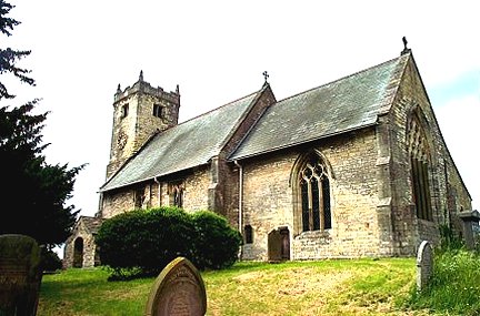
St Peter's Church, Walton, Leeds

The Church of St. Peter in Walton, near Wetherby in West Yorkshire, England, is an active Anglican parish church in the archdeaconry of York and the Diocese...
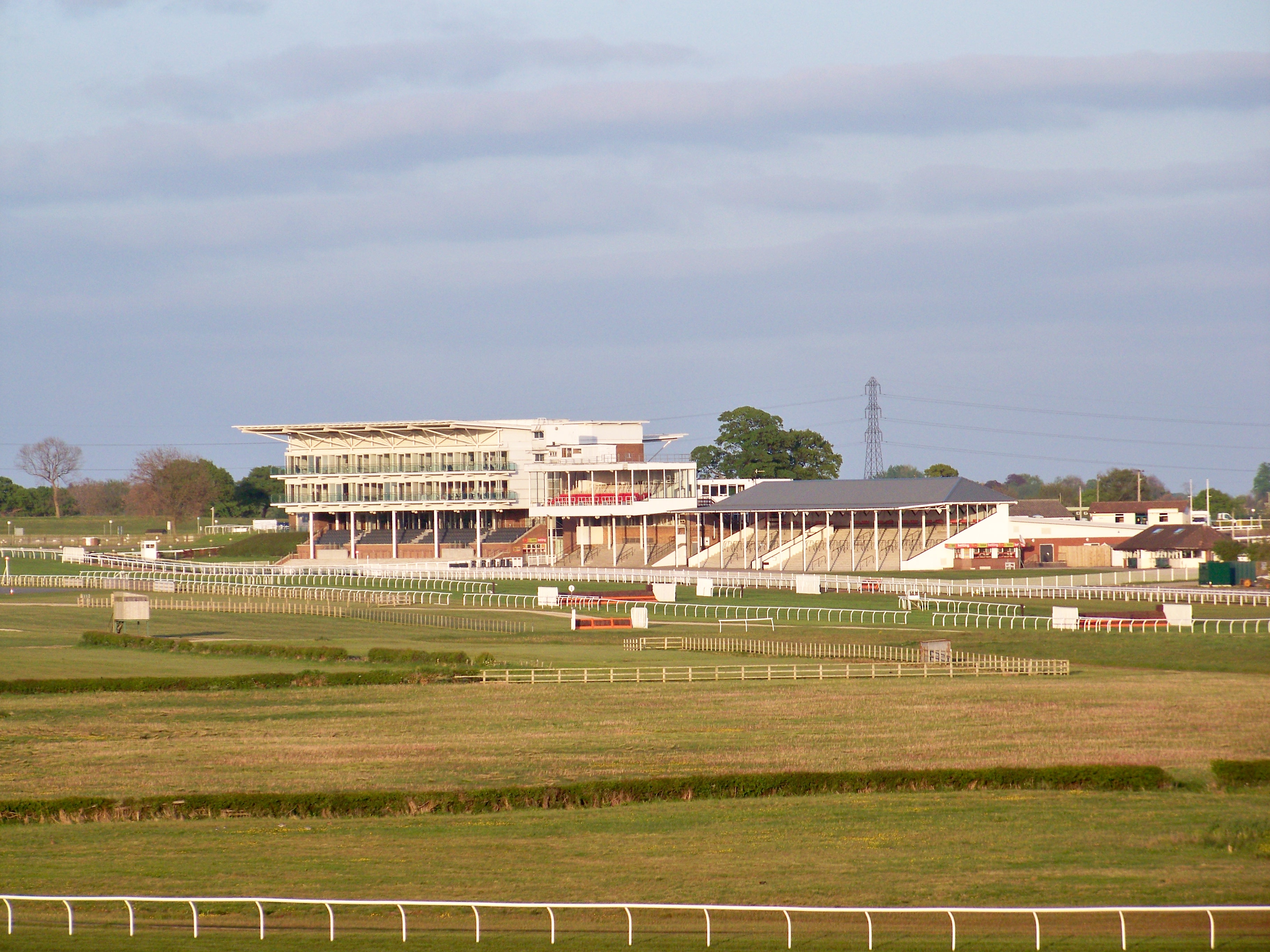
Wetherby Racecourse

Wetherby Racecourse is a racecourse situated near the market town of Wetherby in West Yorkshire, England, located 12 miles (19 km) from Leeds city centre...

Nearby Amenities

Located within 500m of 53.922492,-1.3520696
Wetherby Road Wood Lane
Local Ref: 45027051
Naptan AtcoCode: 450027051
Naptan Bearing: W
Naptan BusStopType: CUS
Naptan CommonName: Wetherby Road Wood Lane
Naptan Crossing: Wood Lane
Naptan Indicator: Stop 45027051
Naptan Landmark: Walton Gate
Naptan Notes: Dummy stop required for Naptan Purposes.
Naptan PlusbusZoneRef: LEEDS
Naptan ShortCommonName: Wood Lane
Naptan Street: Wetherby Road
Naptan Verified: no
Source: naptan_import
Lat/Long: 53.923754/-1.346799
Wetherby Road Wood Lane
Local Ref: 45027052
Naptan AtcoCode: 450027052
Naptan Bearing: E
Naptan BusStopType: CUS
Naptan CommonName: Wetherby Road Wood Lane
Naptan Crossing: Wood Lane
Naptan Indicator: Stop 45027052
Naptan Notes: Dummy stop required for Naptan Purposes.
Naptan PlusbusZoneRef: LEEDS
Naptan ShortCommonName: Wood Lane
Naptan Street: Wetherby Road
Naptan Verified: no
Source: naptan_import
Lat/Long: 53.9238796/-1.3467514
Noexit: yes
Lat/Long: 53.9201809/-1.3583603
Noexit: yes
Lat/Long: 53.9235555/-1.34657
Crossing
Crossing: unmarked
Crossing Island: no
Tactile Paving: no
Lat/Long: 53.9236356/-1.3459285
Material: wood
Power: pole
Lat/Long: 53.9266579/-1.3519844
Material: wood
Power: pole
Lat/Long: 53.9222884/-1.3444474
Material: wood
Power: pole
Lat/Long: 53.9233926/-1.3458077
Material: wood
Power: pole
Lat/Long: 53.922852/-1.3451232
Material: wood
Power: pole
Lat/Long: 53.9248821/-1.3479224
Material: wood
Power: pole
Lat/Long: 53.9244194/-1.3472057
Material: wood
Power: pole
Lat/Long: 53.9239698/-1.3464958
Material: wood
Power: pole
Lat/Long: 53.9255892/-1.3490068
Material: wood
Power: pole
Lat/Long: 53.9259541/-1.3499764
Material: wood
Power: pole
Lat/Long: 53.9252269/-1.3484561
Material: wood
Power: pole
Lat/Long: 53.9263036/-1.3509783
Give Way
Direction: forward
Lat/Long: 53.9238127/-1.3463354
Give Way
Direction: backward
Lat/Long: 53.9237866/-1.3462256
Give Way
Direction: forward
Lat/Long: 53.9236682/-1.3459215
Give Way
Direction: backward
Lat/Long: 53.9235979/-1.3459354
Give Way
Direction: forward
Lat/Long: 53.923744/-1.3463086
Give Way
Direction: backward
Lat/Long: 53.9236262/-1.3460696
Parking
Parking: layby
Lat/Long: 53.9255481/-1.3551901
Information: guidepost
Tourism: information
Lat/Long: 53.9238408/-1.3463622
Information: guidepost
Tourism: information
Lat/Long: 53.9237434/-1.3458983
Image: https://map.atownsend.org.uk/tmp/172075.jpg
Information: guidepost
Tourism: information
Lat/Long: 53.9235012/-1.3459769
The data included in this document is from www.openstreetmap.org. The data is made available under ODbL.

Have you been to West Field?

Leave your review of West Field below (or comments, questions and feedback).