Beaulieu Heath
Downs, Moorland in Hampshire New Forest
England
Beaulieu Heath
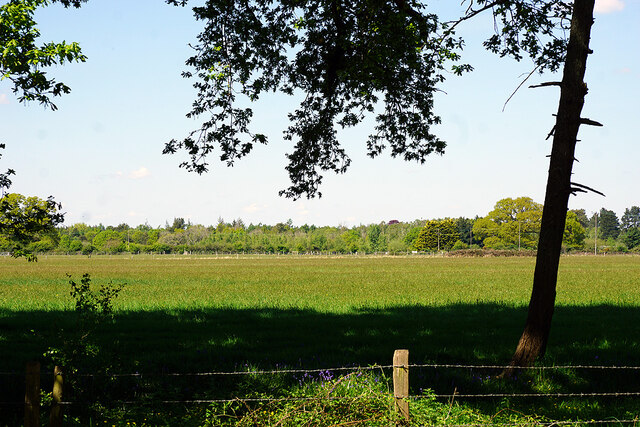
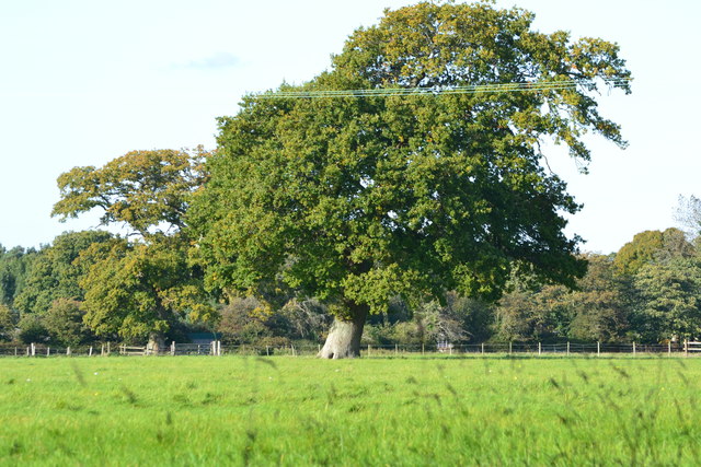
Beaulieu Heath, located in Hampshire, England, is a diverse and picturesque area that encompasses downs and moorland. Spanning approximately 500 acres, the heath is part of the larger New Forest National Park, known for its outstanding natural beauty and rich wildlife.
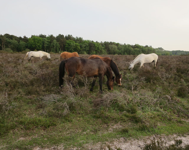
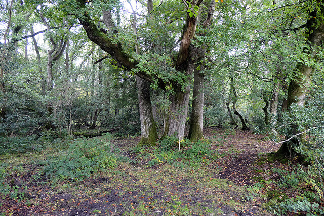
The heathland consists of a mix of open grassland, heather, gorse, and scattered trees, creating a unique and varied landscape. It is home to a wide range of plant species, including heather, bilberry, and various grasses, which provide essential habitats for many native animals and insects.
The area is also known for its bird population, with species such as the Dartford warbler, stonechat, and woodlark frequently spotted in the heath. These birds thrive in the open spaces and benefit from the diverse vegetation and insect life.
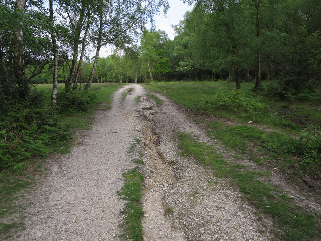
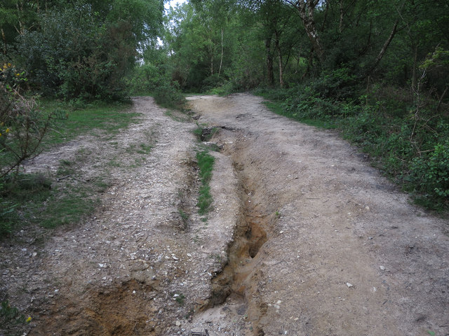
Beaulieu Heath offers a range of walking trails and paths, allowing visitors to explore the stunning natural surroundings. The heath is easily accessible and provides opportunities for outdoor activities such as hiking, birdwatching, and photography.
The area is managed by the Forestry Commission, who work to preserve and enhance the heathland's unique biodiversity. Their efforts include controlled burning and grazing to maintain the heath's open character and prevent the encroachment of scrub and woodland.
Beaulieu Heath is a valuable and cherished part of Hampshire's natural heritage, offering visitors a chance to immerse themselves in a tranquil and diverse ecosystem.
If you have any feedback on the listing, please let us know in the comments section below.
Beaulieu Heath Images
Images are sourced within 2km of 50.843404/-1.4266844 or Grid Reference SU4005. Thanks to Geograph Open Source API. All images are credited.


Beaulieu Heath is located at Grid Ref: SU4005 (Lat: 50.843404, Lng: -1.4266844)
Administrative County: Hampshire
District: New Forest
Police Authority: Hampshire
What 3 Words
///drift.report.email. Near Hythe, Hampshire
Nearby Locations
Related Wikis
Dibden Purlieu
Dibden Purlieu () is a village situated on the edge of the New Forest in Hampshire, England. The village merges with the nearby town of Hythe. It is in...

Noadswood School
Noadswood School is an academy school and specialist Sports College in Dibden Purlieu, Hampshire, England. It provides state funded education for children...
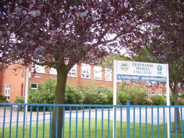
Testwood School
Testwood School (formerly Testwood Sports College) is a secondary school with academy status located in the town of Totton and Eling, England. The school...
Applemore College
Applemore College is a secondary school in Hampshire, England, situated in the village of Dibden Purlieu on the edge of the New Forest. It offers education...
Hardley, Hampshire
Hardley is a suburb of the village of Holbury in the civil parish of Fawley in Hampshire, England. == History == The name Hardley means "hard clearing...
Hythe & Dibden F.C.
Hythe & Dibden Football Club is a football club based in Hythe, near Southampton in Hampshire. They are currently members of the Wessex League Premier...
Fawley A.F.C.
Fawley Association Football Club is a football club based in Fawley, near Southampton, in Hampshire, England. They are currently members of Wessex League...
New Forest Academy
New Forest Academy is a coeducational secondary school and with academy status, located in Holbury in the English county of Hampshire.Previously known...
Nearby Amenities
Located within 500m of 50.843404,-1.4266844Have you been to Beaulieu Heath?
Leave your review of Beaulieu Heath below (or comments, questions and feedback).