Barley Mow Park

Downs, Moorland in Durham

England

Barley Mow Park

St Peter's Church, Monkwearmouth, Sunderland Grade I listed Church 

<span class="nowrap"><a title="https://en.wikipedia.org/wiki/St_Peter%27s_Church,_Monkwearmouth" rel="nofollow ugc noopener" href="https://en.wikipedia.org/wiki/St_Peter%27s_Church,_Monkwearmouth">Link</a><img style="margin-left:2px;" alt="External link" title="External link - shift click to open in new window" src="https://s1.geograph.org.uk/img/external.png" width="10" height="10"/></span>
St Peter's Church, Monkwearmouth, Sunderland Credit: Brian Deegan

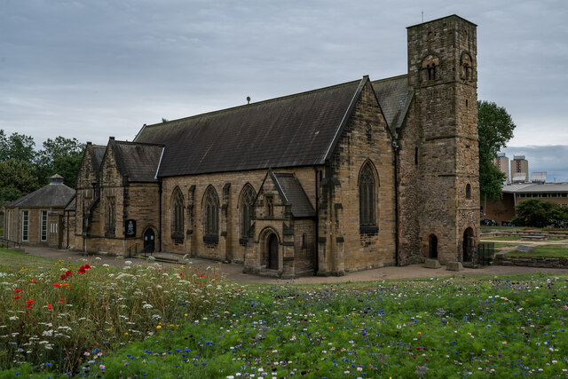
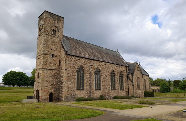
Barley Mow Park is a picturesque recreational area located in Durham, England. Nestled amidst lush greenery and rolling hills, this park offers visitors a serene and tranquil escape from the bustling city life. With its expansive downs and moorland, the park provides a perfect setting for outdoor activities and leisurely strolls.

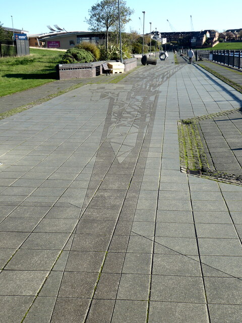
The park spans over a vast area, boasting well-maintained pathways that wind through its picturesque landscape. These pathways are ideal for walking, jogging, or cycling, allowing visitors to immerse themselves in the natural beauty that surrounds them. The downs, covered in soft grasses and dotted with wildflowers, provide a stunning backdrop for picnics or simply relaxing in the sun.

The moorland, with its heather-clad slopes and panoramic views, is a haven for nature enthusiasts and photographers. It is home to a diverse range of flora and fauna, including rare species of birds and wild animals. Visitors can enjoy birdwatching or embark on guided nature walks to discover the park's rich biodiversity.

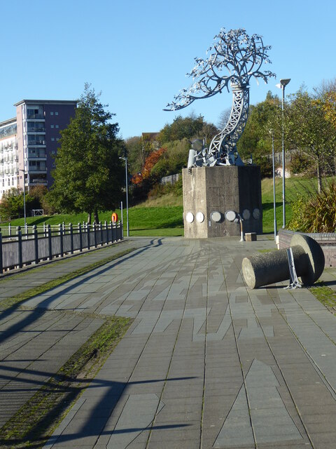
Barley Mow Park also offers several recreational facilities for both children and adults. There are well-equipped play areas for kids, where they can enjoy swings, slides, and climbing frames. Additionally, the park features sports fields and courts for various activities such as football, cricket, tennis, and basketball.

For those seeking a moment of tranquility, the park provides numerous benches and picnic spots where visitors can relax and soak in the peaceful atmosphere. With its natural beauty, recreational amenities, and opportunities for outdoor exploration, Barley Mow Park is a beloved destination for locals and tourists alike.

If you have any feedback on the listing, please let us know in the comments section below.

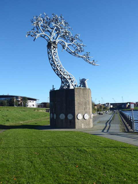
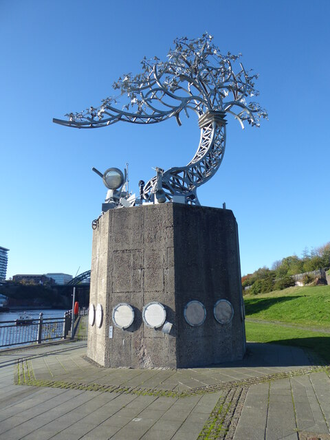
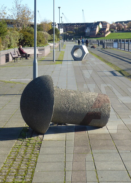
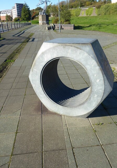
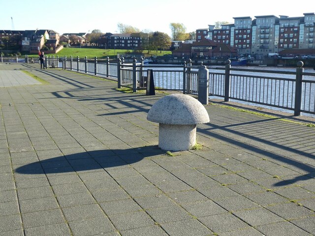
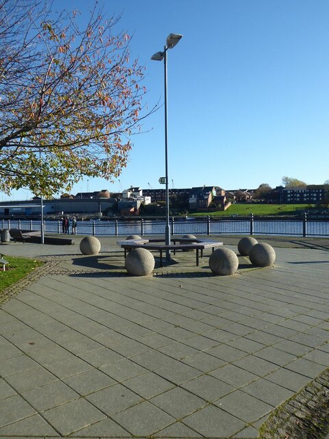
Barley Mow Park Images

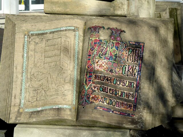
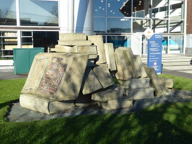
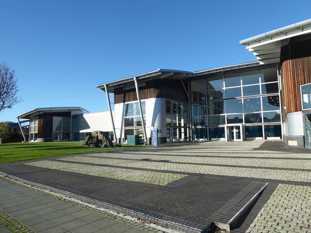
Images are sourced within 2km of 54.895292/-1.3771099 or Grid Reference NZ4055. Thanks to Geograph Open Source API. All images are credited.

St Peter's Church, Monkwearmouth, Sunderland Grade I listed Church 

<span class="nowrap"><a title="https://en.wikipedia.org/wiki/St_Peter%27s_Church,_Monkwearmouth" rel="nofollow ugc noopener" href="https://en.wikipedia.org/wiki/St_Peter%27s_Church,_Monkwearmouth">Link</a><img style="margin-left:2px;" alt="External link" title="External link - shift click to open in new window" src="https://s1.geograph.org.uk/img/external.png" width="10" height="10"/></span>
St Peter's Church, Monkwearmouth, Sunderland
Grade I listed Church LinkExternal link
St Peter's Church in the parish of Monkwearmouth St Peter's Church, Monkwearmouth is the parish church of Monkwearmouth in Sunderland, Tyne and Wear, England. It is one of three churches in the Parish of Monkwearmouth. The others are the Victorian All Saints' Church, Monkwearmouth and the Edwardian St Andrew's Church, Roker.

St Peter's was founded in AD 674–5 as one of the two churches of the Benedictine double monastery of Monkwearmouth–Jarrow Abbey. The other church is St Paul's Church, Jarrow. St Peter's is a Grade I listed building and part of a scheduled monument.
St Peter's Church in the parish of Monkwearmouth
St Peter's Church, Monkwearmouth is the parish church of Monkwearmouth in Sunderland, Tyne and Wear, England. It is one of three churches in the Parish of Monkwearmouth. The others are the Victorian All Saints' Church, Monkwearmouth and the Edwardian St Andrew's Church, Roker. St Peter's was founded in AD 674–5 as one of the two churches of the Benedictine double monastery of Monkwearmouth–Jarrow Abbey. The other church is St Paul's Church, Jarrow. St Peter's is a Grade I listed building and part of a scheduled monument.
"Shadows in another light" Dating from 1998, one of the sculptures forming part of the St Peter's Riverside Sculpture Project. The base is actually the original base of a riverside crane. Sometimes alternatively known as "The Iron Tree". To the east, the supposed shadow of the original crane is picked out in the paving slabs along the riverside path. The University of Sunderland Library can be seen in the distance.
"Shadows in another light"
Dating from 1998, one of the sculptures forming part of the St Peter's Riverside Sculpture Project. The base is actually the original base of a riverside crane. Sometimes alternatively known as "The Iron Tree". To the east, the supposed shadow of the original crane is picked out in the paving slabs along the riverside path. The University of Sunderland Library can be seen in the distance.
"Shadows in another light" Dating from 1998, one of the sculptures forming part of the St Peter's Riverside Sculpture Project. The base is actually the original base of a riverside crane. Sometimes alternatively known as "The Iron Tree". To the east, the supposed shadow of the original crane is picked out in the paving slabs along the riverside path.
"Shadows in another light"
Dating from 1998, one of the sculptures forming part of the St Peter's Riverside Sculpture Project. The base is actually the original base of a riverside crane. Sometimes alternatively known as "The Iron Tree". To the east, the supposed shadow of the original crane is picked out in the paving slabs along the riverside path.
Shadow on St Peter's Riverside path The supposed shadow of a crane is picked out in the paving slabs along the riverside path. The University of Sunderland Library can be seen in the distance. See also <a href="https://www.geograph.org.uk/photo/7333203">NZ4057 : "Shadows in another light"</a>.
Shadow on St Peter's Riverside path
The supposed shadow of a crane is picked out in the paving slabs along the riverside path. The University of Sunderland Library can be seen in the distance. See also NZ4057 : "Shadows in another light".
Sculpture and "shadow" on St Peter's Riverside The supposed shadow of a crane (originally standing on the concrete base of the sculpture) is picked out in the paving slabs along the riverside path. A concrete "rivet" can also be seen, commemorating the days of shipbuilding.  See also <a href="https://www.geograph.org.uk/photo/7333203">NZ4057 : "Shadows in another light"</a>.
Sculpture and "shadow" on St Peter's Riverside
The supposed shadow of a crane (originally standing on the concrete base of the sculpture) is picked out in the paving slabs along the riverside path. A concrete "rivet" can also be seen, commemorating the days of shipbuilding. See also NZ4057 : "Shadows in another light".
Shadow beside St Peter's Riverside The actual shadow of the "Shadows in another light" sculpture. See also <a href="https://www.geograph.org.uk/photo/7333246">NZ4057 : Sculpture and "shadow" on St Peter's Riverside</a>.
Shadow beside St Peter's Riverside
The actual shadow of the "Shadows in another light" sculpture. See also NZ4057 : Sculpture and "shadow" on St Peter's Riverside.
Telescope on St Peter's Riverside The plinth bears the inscription:
"Look up and see behind you. A shadow can raise a memory that nothing can erase."
This refers to the sculpture seen in <a href="https://www.geograph.org.uk/photo/7333208">NZ4057 : "Shadows in another light"</a> and the supposed shadow of a crane seen in <a href="https://www.geograph.org.uk/photo/7333239">NZ4057 : Shadow on St Peter's Riverside path</a>.
Telescope on St Peter's Riverside
The plinth bears the inscription: "Look up and see behind you. A shadow can raise a memory that nothing can erase." This refers to the sculpture seen in NZ4057 : "Shadows in another light" and the supposed shadow of a crane seen in NZ4057 : Shadow on St Peter's Riverside path.
Rivet and nut Two artefacts commemorating the shipbuilding tradition of the locality; part of the St Peter's Riverside Sculpture Project.
Rivet and nut
Two artefacts commemorating the shipbuilding tradition of the locality; part of the St Peter's Riverside Sculpture Project.
Giant nut on St Peter's Riverside Artefact commemorating the shipbuilding tradition of the locality; part of the St Peter's Riverside Sculpture Project. A giant rivet and the "Shadows in another light" sculpture can be seen in the middle distance.
Giant nut on St Peter's Riverside
Artefact commemorating the shipbuilding tradition of the locality; part of the St Peter's Riverside Sculpture Project. A giant rivet and the "Shadows in another light" sculpture can be seen in the middle distance.
St Peter's Riverside Artefacts commemorating the shipbuilding tradition of the locality; part of the St Peter's Riverside Sculpture Project.
St Peter's Riverside
Artefacts commemorating the shipbuilding tradition of the locality; part of the St Peter's Riverside Sculpture Project.
Lamp standard on St Peter's Riverside.
"Pathways to Knowledge" The text was taken from an ancient manuscript kept  in St Peter's Church nearby, possibly with a connection to the Venerable Bede. This page is just one component of a sculpture of a pile of books installed in front of the University Library.
"Pathways to Knowledge"
The text was taken from an ancient manuscript kept in St Peter's Church nearby, possibly with a connection to the Venerable Bede. This page is just one component of a sculpture of a pile of books installed in front of the University Library.
University Library On St Peter's Riverside.
University Library
On St Peter's Riverside.
"Out  of the blue" Glass sculpture by Rachael Woodman, on display in the National Glass Centre.
"Out of the blue"
Glass sculpture by Rachael Woodman, on display in the National Glass Centre.
St Peters Church, Sunderland Church of St Peter, Anglo Saxon church opened AD 674 by Benedict Biscop
St Peters Church, Sunderland
Church of St Peter, Anglo Saxon church opened AD 674 by Benedict Biscop
St Peters Church entrance, Sunderland The entrance gate to St Peter's church, established AD 674 by Benedict Biscop.
St Peters Church entrance, Sunderland
The entrance gate to St Peter's church, established AD 674 by Benedict Biscop.
Show me another place!

Barley Mow Park is located at Grid Ref: NZ4055 (Lat: 54.895292, Lng: -1.3771099)

Unitary Authority: Sunderland

Police Authority: Northumbria

What 3 Words

///wink.oils.rapid. Near Sunderland, Tyne & Wear

Nearby Locations

Hendon Barley Mow Park

Related Wikis

Sunderland Synagogue

The Sunderland Synagogue is a former synagogue building in Sunderland, England. The synagogue, on Ryhope Road, was designed by architect Marcus Kenneth...

Sunderland High School

Sunderland High School was a mixed private day school located in Sunderland, Tyne and Wear, England. Founded in 1883 as the oldest girls' senior school...

Southmoor Academy

Southmoor Academy (formerly Southmoor Community School) is a coeducational secondary school and sixth form located in the Grangetown area of Sunderland...

Palatine Lodge No. 97

Palatine Lodge No. 97 is a Craft Masonic Lodge in Freemasonry under the jurisdiction of the United Grand Lodge of England. The Lodge meets at Wearside...

Nearby Amenities

Located within 500m of 54.895292,-1.3771099
Cycleway: asl
Direction: forward
Lat/Long: 54.897731/-1.3810988
Crossing
Crossing: zebra
Crossing Island: no
Tactile Paving: yes
Lat/Long: 54.8980814/-1.3799463
Mini Roundabout
Direction: clockwise
Lat/Long: 54.8973923/-1.3760907
Telephone
Booth: KX300
Covered: booth
Lat/Long: 54.8960321/-1.3841899
Barrier: lift_gate
Lat/Long: 54.8969495/-1.3781908
Telephone
Lat/Long: 54.8973782/-1.3758486
Post Box
Ref: SR2 58
Lat/Long: 54.8974543/-1.376189
Bus Stop
THE CEDARS-BEECHHOLME COURT-S/B
Bus: yes
Local Ref: SW
Naptan AtcoCode: 410000024434
Naptan Bearing: SW
Naptan CommonName: THE CEDARS-BEECHHOLME COURT-S/B
Naptan Indicator: SW
Naptan Landmark: OPPOSITE BEECHHOLME COURT
Naptan NaptanCode: twrdwpdm
Naptan PlusbusZoneRef: SNDRLND
Naptan Street: THE CEDARS
Naptan Verified: no
Public Transport: platform
Source: naptan_import
Lat/Long: 54.891867/-1.3802175
Bus Stop
THE CEDARS-BEECHHOLME COURT-N/B
Bus: yes
Local Ref: N
Naptan AtcoCode: 410000024931
Naptan Bearing: N
Naptan CommonName: THE CEDARS-BEECHHOLME COURT-N/B
Naptan Indicator: N
Naptan Landmark: OUTSIDE BEECHHOLME COURT
Naptan NaptanCode: twrgagmp
Naptan PlusbusZoneRef: SNDRLND
Naptan Street: THE CEDARS
Naptan Verified: no
Public Transport: platform
Source: naptan_import
Lat/Long: 54.8919905/-1.380475
Bus Stop
RYHOPE ROAD-CHINA STREET-S/B
Bus: yes
Local Ref: S
Naptan AtcoCode: 410000025298
Naptan Bearing: S
Naptan CommonName: RYHOPE ROAD-CHINA STREET-S/B
Naptan Indicator: S
Naptan Landmark: OUTSIDE CHINA STREET JUNCTION
Naptan NaptanCode: twrgapmj
Naptan PlusbusZoneRef: SNDRLND
Naptan Street: RYHOPE ROAD
Naptan Verified: no
Public Transport: platform
Source: naptan_import
Lat/Long: 54.8928711/-1.3755599
Bus Stop
RYHOPE ROAD-CEDARS PARK-N/B
Bus: yes
Local Ref: N
Naptan AtcoCode: 410000025302
Naptan Bearing: N
Naptan CommonName: RYHOPE ROAD-CEDARS PARK-N/B
Naptan Indicator: N
Naptan Landmark: OUTSIDE ST CECILIA'S RC CHURCH
Naptan NaptanCode: twrgapta
Naptan PlusbusZoneRef: SNDRLND
Naptan Street: RYHOPE ROAD
Naptan Verified: no
Public Transport: platform
Source: naptan_import
Lat/Long: 54.8915031/-1.3748429
Bus Stop
Ryhope Road-The Cedars
Bus: yes
Departures Board: timetable
Local Ref: N
Naptan AtcoCode: 410000025303
Naptan Bearing: NW
Naptan Indicator: NW-Bound
Naptan Landmark: Outside Ashbourne Lodge
Naptan NaptanCode: twrgaptd
Naptan PlusbusZoneRef: SNDRLND
Naptan Street: Ryhope Road
Naptan Verified: no
Public Transport: platform
Shelter: yes
Source: naptan_import
Lat/Long: 54.8940854/-1.377558
Bus Stop
VILLETTE ROAD
Bus: yes
Local Ref: S
Naptan AtcoCode: 410000025417
Naptan Bearing: S
Naptan CommonName: VILLETTE ROAD
Naptan Indicator: S
Naptan Landmark: 25M SOUTH OF VILLETTE ROAD
Naptan NaptanCode: twrgatgt
Naptan PlusbusZoneRef: SNDRLND
Naptan Street: CORPORATION ROAD
Naptan Verified: no
Public Transport: platform
Source: naptan_import
Lat/Long: 54.8955413/-1.3702274
Bus Stop
VILLETTE ROAD
Bus: yes
Local Ref: NE
Naptan AtcoCode: 410000025421
Naptan Bearing: NE
Naptan CommonName: VILLETTE ROAD
Naptan Indicator: NE
Naptan Landmark: JUNCTION WITH HENDON VALLEY ROAD
Naptan NaptanCode: twrgatjg
Naptan PlusbusZoneRef: SNDRLND
Naptan Street: VILLETTE ROAD
Naptan Verified: no
Public Transport: platform
Source: naptan_import
Lat/Long: 54.8959826/-1.3704232
Bus Stop
TOWARD ROAD-GRAY ROAD-S/B
Bus: yes
Local Ref: S
Naptan AtcoCode: 410000025428
Naptan Bearing: S
Naptan CommonName: TOWARD ROAD-GRAY ROAD-S/B
Naptan Indicator: S
Naptan Landmark: JUNCTION WITH GRAY ROAD
Naptan NaptanCode: twrgatmd
Naptan PlusbusZoneRef: SNDRLND
Naptan Street: TOWARD ROAD
Naptan Verified: no
Public Transport: platform
Source: naptan_import
Lat/Long: 54.8975398/-1.3761216
Bus Stop
TOWARD ROAD-VILLETTE ROAD-S/B
Bus: yes
Local Ref: S
Naptan AtcoCode: 410000025429
Naptan Bearing: S
Naptan CommonName: TOWARD ROAD-VILLETTE ROAD-S/B
Naptan Indicator: S
Naptan Landmark: OPPOSITE LIBRARY
Naptan NaptanCode: twrgatmg
Naptan PlusbusZoneRef: SNDRLND
Naptan Street: TOWARD ROAD
Naptan Verified: no
Public Transport: platform
Source: naptan_import
Lat/Long: 54.8948229/-1.3738092
Bus Stop
TOWARD ROAD-GRAY ROAD-N/B
Bus: yes
Local Ref: N
Naptan AtcoCode: 410000025430
Naptan Bearing: N
Naptan CommonName: TOWARD ROAD-GRAY ROAD-N/B
Naptan Indicator: N
Naptan Landmark: SOUTH OF GRAY ROAD JUNCTION
Naptan NaptanCode: twrgatmj
Naptan PlusbusZoneRef: SNDRLND
Naptan Street: TOWARD ROAD
Naptan Verified: no
Public Transport: platform
Source: naptan_import
Lat/Long: 54.8971257/-1.3759877
Bus Stop
VILLETTE ROAD
Bus: yes
Local Ref: SW
Naptan AtcoCode: 410000025432
Naptan Bearing: SW
Naptan CommonName: VILLETTE ROAD
Naptan Indicator: SW
Naptan Landmark: OPPOSITE ENTRANCE TO TENNIS COURTS/BOWLING GREEN
Naptan NaptanCode: twrgatmp
Naptan PlusbusZoneRef: SNDRLND
Naptan Street: VILLETTE ROAD
Naptan Verified: no
Public Transport: platform
Source: naptan_import
Lat/Long: 54.8939128/-1.3750558
Bus Stop
THE CEDARS-ASHBOURNE LODGE-W/B
Bus: yes
Local Ref: SW
Naptan AtcoCode: 410000025433
Naptan Bearing: SW
Naptan CommonName: THE CEDARS-ASHBOURNE LODGE-W/B
Naptan Indicator: SW
Naptan Landmark: 50M N/W OPPOSITE ASHBOURNE LODGE NURSING HOME
Naptan NaptanCode: twrgatmt
Naptan PlusbusZoneRef: SNDRLND
Naptan Street: THE CEDARS
Naptan Verified: no
Public Transport: platform
Source: naptan_import
Lat/Long: 54.8930249/-1.3780514
Bus Stop
THE CEDARS-ASHBOURNE LODGE-E/B
Bus: yes
Local Ref: NE
Naptan AtcoCode: 410000025437
Naptan Bearing: NE
Naptan CommonName: THE CEDARS-ASHBOURNE LODGE-E/B
Naptan Indicator: NE
Naptan Landmark: OUTSIDE ASHBOURNE LODGE NURSING HOME
Naptan NaptanCode: twrgatmw
Naptan PlusbusZoneRef: SNDRLND
Naptan Street: THE CEDARS
Naptan Verified: no
Public Transport: platform
Source: naptan_import
Lat/Long: 54.8935032/-1.3775717
Bus Stop
VILLETTE ROAD
Bus: yes
Local Ref: E
Naptan AtcoCode: 410000025438
Naptan Bearing: E
Naptan CommonName: VILLETTE ROAD
Naptan Indicator: E
Naptan Landmark: OUTSIDE ENTRANCE TO BOWLING GREENS
Naptan NaptanCode: twrgatpa
Naptan PlusbusZoneRef: SNDRLND
Naptan Street: VILLETTE ROAD
Naptan Verified: no
Public Transport: platform
Source: naptan_import
Lat/Long: 54.8941632/-1.3748485
Bus Stop
VILLETTE ROAD
Bus: yes
Local Ref: S
Naptan AtcoCode: 410000025439
Naptan Bearing: S
Naptan CommonName: VILLETTE ROAD
Naptan Indicator: S
Naptan Landmark: OUTSIDE ST LEONARD STREET
Naptan NaptanCode: twrgatpd
Naptan PlusbusZoneRef: SNDRLND
Naptan Street: VILLETTE ROAD
Naptan Verified: no
Public Transport: platform
Source: naptan_import
Lat/Long: 54.895297/-1.3716501
Bus Stop
VILLETTE ROAD-N/B
Bus: yes
Local Ref: N
Naptan AtcoCode: 410000025951
Naptan Bearing: N
Naptan CommonName: VILLETTE ROAD-N/B
Naptan Indicator: N
Naptan Landmark: OUTSIDE HENDON VALLEY COURT
Naptan NaptanCode: twrgatpt
Naptan PlusbusZoneRef: SNDRLND
Naptan Street: HENDON VALLEY ROAD
Naptan Verified: no
Public Transport: platform
Source: naptan_import
Lat/Long: 54.8960581/-1.3711081
Bus Stop
TOWARD ROAD-GRAY ROAD-S/B
Bus: yes
Local Ref: S
Naptan AtcoCode: 410000025952
Naptan Bearing: S
Naptan CommonName: TOWARD ROAD-GRAY ROAD-S/B
Naptan Indicator: S
Naptan Landmark: OUTSIDE BEAUMONT LODGE
Naptan NaptanCode: twrjadad
Naptan PlusbusZoneRef: SNDRLND
Naptan Street: TOWARD ROAD
Naptan Verified: no
Public Transport: platform
Source: naptan_import
Lat/Long: 54.8967552/-1.375588
Bus Stop
TOWARD ROAD-VILLETTE ROAD-N/B
Bus: yes
Local Ref: N
Naptan AtcoCode: 410000025958
Naptan Bearing: N
Naptan CommonName: TOWARD ROAD-VILLETTE ROAD-N/B
Naptan Indicator: N
Naptan Landmark: OUTSIDE NO 71 TOWARD ROAD
Naptan NaptanCode: twrgwmga
Naptan PlusbusZoneRef: SNDRLND
Naptan Street: TOWARD ROAD
Naptan Verified: no
Public Transport: platform
Source: naptan_import
Lat/Long: 54.8949503/-1.3741191
Bus Stop
RYHOPE ROAD-CEDARS COURT-S/B
Bus: yes
Local Ref: S
Naptan AtcoCode: 410000024297
Naptan Bearing: S
Naptan CommonName: RYHOPE ROAD-CEDARS COURT-S/B
Naptan Indicator: S
Naptan Landmark: OPPOSITE THE UNIVERSITY OF S/LAND BACKHOUSE PARK
Naptan NaptanCode: twrdwjpd
Naptan PlusbusZoneRef: SNDRLND
Naptan Street: RYHOPE ROAD
Naptan Verified: no
Public Transport: platform
Source: naptan_import
Lat/Long: 54.8956139/-1.3790984
Bus Stop
RYHOPE ROAD-COLLEGE-N/B
Bus: yes
Local Ref: N
Naptan AtcoCode: 410000024304
Naptan Bearing: N
Naptan CommonName: RYHOPE ROAD-COLLEGE-N/B
Naptan Indicator: N
Naptan Landmark: OUTSIDE UNIVERSITY OF S/LAND BACKHOUSE PARK
Naptan NaptanCode: twrdwjpg
Naptan PlusbusZoneRef: SNDRLND
Naptan Street: RYHOPE ROAD
Naptan Verified: no
Public Transport: platform
Source: naptan_import
Lat/Long: 54.8953807/-1.3791955
Bus Stop
Esplanade West-The Cloisters
Bus: yes
Local Ref: N
Naptan AtcoCode: 410000024305
Naptan Bearing: NW
Naptan Indicator: NW-Bound
Naptan Landmark: 30m North Of Christ Church
Naptan NaptanCode: twrdwjpj
Naptan PlusbusZoneRef: SNDRLND
Naptan Street: Stockton Road
Naptan Verified: no
Public Transport: platform
Shelter: yes
Source: naptan_import
Lat/Long: 54.8979809/-1.3815413
Bus Stop
RYHOPE ROAD-MOWBRAY ROAD-S/B
Bus: yes
Local Ref: S
Naptan AtcoCode: 410000024336
Naptan Bearing: S
Naptan CommonName: RYHOPE ROAD-MOWBRAY ROAD-S/B
Naptan Indicator: S
Naptan Landmark: OUTSIDE UNIVERSITY OF SUNDERLAND LANGHAM TOWER
Naptan NaptanCode: twrdwjwm
Naptan PlusbusZoneRef: SNDRLND
Naptan Street: RYHOPE ROAD
Naptan Verified: no
Public Transport: platform
Source: naptan_import
Lat/Long: 54.8975451/-1.3806748
Bus Stop
CHRISTCHURCH BEDE TOWER
Bus: yes
Local Ref: S
Naptan AtcoCode: 410000060008
Naptan Bearing: S
Naptan CommonName: CHRISTCHURCH BEDE TOWER
Naptan Indicator: S
Naptan Landmark: OPPOSITE CHRIST CHURCH
Naptan NaptanCode: twrgpjtm
Naptan PlusbusZoneRef: SNDRLND
Naptan Street: RYHOPE ROAD
Naptan Verified: no
Public Transport: platform
Source: naptan_import
Lat/Long: 54.8977527/-1.3808587
Post Box
Lat/Long: 54.8986655/-1.3816532
Waste Basket
Lat/Long: 54.8950584/-1.3722438
Grafters Gable (a unique combination of street art and storytelling)
Artist Name: Frank Doyle
Artwork Type: graffiti
Tourism: artwork
Lat/Long: 54.8946053/-1.3736298
Generator Method: photovoltaic
Generator Output Electricity: yes
Generator Source: solar
Generator Type: solar_photovoltaic_panel
Location: roof
Power: generator
Lat/Long: 54.8989278/-1.3725339
Generator Method: photovoltaic
Generator Output Electricity: yes
Generator Source: solar
Generator Type: solar_photovoltaic_panel
Location: roof
Power: generator
Lat/Long: 54.8988429/-1.3727324
Generator Method: photovoltaic
Generator Output Electricity: yes
Generator Source: solar
Generator Type: solar_photovoltaic_panel
Location: roof
Power: generator
Lat/Long: 54.898809/-1.3728289
Generator Method: photovoltaic
Generator Output Electricity: yes
Generator Source: solar
Generator Type: solar_photovoltaic_panel
Location: roof
Power: generator
Lat/Long: 54.8987951/-1.3729496
Generator Method: photovoltaic
Generator Output Electricity: yes
Generator Source: solar
Generator Type: solar_photovoltaic_panel
Location: roof
Power: generator
Lat/Long: 54.8987489/-1.3730355
Generator Method: photovoltaic
Generator Output Electricity: yes
Generator Source: solar
Generator Type: solar_photovoltaic_panel
Location: roof
Power: generator
Lat/Long: 54.8987257/-1.3731481
Generator Method: photovoltaic
Generator Output Electricity: yes
Generator Source: solar
Generator Type: solar_photovoltaic_panel
Location: roof
Power: generator
Lat/Long: 54.8986887/-1.3732339
Generator Method: photovoltaic
Generator Output Electricity: yes
Generator Source: solar
Generator Type: solar_photovoltaic_panel
Location: roof
Power: generator
Lat/Long: 54.8985884/-1.373529
Generator Method: photovoltaic
Generator Output Electricity: yes
Generator Source: solar
Generator Type: solar_photovoltaic_panel
Location: roof
Power: generator
Lat/Long: 54.8985468/-1.3734861
Generator Method: photovoltaic
Generator Output Electricity: yes
Generator Source: solar
Generator Type: solar_photovoltaic_panel
Location: roof
Power: generator
Lat/Long: 54.8990049/-1.3732232
Generator Method: photovoltaic
Generator Output Electricity: yes
Generator Source: solar
Generator Type: solar_photovoltaic_panel
Location: roof
Power: generator
Lat/Long: 54.8990357/-1.3731079
Generator Method: photovoltaic
Generator Output Electricity: yes
Generator Source: solar
Generator Type: solar_photovoltaic_panel
Location: roof
Power: generator
Lat/Long: 54.8990758/-1.373014
Generator Method: photovoltaic
Generator Output Electricity: yes
Generator Source: solar
Generator Type: solar_photovoltaic_panel
Location: roof
Power: generator
Lat/Long: 54.8988892/-1.3734673
Generator Method: photovoltaic
Generator Output Electricity: yes
Generator Source: solar
Generator Type: solar_photovoltaic_panel
Location: roof
Power: generator
Lat/Long: 54.8988368/-1.3735504
Generator Method: photovoltaic
Generator Output Electricity: yes
Generator Source: solar
Generator Type: solar_photovoltaic_panel
Location: roof
Power: generator
Lat/Long: 54.898772/-1.373639
Generator Method: photovoltaic
Generator Output Electricity: yes
Generator Source: solar
Generator Type: solar_photovoltaic_panel
Location: roof
Power: generator
Lat/Long: 54.8987103/-1.3737355
Generator Method: photovoltaic
Generator Output Electricity: yes
Generator Source: solar
Generator Type: solar_photovoltaic_panel
Location: roof
Power: generator
Lat/Long: 54.8986609/-1.3738455
Generator Method: photovoltaic
Generator Output Electricity: yes
Generator Source: solar
Generator Type: solar_photovoltaic_panel
Location: roof
Power: generator
Lat/Long: 54.898391/-1.3756292
Generator Method: photovoltaic
Generator Output Electricity: yes
Generator Source: solar
Generator Type: solar_photovoltaic_panel
Location: roof
Power: generator
Lat/Long: 54.8983741/-1.3757177
Generator Method: photovoltaic
Generator Output Electricity: yes
Generator Source: solar
Generator Type: solar_photovoltaic_panel
Location: roof
Power: generator
Lat/Long: 54.8983586/-1.3757767
Generator Method: photovoltaic
Generator Output Electricity: yes
Generator Source: solar
Generator Type: solar_photovoltaic_panel
Location: roof
Power: generator
Lat/Long: 54.8981443/-1.3752778
Generator Method: photovoltaic
Generator Output Electricity: yes
Generator Source: solar
Generator Type: solar_photovoltaic_panel
Location: roof
Power: generator
Lat/Long: 54.8980779/-1.3756104
Generator Method: photovoltaic
Generator Output Electricity: yes
Generator Source: solar
Generator Type: solar_photovoltaic_panel
Location: roof
Power: generator
Lat/Long: 54.8980409/-1.3758437
Generator Method: photovoltaic
Generator Output Electricity: yes
Generator Source: solar
Generator Type: solar_photovoltaic_panel
Location: roof
Power: generator
Lat/Long: 54.8980162/-1.3759161
Generator Method: photovoltaic
Generator Output Electricity: yes
Generator Source: solar
Generator Type: solar_photovoltaic_panel
Location: roof
Power: generator
Lat/Long: 54.8979838/-1.3760717
Generator Method: photovoltaic
Generator Output Electricity: yes
Generator Source: solar
Generator Type: solar_photovoltaic_panel
Location: roof
Power: generator
Lat/Long: 54.8981674/-1.3763212
Generator Method: photovoltaic
Generator Output Electricity: yes
Generator Source: solar
Generator Type: solar_photovoltaic_panel
Location: roof
Power: generator
Lat/Long: 54.8982013/-1.3763426
Generator Method: photovoltaic
Generator Output Electricity: yes
Generator Source: solar
Generator Type: solar_photovoltaic_panel
Location: roof
Power: generator
Lat/Long: 54.8982383/-1.3763694
Generator Method: photovoltaic
Generator Output Electricity: yes
Generator Source: solar
Generator Type: solar_photovoltaic_panel
Location: roof
Power: generator
Lat/Long: 54.8977371/-1.3756211
Generator Method: photovoltaic
Generator Output Electricity: yes
Generator Source: solar
Generator Type: solar_photovoltaic_panel
Location: roof
Power: generator
Lat/Long: 54.8977849/-1.3753797
Generator Method: photovoltaic
Generator Output Electricity: yes
Generator Source: solar
Generator Type: solar_photovoltaic_panel
Location: roof
Power: generator
Lat/Long: 54.8978096/-1.3752724
Generator Method: photovoltaic
Generator Output Electricity: yes
Generator Source: solar
Generator Type: solar_photovoltaic_panel
Location: roof
Power: generator
Lat/Long: 54.8978281/-1.375141
Generator Method: photovoltaic
Generator Output Electricity: yes
Generator Source: solar
Generator Type: solar_photovoltaic_panel
Location: roof
Power: generator
Lat/Long: 54.8977324/-1.3760529
Generator Method: photovoltaic
Generator Output Electricity: yes
Generator Source: solar
Generator Type: solar_photovoltaic_panel
Location: roof
Power: generator
Lat/Long: 54.8976553/-1.37601
Generator Method: photovoltaic
Generator Output Electricity: yes
Generator Source: solar
Generator Type: solar_photovoltaic_panel
Location: roof
Power: generator
Lat/Long: 54.897589/-1.3759752
Generator Method: photovoltaic
Generator Output Electricity: yes
Generator Source: solar
Generator Type: solar_photovoltaic_panel
Location: roof
Power: generator
Lat/Long: 54.89737/-1.3736363
Generator Method: photovoltaic
Generator Output Electricity: yes
Generator Source: solar
Generator Type: solar_photovoltaic_panel
Location: roof
Power: generator
Lat/Long: 54.8973438/-1.3736899
Generator Method: photovoltaic
Generator Output Electricity: yes
Generator Source: solar
Generator Type: solar_photovoltaic_panel
Location: roof
Power: generator
Lat/Long: 54.8965078/-1.3745187
Generator Method: photovoltaic
Generator Output Electricity: yes
Generator Source: solar
Generator Type: solar_photovoltaic_panel
Location: roof
Power: generator
Lat/Long: 54.8963258/-1.3746904
Generator Method: photovoltaic
Generator Output Electricity: yes
Generator Source: solar
Generator Type: solar_photovoltaic_panel
Location: roof
Power: generator
Lat/Long: 54.8962548/-1.3746448
Generator Method: photovoltaic
Generator Output Electricity: yes
Generator Source: solar
Generator Type: solar_photovoltaic_panel
Location: roof
Power: generator
Lat/Long: 54.8958816/-1.3743792
Post Office
Villette Road Post Office
Addr City: Sunderland
Addr Country: GB
Addr Housenumber: 70
Addr Postcode: SR2 8RP
Addr Street: Villette Road
Brand: Post Office
Brand Wikidata: Q1783168
Brand Wikipedia: en:Post Office Ltd
Contact Website: https://www.postoffice.co.uk/branch-finder/2383438/villette-road
Opening Hours: Mo,Tu,Th,Fr 09:00-16:30; We 09:00-14:00; Sa 09:00-13:00
Operator: HJ's
Ref Pol Id: 149050
Lat/Long: 54.8945928/-1.3734189
Stop
Direction: forward
Lat/Long: 54.8986662/-1.3770082
Stop
Direction: backward
Lat/Long: 54.8986917/-1.3768802
Post Box
Drive Through: no
Operator: Royal Mail
Operator Wikidata: Q638098
Post Box Type: pillar
Lat/Long: 54.892569/-1.3756558
Place Of Worship
The Salvation Army - Sunderland Citadel
Addr City: Sunderland
Addr Country: GB
Addr Housenumber: 26
Addr Postcode: SR2 8QH
Addr Street: Cairo Street
Denomination: salvation_army
Religion: christian
Website: https://www.salvationarmy.org.uk/sunderland-citadel
Lat/Long: 54.8940771/-1.3718346
The data included in this document is from www.openstreetmap.org. The data is made available under ODbL.

Have you been to Barley Mow Park?

Leave your review of Barley Mow Park below (or comments, questions and feedback).