Bardi Field

Downs, Moorland in Shetland

Scotland

Bardi Field

East Burra: Houss from West Burra Looking across South Voe towards the scattered dwellings of Houss with the mighty slopes of Shetland's south mainland on the far side of Clift Sound beyond.
East Burra: Houss from West Burra Credit: Chris Downer

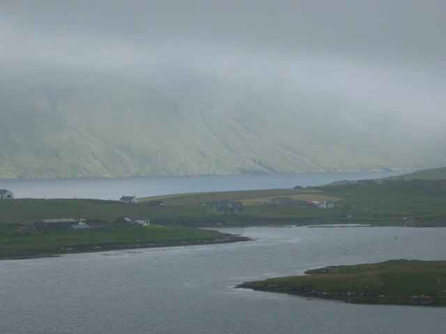
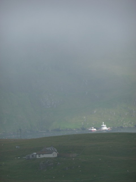
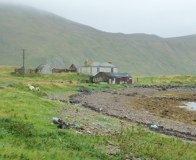
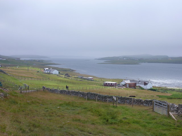
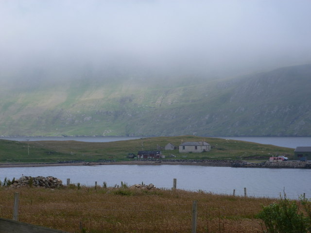
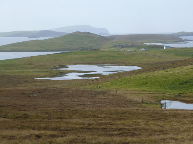
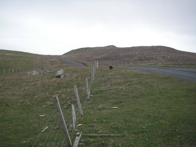
Bardi Field is a vast and picturesque expanse of downs and moorland located in the Shetland Islands, an archipelago off the northeast coast of Scotland. Stretching over a considerable area, the field is characterized by its rolling hills, heathland, and a variety of vegetation that thrives in the rugged Shetland environment.

The field is known for its rich biodiversity and serves as a habitat for numerous native plants and wildlife species. It boasts an array of grasses, wildflowers, and mosses that carpet the ground, creating a colorful and vibrant landscape. Visitors to Bardi Field can expect to encounter a diverse range of bird species, including curlews, lapwings, and meadow pipits, which nest and forage in the area.

The field offers a unique experience for outdoor enthusiasts, providing ample opportunities for walking, birdwatching, and photography. Its tranquil and untouched surroundings make it an ideal location for those seeking solace and a true connection with nature.

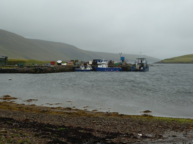
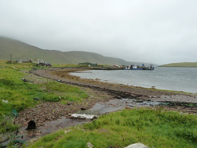
Bardi Field is easily accessible by foot or by vehicle, with several walking trails and designated parking areas available to visitors. The field is managed by local conservation organizations in collaboration with the Shetland Islands Council, ensuring the preservation of its natural beauty and the protection of its delicate ecosystem.

Overall, Bardi Field is a remarkable natural attraction in the Shetland Islands, offering visitors a chance to immerse themselves in the stunning scenery and observe the unique wildlife that thrives in this remote and unspoiled environment.

If you have any feedback on the listing, please let us know in the comments section below.

Bardi Field Images

Images are sourced within 2km of 60.071677/-1.2928987 or Grid Reference HU3932. Thanks to Geograph Open Source API. All images are credited.

East Burra: Houss from West Burra Looking across South Voe towards the scattered dwellings of Houss with the mighty slopes of Shetland's south mainland on the far side of Clift Sound beyond.
East Burra: Houss from West Burra
Looking across South Voe towards the scattered dwellings of Houss with the mighty slopes of Shetland's south mainland on the far side of Clift Sound beyond.
Houss: a house with a dramatic backdrop Looking across to a Houss house, as it were, from West Burra. I haven't been able to exactly locate the house on the map but it's somewhere hereabouts. In the background, a couple of vessels, below the cliffs of the Clift Hills, are catching a very rare bit of sun today - the rarity of the fine weather hinted at by the low mist towards the top of the hills.
Houss: a house with a dramatic backdrop
Looking across to a Houss house, as it were, from West Burra. I haven't been able to exactly locate the house on the map but it's somewhere hereabouts. In the background, a couple of vessels, below the cliffs of the Clift Hills, are catching a very rare bit of sun today - the rarity of the fine weather hinted at by the low mist towards the top of the hills.
Boats at The Taing The boats seen here are moored at a yard on the east coast of the Voe of North House, on the small peninsula called The Taing on East Burra. East Burra is a very narrow island (as is West Burra) that is linked to Mainland Shetland via bridges to Trondra and West Burra. The bridge between West and East Burra is a simple stone arch bridge in Bridge End.
Boats at The Taing
The boats seen here are moored at a yard on the east coast of the Voe of North House, on the small peninsula called The Taing on East Burra. East Burra is a very narrow island (as is West Burra) that is linked to Mainland Shetland via bridges to Trondra and West Burra. The bridge between West and East Burra is a simple stone arch bridge in Bridge End.
The Taing and Voe of North House The Taing is a small promontory of East Burra island into Clift Sound, with the Voe of North House on the right. The little stream entering the Voe at this point is a drain from the small Loch of Houss a few hundred yards to the north.
A closer view of the end of the Taing can be seen here <a href="https://www.geograph.org.uk/photo/2586774">HU3831 : Boats at The Taing</a> and of the cottages on the left of the image, here <a href="https://www.geograph.org.uk/photo/2695373">HU3831 : Cottages on The Taing</a>
The Taing and Voe of North House
The Taing is a small promontory of East Burra island into Clift Sound, with the Voe of North House on the right. The little stream entering the Voe at this point is a drain from the small Loch of Houss a few hundred yards to the north. A closer view of the end of the Taing can be seen here HU3831 : Boats at The Taing and of the cottages on the left of the image, here HU3831 : Cottages on The Taing
Cottages on The Taing A cluster of current and former dwellings at the northern end of The Taing, a small promontory of East Burra island. The Clift Hills of Mainland Shetland rise up behind them as a quite dramatic backdrop.
Cottages on The Taing
A cluster of current and former dwellings at the northern end of The Taing, a small promontory of East Burra island. The Clift Hills of Mainland Shetland rise up behind them as a quite dramatic backdrop.
East Burra: view down South Voe Looking down South Voe, the long inlet separating the islands of East Burra and West Burra.
East Burra: view down South Voe
Looking down South Voe, the long inlet separating the islands of East Burra and West Burra.
East Burra: Clift Sound view Looking along Clift Sound from East Hogaland, with the Clift Hills, on the western side of mainland Shetland, shrouded in a mist that clung on throughout the day.
East Burra: Clift Sound view
Looking along Clift Sound from East Hogaland, with the Clift Hills, on the western side of mainland Shetland, shrouded in a mist that clung on throughout the day.
East Burra: across Voe of North House Looking across this small bay, towards a house with coastal outlooks both front and back - Clift Sound is beyond, with the Clift Hills on the Shetland mainland rising into the mist.
East Burra: across Voe of North House
Looking across this small bay, towards a house with coastal outlooks both front and back - Clift Sound is beyond, with the Clift Hills on the Shetland mainland rising into the mist.
Newton and North Ho Abandoned croft to left of picture.  Newer dispersed settlement.
Newton and North Ho
Abandoned croft to left of picture. Newer dispersed settlement.
Holm Field Climbed after Royl Field with Tricky Speirs still windy. Walked around the various peat hags.
Name:Holm Field
Hill number:4908
Height:290m / 951ft
Area:22: Shetland Islands
Class:Hu
Grid ref:HU395306 (est)
Drop:104m
Col:186m HU394298
Holm Field
Climbed after Royl Field with Tricky Speirs still windy. Walked around the various peat hags. Name:Holm Field Hill number:4908 Height:290m / 951ft Area:22: Shetland Islands Class:Hu Grid ref:HU395306 (est) Drop:104m Col:186m HU394298
Easter Heog Bagged with Tricky Speirs.
Name: Easter Heog
Hill number: 103970
Height: 81m / 266ft
Area:22: Shetland Islands
Class: 0
Grid ref: HU388338 (est)
Drop: 81m
Easter Heog
Bagged with Tricky Speirs. Name: Easter Heog Hill number: 103970 Height: 81m / 266ft Area:22: Shetland Islands Class: 0 Grid ref: HU388338 (est) Drop: 81m
Looking south Taken from close to the Cairn and looking south to Fitful Head. The foreground loch is Gershon and beyond is the Loch of Houss, part of each in the square.
Looking south
Taken from close to the Cairn and looking south to Fitful Head. The foreground loch is Gershon and beyond is the Loch of Houss, part of each in the square.
Clift Sound From East Burra, near Mill Pond, looking south.
Clift Sound
From East Burra, near Mill Pond, looking south.
Voe of North House This sheltered bay off the coast of East Burra is used for fish farming. The Clift  Sound and the Clift Hills can be seen in the background.
Voe of North House
This sheltered bay off the coast of East Burra is used for fish farming. The Clift Sound and the Clift Hills can be seen in the background.
Road on East Burra The tarmac road on the island of East Burra goes as far south as Houss, where this photograph was taken. In 2006 there was a bus service from Scalloway on the Mainland of Shetland to this point, using the road bridges to Trondra and West Burra.
Road on East Burra
The tarmac road on the island of East Burra goes as far south as Houss, where this photograph was taken. In 2006 there was a bus service from Scalloway on the Mainland of Shetland to this point, using the road bridges to Trondra and West Burra.
East Hogaland Junction
East Hogaland Road
East Hogaland Road
Newton, East Burra
Newton, East Burra
Show me another place!

Bardi Field is located at Grid Ref: HU3932 (Lat: 60.071677, Lng: -1.2928987)

Unitary Authority: Shetland Islands

Police Authority: Highlands and Islands

What 3 Words

///design.illogical.crumble. Near Scalloway, Shetland Islands

Related Wikis

South Mainland

The South Mainland of the Shetland Islands is the southern peninsula of Mainland island. It lies south of Hellister (60° 14′N). The greater southern part...

East Burra

East Burra (Scots: East Burra; Old Norse: "Barrey") is one of the Scalloway Islands, a subgroup of the Shetland Islands in Scotland. It is connected by...

Burra, Shetland

Burra (Old Norse: Barrey ) is the collective name for two of the Shetland Islands, West (pop. 753) and East Burra (pop. 66), which are connected by bridge...

West Burra

West Burra is one of the Scalloway Islands, a subgroup of the Shetland Islands in Scotland. It is connected by bridge to East Burra. With an area of 743...

Scalloway Islands

The Scalloway Islands are in Shetland opposite Scalloway on south west of the Mainland. They form a mini-archipelago and include: Burra (two islands linked...

Cunningsburgh

Cunningsburgh, formerly also known as Coningsburgh (Old Norse: Konungsborgr meaning "King's castle"), is a new hamlet and ancient parish in the south of...

Bremirehoull

Bremirehoull is a settlement on the island of Mainland, in Shetland, Scotland. Bremirehoull is situated on the A970 in the Cunningsburgh area. == References... ==

Quarff

Quarff is a small village on Mainland in the Shetland Islands in Scotland. It is located on the main A970 road, 5 miles (8.0 km) south of Shetland's only...

Have you been to Bardi Field?

Leave your review of Bardi Field below (or comments, questions and feedback).