Brown Moor

Downs, Moorland in Yorkshire Harrogate

England

Brown Moor

The Temple, Allerton Park Taken from the A168
The Temple, Allerton Park Credit: Alison Stamp

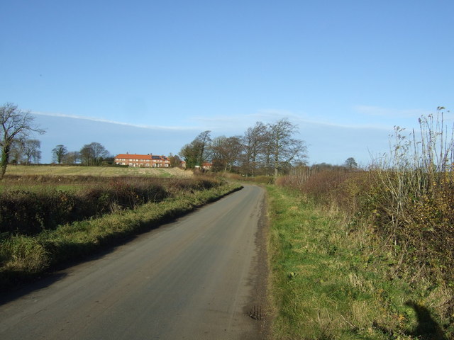
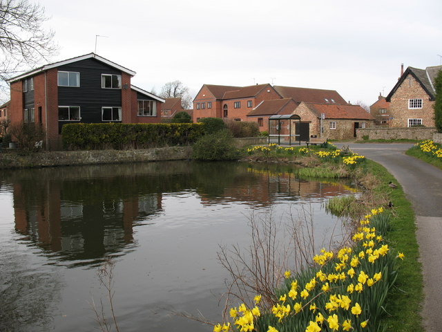
Brown Moor is a picturesque area located in Yorkshire, England, known for its stunning combination of downs and moorland landscapes. This region offers a diverse and unique natural environment that attracts both locals and tourists alike.

Covering a vast area, Brown Moor is characterized by its rolling hills, heather-clad moors, and scattered woodlands. The landscape is a patchwork of vibrant colors throughout the year, with purple heather dominating the summer months and golden bracken in the autumn. The moorland is home to a variety of wildlife, including birds such as curlews and lapwings, as well as mammals like hares and foxes.

The area is crisscrossed by a network of footpaths and trails, making it ideal for outdoor enthusiasts. Hikers and nature lovers can explore the many walking routes that traverse the moorland, providing breathtaking views of the surrounding countryside. Additionally, Brown Moor offers opportunities for mountain biking, horse riding, and birdwatching, ensuring there is something for everyone to enjoy.

In addition to its natural beauty, Brown Moor also boasts a rich cultural heritage. The area is dotted with ancient landmarks, including burial mounds and standing stones, providing glimpses into its past. Visitors can immerse themselves in the history and tradition of the region by visiting nearby historic villages and experiencing the local cuisine and hospitality.

Overall, Brown Moor is a captivating destination that offers a blend of natural beauty, outdoor activities, and cultural experiences. Its diverse landscape and rich history make it a must-visit location for those seeking a true taste of Yorkshire's charm.

If you have any feedback on the listing, please let us know in the comments section below.

Brown Moor Images

Images are sourced within 2km of 54.020657/-1.4095524 or Grid Reference SE3858. Thanks to Geograph Open Source API. All images are credited.

The Temple, Allerton Park Taken from the A168
The Temple, Allerton Park
Taken from the A168
A59 near Flaxby
A59 near Flaxby
Moor Lane Heading south towards Coneythorpe.
Moor Lane
Heading south towards Coneythorpe.
Farmland east of Moor Lane
Poplar Cottage, east of Ferrensby
A168 northbound
A168 northbound
A168 Northbound The Great North Road, and formerly part of the A1.  It is now a much quieter thoroughfare that runs alongside and parallel to the new upgraded motorway that has taken away it numerical title and prestige.
A168 Northbound
The Great North Road, and formerly part of the A1. It is now a much quieter thoroughfare that runs alongside and parallel to the new upgraded motorway that has taken away it numerical title and prestige.
Gated Entrance into Allerton Park Closed entrance from the A168.
Gated Entrance into Allerton Park
Closed entrance from the A168.
A168 outside Allerton Park Heading north, this is part of the old A1 - which now runs alongside and parallel to a recently constructed motorway.
The brick wall on the right marks the boundary of the Allerton Park estate.
A168 outside Allerton Park
Heading north, this is part of the old A1 - which now runs alongside and parallel to a recently constructed motorway. The brick wall on the right marks the boundary of the Allerton Park estate.
The A168 going north past Allerton  Castle  entrance This road was the Great North Road until 1922 when it became the A1,  the A1(M) over to the left has now made this a backwater. The wall to the right is the boundary wall of Allerton Park
The A168 going north past Allerton Castle entrance
This road was the Great North Road until 1922 when it became the A1, the A1(M) over to the left has now made this a backwater. The wall to the right is the boundary wall of Allerton Park
Fishing lake in Flaxby Covert
York Road approaching its end Looking north-eastward. Hard to believe that this was once the A59 and continued across the A1 to York. It is now a road to nowhere and becomes a dead-end upon reaching the A1(M)
York Road approaching its end
Looking north-eastward. Hard to believe that this was once the A59 and continued across the A1 to York. It is now a road to nowhere and becomes a dead-end upon reaching the A1(M)
Old Milestone by old York Road, Flaxby parish Metal plate attached to stone post by the UC road, in parish of FLAXBY (HARROGATE District), old York Road (now a cul de sac), on the verge, almost at end of lane, 200m West of A1(M) carriageway, on South side of road. WR iron casting, erected by the County Council in the 19th century. 

Inscription reads:-
: KNARES / BOROUGH / 4 MILES : : KNARESBOROUGH & GREEN / HAMMERTON / ROAD / FLAXBY : : GREEN / HAMMERTON / 4 MILES :

Grade II listed.  
List Entry Number: 1189514 <span class="nowrap"><a title="https://historicengland.org.uk/listing/the-list/list-entry/1189514" rel="nofollow ugc noopener" href="https://historicengland.org.uk/listing/the-list/list-entry/1189514">Link</a><img style="margin-left:2px;" alt="External link" title="External link - shift click to open in new window" src="https://s1.geograph.org.uk/img/external.png" width="10" height="10"/></span>

Milestone Society National ID: YN_KBGH04.
Old Milestone by old York Road, Flaxby parish
Metal plate attached to stone post by the UC road, in parish of FLAXBY (HARROGATE District), old York Road (now a cul de sac), on the verge, almost at end of lane, 200m West of A1(M) carriageway, on South side of road. WR iron casting, erected by the County Council in the 19th century. Inscription reads:- : KNARES / BOROUGH / 4 MILES : : KNARESBOROUGH & GREEN / HAMMERTON / ROAD / FLAXBY : : GREEN / HAMMERTON / 4 MILES : Grade II listed. List Entry Number: 1189514 LinkExternal link Milestone Society National ID: YN_KBGH04.
A1(M) north of the Allerton Interchange Variable message signs (VMS), also sometimes referred to as matrix signs, are electronic traffic signs used on motorways (and some other major routes) to give drivers information about special events and to warn them about traffic congestion, accidents, incidents, roadworks or speed limits on specific sections of the route. They may also suggest (or instruct) drivers to take alternative routes, limit speed, warn of duration and location of the incidents or just inform of the traffic conditions.
A1(M) north of the Allerton Interchange
Variable message signs (VMS), also sometimes referred to as matrix signs, are electronic traffic signs used on motorways (and some other major routes) to give drivers information about special events and to warn them about traffic congestion, accidents, incidents, roadworks or speed limits on specific sections of the route. They may also suggest (or instruct) drivers to take alternative routes, limit speed, warn of duration and location of the incidents or just inform of the traffic conditions.
Variable Message Sign on the A1(M) in North Yorkshire The A1(M), north of the Allerton Interchange (Junction 47).

Variable message signs (VMS), also sometimes referred to as matrix signs, are electronic traffic signs used on motorways (and some other major routes) to give drivers information about special events and to warn them about traffic congestion, accidents, incidents, roadworks or speed limits on specific sections of the route. They may also suggest (or instruct) drivers to take alternative routes, limit speed, warn of duration and location of the incidents or just inform of the traffic conditions.
Variable Message Sign on the A1(M) in North Yorkshire
The A1(M), north of the Allerton Interchange (Junction 47). Variable message signs (VMS), also sometimes referred to as matrix signs, are electronic traffic signs used on motorways (and some other major routes) to give drivers information about special events and to warn them about traffic congestion, accidents, incidents, roadworks or speed limits on specific sections of the route. They may also suggest (or instruct) drivers to take alternative routes, limit speed, warn of duration and location of the incidents or just inform of the traffic conditions.
A168 heading north The A168 for some distance runs parallel to the A1(M) and gives an alternative route for those wishing to avoid the busier, high speed road. Useful too if there's congestion on the motorway. (The motorway is a short distance beyond the left side trees.)
A168 heading north
The A168 for some distance runs parallel to the A1(M) and gives an alternative route for those wishing to avoid the busier, high speed road. Useful too if there's congestion on the motorway. (The motorway is a short distance beyond the left side trees.)
Flaxby : A1(M) Looking north on the A1(M).
Flaxby : A1(M)
Looking north on the A1(M).
Coneythorpe and Clareton : A1(M) Looking north on the A1(M).
Coneythorpe and Clareton : A1(M)
Looking north on the A1(M).
Show me another place!

Brown Moor is located at Grid Ref: SE3858 (Lat: 54.020657, Lng: -1.4095524)

Division: West Riding

Administrative County: North Yorkshire

District: Harrogate

Police Authority: North Yorkshire

What 3 Words

///amends.objective.headings. Near Knaresborough, North Yorkshire

Nearby Locations

Brown Moor

Related Wikis

Flaxby

Flaxby is a village and civil parish in the Harrogate district of North Yorkshire, England. It is close to the A1(M) motorway and 2 miles (3.2 km) east...

Goldsborough railway station

Goldsborough railway station served the village of Goldsborough, North Yorkshire, England from 1850 to 1965 on the Harrogate line. The station was over...

Coneythorpe

Coneythorpe is a village in the civil parish of Coneythorpe and Clareton, in North Yorkshire, England. It is situated less than 1 mile (1.6 km) west from...

Ferrensby

Ferrensby is a village and civil parish in the Harrogate district of North Yorkshire, England. The population of the civil parish at the 2011 census was...

Related Videos

Aerial footage of Allerton Castle, near Knaresborough North Yorkshire England

Allerton Castle is a Grade I listed nineteenth-century Gothic or Victorian Gothic house at Allerton Mauleverer in North Yorkshire, ...

Allerton Castle Virtual Viewing

Come and explore your dream wedding venue from the comfort of your own home. Congratulations on your engagement!

ARKENDALE: Harrogate Parish #11 of 139

HARROGATE PARISH #11: ARKENDALE Arkendale – “Eorcon's Valley” Welcome back to Harrogate again everyone, and just ...

Nearby Amenities

Located within 500m of 54.020657,-1.4095524
Created By: Merkaartor 0.13
Lat/Long: 54.022521/-1.4027365
Created By: Merkaartor 0.13
Lat/Long: 54.02072/-1.401897
The data included in this document is from www.openstreetmap.org. The data is made available under ODbL.

Have you been to Brown Moor?

Leave your review of Brown Moor below (or comments, questions and feedback).