The Green

Downs, Moorland in Oxfordshire West Oxfordshire

England

The Green

Direction Sign – Signpost on the B4022 in Finstock Located on the southeast side of the junction of the B4022 Charlbury Road and School Road in Finstock parish. 3 arms and annulus finial. See also <a title="https://www.geograph.org.uk/photo/1439986" href="https://www.geograph.org.uk/photo/1439986">Link</a>.

Milestone Society National ID: OX_SP3616
Direction Sign – Signpost on the B4022 in Finstock Credit: John V Nicholls

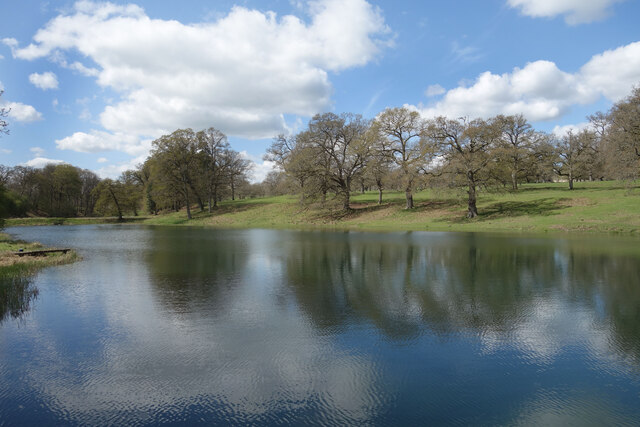
The Green is a picturesque area located in Oxfordshire, England. It is characterized by its stunning landscapes, consisting of downs and moorland. The area is known for its rich natural beauty, attracting nature enthusiasts and outdoor adventurers.

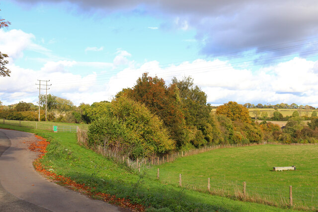
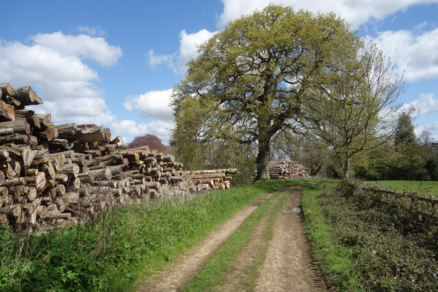
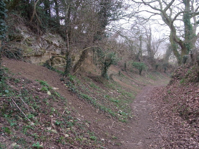
The downs, which are grassy hills, dominate the landscape of The Green. They provide breathtaking panoramic views of the surrounding countryside, making it a popular spot for hikers and walkers. The rolling hills are covered in lush greenery, creating a serene and tranquil atmosphere.

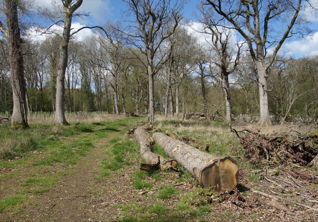
In addition to the downs, The Green is also home to extensive moorland. Moorland is characterized by its open, treeless landscapes, covered in heather and other low-growing vegetation. This unique ecosystem supports a variety of wildlife, including birds, reptiles, and mammals.

The Green offers numerous recreational opportunities for visitors. Walking and hiking trails crisscross the area, allowing people to explore the downs and moorland at their own pace. The hills also provide excellent opportunities for paragliding and hang gliding, attracting thrill-seekers from near and far.

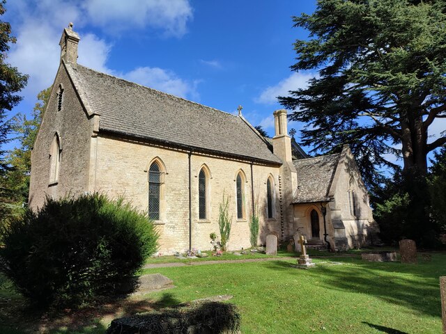
Apart from its natural beauty, The Green is also steeped in history. There are ancient burial sites and archaeological remains scattered throughout the area, giving insight into the region's past. The charming villages and historic buildings in the vicinity add to the overall charm of The Green.

Overall, The Green in Oxfordshire is a haven for nature lovers and history enthusiasts alike. With its stunning downs, vast moorland, and rich historical heritage, it offers a truly immersive experience for all who visit.

If you have any feedback on the listing, please let us know in the comments section below.
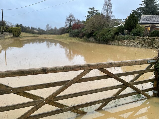
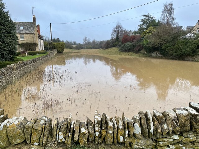
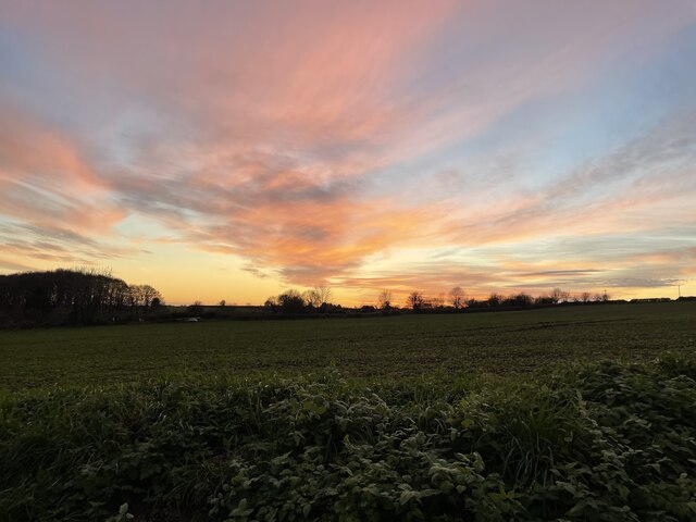
The Green Images

Images are sourced within 2km of 51.849937/-1.4609125 or Grid Reference SP3716. Thanks to Geograph Open Source API. All images are credited.

Direction Sign – Signpost on the B4022 in Finstock Located on the southeast side of the junction of the B4022 Charlbury Road and School Road in Finstock parish. 3 arms and annulus finial. See also <a title="https://www.geograph.org.uk/photo/1439986" href="https://www.geograph.org.uk/photo/1439986">Link</a>.

Milestone Society National ID: OX_SP3616
Direction Sign – Signpost on the B4022 in Finstock
Located on the southeast side of the junction of the B4022 Charlbury Road and School Road in Finstock parish. 3 arms and annulus finial. See also Link. Milestone Society National ID: OX_SP3616
The Dene in flood The Dene, below Lower Farm, flooded
The Dene in flood
The Dene, below Lower Farm, flooded
Lower Farm and The Dene View of Lower Farm with The Dene in flood
Lower Farm and The Dene
View of Lower Farm with The Dene in flood
Sunset from Oxfordshire Way Looking towards Witney from Oxfordshire Way at sunset
Sunset from Oxfordshire Way
Looking towards Witney from Oxfordshire Way at sunset
Park Farm Footpath near Finstock.
Park Farm
Footpath near Finstock.
The Plough Inn Public House in Finstock.
The Plough Inn
Public House in Finstock.
Fields near Finstock Fields and power lines near Finstock.
Fields near Finstock
Fields and power lines near Finstock.
Finstock Footpath Path off High Street, Finstock.
Finstock Footpath
Path off High Street, Finstock.
Holy Trinity Church, Finstock
St Peter's Church, Wilcote
The Plough Inn (1), The Bottom, Finstock, Oxon Originally a house with date of 1772 and now an inn. It is the last inn or public house in the village, following the closure of The Crown just over ten years ago. This was converted into a house. The Plough Inn is a Grade II listed building.

<a href="https://www.geograph.org.uk/photo/7420831">SP3616 : The Plough Inn (2) - sign, The Bottom, Finstock, Oxon</a>.
The Plough Inn (1), The Bottom, Finstock, Oxon
Originally a house with date of 1772 and now an inn. It is the last inn or public house in the village, following the closure of The Crown just over ten years ago. This was converted into a house. The Plough Inn is a Grade II listed building. SP3616 : The Plough Inn (2) - sign, The Bottom, Finstock, Oxon.
The Plough Inn (2) - sign, The Bottom, Finstock, Oxon The sign is on a pole adjacent to the road which the inn fronts.

<a href="https://www.geograph.org.uk/photo/7420821">SP3616 : The Plough Inn (1), The Bottom, Finstock, Oxon</a>.
The Plough Inn (2) - sign, The Bottom, Finstock, Oxon
The sign is on a pole adjacent to the road which the inn fronts. SP3616 : The Plough Inn (1), The Bottom, Finstock, Oxon.
Junction of The Bottom and Well Hill, Finstock, Oxon The road coming in on the right is Well Hill.
Junction of The Bottom and Well Hill, Finstock, Oxon
The road coming in on the right is Well Hill.
Part of Finstock Village Finstock is in a valley. This is coming into the village from the east.
Part of Finstock Village
Finstock is in a valley. This is coming into the village from the east.
Southill Park Drive A very well kept private road leading to Cornbury Park. It is also a public footpath and cycleway
Southill Park Drive
A very well kept private road leading to Cornbury Park. It is also a public footpath and cycleway
Logs by the Path Timber stacks beside the track to Topples Wood.
Logs by the Path
Timber stacks beside the track to Topples Wood.
Topples Wood A path in Topples Wood where there has been a lot of felling and replanting.
Topples Wood. Could be an advert for a chain saw.
Topples Wood
A path in Topples Wood where there has been a lot of felling and replanting. Topples Wood. Could be an advert for a chain saw.
Lake in Cornbury Park A line of ornamental lakes has been created in the park along the course of a short tributary of the Evenlode, originating from springs in the park and the adjoining Wychwood Forest.
Lake in Cornbury Park
A line of ornamental lakes has been created in the park along the course of a short tributary of the Evenlode, originating from springs in the park and the adjoining Wychwood Forest.
Show me another place!

The Green is located at Grid Ref: SP3716 (Lat: 51.849937, Lng: -1.4609125)

Administrative County: Oxfordshire

District: West Oxfordshire

Police Authority: Thames Valley

What 3 Words

///moped.cove.crouching. Near Stonesfield, Oxfordshire

Related Wikis

Finstock railway station

Finstock railway station serves the village of Finstock and the hamlet of Fawler in Oxfordshire, England. It is some distance from Finstock itself, being...

Fawler

Fawler is a hamlet and civil parish in the valley of the River Evenlode, 1.5 miles (2.4 km) southeast of Charlbury in Oxfordshire, England. There are...

Cornbury and Wychwood

Cornbury and Wychwood is a civil parish in West Oxfordshire. It includes the country estate of Cornbury Park (Ordnance Survey grid reference SP350181)...

Finstock

Finstock is a village and civil parish about 2 miles (3 km) south of Charlbury in Oxfordshire, England. The parish is bounded to the northeast by the...

Wilcote

Wilcote is a hamlet about 3+1⁄2 miles (5.6 km) north of Witney in Oxfordshire, England. Wilcote was a hamlet of Cogges from at least the Middle Ages until...

Stonesfield Common, Bottoms and Banks

Stonesfield Common, Bottoms and Banks is a 27.45-hectare (67.8-acre) biological Site of Special Scientific Interest (SSSI) south of Stonesfield in Oxfordshire...

Ramsden, Oxfordshire

Ramsden is a village and civil parish about 3+1⁄2 miles (5.6 km) north of Witney in West Oxfordshire. The 2011 Census recorded the parish's population...

Stonesfield

Stonesfield is a village and civil parish about 5 miles (8 km) north of Witney in Oxfordshire, and about 10 miles (17 km) north-west of Oxford. The village...

Related Videos

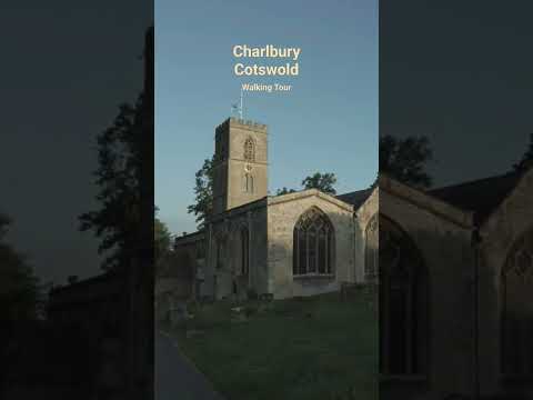
Charlbury, Cotswolds, England, A Magical Early Morning Walking Tour 4K

Welcome to this walking tour in 4K. Today I'm taking you on a beautiful early morning walk tour of Charlbury in the Cotswolds.

Charlbury, Cotswolds Sunrise walking Tour

Welcome to this walking tour in 4K. Today I'm taking you on a beautiful early morning walk tour of Charlbury in the Cotswolds.

Charlbury, Cotswolds Early Morning walking Tour

Welcome to this walking tour in 4K. Today I'm taking you on a beautiful early morning walk tour of Charlbury in the Cotswolds.

Charming little town || Charlbury, English Countryside

The small west Oxfordshire town was acknowledged as a great place to live for its beautiful surroundings. The small historic ...

Nearby Amenities

Located within 500m of 51.849937,-1.4609125
Fawler
Is In: Oxfordshire, England, UK
Place: hamlet
Lat/Long: 51.8516247/-1.4624722
Barrier: kissing_gate
Bicycle: no
Foot: designated
Lat/Long: 51.8471432/-1.4663515
Barrier: stile
Lat/Long: 51.8488835/-1.4615373
Barrier: stile
Foot: yes
Lat/Long: 51.8494482/-1.4612373
Bus Stop
Main Street
Bus: yes
Naptan AtcoCode: 340000309OV
Naptan Bearing: E
Naptan CommonName: Main Street
Naptan Indicator: Opp Rose Cottages
Naptan Landmark: Manor House
Naptan NaptanCode: oxfgapaj
Naptan Street: Main Street
Naptan Verified: no
Public Transport: platform
Source: naptan_import
Lat/Long: 51.8509299/-1.4616293
Main Street
Naptan AtcoCode: 340000309V
Naptan Bearing: W
Naptan BusStopType: CUS
Naptan CommonName: Main Street
Naptan Indicator: o/s Rose Cottages
Naptan Landmark: Manor House
Naptan NaptanCode: oxfamapj
Naptan Street: Main Street
Naptan Verified: no
Source: naptan_import
Lat/Long: 51.8508672/-1.4616736
Barrier: kissing_gate
Foot: yes
Lat/Long: 51.8482721/-1.4634495
Power: pole
Source: Bing
Lat/Long: 51.8524701/-1.4663041
Power: pole
Source: Bing
Lat/Long: 51.8534518/-1.461836
Power: pole
Source: Bing
Lat/Long: 51.8535909/-1.460924
Power: pole
Source: Bing
Lat/Long: 51.8530036/-1.4655342
Power: pole
Source: Bing
Lat/Long: 51.8533259/-1.4637886
Power: pole
Source: Bing
Lat/Long: 51.8521265/-1.4667685
Power: pole
Source: Bing
Lat/Long: 51.8531254/-1.4646469
Power: pole
Source: Bing
Lat/Long: 51.8517205/-1.4672862
Communication Gsm-r: yes
Man Made: mast
Lat/Long: 51.8473379/-1.4582312
Telephone
Booth: K6
Covered: booth
Listed Status: Grade II
Operator: BT
Operator Wikidata: Q593786
Phone: +44 1993 891214
Lat/Long: 51.8510921/-1.4624194
The data included in this document is from www.openstreetmap.org. The data is made available under ODbL.

Have you been to The Green?

Leave your review of The Green below (or comments, questions and feedback).