Byergates Field

Downs, Moorland in Yorkshire Harrogate

England

Byergates Field

River Ure at Boroughbridge Camping and Caravan Club Site
River Ure at Boroughbridge Camping and Caravan Club Site Credit: Sandy Gerrard

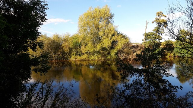
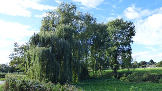
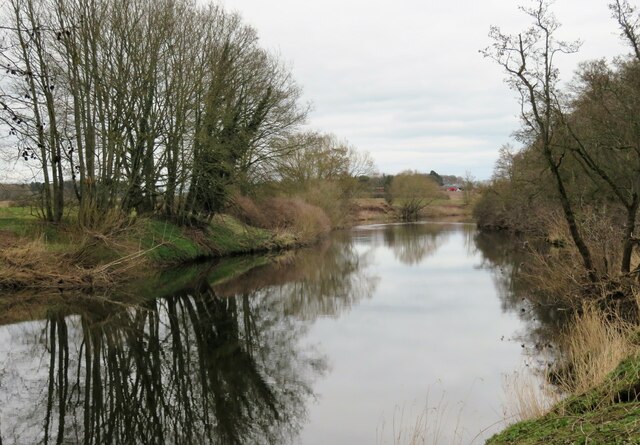
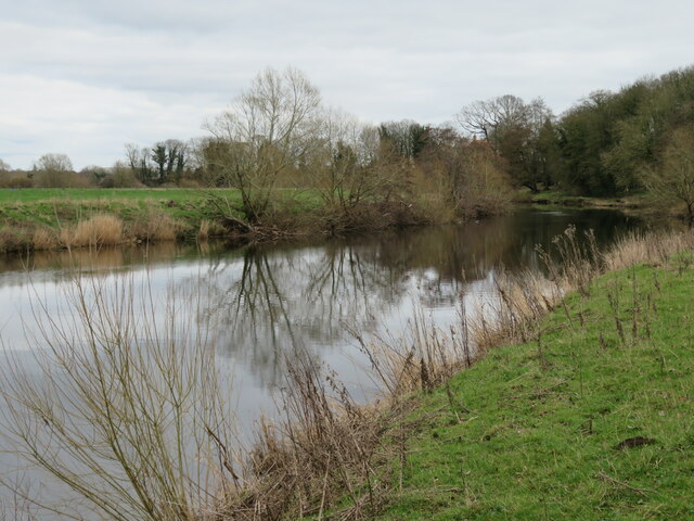
Byergates Field is a picturesque area located in the county of Yorkshire, in the northern part of England. It is situated amidst the stunning landscape of the Yorkshire Downs and Moorland, offering visitors a unique and captivating experience.

The field itself is expansive, spanning over several acres of lush greenery and rolling hills. It is characterized by its breathtaking natural beauty, with vibrant wildflowers dotting the landscape and a tranquil atmosphere that is perfect for relaxation and recreation.

The Yorkshire Downs, which surround Byergates Field, are a range of low-lying hills that provide a stunning backdrop to the area. These hills are known for their sweeping vistas, offering panoramic views of the surrounding countryside. The moorland, on the other hand, is a rugged and wild terrain with its own distinct charm. It is home to an array of unique flora and fauna, including heather, grouse, and various species of birds.

Byergates Field is a popular destination for nature enthusiasts, hikers, and photographers. The field offers numerous walking trails, allowing visitors to explore the area and discover its hidden gems. From leisurely strolls to more challenging hikes, there is something for everyone to enjoy.

In addition to its natural beauty, Byergates Field also has a rich history. The area is dotted with ancient ruins and historical landmarks, giving visitors a glimpse into the region's past. Exploring these sites adds an extra layer of fascination to the already captivating landscape.

Overall, Byergates Field in Yorkshire is a must-visit destination for those seeking to immerse themselves in the beauty of nature and explore the rich history of the region.

If you have any feedback on the listing, please let us know in the comments section below.

Byergates Field Images

Images are sourced within 2km of 54.080946/-1.435752 or Grid Reference SE3765. Thanks to Geograph Open Source API. All images are credited.

River Ure at Boroughbridge Camping and Caravan Club Site
Weeping Willow at Roecliffe
River Ure at Roecliffe
River Ure at Roecliffe Grange
Minskip, Wild Swan PH The benchmark is cut into the north-east facing wall of the pub.
Minskip, Wild Swan PH
The benchmark is cut into the north-east facing wall of the pub.
Minskip, Wild Swan PH There is a benchmark cut into the north-east facing wall of the pub, which is the gable end.
Minskip, Wild Swan PH
There is a benchmark cut into the north-east facing wall of the pub, which is the gable end.
Bridleway towards Roecliffe Lodge A tarmacked lane which is both private road and public bridleway with the redbrick house of Roecliffe Lodge in the distance.
Bridleway towards Roecliffe Lodge
A tarmacked lane which is both private road and public bridleway with the redbrick house of Roecliffe Lodge in the distance.
Foster Flatts Farm Seen across the fields from the bridleway heading NE from Roecliffe Lodge. I note that on old maps the farm is referred to as 'Foster Flat'.
Foster Flatts Farm
Seen across the fields from the bridleway heading NE from Roecliffe Lodge. I note that on old maps the farm is referred to as 'Foster Flat'.
Private Road to Wheatlands Farm Tarmacked road which is also a footpath past Wheatlands Farm.
Private Road to Wheatlands Farm
Tarmacked road which is also a footpath past Wheatlands Farm.
Track west of Wheatlands Farm One might also describe this as a public footpath, but if the OS map and NYCC official rights of way map are to be believed, then the line of the path is around 20m to the right in a crop field. [number 15.113/3]
Track west of Wheatlands Farm
One might also describe this as a public footpath, but if the OS map and NYCC official rights of way map are to be believed, then the line of the path is around 20m to the right in a crop field. [number 15.113/3]
A friendly welcome Three friendly donkeys by the path below Westwick Hall.
A friendly welcome
Three friendly donkeys by the path below Westwick Hall.
View along the Ure View downstream from the right bank where the path passes through Cherry Island Wood, a section which can be very muddy and with several awkward crossings of minor drainage channels.
View along the Ure
View downstream from the right bank where the path passes through Cherry Island Wood, a section which can be very muddy and with several awkward crossings of minor drainage channels.
No cruise liners beyond this point Danger sign on the bank of the Ure on the approach to where electricity transmission lines cross the river. One wonders if there could be any craft using this stretch of the river with a mast more than 4.9m high.
No cruise liners beyond this point
Danger sign on the bank of the Ure on the approach to where electricity transmission lines cross the river. One wonders if there could be any craft using this stretch of the river with a mast more than 4.9m high.
The Ure at Roecliffe The river is some way below the village at the bottom of a slope, thus keeping the village properties well above flood level.
The Ure at Roecliffe
The river is some way below the village at the bottom of a slope, thus keeping the village properties well above flood level.
Becklands Lane Rough surfaced lane, south east of Roecliffe village. Also the line of a public footpath.
Becklands Lane
Rough surfaced lane, south east of Roecliffe village. Also the line of a public footpath.
Track of former railway Now the line of a public footpath towards Minskip, but once the track of the railway line from Knaresborough through Boroughbridge to Pillmoor Junction.
Track of former railway
Now the line of a public footpath towards Minskip, but once the track of the railway line from Knaresborough through Boroughbridge to Pillmoor Junction.
Industry in the countryside A section of diverted footpath number 15.113/12 which passes close to a huge warehouse which forms part of a site owned by a food distribution company. Part of the Bar lane industrial site which has expanded since the upgrading of the A1 to motorway status, and is close to junction 48.
Industry in the countryside
A section of diverted footpath number 15.113/12 which passes close to a huge warehouse which forms part of a site owned by a food distribution company. Part of the Bar lane industrial site which has expanded since the upgrading of the A1 to motorway status, and is close to junction 48.
A house on Main Street (A6055), Minskip The A6055 road stretches for 56 kilometres (nearly 35 miles) through North Yorkshire, from Knaresborough to Barton: <span class="nowrap"><a title="https://www.sabre-roads.org.uk/wiki/index.php?title=A6055" rel="nofollow ugc noopener" href="https://www.sabre-roads.org.uk/wiki/index.php?title=A6055">Link</a><img style="margin-left:2px;" alt="External link" title="External link - shift click to open in new window" src="https://s1.geograph.org.uk/img/external.png" width="10" height="10"/></span>
A house on Main Street (A6055), Minskip
The A6055 road stretches for 56 kilometres (nearly 35 miles) through North Yorkshire, from Knaresborough to Barton: LinkExternal link
Show me another place!

Byergates Field is located at Grid Ref: SE3765 (Lat: 54.080946, Lng: -1.435752)

Division: West Riding

Administrative County: North Yorkshire

District: Harrogate

Police Authority: North Yorkshire

What 3 Words

///notice.visits.reclusive. Near Boroughbridge, North Yorkshire

Related Wikis

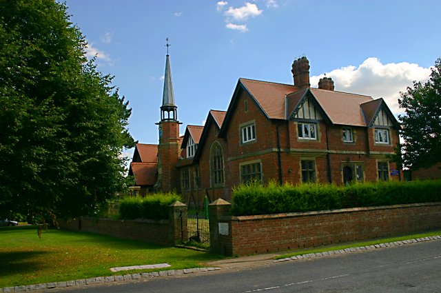
St Mary's Church, Roecliffe

St Mary's Church is a redundant Church of England parish church in the village of Roecliffe, North Yorkshire, England (grid reference SE375659). It is...

Roecliffe

Roecliffe is a village and civil parish in the Harrogate district of North Yorkshire, England. It is situated near the A1 road motorway which connects...

Minskip

Minskip is a village in the civil parish of Boroughbridge, in North Yorkshire, England. It is on the A6055 road and 1 mile south-west of Boroughbridge...

Staveley, North Yorkshire

Staveley is a village and civil parish in the Harrogate district of North Yorkshire, England. It is situated 4 miles (6.4 km) north of Knaresborough and...

Devil's Arrows

The Devil's Arrows are four standing stones or menhirs in an alignment approximately 660 feet (200 m) to the east of the A1(M), adjacent to Roecliffe Lane...

Westwick, North Yorkshire

Westwick is a civil parish in Harrogate district in North Yorkshire, England. It lies 3 miles (5 km) west of Boroughbridge, on the south bank of the River...

Bishop Monkton Ings

Bishop Monkton Ings is a Site of Special Scientific Interest, or SSSI, situated east of Bishop Monkton village in North Yorkshire, England. It consists...

Copgrove

Copgrove is a village and civil parish in the Harrogate district of North Yorkshire, England, five miles (8 km) south-west of Boroughbridge and the A1...

Nearby Amenities

Located within 500m of 54.080946,-1.435752
Tourism: artwork
Lat/Long: 54.0788924/-1.4350551
Power: pole
Lat/Long: 54.0780519/-1.4310068
Power: pole
Lat/Long: 54.0779354/-1.4324203
Power: pole
Lat/Long: 54.0778143/-1.4338633
Power: pole
Lat/Long: 54.0777026/-1.4351535
Power: pole
Lat/Long: 54.0775704/-1.4366287
Power: pole
Lat/Long: 54.0774508/-1.4381683
Power: pole
Lat/Long: 54.0773406/-1.4393377
The data included in this document is from www.openstreetmap.org. The data is made available under ODbL.

Have you been to Byergates Field?

Leave your review of Byergates Field below (or comments, questions and feedback).