Black Meadow

Downs, Moorland in Shetland

Scotland

Black Meadow

The Nev, Fitful Head, from the air With a view to Ward of Scousburgh
The Nev, Fitful Head, from the air Credit: Mike Pennington

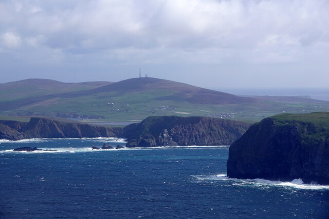
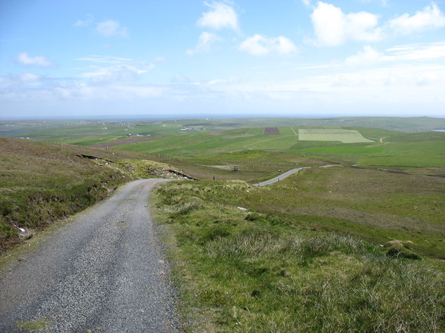
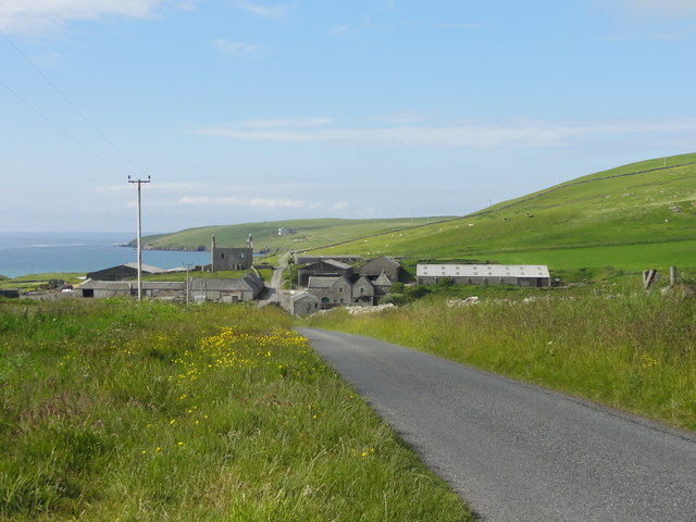
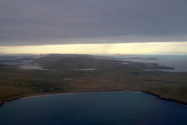
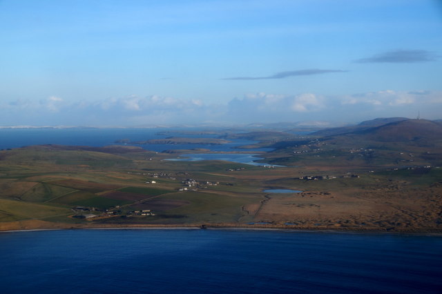
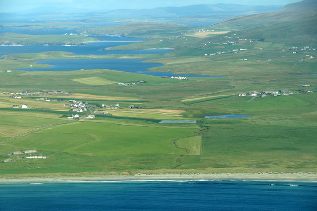
Black Meadow is a serene and picturesque area nestled within the stunning Shetland Islands. Located in the northernmost part of Scotland, this vast expanse of land covers a sprawling 10 square miles. Renowned for its rugged beauty and remarkable biodiversity, Black Meadow is a true testament to the unspoiled natural wonders of the Shetland Islands.

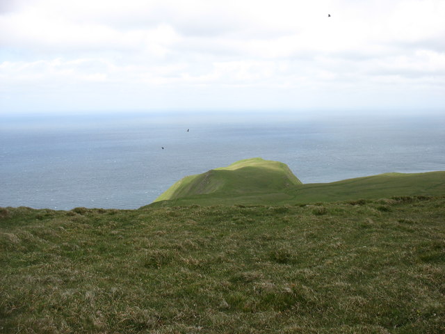
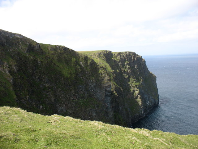
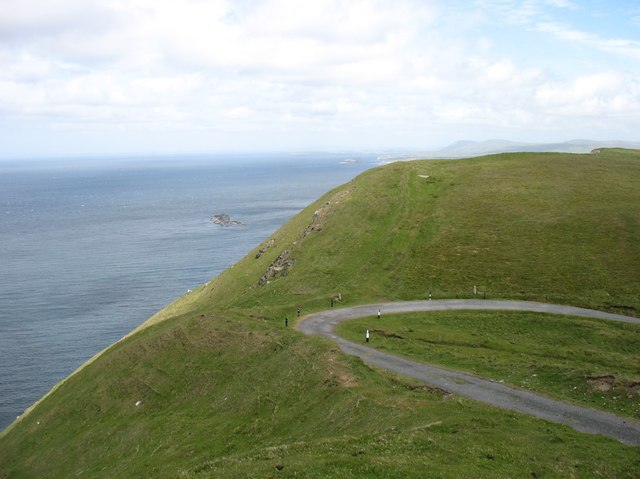
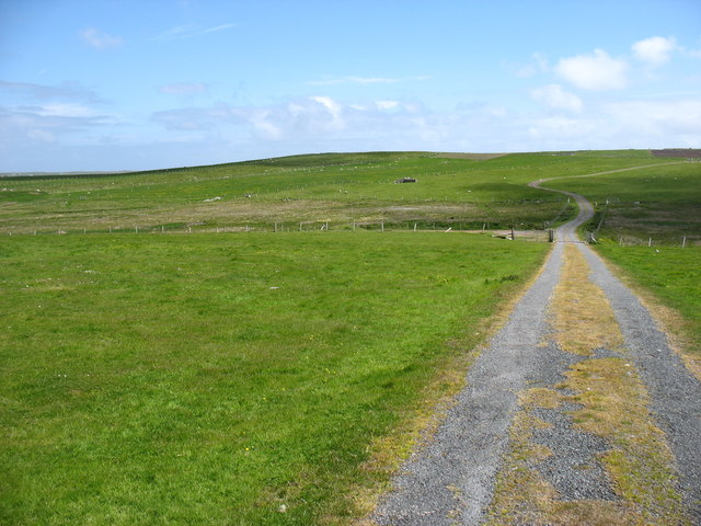
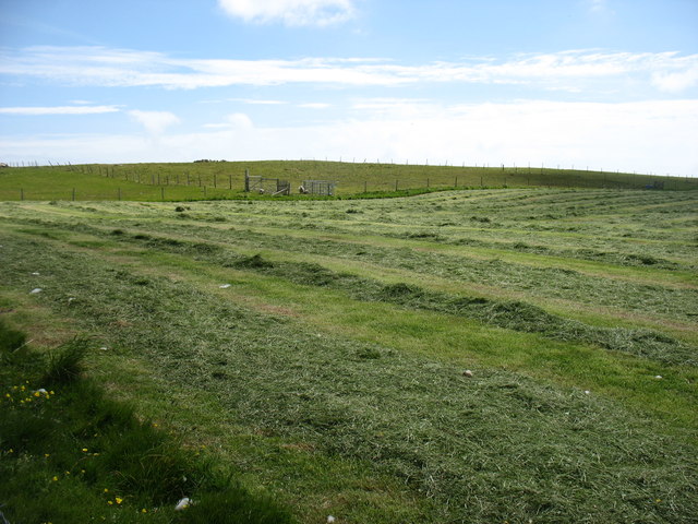
With its rolling hills, undulating moorland, and distinctive peat bogs, Black Meadow offers visitors a unique opportunity to immerse themselves in the untamed beauty of the Shetlands. The area is characterized by its rich black soil, which gives the meadow its name and contributes to the lush vegetation that blankets the landscape.

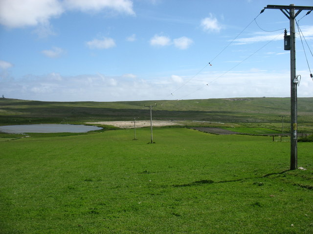
Black Meadow is home to a diverse range of plant and animal species, making it a haven for nature enthusiasts and wildlife watchers. Visitors may spot an array of bird species, including the iconic Shetland pony, which roams freely across the meadow. The area is also teeming with small mammals, such as otters and hares, adding to the enchanting allure of the landscape.

For those seeking outdoor adventures, Black Meadow offers ample opportunities for hiking, birdwatching, and photography. The meandering trails that crisscross the area allow visitors to explore its hidden corners, discover hidden waterfalls, and marvel at the breathtaking panoramic views.

Whether it's the tranquility of the moorland, the wild beauty of the peat bogs, or the captivating wildlife, Black Meadow in Shetland is a destination that promises an unforgettable experience for nature lovers and adventurers alike.

If you have any feedback on the listing, please let us know in the comments section below.

Black Meadow Images

Images are sourced within 2km of 59.910235/-1.3573754 or Grid Reference HU3614. Thanks to Geograph Open Source API. All images are credited.

The Nev, Fitful Head, from the air With a view to Ward of Scousburgh
The Nev, Fitful Head, from the air
With a view to Ward of Scousburgh
Fitful Head from the air
Dotterel (Chardrius morinellus), near Bakkasetter A migrant in Shetland.
Dotterel (Chardrius morinellus), near Bakkasetter
A migrant in Shetland.
The Ords, Fitful Head
Cliffs at The Nev, north of Fitful Head
The bend in the track There is a well-graded track up to the communications masts on Fitful Head. Clearly, it is not open to the public to drive up, but it is an easy walk from Quendale. At this point, there is a sharp bend. Coming down, I certainly would not want to lose control here, or miss the turn in mist. The consequences are pretty clear!

I think that the rocks just left of centre must be Swarta Skerry, in <a href="https://www.geograph.org.uk/gridref/HU3415">HU3415</a>.
The bend in the track
There is a well-graded track up to the communications masts on Fitful Head. Clearly, it is not open to the public to drive up, but it is an easy walk from Quendale. At this point, there is a sharp bend. Coming down, I certainly would not want to lose control here, or miss the turn in mist. The consequences are pretty clear! I think that the rocks just left of centre must be Swarta Skerry, in HU3415.
The track from Fitful Head A well-graded track serves the communications station on Fitful Head. Clearly, it is not open to the public to drive, but it gives an easy walk. This is looking back downhill towards Quendale.
The track from Fitful Head
A well-graded track serves the communications station on Fitful Head. Clearly, it is not open to the public to drive, but it gives an easy walk. This is looking back downhill towards Quendale.
The track from Fitful Head Looking east towards Gord Farm and Quendale.

The public are not allowed to drive up this track, which is used by engineers servicing the masts on Fitful Head. But it makes for a very easy walk to this 283m high hill.
The track from Fitful Head
Looking east towards Gord Farm and Quendale. The public are not allowed to drive up this track, which is used by engineers servicing the masts on Fitful Head. But it makes for a very easy walk to this 283m high hill.
Drying the hay at Gord Farm At least two weeks of dry weather must have been very welcome. And another week, at least, to come.
Drying the hay at Gord Farm
At least two weeks of dry weather must have been very welcome. And another week, at least, to come.
Loch of Hillwell Electricity power cables may not be among the most attractive items in rural areas - but they are vital to local life and (in Geograph terms) certainly "typical of the square".
Loch of Hillwell
Electricity power cables may not be among the most attractive items in rural areas - but they are vital to local life and (in Geograph terms) certainly "typical of the square".
Quendale Farm & Mill Road leading to Quendale Farm and Mill
Quendale Farm & Mill
Road leading to Quendale Farm and Mill
Bay of Quendale from the air Taken from a plane just after take-off from Sumburgh Airport. The Loch of Hillwell and, further back, the Lochs of Spiggie and Brow can be seen. In the distance some of the rest of Shetland is in sunshine, including Noss and Bressay on the right.
Bay of Quendale from the air
Taken from a plane just after take-off from Sumburgh Airport. The Loch of Hillwell and, further back, the Lochs of Spiggie and Brow can be seen. In the distance some of the rest of Shetland is in sunshine, including Noss and Bressay on the right.
Quendale Farm Opposite Quendale Mill is Quendale Farm, above which is a substantial ruined house, a Shetland haa or laird's house.
Quendale Farm
Opposite Quendale Mill is Quendale Farm, above which is a substantial ruined house, a Shetland haa or laird's house.
Quendale Mill The mill dates from the 1860s and is open to the public in summer.
Quendale Mill
The mill dates from the 1860s and is open to the public in summer.
Quendale and Hillwell from the air Taken from a plane just after take-off from Sumburgh Airport.
Quendale and Hillwell from the air
Taken from a plane just after take-off from Sumburgh Airport.
Quendale and Hillwell from the air
Loch of Hillwell
Loch of Hillwell
The Cart Shed, Quendale Mill The Mill was originally built in 1867 and its primary purpose was to handle the grain from the Quendale Estate and for crofters from the wider surrounding area. Most of the grinding was done in winter when there was plenty of water in the dam to drive the Mill’s machinery. The Mill ceased operations in 1948.

During the time the Mill was in operation, crofters brought their Oats and Bere by horse and cart to the Mill to be processed into meal for eventual use in the production of Oatmeal and Beremeal bannocks – a staple diet for Shetlanders at the time. Once roads had been improved to allow vehicular transport, crofters from as far afield as Scalloway and Whiteness also joined the others in bringing their grain crops to the Mill for processing. 

Today the Mill is completely renovated and restored with help from the Shetland Amenity Trust.  It has been operated by The South Mainland Community History Group as a visitor attraction since 1993. It is a Category A listed building (LB5417 <span class="nowrap"><a title="http://portal.historicenvironment.scot/designation/LB5417" rel="nofollow ugc noopener" href="http://portal.historicenvironment.scot/designation/LB5417">Link</a><img style="margin-left:2px;" alt="External link" title="External link - shift click to open in new window" src="https://s1.geograph.org.uk/img/external.png" width="10" height="10"/></span>  Historic Environment Scotland).

http:<span class="nowrap"><a title="http://www.quendalemill.co.uk/history.html" rel="nofollow ugc noopener" href="http://www.quendalemill.co.uk/history.html">Link</a><img style="margin-left:2px;" alt="External link" title="External link - shift click to open in new window" src="https://s1.geograph.org.uk/img/external.png" width="10" height="10"/></span>  Quendale Mill website
The Cart Shed, Quendale Mill
The Mill was originally built in 1867 and its primary purpose was to handle the grain from the Quendale Estate and for crofters from the wider surrounding area. Most of the grinding was done in winter when there was plenty of water in the dam to drive the Mill’s machinery. The Mill ceased operations in 1948. During the time the Mill was in operation, crofters brought their Oats and Bere by horse and cart to the Mill to be processed into meal for eventual use in the production of Oatmeal and Beremeal bannocks – a staple diet for Shetlanders at the time. Once roads had been improved to allow vehicular transport, crofters from as far afield as Scalloway and Whiteness also joined the others in bringing their grain crops to the Mill for processing. Today the Mill is completely renovated and restored with help from the Shetland Amenity Trust. It has been operated by The South Mainland Community History Group as a visitor attraction since 1993. It is a Category A listed building (LB5417 LinkExternal link Historic Environment Scotland). http:LinkExternal link Quendale Mill website
Show me another place!

Black Meadow is located at Grid Ref: HU3614 (Lat: 59.910235, Lng: -1.3573754)

Unitary Authority: Shetland Islands

Police Authority: Highlands and Islands

What 3 Words

///earmarked.overgrown.berated. Near Sumburgh, Shetland Islands

Nearby Locations

Black Meadow

Related Wikis

Fitful Head

Fitful Head is a 283-metre-high (928 ft) headland at the southwest corner of Mainland, Shetland, Scotland, some 6 kilometres (3.7 mi) northwest of the...

Lochs of Spiggie and Brow

The Lochs of Spiggie and Brow are located west of Boddam in the parish of Dunrossness, in the South Mainland of Shetland, Scotland, about 6 km north of...

MV Braer

The MV Braer was an oil tanker which ran aground during a storm off Shetland, Scotland, in January 1993, and nearly a week later broke up during the most...

Toab, Shetland

Toab is the southernmost village on Mainland, Shetland, Scotland. It is part of Virkie and overlooks Sumburgh Airport. Toab is within the parish of Dunrossness...

Boddam, Shetland

Boddam is a village on the island of Mainland, in Shetland, Scotland. Boddam is an area of Dunrossness in the South Mainland of Shetland. Although Boddam...

Exnaboe

Exnaboe, locally referred to as 'bö', is a settlement in the Virkie area of the parish of Dunrossness, South Mainland, Shetland, Scotland, overlooking...

Scousburgh

Scousburgh is a small community in the parish of Dunrossness, in the South Mainland of Shetland, Scotland, overlooking the picturesque Scousburgh Sand...

Dunrossness

Dunrossness, (Old Norse: Dynrastarnes meaning "headland of the loud tide-race", referring to the noise of Sumburgh Roost) is the southernmost parish of...

Nearby Amenities

Located within 500m of 59.910235,-1.3573754
Barrier: cattle_grid
Lat/Long: 59.9111157/-1.3656974
Barrier: cattle_grid
Lat/Long: 59.9114304/-1.3560089
The data included in this document is from www.openstreetmap.org. The data is made available under ODbL.

Have you been to Black Meadow?

Leave your review of Black Meadow below (or comments, questions and feedback).