Back Green

Downs, Moorland in Shetland

Scotland

Back Green

Spiggie and Loch of Spiggie
Spiggie and Loch of Spiggie Credit: Mike Pennington

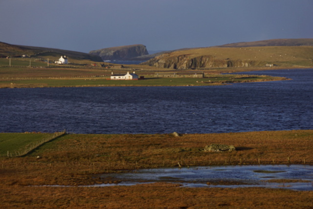
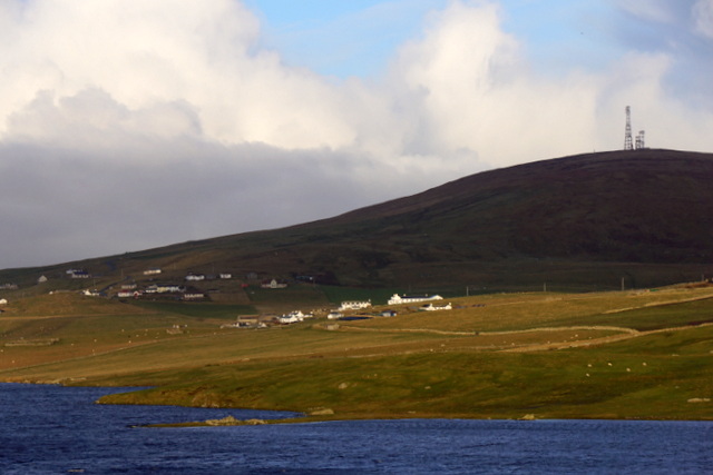
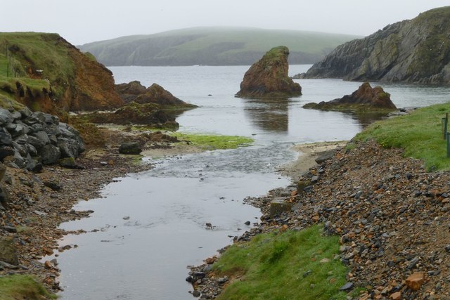
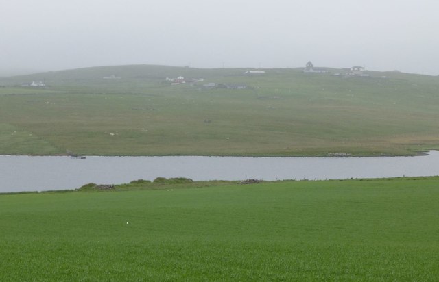
Back Green is a picturesque area situated in the Shetland Islands, Scotland. Nestled amidst the stunning landscapes of Downs and Moorland, this region offers a unique blend of natural beauty and tranquility. It is located on the western coast of the islands, providing breathtaking views of the North Atlantic Ocean.

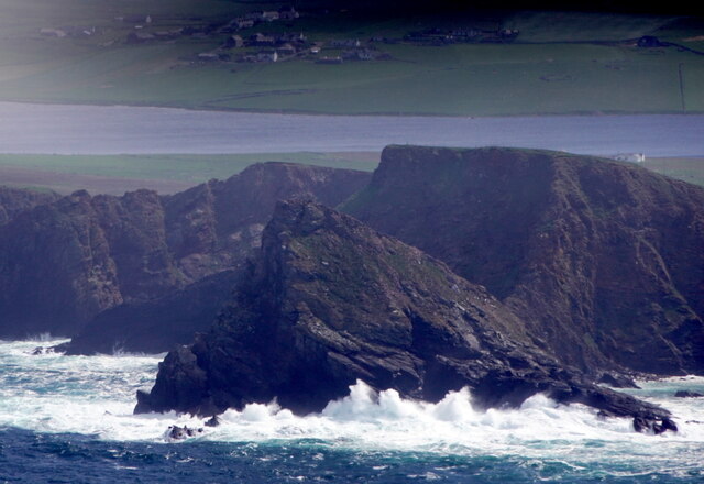
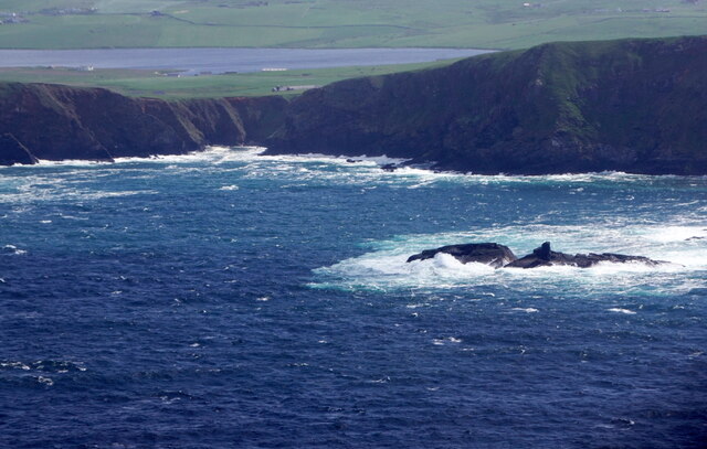
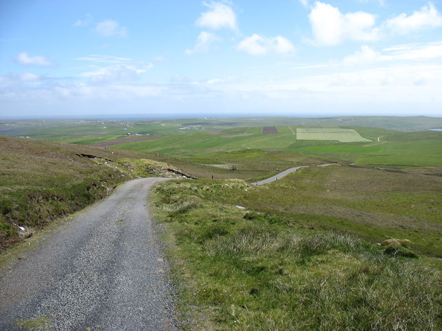
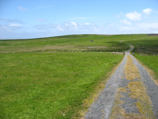
The Downs in Back Green are characterized by gently rolling hills covered in lush green grass. These open spaces are ideal for leisurely walks and picnics, allowing visitors to immerse themselves in the peaceful surroundings. The Moorland, on the other hand, offers a more rugged terrain, with heather-covered hills and rocky outcrops. This creates a striking contrast to the Downs, attracting hikers and nature enthusiasts who seek a more challenging adventure.

Back Green is home to a diverse range of flora and fauna, making it a haven for wildlife lovers. The area boasts an abundance of bird species, including puffins, guillemots, and kittiwakes, which can be observed along the cliffs and rocky shores. Additionally, visitors may catch a glimpse of seals basking on the rocks or otters playing in the nearby streams.

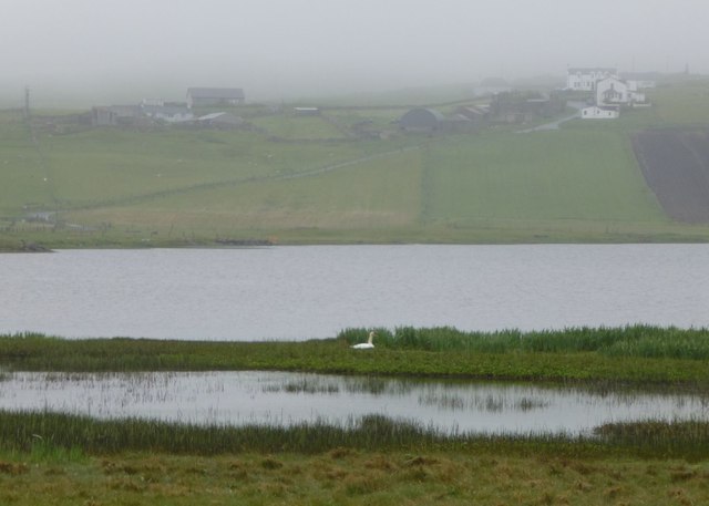
The tranquility of Back Green is further enhanced by its remote location, offering visitors a true escape from the hustle and bustle of everyday life. The absence of major tourist facilities contributes to the area's unspoiled charm, allowing visitors to truly connect with nature. Whether it's exploring the rugged Moorland or enjoying a peaceful stroll along the Downs, Back Green offers an unforgettable experience for those seeking solace in the natural beauty of the Shetland Islands.

If you have any feedback on the listing, please let us know in the comments section below.

Back Green Images

Images are sourced within 2km of 59.928791/-1.3601117 or Grid Reference HU3516. Thanks to Geograph Open Source API. All images are credited.

Spiggie and Loch of Spiggie
Stack o' da Noup, Spiggie, from the air
Swarta Skerry, Noss, Spiggie, from the air
Dotterel (Chardrius morinellus), near Bakkasetter A migrant in Shetland.
Dotterel (Chardrius morinellus), near Bakkasetter
A migrant in Shetland.
Loch of Spiggie at dusk From Scousburgh looking towards Fitful Head.
Loch of Spiggie at dusk
From Scousburgh looking towards Fitful Head.
The track from Fitful Head A well-graded track serves the communications station on Fitful Head. Clearly, it is not open to the public to drive, but it gives an easy walk. This is looking back downhill towards Quendale.
The track from Fitful Head
A well-graded track serves the communications station on Fitful Head. Clearly, it is not open to the public to drive, but it gives an easy walk. This is looking back downhill towards Quendale.
The track from Fitful Head Looking east towards Gord Farm and Quendale.

The public are not allowed to drive up this track, which is used by engineers servicing the masts on Fitful Head. But it makes for a very easy walk to this 283m high hill.
The track from Fitful Head
Looking east towards Gord Farm and Quendale. The public are not allowed to drive up this track, which is used by engineers servicing the masts on Fitful Head. But it makes for a very easy walk to this 283m high hill.
Setter Marsh, Loch of Spiggie With a view through to Colsay in the distance.
Setter Marsh, Loch of Spiggie
With a view through to Colsay in the distance.
Loch of Spiggie, Scousburgh and the Ward of Scousburgh
The north end of the Loch of Spiggie
House at Spiggie, beside Loch of Spiggie
Looking across pasture to Symblisetter The new building replacing the now derelict croft.
Looking across pasture to Symblisetter
The new building replacing the now derelict croft.
Lone fisherman at Loch of Spiggie Perhaps fishing is better in the rain!
Littleness farm on the left.
Lone fisherman at Loch of Spiggie
Perhaps fishing is better in the rain! Littleness farm on the left.
Symblisetter Modern houses overlooking Loch of Spiggie.
Symblisetter
Modern houses overlooking Loch of Spiggie.
The outflow from Loch of Spiggie Into Muckle Sound.
Colsay in the distance.
The outflow from Loch of Spiggie
Into Muckle Sound. Colsay in the distance.
Swan nesting on shore of Loch of Spiggie South Scousburgh across the loch. Spiggie Hotel on the right.
Swan nesting on shore of Loch of Spiggie
South Scousburgh across the loch. Spiggie Hotel on the right.
Loch of Spiggie On a damp and dismal day!
Viewed from near Knowe of Bakkasetter.
Loch of Spiggie
On a damp and dismal day! Viewed from near Knowe of Bakkasetter.
Looking across Loch of Spiggie Towards Longfield.
Looking across Loch of Spiggie
Towards Longfield.
Show me another place!

Back Green is located at Grid Ref: HU3516 (Lat: 59.928791, Lng: -1.3601117)

Unitary Authority: Shetland Islands

Police Authority: Highlands and Islands

What 3 Words

///shadowing.give.scuba. Near Sumburgh, Shetland Islands

Related Wikis

Lochs of Spiggie and Brow

The Lochs of Spiggie and Brow are located west of Boddam in the parish of Dunrossness, in the South Mainland of Shetland, Scotland, about 6 km north of...

Colsay

Colsay is an uninhabited island off the South West coast of Mainland, Shetland. Fora Ness lies to the south, across the Muckle Sound. The highest elevation...

Scousburgh

Scousburgh is a small community in the parish of Dunrossness, in the South Mainland of Shetland, Scotland, overlooking the picturesque Scousburgh Sand...

Fitful Head

Fitful Head is a 283-metre-high (928 ft) headland at the southwest corner of Mainland, Shetland, Scotland, some 6 kilometres (3.7 mi) northwest of the...

Nearby Amenities

Located within 500m of 59.928791,-1.3601117
Passing Place
Lat/Long: 59.9308924/-1.353488
Power: pole
Lat/Long: 59.9329662/-1.3576681
Power: pole
Lat/Long: 59.932648/-1.3596731
Power: pole
Lat/Long: 59.9323586/-1.3604701
Power: pole
Lat/Long: 59.9329142/-1.3600266
Power: pole
Lat/Long: 59.9332428/-1.3603915
The data included in this document is from www.openstreetmap.org. The data is made available under ODbL.

Have you been to Back Green?

Leave your review of Back Green below (or comments, questions and feedback).