Market Flat

Downs, Moorland in Yorkshire Harrogate

England

Market Flat

Farnham, Branton Court Branton Court is on the west side of Shaw Lane, a track which leads from Farnham to Copgrove. On the north-east facing wall which is alongside the track, there is a very large benchmark cut into the stonework to the left of 2 black letter boxes.
Farnham, Branton Court Credit: Mel Towler

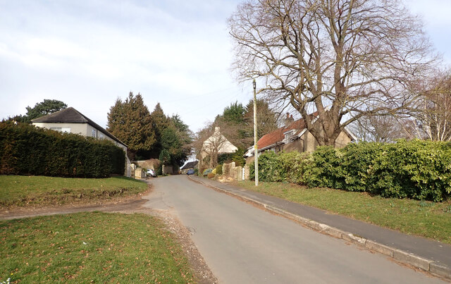
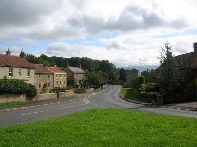
Market Flat is a picturesque village nestled in the heart of Yorkshire, England. Situated amidst the sprawling Yorkshire Downs and Moorland, the village offers breathtaking views of the surrounding natural beauty. With a population of around 500 residents, Market Flat exudes a charming small-town atmosphere that attracts both locals and visitors alike.

The village is renowned for its bustling market, which takes place every Saturday in the central square. Here, locals gather to sell a wide array of products, ranging from locally grown fruits and vegetables to handmade crafts and antiques. The market is a vibrant hub of activity, drawing in visitors from nearby towns and villages.

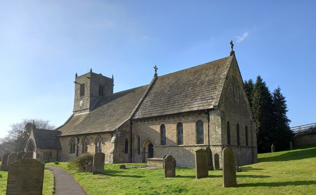
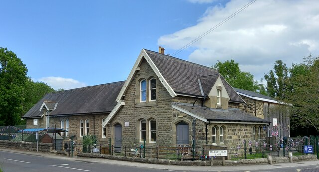
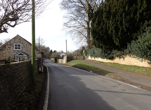
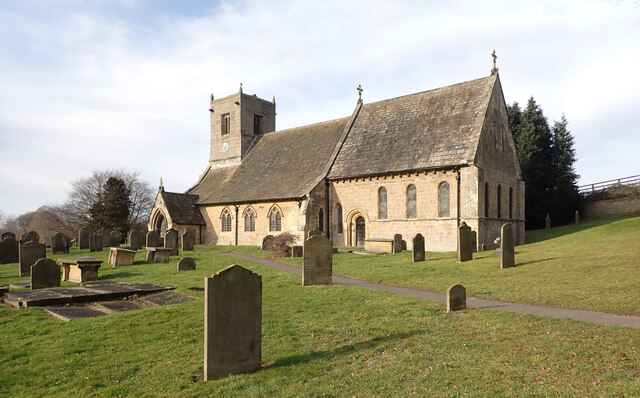
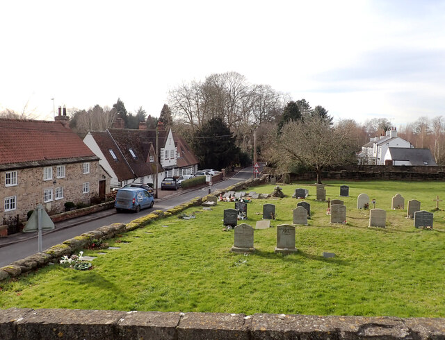
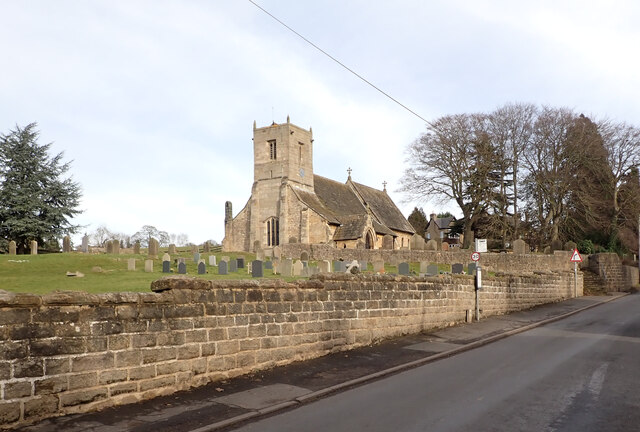
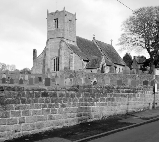
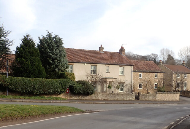
Market Flat is also known for its historic stone buildings which line the narrow streets. These architectural gems reflect the village's rich history, dating back several centuries. The village church, St. Mary's, is a prominent landmark that stands tall in the center of Market Flat. Built in the 12th century, the church is a testament to the village's deep-rooted heritage.

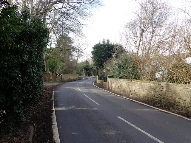
For outdoor enthusiasts, Market Flat offers ample opportunities to explore the surrounding countryside. The Yorkshire Downs, with their rolling hills and expansive fields, provide a picturesque backdrop for hiking, cycling, and horseback riding. The nearby Moorland offers a wilder, more rugged landscape, perfect for adventurous souls seeking a challenge.

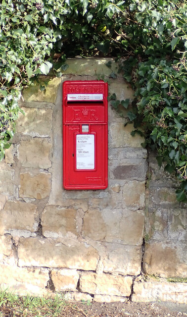
Market Flat also boasts a selection of cozy pubs, quaint tearooms, and charming bed and breakfast establishments, ensuring that visitors are well-catered for during their stay. With its idyllic setting and rich history, Market Flat is a must-visit destination for those seeking a taste of traditional Yorkshire charm.

If you have any feedback on the listing, please let us know in the comments section below.
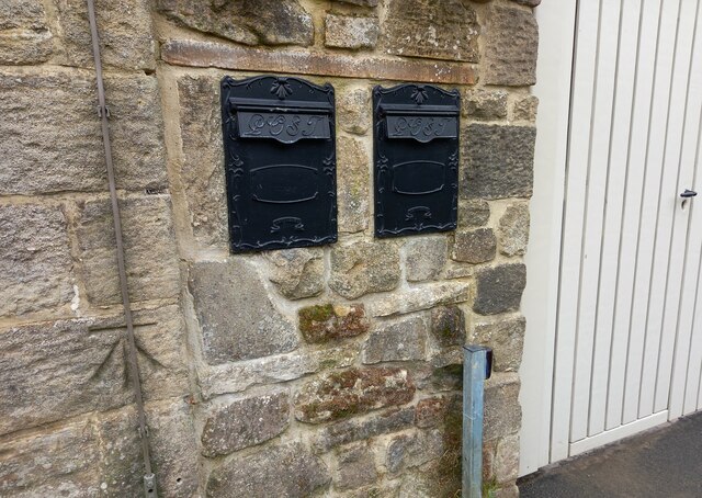
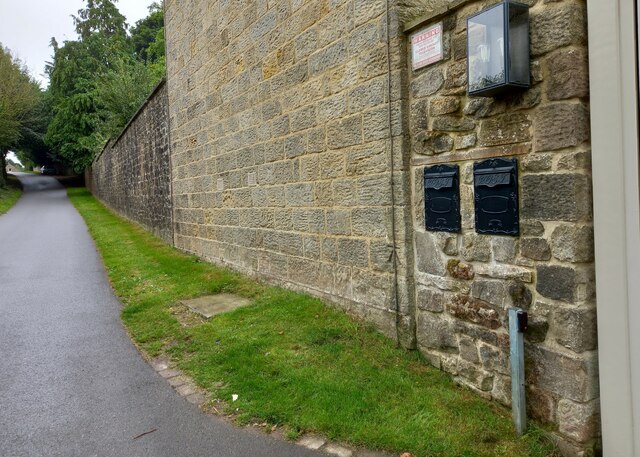
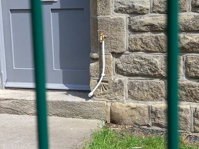
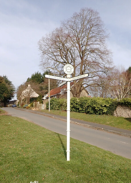
Market Flat Images

Images are sourced within 2km of 54.026186/-1.4719385 or Grid Reference SE3459. Thanks to Geograph Open Source API. All images are credited.

Farnham, Branton Court Branton Court is on the west side of Shaw Lane, a track which leads from Farnham to Copgrove. On the north-east facing wall which is alongside the track, there is a very large benchmark cut into the stonework to the left of 2 black letter boxes.
Farnham, Branton Court
Branton Court is on the west side of Shaw Lane, a track which leads from Farnham to Copgrove. On the north-east facing wall which is alongside the track, there is a very large benchmark cut into the stonework to the left of 2 black letter boxes.
Farnham, Branton Court A wider angle looking south along Shaw Lane to Farnham. On the right is the house wall of Branton Court and a clear benchmark is cut into the stonework to the left of 2 black letter boxes.
Farnham, Branton Court
A wider angle looking south along Shaw Lane to Farnham. On the right is the house wall of Branton Court and a clear benchmark is cut into the stonework to the left of 2 black letter boxes.
Farnham, St Oswald's church The benchmark is on the rear of the church, on the south east face.
Farnham, St Oswald's church
The benchmark is on the rear of the church, on the south east face.
Farnham, St Oswald's church There is a benchmark on the rear of the church, on the south east face.
Farnham, St Oswald's church
There is a benchmark on the rear of the church, on the south east face.
Lingerfield school The benchmark is cut on the north-west facing wall, below a tap and to the right of the door on the left.
Lingerfield school
The benchmark is cut on the north-west facing wall, below a tap and to the right of the door on the left.
Lingerfield school There is a benchmark cut intothe north-west facing wall, below a tap and to the right of the grey door on the left.
Lingerfield school
There is a benchmark cut intothe north-west facing wall, below a tap and to the right of the grey door on the left.
Shaw Lane, Farnham
Shaw Lane, Farnham
Guide post, Shaw Lane, Farnham The post reads:
"FARNHAM
349606
N. YORKS

BRIDLEPATH

SCOTTON & RIPLEY

KNARESBOROUGH".
Guide post, Shaw Lane, Farnham
The post reads: "FARNHAM 349606 N. YORKS BRIDLEPATH SCOTTON & RIPLEY KNARESBOROUGH".
Stang Lane, Farnham
Stang Lane, Farnham
St. Oswald's Church, Farnham St. Oswald's Church in Farnham was built in the 12th century. It has additions from the 13th and 14th centuries and the tower was built c1500. It was restored in the 19th century and is a Grade I listed building.
St. Oswald's Church, Farnham
St. Oswald's Church in Farnham was built in the 12th century. It has additions from the 13th and 14th centuries and the tower was built c1500. It was restored in the 19th century and is a Grade I listed building.
Graveyard and Stang Lane seen from St. Oswald's Church, Farnham St. Oswald's Church in Farnham was built in the 12th century. It has additions from the 13th and 14th centuries and the tower was built c1500. It was restored in the 19th century and is a Grade I listed building.
Graveyard and Stang Lane seen from St. Oswald's Church, Farnham
St. Oswald's Church in Farnham was built in the 12th century. It has additions from the 13th and 14th centuries and the tower was built c1500. It was restored in the 19th century and is a Grade I listed building.
Stang Lane, Farnham
Stang Lane, Farnham
Stang Lane, Farnham
Stang Lane, Farnham
Stang Lane entering Farnham
St. Oswald's Church, Farnham St. Oswald's Church in Farnham was built in the 12th century. It has additions from the 13th and 14th centuries and the tower was built c1500. It was restored in the 19th century and is a Grade I listed building.
St. Oswald's Church, Farnham
St. Oswald's Church in Farnham was built in the 12th century. It has additions from the 13th and 14th centuries and the tower was built c1500. It was restored in the 19th century and is a Grade I listed building.
Main Street, Farnham A close-up of the post box can be seen in <a href="https://www.geograph.org.uk/photo/7399002">SE3460 : Post box, Main Street, Farnham</a>.
Main Street, Farnham
A close-up of the post box can be seen in SE3460 : Post box, Main Street, Farnham.
Post box, Main Street, Farnham This post box can be seen in context in <a href="https://www.geograph.org.uk/photo/7398997">SE3460 : Main Street, Farnham</a>.
Post box, Main Street, Farnham
This post box can be seen in context in SE3460 : Main Street, Farnham.
Show me another place!

Market Flat is located at Grid Ref: SE3459 (Lat: 54.026186, Lng: -1.4719385)

Division: West Riding

Administrative County: North Yorkshire

District: Harrogate

Police Authority: North Yorkshire

What 3 Words

///fatherly.poodle.photocopy. Near Knaresborough, North Yorkshire

Nearby Locations

Market Flat Lingerfield

Related Wikis

Scriven

Scriven is a village and civil parish in the Harrogate district of North Yorkshire, England, close to the town of Knaresborough. From 1947 to 1998 Scriven...

Jacob Smith Park

Jacob Smith Park is a park owned by Harrogate Borough Council in the outskirts of Knaresborough, North Yorkshire, England. It is located in Scriven, and...

Farnham, North Yorkshire

Farnham is a village and civil parish in the Harrogate district of North Yorkshire, England. It is situated 2 miles (3.2 km) north of Knaresborough....

Farnham Mires

Farnham Mires is a Site of Special Scientific Interest, or SSSI, to the east of the village of Farnham, North Yorkshire, England. It consists of a spring...

Nearby Amenities

Located within 500m of 54.026186,-1.4719385
Power: tower
Lat/Long: 54.0259105/-1.4658167
Power: tower
Lat/Long: 54.0275176/-1.4702042
Power: tower
Lat/Long: 54.027965/-1.4745065
Power: pole
Lat/Long: 54.0258865/-1.4761396
Power: pole
Lat/Long: 54.0260861/-1.4772697
Power: pole
Lat/Long: 54.0263277/-1.4786166
Power: pole
Lat/Long: 54.025599/-1.4746015
Line Management: branch
Power: pole
Lat/Long: 54.0253571/-1.47328
Power: pole
Lat/Long: 54.0251151/-1.4719426
Power: pole
Lat/Long: 54.0247288/-1.4706591
Power: pole
Lat/Long: 54.0243506/-1.4694276
Power: pole
Lat/Long: 54.0239454/-1.4680881
Power: pole
Lat/Long: 54.0235532/-1.4668106
Power: pole
Lat/Long: 54.0248279/-1.4734426
Power: pole
Lat/Long: 54.0241544/-1.4736544
The data included in this document is from www.openstreetmap.org. The data is made available under ODbL.

Have you been to Market Flat?

Leave your review of Market Flat below (or comments, questions and feedback).