Yamna Field

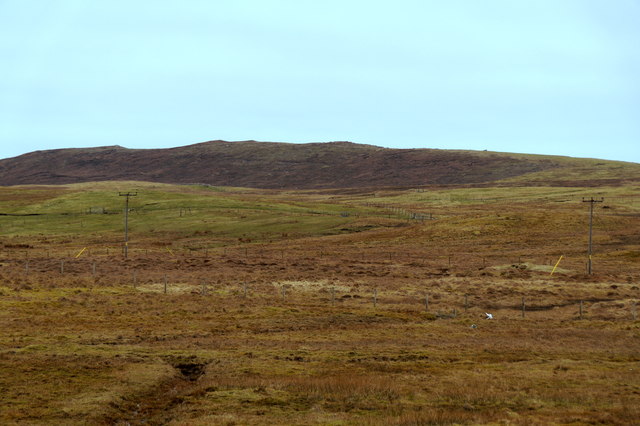
Downs, Moorland in Shetland

Scotland

Yamna Field

Ollaberry Shop at Hogaland
Ollaberry Shop at Hogaland Credit: Mike Pennington

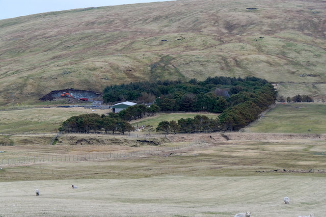
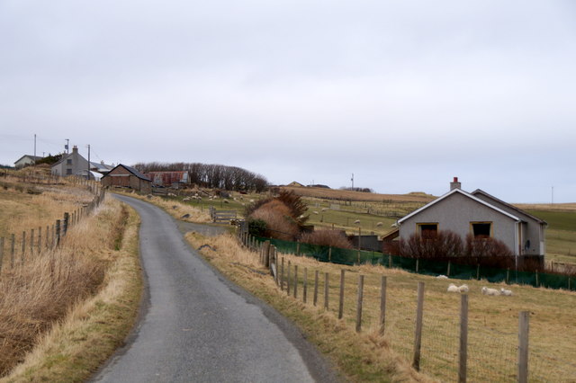
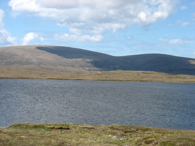
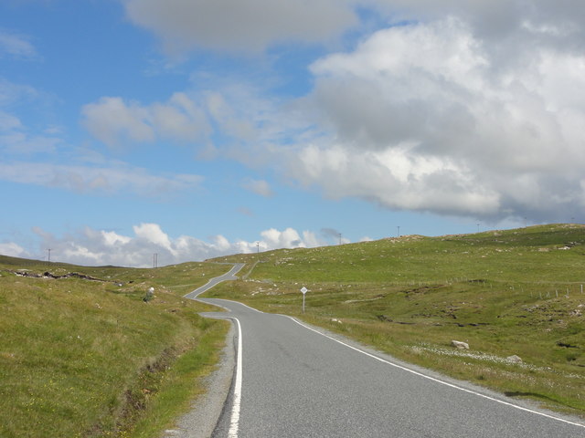
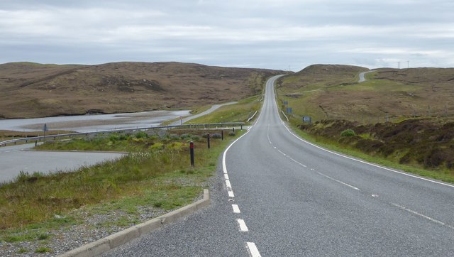
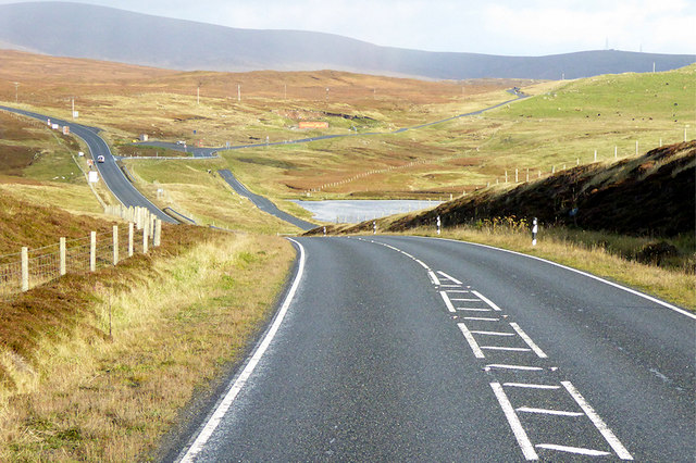
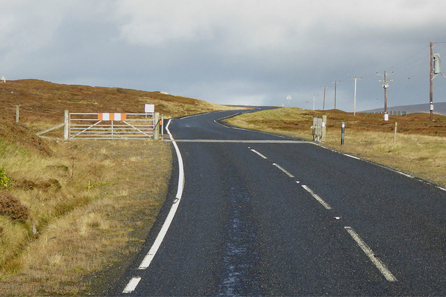
Yamna Field is a picturesque area located on the Shetland Islands, off the northeastern coast of Scotland. Covering a vast expanse of downs and moorland, this natural landscape offers breathtaking views and a diverse range of flora and fauna.

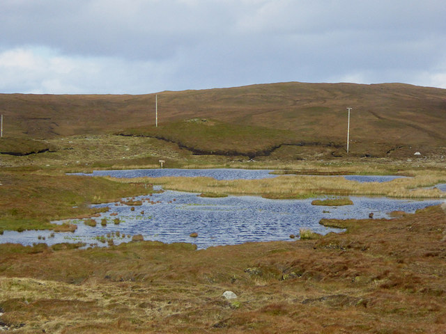
The field is characterized by its rolling hills and open grasslands, which provide a haven for various species of birds, including puffins, guillemots, and razorbills. It is also home to several rare plant species, such as the Shetland Mouse-ear and the Scottish Primrose, which thrive in the unique climate and soil conditions of the area.

Yamna Field is a popular spot for outdoor enthusiasts and nature lovers who enjoy hiking, birdwatching, and photography. The undulating terrain and panoramic vistas make it an ideal location for capturing stunning images of the surrounding landscape.

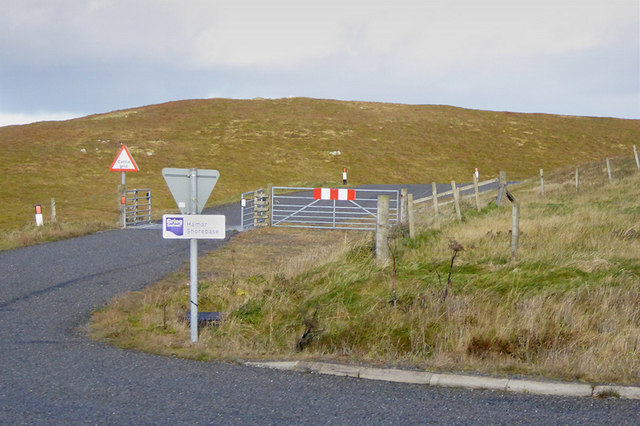
Visitors to Yamna Field can expect to encounter a tranquil and serene atmosphere, as the area is relatively untouched by human development. The absence of modern structures and facilities allows visitors to immerse themselves in the beauty of nature and experience a sense of peace and tranquility.

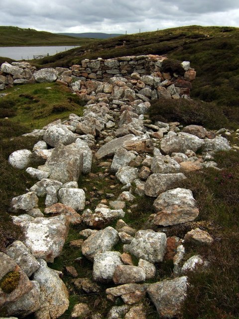
In addition to its natural beauty, Yamna Field also holds historical significance. The remains of ancient settlements and burial grounds can be found in the vicinity, providing glimpses into the island's rich past and captivating visitors with its mysterious allure.

Overall, Yamna Field in Shetland is a remarkable destination that showcases the beauty of Scotland's natural landscapes, offering visitors a chance to connect with nature and explore the island's diverse flora and fauna.

If you have any feedback on the listing, please let us know in the comments section below.
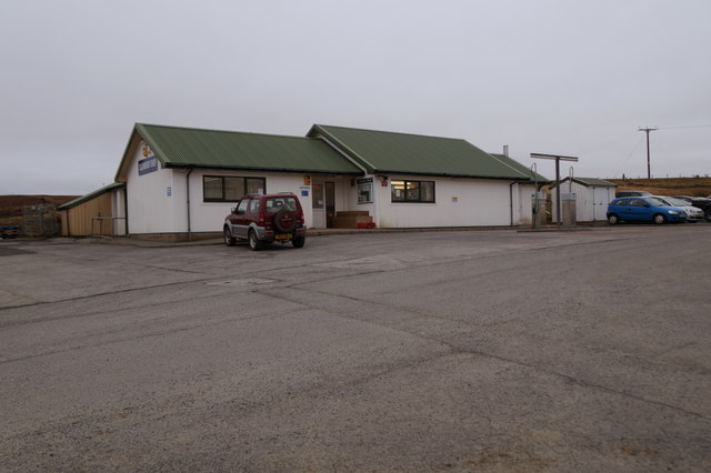
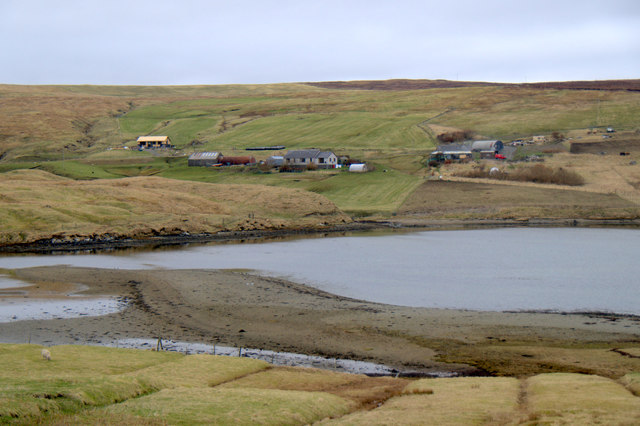
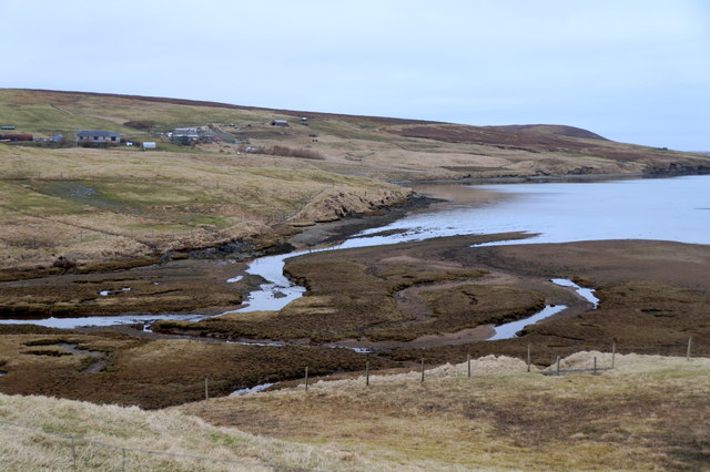
Yamna Field Images

Images are sourced within 2km of 60.478829/-1.3854441 or Grid Reference HU3377. Thanks to Geograph Open Source API. All images are credited.

Ollaberry Shop at Hogaland
Moorland above North Gluss Looking towards Yamna Field.
Moorland above North Gluss
Looking towards Yamna Field.
The head of Gluss Voe at Bardister
East Burn flowing into the head of Gluss Voe at Bardister
Knowes, Gluss
Knowes, Gluss
North Gluss
North Gluss
Eela Water Ronas Hill (the highest hill in Shetland) and Mid Field beyond.
Eela Water
Ronas Hill (the highest hill in Shetland) and Mid Field beyond.
The north tip of Punds Water
Punds Water View from the lay-by at Punds Water
Punds Water
View from the lay-by at Punds Water
Single track road View of the A970 single track road heading north
Single track road
View of the A970 single track road heading north
Peat cutting Stacked for drying.
Peat cutting
Stacked for drying.
Road junction on A970 The A970 is a single-carriageway road that runs from south to north of Mainland Shetland, Scotland. The road also spurs to Scalloway and Hillswick.
This is the spur for Hillswick so all three roads are the A970!
Note the new road cutting directly over the hill while the old road meanders beside the loch and around the hill.
Road junction on A970
The A970 is a single-carriageway road that runs from south to north of Mainland Shetland, Scotland. The road also spurs to Scalloway and Hillswick. This is the spur for Hillswick so all three roads are the A970! Note the new road cutting directly over the hill while the old road meanders beside the loch and around the hill.
Cattle Grid on Side Road near Punds Water
Northbound A970 towards Sandy Lochs The A970 runs for 71 miles across most of the length of the "Mainland" in the Shetland Islands. It is a good-quality single-carriageway road for most of its route. Travelling from south to north, the road begins at Grutness near Sumburgh Airport and winds around the many hills and inlets passing close to a number of small villages without going through any large ones before Lerwick. After looping around Lerwick, a short spur runs to Scalloway whilst the main route continues northwards towards Brae where it crosses the narrow isthmus of Mavis Grind. At Sandy Lochs the road splits and a four-mile spur goes through Urafirth to Hillswick. The main route continuing to the right towards its northern terminus at Isbister. This last part of the route tends to be narrower with passing places.

<span class="nowrap"><a title="https://www.sabre-roads.org.uk/wiki/index.php?title=A970" rel="nofollow ugc noopener" href="https://www.sabre-roads.org.uk/wiki/index.php?title=A970">Link</a><img style="margin-left:2px;" alt="External link" title="External link - shift click to open in new window" src="https://s1.geograph.org.uk/img/external.png" width="10" height="10"/></span>  SABRE
Northbound A970 towards Sandy Lochs
The A970 runs for 71 miles across most of the length of the "Mainland" in the Shetland Islands. It is a good-quality single-carriageway road for most of its route. Travelling from south to north, the road begins at Grutness near Sumburgh Airport and winds around the many hills and inlets passing close to a number of small villages without going through any large ones before Lerwick. After looping around Lerwick, a short spur runs to Scalloway whilst the main route continues northwards towards Brae where it crosses the narrow isthmus of Mavis Grind. At Sandy Lochs the road splits and a four-mile spur goes through Urafirth to Hillswick. The main route continuing to the right towards its northern terminus at Isbister. This last part of the route tends to be narrower with passing places. LinkExternal link SABRE
Flossy Loch, Shetland
Cattle Grid on the A970 The A970 runs for 71 miles across most of the length of the "Mainland" in the Shetland Islands. It is a good-quality single-carriageway road for most of its route. Travelling from south to north, the road begins at Grutness near Sumburgh Airport and winds around the many hills and inlets passing close to a number of small villages without going through any large ones before Lerwick. After looping around Lerwick, a short spur runs to Scalloway whilst the main route continues northwards towards Brae where it crosses the narrow isthmus of Mavis Grind. At Sandy Lochs the road splits and a four-mile spur goes through Urafirth to Hillswick. The main route continuing to the right towards its northern terminus at Isbister. This last part of the route tends to be narrower with passing places.

<span class="nowrap"><a title="https://www.sabre-roads.org.uk/wiki/index.php?title=A970" rel="nofollow ugc noopener" href="https://www.sabre-roads.org.uk/wiki/index.php?title=A970">Link</a><img style="margin-left:2px;" alt="External link" title="External link - shift click to open in new window" src="https://s1.geograph.org.uk/img/external.png" width="10" height="10"/></span>  SABRE
Cattle Grid on the A970
The A970 runs for 71 miles across most of the length of the "Mainland" in the Shetland Islands. It is a good-quality single-carriageway road for most of its route. Travelling from south to north, the road begins at Grutness near Sumburgh Airport and winds around the many hills and inlets passing close to a number of small villages without going through any large ones before Lerwick. After looping around Lerwick, a short spur runs to Scalloway whilst the main route continues northwards towards Brae where it crosses the narrow isthmus of Mavis Grind. At Sandy Lochs the road splits and a four-mile spur goes through Urafirth to Hillswick. The main route continuing to the right towards its northern terminus at Isbister. This last part of the route tends to be narrower with passing places. LinkExternal link SABRE
Wester Water mill and sluice The old sluice way to channel water to this mill is clearly seen here.
Wester Water mill and sluice
The old sluice way to channel water to this mill is clearly seen here.
Ollaberry: postbox № ZE2 36 A standard Elizabeth II-reign postbox mounted on a metal pole, standing outside the village shop which is situated a mile or so outside the village, serving outlying communities as well. The box is emptied at 7:30 each weekday and Saturday morning.
Ollaberry: postbox № ZE2 36
A standard Elizabeth II-reign postbox mounted on a metal pole, standing outside the village shop which is situated a mile or so outside the village, serving outlying communities as well. The box is emptied at 7:30 each weekday and Saturday morning.
Show me another place!

Yamna Field is located at Grid Ref: HU3377 (Lat: 60.478829, Lng: -1.3854441)

Unitary Authority: Shetland Islands

Police Authority: Highlands and Islands

What 3 Words

///standing.novels.slimy. Near Toft, Shetland Islands

Related Wikis

Eela Water

Eela Water is a freshwater loch (lake) in Northmavine, part of the mainland of Shetland in Scotland. Besides being a freshwater fishing location, the site...

Punds Water

Punds Water is a freshwater loch near Mangaster in Northmavine, Shetland. It also gives its name to a nearby Neolithic heel-shaped cairn. == Heel-shaped... ==

Northmavine

Northmavine or Northmaven (Old Norse: Norðan Mæfeið, meaning ‘the land north of the Mavis Grind’) is a peninsula in northwest Mainland Shetland in Scotland...

Gunnister

Gunnister is a small 'abandoned' village at the North-West Mainland in Shetland, Scotland. It is most commonly known for the Gunnister Man - the remains...

Have you been to Yamna Field?

Leave your review of Yamna Field below (or comments, questions and feedback).