Gibbet Moor
Downs, Moorland in Derbyshire Derbyshire Dales
England
Gibbet Moor

Gibbet Moor, located in Derbyshire, England, is a picturesque expanse of downs and moorland that offers stunning natural beauty and rich historical significance. Covering an area of approximately 10 square miles, Gibbet Moor is situated within the Peak District National Park, making it a popular destination for nature enthusiasts and history buffs alike.
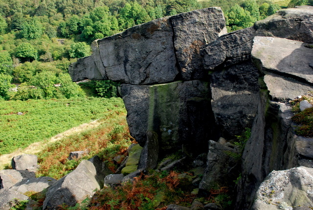
The moorland is characterized by its rolling hills, heather-covered landscapes, and scattered rocky outcrops, providing a diverse habitat for a range of flora and fauna. Visitors can expect to encounter a variety of bird species, including grouse, curlew, and peregrine falcons, as well as rare wildflowers such as cotton grass and bilberry.
Gibbet Moor is also steeped in history, with evidence of human activity dating back to the Neolithic period. The area is home to several ancient burial mounds and stone circles, reflecting its importance as a spiritual and ceremonial site in prehistoric times.
One notable feature of Gibbet Moor is the remnants of the village of Gibbet, which was inhabited until the early 19th century. The village derived its name from the gibbet (a wooden structure used for public executions) that once stood on the moor, serving as a grim warning to would-be criminals. While the village itself has vanished, visitors can still see the foundations of former buildings and gain insight into the lives of its former residents.
Overall, Gibbet Moor is a captivating destination that combines natural beauty with a fascinating historical legacy, offering visitors a unique and immersive experience in the heart of Derbyshire's countryside.
If you have any feedback on the listing, please let us know in the comments section below.
Gibbet Moor Images
Images are sourced within 2km of 53.23063/-1.5754912 or Grid Reference SK2870. Thanks to Geograph Open Source API. All images are credited.


Gibbet Moor is located at Grid Ref: SK2870 (Lat: 53.23063, Lng: -1.5754912)
Administrative County: Derbyshire
District: Derbyshire Dales
Police Authority: Derbyshire
What 3 Words
///marshes.obstruct.wakes. Near Baslow, Derbyshire
Nearby Locations
Related Wikis
Gibbet Moor
Gibbet Moor is a small gritstone upland area in the Derbyshire Peak District of central and northern England, near the village of Baslow. Its highest point...

Hob Hurst's House
Hob Hurst's House is a Bronze Age barrow on Beeley Moor near Bakewell in Derbyshire. It is unique in that instead of the normal round shape, Hob Hurst...

North East Derbyshire (UK Parliament constituency)
North East Derbyshire is a constituency created in 1885 represented in the House of Commons of the UK Parliament since 2017 by Lee Rowley of the Conservative...
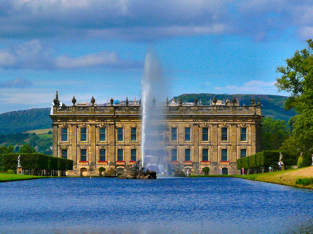
Emperor Fountain
The Emperor Fountain is a 19th-century fountain in the grounds of Chatsworth House, Derbyshire, England. The Canal Pond in which the fountain stands is...
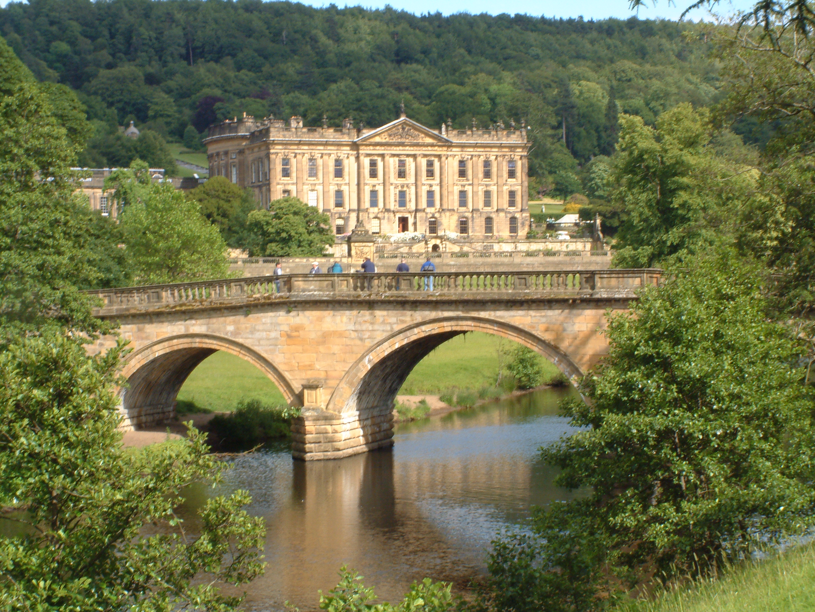
Chatsworth House
Chatsworth House is a stately home in the Derbyshire Dales, 4 miles (6.4 km) north-east of Bakewell and 9 miles (14 km) west of Chesterfield, England....

Beeley Moor
Beeley Moor is a small gritstone upland area in the Derbyshire Peak District of central and northern England, near the villages of Beeley and Baslow. Its...

Column of the Temple of Poseidon at Chatsworth
The column of the Temple of Poseidon is one of the surviving features from the period of the sixth Duke of Devonshire in the Chatsworth House garden. Surmounted...
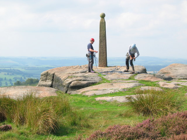
Birchen Edge
Birchen Edge is a gritstone rock face in the Peak District, England, popular with walkers and novice climbers as most of the climbing routes are in the...
Have you been to Gibbet Moor?
Leave your review of Gibbet Moor below (or comments, questions and feedback).