Black Fell

Downs, Moorland in Durham

England

Black Fell

Washington Car Park The view of the Galleries Shopping Centre in Washington.
Washington Car Park Credit: Gordon Griffiths

Black Fell is a prominent upland area located in County Durham, England. Situated within the North Pennines Area of Outstanding Natural Beauty, it is part of a larger expanse of moorland that stretches across Weardale and Teesdale. Rising to an elevation of approximately 663 meters (2,175 feet), Black Fell offers stunning panoramic views of the surrounding countryside.

The area is characterized by its rugged and wild landscape, featuring heather-clad moorland, rocky outcrops, and deep valleys carved by ancient glacial activity. Black Fell is an important habitat for a variety of wildlife, including upland birds such as curlews, grouse, and golden plovers. It is also home to several rare plant species, including the Alpine saxifrage and the juniper.

Access to Black Fell is primarily by foot, with several public footpaths and trails traversing the area. These paths provide opportunities for visitors to explore the moorland, taking in the breathtaking scenery and enjoying the tranquility of the surroundings. Hikers and nature enthusiasts can also observe the remnants of the area's lead mining past, with the ruins of old mine buildings and spoil heaps scattered across the landscape.

Black Fell offers a unique experience for those seeking to immerse themselves in the beauty of the North Pennines. Its remote and unspoiled nature provides a peaceful retreat from the hustle and bustle of everyday life, making it a popular destination for outdoor enthusiasts and those seeking a connection with nature.

If you have any feedback on the listing, please let us know in the comments section below.
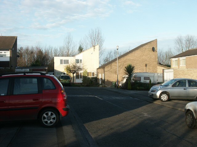
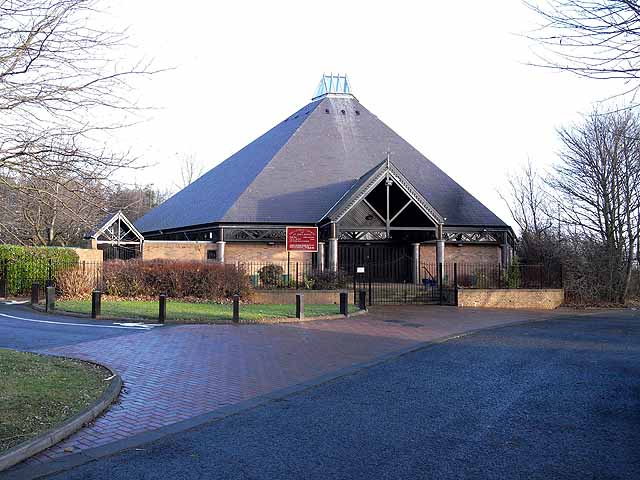
Black Fell Images

Images are sourced within 2km of 54.904909/-1.560584 or Grid Reference NZ2856. Thanks to Geograph Open Source API. All images are credited.

Washington Car Park The view of the Galleries Shopping Centre in Washington.
Washington Car Park
The view of the Galleries Shopping Centre in Washington.
Washington F Pit Museum In the 18th/19th century, a series of coal pits were sunk in the area and lettered from A - J. F pit was sunk in 1777. By the 1960s F Pit employed 1500 men and was the UK's oldest working coalmine.  

F Pit was closed in 1968.  The pit head and winding house was preserved as a small museum (open summer weekends only).  Today it is in a park and surrounded by trees; it is difficult to imagine the working pit with its 200 ft high slagheap!

More info: <span class="nowrap"><a title="http://www.twmuseums.org.uk/sunderland/fpit.php" rel="nofollow ugc noopener" href="http://www.twmuseums.org.uk/sunderland/fpit.php">Link</a><img style="margin-left:2px;" alt="External link" title="External link - shift click to open in new window" src="https://s1.geograph.org.uk/img/external.png" width="10" height="10"/></span>

Historical info: <span class="nowrap"><a title="http://www.washington.co.uk/eh.htm" rel="nofollow ugc noopener" href="http://www.washington.co.uk/eh.htm">Link</a><img style="margin-left:2px;" alt="External link" title="External link - shift click to open in new window" src="https://s1.geograph.org.uk/img/external.png" width="10" height="10"/></span> (halfway down the page)
Washington F Pit Museum
In the 18th/19th century, a series of coal pits were sunk in the area and lettered from A - J. F pit was sunk in 1777. By the 1960s F Pit employed 1500 men and was the UK's oldest working coalmine. F Pit was closed in 1968. The pit head and winding house was preserved as a small museum (open summer weekends only). Today it is in a park and surrounded by trees; it is difficult to imagine the working pit with its 200 ft high slagheap! More info: LinkExternal link Historical info: LinkExternal link (halfway down the page)
The Galleries shopping centre What in the USA would be called a 'downtown mall', the Galleries is a 1970s-built shopping centre - depressingly similar to many such found across the UK.  It is the main shopping centre in Washington and the main feature in this square.
The Galleries shopping centre
What in the USA would be called a 'downtown mall', the Galleries is a 1970s-built shopping centre - depressingly similar to many such found across the UK. It is the main shopping centre in Washington and the main feature in this square.
Pond and fields near Sheddon's Hill Looking northward from The Mill House Car Park. The pond would seem to be a recent addition to the landscape. Whilst shown on current OS mapping it is not on my earlier Explorer map. The other possible giveaway are the tops of the fence posts - once a field boundary?
Pond and fields near Sheddon's Hill
Looking northward from The Mill House Car Park. The pond would seem to be a recent addition to the landscape. Whilst shown on current OS mapping it is not on my earlier Explorer map. The other possible giveaway are the tops of the fence posts - once a field boundary?
Birtley Statue The view of the Statue of Lt Colonel Edward Moseley Perkins off Fell Bank, Birtley.
Birtley Statue
The view of the Statue of Lt Colonel Edward Moseley Perkins off Fell Bank, Birtley.
Kateregina View The view of Fell Bank in Birtley, Gateshead.
Kateregina View
The view of Fell Bank in Birtley, Gateshead.
St John The Evangelist The view of the Church on Birtley Lane, Birtley.
St John The Evangelist
The view of the Church on Birtley Lane, Birtley.
Parsons Road The view up the Washington Road.
Parsons Road
The view up the Washington Road.
Ordnance Survey Cut Mark This mark can be found on the roadside wall of the Mill House Inn.
The recorded details give a height of 121.1838 metres above sea level.
For more detail see : <span class="nowrap"><a title="https://www.bench-marks.org.uk/bm174641" rel="nofollow ugc noopener" href="https://www.bench-marks.org.uk/bm174641">Link</a><img style="margin-left:2px;" alt="External link" title="External link - shift click to open in new window" src="https://s1.geograph.org.uk/img/external.png" width="10" height="10"/></span>
Ordnance Survey Cut Mark
This mark can be found on the roadside wall of the Mill House Inn. The recorded details give a height of 121.1838 metres above sea level. For more detail see : LinkExternal link
Benchmark on wall bounding grounds of Eighton Lodge Ordnance Survey cut mark benchmark levelled at 80.751m above Newlyn Datum verified 1962
Benchmark on wall bounding grounds of Eighton Lodge
Ordnance Survey cut mark benchmark levelled at 80.751m above Newlyn Datum verified 1962
Wall bounding grounds of Eighton Lodge on NE side of Durham Road There is an Ordnance Survey benchmark <a href="https://www.geograph.org.uk/photo/7287089">NZ2657 : Benchmark on wall bounding grounds of Eighton Lodge</a> on the wall on the far side of the entrance wall piers
Wall bounding grounds of Eighton Lodge on NE side of Durham Road
There is an Ordnance Survey benchmark NZ2657 : Benchmark on wall bounding grounds of Eighton Lodge on the wall on the far side of the entrance wall piers
Angel View hotel and restaurant
Roadworks on A1 at A167 junction
Bowes Railway Path approaching bridge under Newcastle Bank
Bowes Railway Path closed at A1 underpass - time for Plan B!
Nos. 39 and 37 Long Bank
Joseph Hopper Terrace on NE side of A167 Houses named after the founder of the Durham Aged Mineworkers Homes Association. The stone plaque includes 1899 date.
Joseph Hopper Terrace on NE side of A167
Houses named after the founder of the Durham Aged Mineworkers Homes Association. The stone plaque includes 1899 date.
#2 Long Bank, The Cottage at Newcastle Bank (A167) junction Ordnance Survey records indicate that a benchmark levelled at 56.781m above Newlyn Datum was verified in 1962 1.5m left of the metal gate: the mark is probably still there hidden in the hedge
#2 Long Bank, The Cottage at Newcastle Bank (A167) junction
Ordnance Survey records indicate that a benchmark levelled at 56.781m above Newlyn Datum was verified in 1962 1.5m left of the metal gate: the mark is probably still there hidden in the hedge
Show me another place!

Black Fell is located at Grid Ref: NZ2856 (Lat: 54.904909, Lng: -1.560584)

Unitary Authority: Sunderland

Police Authority: Northumbria

What 3 Words

///jukebox.cook.bake. Near Washington, Tyne & Wear

Related Wikis

Blackfell

Blackfell is a village located in the new town of Washington, Tyne and Wear in England.Construction of the village began in the 1960s, and was completed...

Springwell Village

Springwell Village is a village in the City of Sunderland, bordering Gateshead, approximately 7.6 miles (12.2 km) from Newcastle upon Tyne, 9 miles (14...

Birtley, Tyne and Wear

Birtley is a town in the Metropolitan Borough of Gateshead, in Tyne and Wear, England. It is situated to the south of Gateshead and is conjoined to Chester...

Oxclose

Oxclose is an area of Washington, Tyne and Wear, England. It is located between the A1231, A182 and A195 highways, close to Sunderland, and is well served...

Albany, Tyne and Wear

Albany is a suburb of Washington in the City of Sunderland in Tyne and Wear, historically part of County Durham. It is in the north of the town. The village...

Oxclose Community Academy

Oxclose Community Academy (formerly Oxclose Community School) is a coeducational secondary school located in Oxclose in the City of Sunderland, Tyne and...

Eighton Banks

Eighton Banks is a small village in the Metropolitan Borough of Gateshead, which is located around 4.5 miles (7 km) from Newcastle upon Tyne. The village...

Lord Lawson of Beamish Academy

Lord Lawson of Beamish Academy (formerly Lord Lawson of Beamish Community School) is a coeducational secondary school and sixth form located in the town...

Related Videos

Three Fingers Lookout 🔭 | Washington State | Travel USA | Snohomish | 🎥 by William Frohne

Three Fingers Lookout | Washington State | Travel USA | Snohomish | by William Frohne #threefingers #washington ...

Love downhill complains walking uphill

Humans are walking a self a step in life and not exploring the endless possiblites this life allow us all.

Reel Hawks Studio: Travel and Nature

Lucky to live in Washington state! Pictured: Mount Si Fall scenes Ana's hummingbird Crop duster The Palouse Palouse Falls Find ...

walking Washington Woods with my dog Teddy #cockapoo #Washington #walking

having a walk through the woods of Washington tyne and wear , Woods were havannah , Princess Anne and Fatfield/Cox Green ...

Nearby Amenities

Located within 500m of 54.904909,-1.560584
Motorway Junction
Lat/Long: 54.9038041/-1.5539252
Pub
Mill House
Addr City: Chester-le-Street
Addr Postcode: DH3 1RE
Addr Street: Blackfell
Addr Town: Birtley
Lat/Long: 54.9083127/-1.5568936
Bus Stop
MILL HOUSE INN-W/B
Local Ref: S
Naptan AtcoCode: 410000022010
Naptan Bearing: S
Naptan CommonName: MILL HOUSE INN-W/B
Naptan Indicator: S
Naptan Landmark: OPPOSITE THE MILL HOUSE PUBLIC HOUSE
Naptan NaptanCode: twrdpjtm
Naptan Street: B1288
Naptan Verified: no
Source: naptan_import
Lat/Long: 54.9081549/-1.5566365
Bus Stop
FOXPOND ROUNDABOUT-S/B
Local Ref: NW
Naptan AtcoCode: 410000022011
Naptan Bearing: NW
Naptan CommonName: FOXPOND ROUNDABOUT-S/B
Naptan Indicator: NW
Naptan Landmark: FOX POND AND FOX POND KENNELS
Naptan NaptanCode: twrdpjtp
Naptan Street: EIGHTON ROAD
Naptan Verified: no
Source: naptan_import
Lat/Long: 54.9075637/-1.5596376
Bus Stop
PORTOBELLO ROAD-LAZY BAR RANCH-N/B
Local Ref: E
Naptan AtcoCode: 410000022019
Naptan Bearing: E
Naptan CommonName: PORTOBELLO ROAD-LAZY BAR RANCH-N/B
Naptan Indicator: E
Naptan Landmark: LAZY BAR RANCH
Naptan NaptanCode: twrdpjwp
Naptan Street: PORTOBELLO ROAD
Naptan Verified: no
Shelter: no
Source: naptan_import
Tactile Paving: no
Lat/Long: 54.9036265/-1.564328
Bus Stop
FOXPOND ROUNDABOUT-N/B
Local Ref: N
Naptan AtcoCode: 410000022020
Naptan Bearing: N
Naptan CommonName: FOXPOND ROUNDABOUT-N/B
Naptan Indicator: N
Naptan Landmark: FOX POND AND FOX POND KENNELS
Naptan NaptanCode: twrdpjwt
Naptan Street: EIGHTON ROAD
Naptan Verified: no
Source: naptan_import
Lat/Long: 54.9075461/-1.5597314
Bus Stop
MILL HOUSE INN-N/B
Local Ref: N
Naptan AtcoCode: 410000022021
Naptan Bearing: N
Naptan CommonName: MILL HOUSE INN-N/B
Naptan Indicator: N
Naptan Landmark: OUTSIDE THE MILL HOUSE PUBLIC HOUSE
Naptan NaptanCode: twrdpmad
Naptan Street: B1288
Naptan Verified: no
Source: naptan_import
Lat/Long: 54.9085041/-1.5562895
Bus Stop
Mount Pleasant
Bench: no
Bin: yes
Bus: yes
Lit: yes
Local Ref: E
Naptan AtcoCode: 410000022961
Naptan Bearing: E
Naptan Indicator: E-Bound
Naptan Landmark: Opposite Beamish View
Naptan NaptanCode: twrgwadj
Naptan Street: Mount Pleasant Road
Naptan Verified: yes
Public Transport: platform
Shelter: yes
Source: naptan_import
Tactile Paving: no
Lat/Long: 54.9012661/-1.5648395
Traffic Signals
Traffic Signals: signal
Lat/Long: 54.9058761/-1.5622157
Traffic Signals
Traffic Signals: signal
Lat/Long: 54.9066311/-1.5588236
Traffic Signals
Traffic Signals: signal
Lat/Long: 54.9070732/-1.5587241
Traffic Signals
Traffic Signals: signal
Lat/Long: 54.9071282/-1.5585068
Power: tower
Lat/Long: 54.9030722/-1.5561245
Black Fell
Place: locality
Source: OS 1:25k
Lat/Long: 54.9057674/-1.5616887
Noexit: yes
Lat/Long: 54.9041036/-1.5650638
Crossing
Crossing: unmarked
Lat/Long: 54.9014348/-1.5643396
Noexit: yes
Lat/Long: 54.902394/-1.5649243
Noexit: yes
Lat/Long: 54.9056426/-1.5665752
Noexit: yes
Lat/Long: 54.9023563/-1.5657559
Noexit: yes
Lat/Long: 54.9030401/-1.5659621
Noexit: yes
Lat/Long: 54.9042447/-1.5652113
Noexit: yes
Lat/Long: 54.9028629/-1.5667053
Noexit: yes
Lat/Long: 54.9027256/-1.5649597
Noexit: yes
Lat/Long: 54.9022561/-1.566142
Traffic Signals
Traffic Signals: signal
Lat/Long: 54.907262/-1.5593837
Traffic Signals
Traffic Signals: signal
Lat/Long: 54.9067107/-1.5594781
Power: tower
Lat/Long: 54.9073769/-1.5603439
Noexit: yes
Lat/Long: 54.9020534/-1.5647579
Phone
Check Date: 2021-09-07
Emergency: phone
Lat/Long: 54.9039206/-1.5613316
Power: tower
Lat/Long: 54.9013234/-1.5561816
Power: tower
Lat/Long: 54.9043076/-1.5573298
Traffic Signals
Traffic Signals: signal
Lat/Long: 54.9071116/-1.559344
Traffic Signals
Traffic Signals: signal
Lat/Long: 54.905748/-1.5621512
Post Box
Ref: NE37 311
Lat/Long: 54.9055725/-1.5540529
Street Lamp
Lat/Long: 54.9068709/-1.5590715
Crossing
Crossing: uncontrolled
Crossing Island: no
Crossing Markings: dots
Tactile Paving: yes
Lat/Long: 54.9066559/-1.5585958
Traffic Signals
Traffic Signals: signal
Lat/Long: 54.9065107/-1.5588045
Traffic Signals
Traffic Signals: signal
Lat/Long: 54.9066867/-1.5597316
Noexit: yes
Lat/Long: 54.9009331/-1.5622576
Noexit: yes
Lat/Long: 54.9008066/-1.56216
Noexit: yes
Lat/Long: 54.9006778/-1.5620622
Noexit: yes
Lat/Long: 54.9005428/-1.5619607
Post Box
Check Date Collection Times: 2022-06-12
Collection Times: Mo-Fr 16:30, Sa 11:15
Ref: DH3 110
Royal Cypher: EIIR
Royal Cypher Wikidata: Q33102113
Lat/Long: 54.9013389/-1.5647106
Generator Method: photovoltaic
Generator Output Electricity: yes
Generator Source: solar
Generator Type: solar_photovoltaic_panel
Location: roof
Power: generator
Lat/Long: 54.9045825/-1.5529025
Generator Method: photovoltaic
Generator Output Electricity: yes
Generator Source: solar
Generator Type: solar_photovoltaic_panel
Location: roof
Power: generator
Lat/Long: 54.9037279/-1.5658915
Generator Method: photovoltaic
Generator Output Electricity: yes
Generator Source: solar
Generator Type: solar_photovoltaic_panel
Location: roof
Power: generator
Lat/Long: 54.9037603/-1.5657735
Generator Method: photovoltaic
Generator Output Electricity: yes
Generator Source: solar
Generator Type: solar_photovoltaic_panel
Location: roof
Power: generator
Lat/Long: 54.9022243/-1.5664467
Generator Method: photovoltaic
Generator Output Electricity: yes
Generator Source: solar
Generator Type: solar_photovoltaic_panel
Location: roof
Power: generator
Lat/Long: 54.902269/-1.5663877
Generator Method: photovoltaic
Generator Output Electricity: yes
Generator Source: solar
Generator Type: solar_photovoltaic_panel
Location: roof
Power: generator
Lat/Long: 54.9006582/-1.5631114
Generator Method: photovoltaic
Generator Output Electricity: yes
Generator Source: solar
Generator Type: solar_photovoltaic_panel
Location: roof
Power: generator
Lat/Long: 54.9059979/-1.5533119
Generator Method: photovoltaic
Generator Output Electricity: yes
Generator Source: solar
Generator Type: solar_photovoltaic_panel
Location: roof
Power: generator
Lat/Long: 54.9059594/-1.5544063
Generator Method: photovoltaic
Generator Output Electricity: yes
Generator Source: solar
Generator Type: solar_photovoltaic_panel
Location: roof
Power: generator
Lat/Long: 54.9059655/-1.5544492
Noexit: yes
Lat/Long: 54.9053332/-1.5672734
Noexit: yes
Lat/Long: 54.9013933/-1.5648521
Camera Mount: pole
Camera Type: panning
Check Date: 2021-10-21
Man Made: surveillance
Surveillance: traffic
Surveillance Type: camera
Lat/Long: 54.9055074/-1.5646248
Maxspeed: 50 mph
Traffic Sign: maxspeed
Lat/Long: 54.9028152/-1.5609518
Maxspeed: 50 mph
Traffic Sign: maxspeed
Lat/Long: 54.9027566/-1.5612448
Noexit: yes
Lat/Long: 54.9047041/-1.5657962
Noexit: yes
Lat/Long: 54.9035879/-1.5649246
Crossing
Crossing: uncontrolled
Crossing Island: no
Crossing Markings: dots
Tactile Paving: yes
Lat/Long: 54.9070943/-1.5585444
Crossing
Crossing: uncontrolled
Crossing Island: no
Crossing Markings: dots
Tactile Paving: yes
Lat/Long: 54.9071649/-1.5586536
Crossing
Crossing: unmarked
Lat/Long: 54.9080205/-1.5570348
Crossing
Crossing: unmarked
Lat/Long: 54.9077061/-1.5576088
Crossing
Crossing: uncontrolled
Crossing Island: no
Crossing Markings: dots
Tactile Paving: yes
Lat/Long: 54.9072202/-1.5593144
Crossing
Crossing: uncontrolled
Crossing Island: no
Crossing Markings: dots
Tactile Paving: yes
Lat/Long: 54.9071784/-1.5594682
Crossing
Crossing: unmarked
Crossing Island: no
Crossing Markings: no
Tactile Paving: yes
Lat/Long: 54.9058924/-1.562118
Crossing
Crossing: unmarked
Lat/Long: 54.9014079/-1.5641332
Crossing
Crossing: unmarked
Lat/Long: 54.9016676/-1.5644399
Crossing
Crossing: unmarked
Lat/Long: 54.9016142/-1.5636509
Crossing
Crossing: unmarked
Lat/Long: 54.9015863/-1.563605
Crossing
Crossing: unmarked
Lat/Long: 54.9015407/-1.5635574
Traffic Calming: hump
Lat/Long: 54.904032/-1.5671034
Noexit: yes
Lat/Long: 54.9045046/-1.5678705
Generator Method: photovoltaic
Generator Output Electricity: yes
Generator Source: solar
Generator Type: solar_photovoltaic_panel
Location: roof
Power: generator
Lat/Long: 54.9013956/-1.5654378
Generator Method: photovoltaic
Generator Output Electricity: yes
Generator Source: solar
Generator Type: solar_photovoltaic_panel
Location: roof
Power: generator
Lat/Long: 54.9013948/-1.565356
Addr City: Chester-le-Street
Addr Housenumber: 2
Addr Postcode: DH3 1RU
Addr Street: Bewicke View
Addr Town: Birtley
Building: house
Ref GB Uprn: 10022984308
Lat/Long: 54.901519/-1.564956
Addr City: Chester-le-Street
Addr Housenumber: 58
Addr Postcode: DH3 1RX
Addr Street: Leafield Close
Addr Town: Birtley
Building: house
Ref GB Uprn: 10022996708
Lat/Long: 54.904658/-1.568291
Addr City: Chester-le-Street
Addr Housenumber: 22
Addr Postcode: DH3 1RD
Addr Street: Northside
Addr Town: Birtley
Building: house
Ref GB Uprn: 10090412162
Lat/Long: 54.9035915/-1.5655854
Addr City: Chester-le-Street
Addr Housenumber: 2
Addr Postcode: DH3 1RX
Addr Street: Leafield Close
Addr Town: Birtley
Building: house
Ref GB Uprn: 10022996679
Lat/Long: 54.903054/-1.56706
Addr City: Chester-le-Street
Addr Housenumber: 16
Addr Postcode: DH3 1RT
Addr Street: The Brambles
Addr Town: Birtley
Building: house
Ref GB Uprn: 10022995855
Lat/Long: 54.904753/-1.564781
Addr City: Chester-le-Street
Addr Housenumber: 21
Addr Postcode: DH3 1RD
Addr Street: Northside
Addr Town: Birtley
Building: house
Ref GB Uprn: 100000011817
Lat/Long: 54.9037692/-1.5657646
Addr City: Chester-le-Street
Addr Housenumber: 33
Addr Postcode: DH3 1RX
Addr Street: Leafield Close
Addr Town: Birtley
Building: house
Ref GB Uprn: 10022996705
Lat/Long: 54.904458/-1.567716
Addr City: Chester-le-Street
Addr Housenumber: 54
Addr Postcode: DH3 1RX
Addr Street: Leafield Close
Addr Town: Birtley
Building: house
Ref GB Uprn: 10022996710
Lat/Long: 54.904692/-1.567838
Addr City: Chester-le-Street
Addr Housenumber: 3
Addr Postcode: DH3 1RX
Addr Street: Leafield Close
Addr Town: Birtley
Building: house
Ref GB Uprn: 10022996680
Lat/Long: 54.903314/-1.56698
Addr City: Chester-le-Street
Addr Housenumber: 2
Addr Postcode: DH3 1RT
Addr Street: The Brambles
Addr Town: Birtley
Building: house
Ref GB Uprn: 10022995832
Lat/Long: 54.903838/-1.565181
Addr City: Chester-le-Street
Addr Housenumber: 10
Addr Postcode: DH3 1RT
Addr Street: The Brambles
Addr Town: Birtley
Building: house
Ref GB Uprn: 10022995839
Lat/Long: 54.904648/-1.565577
Addr City: Chester-le-Street
Addr Housenumber: 21
Addr Postcode: DH3 1RX
Addr Street: Leafield Close
Addr Town: Birtley
Building: house
Ref GB Uprn: 10022996699
Lat/Long: 54.904044/-1.567455
Addr City: Chester-le-Street
Addr Housenumber: 29
Addr Postcode: DH3 1RU
Addr Street: Bewicke View
Addr Town: Birtley
Building: house
Ref GB Uprn: 10022995752
Lat/Long: 54.902341/-1.566039
Addr City: Chester-le-Street
Addr Housenumber: 26
Addr Postcode: DH3 1RX
Addr Street: Leafield Close
Addr Town: Birtley
Building: house
Ref GB Uprn: 10022996724
Lat/Long: 54.903429/-1.566339
Addr City: Chester-le-Street
Addr Housenumber: 1
Addr Postcode: DH3 1RT
Addr Street: The Brambles
Addr Town: Birtley
Building: house
Ref GB Uprn: 10022995831
Lat/Long: 54.903757/-1.565119
Addr City: Chester-le-Street
Addr Housenumber: 17
Addr Postcode: DH3 1RX
Addr Street: Leafield Close
Addr Town: Birtley
Building: house
Ref GB Uprn: 10022996697
Lat/Long: 54.903863/-1.567208
Addr City: Chester-le-Street
Addr Housenumber: 41
Addr Postcode: DH3 1RU
Addr Street: Bewicke View
Addr Town: Birtley
Building: house
Ref GB Uprn: 10022984332
Lat/Long: 54.901824/-1.564703
Addr City: Chester-le-Street
Addr Housenumber: 1
Addr Postcode: DH3 1RX
Addr Street: Leafield Close
Addr Town: Birtley
Building: house
Ref GB Uprn: 10022996678
Lat/Long: 54.903324/-1.567182
Addr City: Chester-le-Street
Addr Housenumber: 12
Addr Postcode: DH3 1RX
Addr Street: Leafield Close
Addr Town: Birtley
Building: house
Ref GB Uprn: 10022996687
Lat/Long: 54.902729/-1.566503
Addr City: Chester-le-Street
Addr Housename: Roxbury House
Addr Postcode: DH3 1RD
Addr Street: Northside
Addr Town: Birtley
Building: house
Ref GB Uprn: 10022997581
Lat/Long: 54.904768/-1.566325
Addr City: Chester-le-Street
Addr Housenumber: 5
Addr Postcode: DH3 1RT
Addr Street: The Brambles
Addr Town: Birtley
Building: house
Ref GB Uprn: 10022995835
Lat/Long: 54.904108/-1.565349
Addr City: Chester-le-Street
Addr Housename: Willow Croft
Addr Postcode: DH3 1RD
Addr Street: Northside
Addr Town: Birtley
Building: house
Ref GB Uprn: 10090410283
Lat/Long: 54.90555/-1.566332
Addr City: Chester-le-Street
Addr Housenumber: 2
Addr Postcode: DH3 1RD
Addr Street: Northside
Addr Town: Birtley
Building: house
Ref GB Uprn: 10022996746
Lat/Long: 54.905242/-1.565867
Addr City: Chester-le-Street
Addr Housenumber: 9
Addr Postcode: DH3 1RX
Addr Street: Leafield Close
Addr Town: Birtley
Building: house
Ref GB Uprn: 10022996694
Lat/Long: 54.903665/-1.567054
Addr City: Chester-le-Street
Addr Housenumber: 1
Addr Postcode: DH3 1RU
Addr Street: Bewicke View
Addr Town: Birtley
Building: house
Ref GB Uprn: 10022984307
Lat/Long: 54.901348/-1.565005
Addr City: Chester-le-Street
Addr Housenumber: 4
Addr Postcode: DH3 1RX
Addr Street: Leafield Close
Addr Town: Birtley
Building: house
Ref GB Uprn: 10022996681
Lat/Long: 54.903053/-1.566858
Addr City: Chester-le-Street
Addr Housenumber: 14
Addr Postcode: DH3 1RX
Addr Street: Leafield Close
Addr Town: Birtley
Building: house
Ref GB Uprn: 10022996688
Lat/Long: 54.902655/-1.566067
Addr City: Chester-le-Street
Addr Housenumber: 3
Addr Postcode: DH3 1RA
Addr Street: Rosedale
Addr Town: Birtley
Building: house
Ref GB Uprn: 10022996543
Lat/Long: 54.902924/-1.565845
Addr City: Chester-le-Street
Addr Housenumber: 8
Addr Postcode: DH3 1RU
Addr Street: Bewicke View
Addr Town: Birtley
Building: house
Ref GB Uprn: 10022984313
Lat/Long: 54.901449/-1.565409
Addr City: Chester-le-Street
Addr Housenumber: 12
Addr Postcode: DH3 1RT
Addr Street: The Brambles
Addr Town: Birtley
Building: house
Ref GB Uprn: 10022995841
Lat/Long: 54.904387/-1.565237
Addr City: Chester-le-Street
Addr Housenumber: 37
Addr Postcode: DH3 1RU
Addr Street: Bewicke View
Addr Town: Birtley
Building: house
Ref GB Uprn: 10022984328
Lat/Long: 54.90195/-1.564998
Addr City: Chester-le-Street
Addr Housenumber: 22
Addr Postcode: DH3 1RT
Addr Street: The Brambles
Addr Town: Birtley
Building: house
Ref GB Uprn: 10022995864
Lat/Long: 54.904349/-1.564738
Addr City: Chester-le-Street
Addr Housenumber: 18
Addr Postcode: DH3 1RT
Addr Street: The Brambles
Addr Town: Birtley
Building: house
Ref GB Uprn: 10022995859
Lat/Long: 54.904672/-1.56461
Addr City: Chester-le-Street
Addr Housenumber: 9
Addr Postcode: DH3 1RD
Addr Street: Northside
Addr Town: Birtley
Building: house
Ref GB Uprn: 10090414383
Lat/Long: 54.904966/-1.566432
Addr City: Chester-le-Street
Addr Housenumber: 29
Addr Postcode: DH3 1RX
Addr Street: Leafield Close
Addr Town: Birtley
Building: house
Ref GB Uprn: 10022996703
Lat/Long: 54.90426/-1.567422
Addr City: Chester-le-Street
Addr Housenumber: 48
Addr Postcode: DH3 1RU
Addr Street: Bewicke View
Addr Town: Birtley
Building: house
Ref GB Uprn: 10022996885
Lat/Long: 54.902634/-1.565084
Addr City: Chester-le-Street
Addr Housenumber: 7
Addr Postcode: DH3 1RX
Addr Street: Leafield Close
Addr Town: Birtley
Building: house
Ref GB Uprn: 10022996684
Lat/Long: 54.903358/-1.566621
Addr City: Chester-le-Street
Addr Housenumber: 15
Addr Postcode: DH3 1RT
Addr Street: The Brambles
Addr Town: Birtley
Building: house
Ref GB Uprn: 10022995854
Lat/Long: 54.90479/-1.564936
Addr City: Chester-le-Street
Addr Housenumber: 31
Addr Postcode: DH3 1RU
Addr Street: Bewicke View
Addr Town: Birtley
Building: house
Ref GB Uprn: 10022995754
Lat/Long: 54.902143/-1.565979
Addr City: Chester-le-Street
Addr Housenumber: 25
Addr Postcode: DH3 1RD
Addr Street: Northside
Addr Town: Birtley
Building: house
Ref GB Uprn: 10022991118
Lat/Long: 54.902609/-1.565631
Addr City: Chester-le-Street
Addr Housenumber: 24
Addr Postcode: DH3 1RT
Addr Street: The Brambles
Addr Town: Birtley
Building: house
Ref GB Uprn: 10022995866
Lat/Long: 54.904178/-1.564834
Addr City: Chester-le-Street
Addr Housenumber: 19
Addr Postcode: DH3 1RX
Addr Street: Leafield Close
Addr Town: Birtley
Building: house
Ref GB Uprn: 10022996698
Lat/Long: 54.90407/-1.567283
Addr City: Chester-le-Street
Addr Housenumber: 25
Addr Postcode: DH3 1RX
Addr Street: Leafield Close
Addr Town: Birtley
Building: house
Ref GB Uprn: 10022996701
Lat/Long: 54.904225/-1.567906
Addr City: Chester-le-Street
Addr Housename: Whinfield House
Addr Housenumber: 28
Addr Postcode: DH3 1RD
Addr Street: Northside
Addr Town: Birtley
Building: house
Ref GB Uprn: 10022991119
Lat/Long: 54.903469/-1.564919
Addr City: Chester-le-Street
Addr Housenumber: 53
Addr Postcode: DH3 1RU
Addr Street: Bewicke View
Addr Town: Birtley
Building: house
Ref GB Uprn: 10022996890
Lat/Long: 54.902228/-1.564668
Addr City: Chester-le-Street
Addr Housenumber: 2
Addr Postcode: DH3 1RA
Addr Street: Rosedale
Addr Town: Birtley
Building: house
Ref GB Uprn: 10022996542
Lat/Long: 54.903221/-1.565889
Addr City: Chester-le-Street
Addr Housenumber: 44
Addr Postcode: DH3 1RU
Addr Street: Bewicke View
Addr Town: Birtley
Building: house
Ref GB Uprn: 10022996881
Lat/Long: 54.902223/-1.565728
Addr City: Chester-le-Street
Addr Housenumber: 51
Addr Postcode: DH3 1RU
Addr Street: Bewicke View
Addr Town: Birtley
Building: house
Ref GB Uprn: 10022996888
Lat/Long: 54.902497/-1.564649
Addr City: Chester-le-Street
Addr Housenumber: 32
Addr Postcode: DH3 1RU
Addr Street: Bewicke View
Addr Town: Birtley
Building: house
Ref GB Uprn: 10022995755
Lat/Long: 54.902053/-1.565995
Addr City: Chester-le-Street
Addr Housenumber: 3
Addr Postcode: DH3 1RD
Addr Street: Northside
Addr Town: Birtley
Building: house
Ref GB Uprn: 10022996747
Lat/Long: 54.905161/-1.565634
Addr City: Chester-le-Street
Addr Housenumber: 28
Addr Postcode: DH3 1RU
Addr Street: Bewicke View
Addr Town: Birtley
Building: house
Ref GB Uprn: 10022995751
Lat/Long: 54.902261/-1.566367
Addr City: Chester-le-Street
Addr Housenumber: 46
Addr Postcode: DH3 1RX
Addr Street: Leafield Close
Addr Town: Birtley
Building: house
Ref GB Uprn: 10022996714
Lat/Long: 54.904573/-1.567138
Addr City: Chester-le-Street
Addr Housenumber: 8
Addr Postcode: DH3 1RX
Addr Street: Leafield Close
Addr Town: Birtley
Building: house
Ref GB Uprn: 10022996685
Lat/Long: 54.90282/-1.566907
Addr City: Chester-le-Street
Addr Housenumber: 1
Addr Postcode: DH3 1RD
Addr Street: Northside
Addr Town: Birtley
Building: house
Ref GB Uprn: 10022996745
Lat/Long: 54.905333/-1.566131
Addr City: Chester-le-Street
Addr Housenumber: 16
Addr Postcode: DH3 1RX
Addr Street: Leafield Close
Addr Town: Birtley
Building: house
Ref GB Uprn: 10022996689
Lat/Long: 54.902844/-1.566189
Addr City: Chester-le-Street
Addr Housenumber: 22
Addr Postcode: DH3 1RU
Addr Street: Bewicke View
Addr Town: Birtley
Building: house
Ref GB Uprn: 10022984326
Lat/Long: 54.901639/-1.565828
Addr City: Chester-le-Street
Addr Housenumber: 24
Addr Postcode: DH3 1RX
Addr Street: Leafield Close
Addr Town: Birtley
Building: house
Ref GB Uprn: 10022996693
Lat/Long: 54.903339/-1.566309
Addr City: Chester-le-Street
Addr Housenumber: 19
Addr Postcode: DH3 1RT
Addr Street: The Brambles
Addr Town: Birtley
Building: house
Ref GB Uprn: 10022995861
Lat/Long: 54.904627/-1.564517
Addr City: Chester-le-Street
Addr Housenumber: 26
Addr Postcode: DH3 1RT
Addr Street: The Brambles
Addr Town: Birtley
Building: house
Ref GB Uprn: 10022995868
Lat/Long: 54.903945/-1.564805
Addr City: Chester-le-Street
Addr Housenumber: 50
Addr Postcode: DH3 1RX
Addr Street: Leafield Close
Addr Town: Birtley
Building: house
Ref GB Uprn: 10022996712
Lat/Long: 54.904655/-1.567433
Addr City: Chester-le-Street
Addr Housenumber: 21
Addr Postcode: DH3 1RU
Addr Street: Bewicke View
Addr Town: Birtley
Building: house
Ref GB Uprn: 10022984325
Lat/Long: 54.901567/-1.565813
Addr City: Chester-le-Street
Addr Housenumber: 13
Addr Postcode: DH3 1RT
Addr Street: The Brambles
Addr Town: Birtley
Building: house
Ref GB Uprn: 10022995851
Lat/Long: 54.904746/-1.565296
Addr City: Chester-le-Street
Addr Housenumber: 6
Addr Postcode: DH3 1RU
Addr Street: Bewicke View
Addr Town: Birtley
Building: house
Ref GB Uprn: 10022984311
Lat/Long: 54.90161/-1.565423
Addr City: Chester-le-Street
Addr Housenumber: 48
Addr Postcode: DH3 1RX
Addr Street: Leafield Close
Addr Town: Birtley
Building: house
Ref GB Uprn: 10022996713
Lat/Long: 54.904636/-1.567262
Addr City: Chester-le-Street
Addr Housenumber: 21
Addr Postcode: DH3 1RT
Addr Street: The Brambles
Addr Town: Birtley
Building: house
Ref GB Uprn: 10022995863
Lat/Long: 54.904447/-1.564675
Addr City: Chester-le-Street
Addr Housenumber: 23
Addr Postcode: DH3 1RT
Addr Street: The Brambles
Addr Town: Birtley
Building: house
Ref GB Uprn: 10022995865
Lat/Long: 54.904259/-1.564786
Addr City: Chester-le-Street
Addr Housenumber: 14
Addr Postcode: DH3 1RT
Addr Street: The Brambles
Addr Town: Birtley
Building: house
Ref GB Uprn: 10022995852
Lat/Long: 54.904809/-1.565139
Addr City: Chester-le-Street
Addr Housenumber: 24
Addr Postcode: DH3 1RD
Addr Street: Northside
Addr Town: Birtley
Building: house
Ref GB Uprn: 100000011822
Lat/Long: 54.90302/-1.565018
Addr City: Chester-le-Street
Addr Housenumber: 5
Addr Postcode: DH3 1RD
Addr Street: Northside
Addr Town: Birtley
Building: house
Ref GB Uprn: 10022996749
Lat/Long: 54.904892/-1.565762
Addr City: Chester-le-Street
Addr Housenumber: 52
Addr Postcode: DH3 1RX
Addr Street: Leafield Close
Addr Town: Birtley
Building: house
Ref GB Uprn: 10022996711
Lat/Long: 54.904683/-1.56762
Addr City: Chester-le-Street
Addr Housenumber: 56
Addr Postcode: DH3 1RX
Addr Street: Leafield Close
Addr Town: Birtley
Building: house
Ref GB Uprn: 10022996709
Lat/Long: 54.904711/-1.568088
Addr City: Chester-le-Street
Addr Housenumber: 39
Addr Postcode: DH3 1RU
Addr Street: Bewicke View
Addr Town: Birtley
Building: house
Ref GB Uprn: 10022984330
Lat/Long: 54.902128/-1.564544
Addr City: Chester-le-Street
Addr Housenumber: 32
Addr Postcode: DH3 1RX
Addr Street: Leafield Close
Addr Town: Birtley
Building: house
Ref GB Uprn: 10022996721
Lat/Long: 54.903852/-1.566444
Addr City: Chester-le-Street
Addr Housenumber: 5
Addr Postcode: DH3 1RX
Addr Street: Leafield Close
Addr Town: Birtley
Building: house
Ref GB Uprn: 10022996682
Lat/Long: 54.903232/-1.566622
Addr City: Chester-le-Street
Addr Housenumber: 22A
Addr Postcode: DH3 1RD
Addr Street: Northside
Addr Town: Birtley
Building: house
Ref GB Uprn: 10090413260
Lat/Long: 54.903507/-1.565512
Addr City: Chester-le-Street
Addr Housenumber: 40
Addr Postcode: DH3 1RX
Addr Street: Leafield Close
Addr Town: Birtley
Building: house
Ref GB Uprn: 10022996717
Lat/Long: 54.90415/-1.567002
Addr City: Chester-le-Street
Addr Housenumber: 42
Addr Postcode: DH3 1RX
Addr Street: Leafield Close
Addr Town: Birtley
Building: house
Ref GB Uprn: 10022996716
Lat/Long: 54.904312/-1.567063
Addr City: Chester-le-Street
Addr Housenumber: 26
Addr Postcode: DH3 1RU
Addr Street: Bewicke View
Addr Town: Birtley
Building: house
Ref GB Uprn: 10022996757
Lat/Long: 54.902001/-1.566464
Addr City: Chester-le-Street
Addr Housenumber: 50
Addr Postcode: DH3 1RU
Addr Street: Bewicke View
Addr Town: Birtley
Building: house
Ref GB Uprn: 10022996887
Lat/Long: 54.90265/-1.564726
Addr City: Chester-le-Street
Addr Housenumber: 11
Addr Postcode: DH3 1RX
Addr Street: Leafield Close
Addr Town: Birtley
Building: house
Ref GB Uprn: 10022996695
Lat/Long: 54.903504/-1.567149
Addr City: Chester-le-Street
Addr Housenumber: 6
Addr Postcode: DH3 1RT
Addr Street: The Brambles
Addr Town: Birtley
Building: house
Ref GB Uprn: 10022995836
Lat/Long: 54.90419/-1.565426
Addr City: Chester-le-Street
Addr Housename: Barcombe
Addr Postcode: DH3 1RD
Addr Street: Northside
Addr Town: Birtley
Building: house
Ref GB Uprn: 100000011809
Lat/Long: 54.903371/-1.565264
Addr City: Chester-le-Street
Addr Housenumber: 18
Addr Postcode: DH3 1RX
Addr Street: Leafield Close
Addr Town: Birtley
Building: house
Ref GB Uprn: 10022996690
Lat/Long: 54.902925/-1.56622
Addr City: Chester-le-Street
Addr Housenumber: 27
Addr Postcode: DH3 1RT
Addr Street: The Brambles
Addr Town: Birtley
Building: house
Ref GB Uprn: 10022995869
Lat/Long: 54.9039/-1.564899
Addr City: Chester-le-Street
Addr Housenumber: 43
Addr Postcode: DH3 1RU
Addr Street: Bewicke View
Addr Town: Birtley
Building: house
Ref GB Uprn: 10022996880
Lat/Long: 54.902231/-1.565588
Addr City: Chester-le-Street
Addr Housenumber: 9
Addr Postcode: DH3 1RT
Addr Street: The Brambles
Addr Town: Birtley
Building: house
Ref GB Uprn: 10022995838
Lat/Long: 54.904567/-1.565485
Addr City: Chester-le-Street
Addr Housenumber: 11
Addr Postcode: DH3 1RT
Addr Street: The Brambles
Addr Town: Birtley
Building: house
Ref GB Uprn: 10022995840
Lat/Long: 54.904747/-1.565623
Addr City: Chester-le-Street
Addr Housenumber: 8
Addr Postcode: DH3 1RT
Addr Street: The Brambles
Addr Town: Birtley
Building: house
Ref GB Uprn: 10022984685
Lat/Long: 54.904352/-1.565581
Addr City: Chester-le-Street
Addr Housenumber: 31
Addr Postcode: DH3 1RX
Addr Street: Leafield Close
Addr Town: Birtley
Building: house
Ref GB Uprn: 10022996704
Lat/Long: 54.904431/-1.567529
Addr City: Chester-le-Street
Addr Housenumber: 27
Addr Postcode: DH3 1RX
Addr Street: Leafield Close
Addr Town: Birtley
Building: house
Ref GB Uprn: 10022996702
Lat/Long: 54.904198/-1.567688
Addr City: Chester-le-Street
Addr Housenumber: 21A
Addr Postcode: DH3 1RD
Addr Street: Northside
Addr Town: Birtley
Building: house
Ref GB Uprn: 10090413323
Lat/Long: 54.9036765/-1.5656822
Addr City: Chester-le-Street
Addr Housenumber: 33
Addr Postcode: DH3 1RU
Addr Street: Bewicke View
Addr Town: Birtley
Building: house
Ref GB Uprn: 10022995756
Lat/Long: 54.901981/-1.56598
Addr City: Chester-le-Street
Addr Housename: Fox Hill
Addr Postcode: DH3 1RD
Addr Street: Northside
Addr Town: Birtley
Building: house
Nohousenumber: yes
Ref GB Uprn: 10090413373
Lat/Long: 54.903657/-1.564855
Addr City: Chester-le-Street
Addr Housenumber: 3
Addr Postcode: DH3 1RU
Addr Street: Bewicke View
Addr Town: Birtley
Building: house
Ref GB Uprn: 10022996750
Lat/Long: 54.901672/-1.564923
Addr City: Chester-le-Street
Addr Housenumber: 1
Addr Postcode: DH3 1RA
Addr Street: Rosedale
Addr Town: Birtley
Building: house
Ref GB Uprn: 10022998247
Lat/Long: 54.903274/-1.565655
Addr City: Chester-le-Street
Addr Housenumber: 9
Addr Postcode: DH3 1RU
Addr Street: Bewicke View
Addr Town: Birtley
Building: house
Ref GB Uprn: 10022984314
Lat/Long: 54.901395/-1.565394
Addr City: Chester-le-Street
Addr Housenumber: 54
Addr Postcode: DH3 1RU
Addr Street: Bewicke View
Addr Town: Birtley
Building: house
Ref GB Uprn: 10022996891
Lat/Long: 54.902256/-1.56512
Addr City: Chester-le-Street
Addr Housenumber: 26
Addr Postcode: DH3 1RD
Addr Street: Northside
Addr Town: Birtley
Building: house
Ref GB Uprn: 10022997700
Lat/Long: 54.902699/-1.56577
Addr City: Chester-le-Street
Addr Housenumber: 22
Addr Postcode: DH3 1RX
Addr Street: Leafield Close
Addr Town: Birtley
Building: house
Ref GB Uprn: 10022996692
Lat/Long: 54.903195/-1.56631
Addr City: Chester-le-Street
Addr Housenumber: 3
Addr Postcode: DH3 1RT
Addr Street: The Brambles
Addr Town: Birtley
Building: house
Ref GB Uprn: 10022995833
Lat/Long: 54.903928/-1.565226
Addr City: Chester-le-Street
Addr Housenumber: 17
Addr Postcode: DH3 1RT
Addr Street: The Brambles
Addr Town: Birtley
Building: house
Ref GB Uprn: 10022995857
Lat/Long: 54.904708/-1.564703
Addr City: Chester-le-Street
Addr Housenumber: 4
Addr Postcode: DH3 1RT
Addr Street: The Brambles
Addr Town: Birtley
Building: house
Ref GB Uprn: 10022995834
Lat/Long: 54.904009/-1.565304
Addr City: Chester-le-Street
Addr Housenumber: 4
Addr Postcode: DH3 1RD
Addr Street: Northside
Addr Town: Birtley
Building: house
Ref GB Uprn: 10022996748
Lat/Long: 54.905034/-1.565386
Addr City: Chester-le-Street
Addr Housenumber: 38
Addr Postcode: DH3 1RU
Addr Street: Bewicke View
Addr Town: Birtley
Building: house
Ref GB Uprn: 10022984329
Lat/Long: 54.902076/-1.564903
Addr City: Chester-le-Street
Addr Housenumber: 23
Addr Postcode: DH3 1RX
Addr Street: Leafield Close
Addr Town: Birtley
Building: house
Ref GB Uprn: 10022996700
Lat/Long: 54.903955/-1.567659
Addr City: Chester-le-Street
Addr Housenumber: 10
Addr Postcode: DH3 1RX
Addr Street: Leafield Close
Addr Town: Birtley
Building: house
Ref GB Uprn: 10022996686
Lat/Long: 54.902738/-1.566736
Addr City: Chester-le-Street
Addr Housenumber: 27
Addr Postcode: DH3 1RU
Addr Street: Bewicke View
Addr Town: Birtley
Building: house
Ref GB Uprn: 10022995750
Lat/Long: 54.902144/-1.566446
Addr City: Chester-le-Street
Addr Housenumber: 52
Addr Postcode: DH3 1RU
Addr Street: Bewicke View
Addr Town: Birtley
Building: house
Ref GB Uprn: 10022996889
Lat/Long: 54.902335/-1.56462
Addr City: Chester-le-Street
Addr Housenumber: 40
Addr Postcode: DH3 1RU
Addr Street: Bewicke View
Addr Town: Birtley
Building: house
Ref GB Uprn: 10022984331
Lat/Long: 54.901958/-1.564499
Addr City: Chester-le-Street
Addr Housenumber: 34
Addr Postcode: DH3 1RX
Addr Street: Leafield Close
Addr Town: Birtley
Building: house
Ref GB Uprn: 10022996720
Lat/Long: 54.903835/-1.566693
Addr City: Chester-le-Street
Addr Housenumber: 5
Addr Postcode: DH3 1RA
Addr Street: Rosedale
Addr Town: Birtley
Building: house
Ref GB Uprn: 10022996545
Lat/Long: 54.902994/-1.565455
Addr City: Chester-le-Street
Addr Housenumber: 38
Addr Postcode: DH3 1RX
Addr Street: Leafield Close
Addr Town: Birtley
Building: house
Ref GB Uprn: 10022996718
Lat/Long: 54.90406/-1.56694
Addr City: Chester-le-Street
Addr Housenumber: 20
Addr Postcode: DH3 1RX
Addr Street: Leafield Close
Addr Town: Birtley
Building: house
Ref GB Uprn: 10022996691
Lat/Long: 54.903069/-1.566234
Addr City: Chester-le-Street
Addr Housename: The Willows
Addr Housenumber: 20
Addr Postcode: DH3 1RD
Addr Street: Northside
Addr Town: Birtley
Building: house
Ref GB Uprn: 10022991120
Lat/Long: 54.9038863/-1.5658792
Addr City: Chester-le-Street
Addr Housenumber: 47
Addr Postcode: DH3 1RU
Addr Street: Bewicke View
Addr Town: Birtley
Building: house
Ref GB Uprn: 10022996884
Lat/Long: 54.902571/-1.565194
Addr City: Chester-le-Street
Addr Housenumber: 28
Addr Postcode: DH3 1RX
Addr Street: Leafield Close
Addr Town: Birtley
Building: house
Ref GB Uprn: 10022996723
Lat/Long: 54.903573/-1.5664
Addr City: Chester-le-Street
Addr Housenumber: 36
Addr Postcode: DH3 1RX
Addr Street: Leafield Close
Addr Town: Birtley
Building: house
Ref GB Uprn: 10022996719
Lat/Long: 54.903826/-1.566849
Addr City: Chester-le-Street
Addr Housenumber: 27
Addr Postcode: DH3 1RD
Addr Street: Northside
Addr Town: Birtley
Building: house
Ref GB Uprn: 10070837435
Lat/Long: 54.902805/-1.565301
Addr City: Chester-le-Street
Addr Housenumber: 44
Addr Postcode: DH3 1RX
Addr Street: Leafield Close
Addr Town: Birtley
Building: house
Ref GB Uprn: 10022996715
Lat/Long: 54.90442/-1.567077
Addr City: Chester-le-Street
Addr Housenumber: 30
Addr Postcode: DH3 1RX
Addr Street: Leafield Close
Addr Town: Birtley
Building: house
Ref GB Uprn: 10022996722
Lat/Long: 54.903663/-1.56643
Addr City: Chester-le-Street
Addr Housenumber: 37
Addr Postcode: DH3 1RX
Addr Street: Leafield Close
Addr Town: Birtley
Building: house
Ref GB Uprn: 10022996707
Lat/Long: 54.904496/-1.568121
Addr City: Chester-le-Street
Addr Housenumber: 30
Addr Postcode: DH3 1RU
Addr Street: Bewicke View
Addr Town: Birtley
Building: house
Ref GB Uprn: 10022995753
Lat/Long: 54.902197/-1.566009
Addr City: Chester-le-Street
Addr Housenumber: 49
Addr Postcode: DH3 1RU
Addr Street: Bewicke View
Addr Town: Birtley
Building: house
Ref GB Uprn: 10022996886
Lat/Long: 54.902812/-1.564833
Addr City: Chester-le-Street
Addr Housenumber: 6
Addr Postcode: DH3 1RX
Addr Street: Leafield Close
Addr Town: Birtley
Building: house
Ref GB Uprn: 10022996683
Lat/Long: 54.903025/-1.566577
Addr City: Chester-le-Street
Addr Housenumber: 34
Addr Postcode: DH3 1RU
Addr Street: Bewicke View
Addr Town: Birtley
Building: house
Ref GB Uprn: 10022996758
Lat/Long: 54.901989/-1.565653
Addr City: Chester-le-Street
Addr Housenumber: 20
Addr Postcode: DH3 1RT
Addr Street: The Brambles
Addr Town: Birtley
Building: house
Ref GB Uprn: 10022995862
Lat/Long: 54.90459/-1.564393
Addr City: Chester-le-Street
Addr Housenumber: 7
Addr Postcode: DH3 1RT
Addr Street: The Brambles
Addr Town: Birtley
Building: house
Ref GB Uprn: 10022995837
Lat/Long: 54.904271/-1.565503
Addr City: Chester-le-Street
Addr Housenumber: 45
Addr Postcode: DH3 1RU
Addr Street: Bewicke View
Addr Town: Birtley
Building: house
Ref GB Uprn: 10022996882
Lat/Long: 54.902429/-1.565617
Addr City: Chester-le-Street
Addr Housenumber: 46
Addr Postcode: DH3 1RU
Addr Street: Bewicke View
Addr Town: Birtley
Building: house
Ref GB Uprn: 10022996883
Lat/Long: 54.9025/-1.56532
Addr City: Chester-le-Street
Addr Housenumber: 35
Addr Postcode: DH3 1RX
Addr Street: Leafield Close
Addr Town: Birtley
Building: house
Ref GB Uprn: 10022996706
Lat/Long: 54.904397/-1.568044
Addr City: Chester-le-Street
Addr Housenumber: 42
Addr Postcode: DH3 1RU
Addr Street: Bewicke View
Addr Town: Birtley
Building: house
Ref GB Uprn: 10022996879
Lat/Long: 54.90224/-1.565463
Addr City: Chester-le-Street
Addr Housenumber: 7
Addr Postcode: DH3 1RU
Addr Street: Bewicke View
Addr Town: Birtley
Building: house
Ref GB Uprn: 10022984312
Lat/Long: 54.901548/-1.565424
Noexit: yes
Lat/Long: 54.9051774/-1.5653908
Noexit: yes
Lat/Long: 54.9054731/-1.5661365
Noexit: yes
Lat/Long: 54.9053736/-1.5658776
Noexit: yes
Lat/Long: 54.9049079/-1.565938
Noexit: yes
Lat/Long: 54.9052772/-1.5656336
Noexit: yes
Lat/Long: 54.9027358/-1.5655223
Crossing
Crossing: unmarked
Crossing Island: no
Crossing Markings: no
Tactile Paving: yes
Lat/Long: 54.9067864/-1.5584899
Crossing
Crossing: uncontrolled
Crossing Island: no
Crossing Markings: dots
Tactile Paving: yes
Lat/Long: 54.9065419/-1.5588858
Crossing
Crossing: uncontrolled
Crossing Island: no
Crossing Markings: dots
Tactile Paving: yes
Lat/Long: 54.9067243/-1.5596847
Crossing
Crossing: uncontrolled
Crossing Island: no
Crossing Markings: dots
Tactile Paving: yes
Lat/Long: 54.906583/-1.5595369
The data included in this document is from www.openstreetmap.org. The data is made available under ODbL.

Have you been to Black Fell?

Leave your review of Black Fell below (or comments, questions and feedback).