Cattis-side Moor

Downs, Moorland in Derbyshire Derbyshire Dales

England

Cattis-side Moor

Stanage Edge Stanage Edge above the path coming up from Dennis Knoll
Stanage Edge Credit: Shaun Ferguson

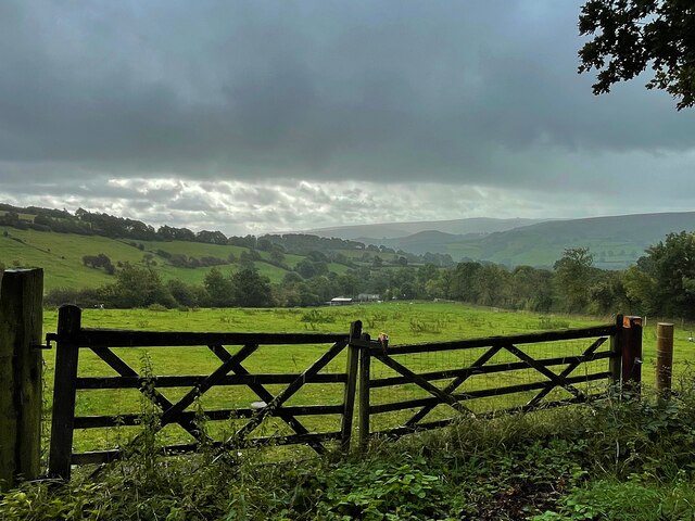
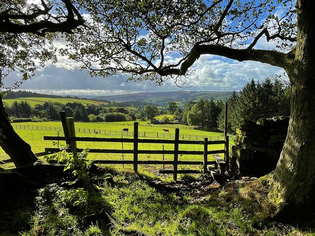
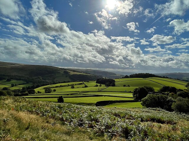
Cattis-side Moor is a picturesque area located in the county of Derbyshire, England. Situated in the eastern part of the county, it is a landscape characterized by rolling downs and expansive moorland. Covering an area of approximately 10 square miles, Cattis-side Moor is part of the larger Peak District National Park.

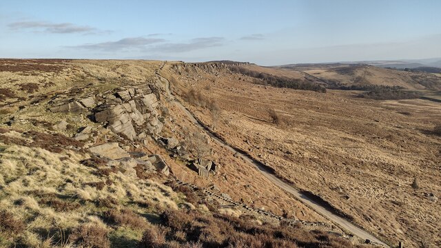
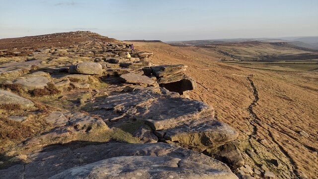
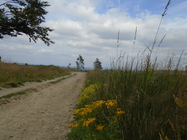
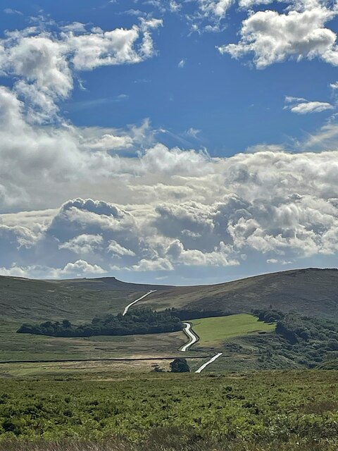
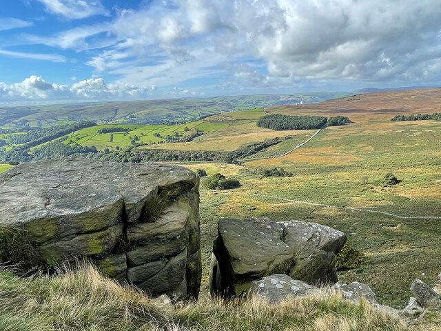
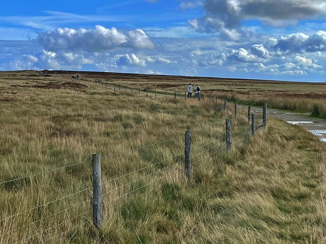
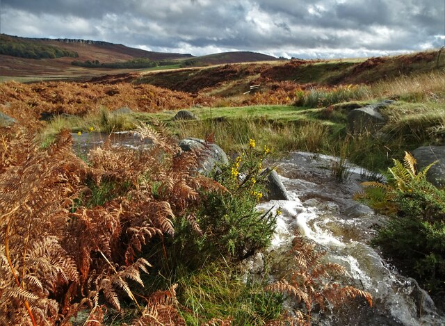
The moorland of Cattis-side is a captivating sight, with its vast stretches of open land covered in heather, grasses, and scattered rocks. The area boasts a rich biodiversity, providing a habitat for various plant and animal species. Visitors can often spot birds such as curlews, lapwings, and red grouse, as well as small mammals like rabbits and hares.

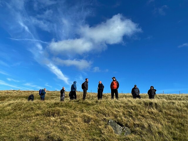
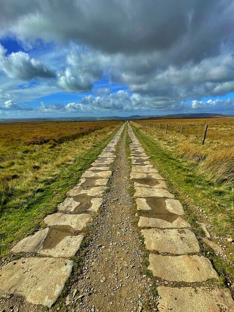
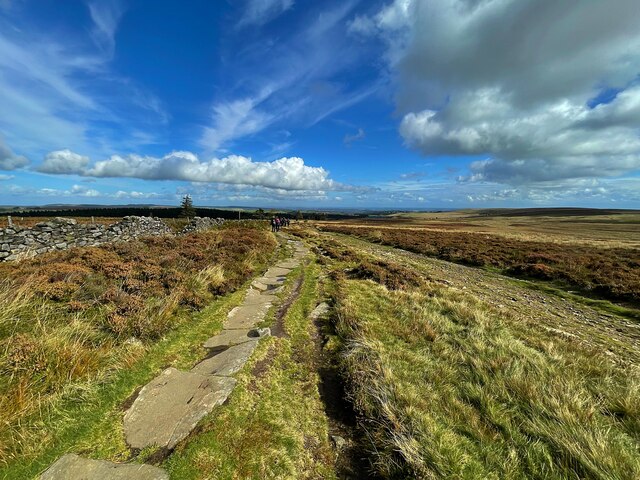
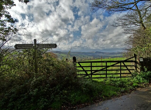
The terrain of Cattis-side Moor is undulating, with gentle slopes and a few steeper inclines. It is a popular destination for outdoor enthusiasts, offering opportunities for walking, hiking, and cycling. Several well-marked paths crisscross the moor, allowing visitors to explore its beauty and enjoy the fresh air.

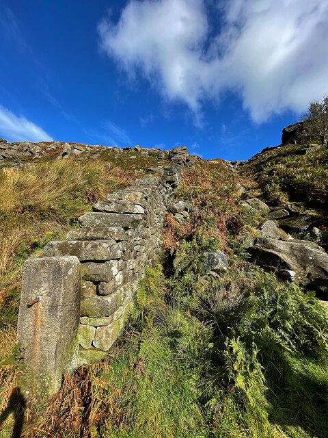
Cattis-side Moor also holds historical significance. There are remnants of ancient settlements and burial mounds scattered across the landscape, providing glimpses into the area's past. These archaeological sites are a testament to the human history that has unfolded in this region over centuries.

Overall, Cattis-side Moor is a tranquil and captivating location, offering visitors a chance to connect with nature and immerse themselves in the beauty of the Derbyshire countryside.

If you have any feedback on the listing, please let us know in the comments section below.

Cattis-side Moor Images

Images are sourced within 2km of 53.343759/-1.6399016 or Grid Reference SK2483. Thanks to Geograph Open Source API. All images are credited.

Stanage Edge Stanage Edge above the path coming up from Dennis Knoll
Stanage Edge
Stanage Edge above the path coming up from Dennis Knoll
Stanedge Pole Stanedge Pole on the moor above Stanage Edge
Stanedge Pole
Stanedge Pole on the moor above Stanage Edge
Stanage Edge Stanage Edge above the path to Hook's Car parking
Stanage Edge
Stanage Edge above the path to Hook's Car parking
Long Causeway track Descending from Stanedge Pole towards Redmires reservoir.   Interesting dead tree.  Ragwort and rosebay willowherb.
Long Causeway track
Descending from Stanedge Pole towards Redmires reservoir. Interesting dead tree. Ragwort and rosebay willowherb.
Longcauseway More ragwort on Long Causeway.   A paved section on the left side of the track. Sheffield just visible in the haze on the horizon.
Longcauseway
More ragwort on Long Causeway. A paved section on the left side of the track. Sheffield just visible in the haze on the horizon.
Cloudy sky over the Derwent Valley From Hurstclough Lane. Fortunately the grey clouds passed without depositing too much rain.
Cloudy sky over the Derwent Valley
From Hurstclough Lane. Fortunately the grey clouds passed without depositing too much rain.
Looking over the Derwent Valley From a public footpath in Bolehill Wood.
Looking over the Derwent Valley
From a public footpath in Bolehill Wood.
Cloudy blue sky over green fields and trees The glorious view to the east from Bole Hill
Cloudy blue sky over green fields and trees
The glorious view to the east from Bole Hill
View from a path to Stanage Edge The minor road runs over Cattis-side Moor between Stanage Edge and Carrhead Rocks.
View from a path to Stanage Edge
The minor road runs over Cattis-side Moor between Stanage Edge and Carrhead Rocks.
Wall and stream below Stanage Edge
The view from Stanage Edge Looking over Bamford Moor to the Hope Valley.
The view from Stanage Edge
Looking over Bamford Moor to the Hope Valley.
On Stanage Edge A group of walkers are admiring the view.
On Stanage Edge
A group of walkers are admiring the view.
The path to Stanedge Pole
Byway between Stanedge Pole and Stanage Edge Strange that the pole <a href="https://www.geograph.org.uk/photo/6981418">SK2484 : Stanedge Pole</a> and the edge are spelled differently.
Byway between Stanedge Pole and Stanage Edge
Strange that the pole SK2484 : Stanedge Pole and the edge are spelled differently.
Stanedge Pole The pole marks the border between South Yorkshire and Derbyshire. A pole has stood on the site since the mid-16th century and a new pole was erected in 2016. <span class="nowrap"><a title="https://en.wikipedia.org/wiki/Stanedge_Pole" rel="nofollow ugc noopener" href="https://en.wikipedia.org/wiki/Stanedge_Pole">Link</a><img style="margin-left:2px;" alt="External link" title="External link - shift click to open in new window" src="https://s1.geograph.org.uk/img/external.png" width="10" height="10"/></span>
Stanedge Pole
The pole marks the border between South Yorkshire and Derbyshire. A pole has stood on the site since the mid-16th century and a new pole was erected in 2016. LinkExternal link
The path between Stanedge Pole and the Redmires Reservoirs It's actually a byway open to all traffic but I've yet to see a motorised vehicle using it.
The path between Stanedge Pole and the Redmires Reservoirs
It's actually a byway open to all traffic but I've yet to see a motorised vehicle using it.
Hood Brook draining through Sheepwash Bank
At the junction of Birley Lane and Coggers Lane Looking towards Hope Cement Works in The Hope Valley.
At the junction of Birley Lane and Coggers Lane
Looking towards Hope Cement Works in The Hope Valley.
Show me another place!

Cattis-side Moor is located at Grid Ref: SK2483 (Lat: 53.343759, Lng: -1.6399016)

Administrative County: Derbyshire

District: Derbyshire Dales

Police Authority: Derbyshire

What 3 Words

///translated.times.tracks. Near Hathersage, Derbyshire

Related Wikis

Stanage Edge

Stanage Edge, or simply Stanage (from "stone edge") is a gritstone escarpment in the Peak District, England, famous as a location for climbing. It lies...

Hood Brook

Hood Brook is a stream in the Derbyshire Peak District, originating near Stanage Edge, close to Robin Hoods Cave. == Background == Hood Brook flows south...

St Michael and All Angels' Church, Hathersage

St Michael and All Angels’ Church, Hathersage, is a Grade I listed parish church in the Church of England in Hathersage, Derbyshire. == History == The...

Long Causeway

Long Causeway or Long Causey was a medieval packhorse route in England, which ran between Sheffield in South Yorkshire and Hathersage in Derbyshire. In...
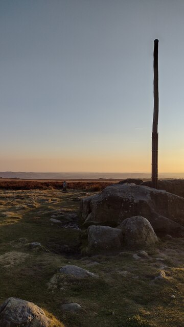
Stanedge Pole

Stanedge Pole also known as Stanage Pole (grid reference SK2468784429) is a landmark on Hallam Moors close to Stanage Edge in South Yorkshire, England...

Higger Tor

Higger Tor or Higgar Tor is a gritstone tor in the Dark Peak, in the north of the Peak District National Park in England. It overlooks the Burbage Valley...

Hathersage

Hathersage ( HATHə-sidge) is a village and civil parish in the Peak District in Derbyshire, England. It lies slightly to the north of the River Derwent...

Hathersage railway station

Hathersage railway station serves the village of Hathersage in the Derbyshire Peak District, in England. == History == The station was opened on 25 June...

Nearby Amenities

Located within 500m of 53.343759,-1.6399016
Barrier: cattle_grid
Lat/Long: 53.3448048/-1.6466886
Passing Place
Lat/Long: 53.3466796/-1.6387093
Passing Place
Lat/Long: 53.3447606/-1.6364442
Passing Place
Lat/Long: 53.3452457/-1.6369941
Passing Place
Lat/Long: 53.3475248/-1.6398415
Passing Place
Lat/Long: 53.3439733/-1.6355398
Bicycle Parking
Hooks Car
Capacity: 12
Source: survey
Lat/Long: 53.3422971/-1.6335348
Bus Stop
Stanage Hook's Car
Bench: no
Bus: yes
Network: Derbyshire County Council
Public Transport: platform
Shelter: no
Source: survey
Lat/Long: 53.3421147/-1.6333256
The data included in this document is from www.openstreetmap.org. The data is made available under ODbL.

Have you been to Cattis-side Moor?

Leave your review of Cattis-side Moor below (or comments, questions and feedback).