Hoyland Moor

Downs, Moorland in Yorkshire

England

Hoyland Moor

Disused quarry Disused quarry, off High Bank Lane, Thurlstone, South Yorkshire.
Disused quarry Credit: Dave Pickersgill

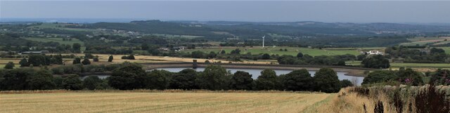
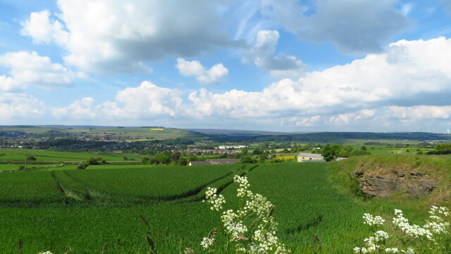
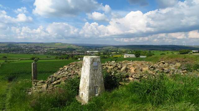
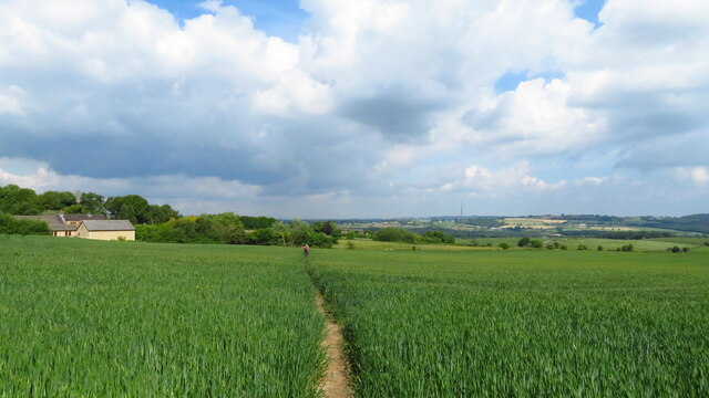
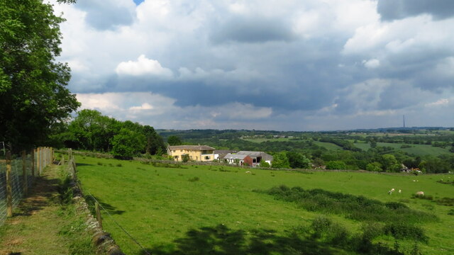
Hoyland Moor is a picturesque expanse of moorland located in the county of South Yorkshire, England. Situated near the village of Hoyland, this natural landscape offers visitors a unique blend of tranquil beauty and historical significance.

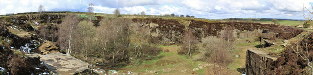
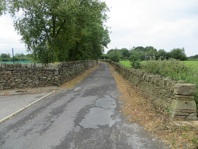
Covering an area of approximately 200 hectares, Hoyland Moor is characterized by its rolling hills, open heather-covered terrain, and scattered patches of woodland. The moorland boasts a diverse range of flora and fauna, including rare species such as the bilberry and heath spotted orchid, making it an important site for conservation.

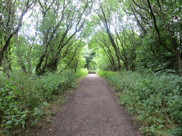
The moorland is crisscrossed by a network of footpaths and bridleways, allowing visitors to explore its vast expanse and take in the stunning views of the surrounding countryside. It is a popular destination for walkers, cyclists, and horse riders, who can enjoy the peacefulness and tranquility of the area.

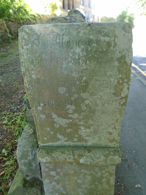
Hoyland Moor also holds historical significance, with evidence of human activity dating back thousands of years. Archaeological discoveries have revealed the existence of Bronze Age burial mounds, indicating that the moorland has been inhabited for centuries. Additionally, remnants of coal mining can still be seen, providing a glimpse into the area's industrial past.

Today, Hoyland Moor is managed by the local authorities and conservation organizations, ensuring its preservation for future generations to enjoy. With its natural beauty, rich history, and recreational opportunities, Hoyland Moor is a true gem in the Yorkshire countryside.

If you have any feedback on the listing, please let us know in the comments section below.

Hoyland Moor Images

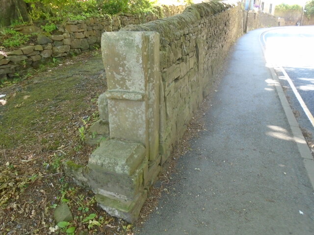
Images are sourced within 2km of 53.540163/-1.6413316 or Grid Reference SE2304. Thanks to Geograph Open Source API. All images are credited.

Disused quarry Disused quarry, off High Bank Lane, Thurlstone, South Yorkshire.
Disused quarry
Disused quarry, off High Bank Lane, Thurlstone, South Yorkshire.
Old milestone On the A628 approaching Penistone this 'listed' milestone from the 32 mile long Doncaster to Saltersbrook turnpike is next to the bus-stop.   A new town sign has recently been erected close by.  Repainted in 2016, it would now benefit from a good wash down to remove dirt thrown up by passing lorries and other heavy traffic.
Old milestone
On the A628 approaching Penistone this 'listed' milestone from the 32 mile long Doncaster to Saltersbrook turnpike is next to the bus-stop. A new town sign has recently been erected close by. Repainted in 2016, it would now benefit from a good wash down to remove dirt thrown up by passing lorries and other heavy traffic.
Old milestone This milestone is on the south side of the road on the one way system down Church Street in Penistone.  It is under a large tree and must have been painted very many years ago judging by the remnants of white paint.  It is similar to the old stone <a href="https://www.geograph.org.uk/photo/7199866">SK3099 : Old milestone</a> down the passageway in Wortley, but slightly wider.  It is another stone for the benchmark enthusiasts.

Milestone Society National ID: YS_SFPN13
Old milestone
This milestone is on the south side of the road on the one way system down Church Street in Penistone. It is under a large tree and must have been painted very many years ago judging by the remnants of white paint. It is similar to the old stone SK3099 : Old milestone down the passageway in Wortley, but slightly wider. It is another stone for the benchmark enthusiasts. Milestone Society National ID: YS_SFPN13
Old milestone The tollroad from Huddersfield to Penistone leaves West Yorkshire just north of Ingbirchworth on the A629.   It enters South Yorkshire and dips down into the town on the B6462, still called Huddersfield Road.   This original tollroad stone 12 miles from Huddersfield is at the top of the hill above the Grammar School.   Grade II listed 1315077.
Old milestone
The tollroad from Huddersfield to Penistone leaves West Yorkshire just north of Ingbirchworth on the A629. It enters South Yorkshire and dips down into the town on the B6462, still called Huddersfield Road. This original tollroad stone 12 miles from Huddersfield is at the top of the hill above the Grammar School. Grade II listed 1315077.
Old milestone The pre-turnpike era milestone on Huddersfield Road, B6462, can just be seen in the wall almost opposite the second spot of sunshine.  The eroded legends are LONDON/177/Miles/Huddersfield/12/Penistone/1½  (6044122).   However the turnpike milestone a little further north (7226692) has the legends Huddersfield 12, Penistone ½ so the datum points in Penistone are different. The end stone is a memorial stone.
Old milestone
The pre-turnpike era milestone on Huddersfield Road, B6462, can just be seen in the wall almost opposite the second spot of sunshine. The eroded legends are LONDON/177/Miles/Huddersfield/12/Penistone/1½ (6044122). However the turnpike milestone a little further north (7226692) has the legends Huddersfield 12, Penistone ½ so the datum points in Penistone are different. The end stone is a memorial stone.
Memorial stone The memorial stone on Huddersfield Road, B6462, is to Joseph son of William and Margaret ? late of BRYNMAWR.   A connection to Penistone or the stone transported from Wales for some reason.
Memorial stone
The memorial stone on Huddersfield Road, B6462, is to Joseph son of William and Margaret ? late of BRYNMAWR. A connection to Penistone or the stone transported from Wales for some reason.
Woodland footpath giving access to Royd Moor Reservoir Looking north-westward.
Woodland footpath giving access to Royd Moor Reservoir
Looking north-westward.
Wall enclosed Long Lane near Penistone Grammar School Looking westward. The school playing fields are on both sides of the road.
Wall enclosed Long Lane near Penistone Grammar School
Looking westward. The school playing fields are on both sides of the road.
In the Inn The Old Crown, Penistone is one of my favourite British pubs.
In the Inn
The Old Crown, Penistone is one of my favourite British pubs.
The Old Crown Been in here a few times!
The Old Crown
Been in here a few times!
Royd Moor Reservoir
Royd Moor Reservoir
St. Saviour's Church, Thurlstone
Kibble Brewery, Thurlstone Located in old stables in the car park of the Crystal Palace.
Kibble Brewery, Thurlstone
Located in old stables in the car park of the Crystal Palace.
Ordnance Survey Cut Mark This mark can be found on a gatepost beside Royd Moor Road, Royd Moor.
The recorded details give a height of 261.5855 metres above sea level.
For more detail see : <span class="nowrap"><a title="https://www.bench-marks.org.uk/bm91414" rel="nofollow ugc noopener" href="https://www.bench-marks.org.uk/bm91414">Link</a><img style="margin-left:2px;" alt="External link" title="External link - shift click to open in new window" src="https://s1.geograph.org.uk/img/external.png" width="10" height="10"/></span>
Ordnance Survey Cut Mark
This mark can be found on a gatepost beside Royd Moor Road, Royd Moor. The recorded details give a height of 261.5855 metres above sea level. For more detail see : LinkExternal link
View towards Penistone from Hoylandswaine Trig Point
Hoylandswaine trig point and view over Penistone
On the path from Hoylandswaine towards Renald Lane
On path leading west towards Cat Hill Farm, Cat Hill
Show me another place!

Hoyland Moor is located at Grid Ref: SE2304 (Lat: 53.540163, Lng: -1.6413316)

Division: West Riding

Unitary Authority: Barnsley

Police Authority: South Yorkshire

What 3 Words

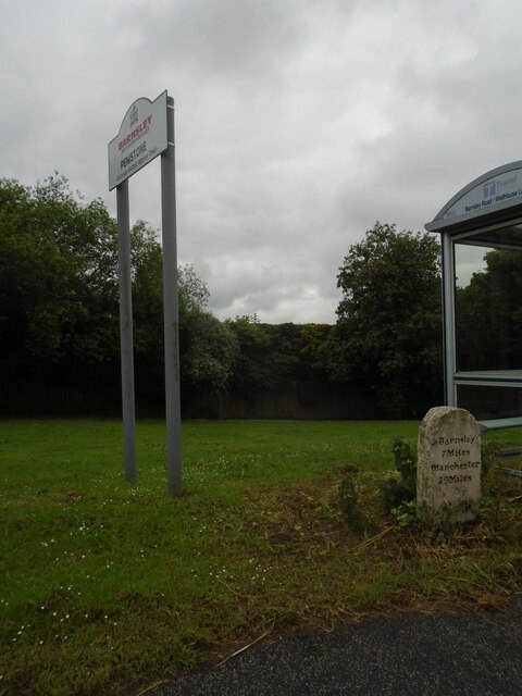
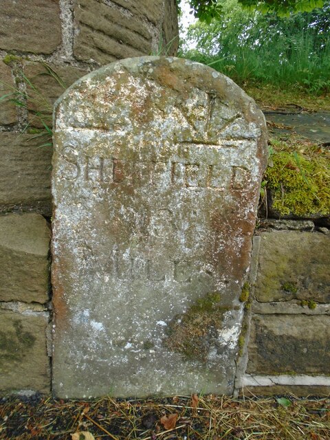
///ruler.spillage.swerves. Near Penistone, South Yorkshire

Related Wikis

Penistone Grammar School

Penistone Grammar School (PGS) is a co-educational comprehensive secondary school and sixth form located in Penistone, South Yorkshire, England. Founded...

Gunthwaite

Gunthwaite is a hamlet in the Metropolitan Borough of Barnsley in South Yorkshire, England. It is in the civil parish of Gunthwaite and Ingbirchworth and...

Gunthwaite and Ingbirchworth

Gunthwaite and Ingbirchworth is a civil parish in the Barnsley district, in the county of South Yorkshire, England. It contains the hamlet of Gunthwaite...

Penistone Rural District

Penistone Rural District was a rural district in the West Riding of Yorkshire. It was named after but did not contain Penistone. The town itself was contained...

Nearby Amenities

Located within 500m of 53.540163,-1.6413316
Bus Stop
Huddersfield Road/Well House Lane
Bench: no
Bin: no
Bus: yes
Departures Board: timetable
Lit: yes
Naptan AtcoCode: 370055244
Naptan Bearing: SE
Naptan CommonName: Huddersfield Road/Well House Lane
Naptan Indicator: 55244
Naptan Landmark: 55244
Naptan PlusbusZoneRef: ROTHCEN
Naptan Street: Huddersfield Road
Naptan Verified: yes
Public Transport: platform
Shelter: yes
Source: naptan_import
Tactile Paving: no
Lat/Long: 53.5373562/-1.6406079
Bus Stop
Huddersfield Road/Carr Head Lane
Bench: no
Bin: no
Bus: yes
Departures Board: timetable
Lit: no
Naptan AtcoCode: 370051058
Naptan Bearing: NW
Naptan CommonName: Huddersfield Road/Carr Head Lane
Naptan Indicator: 51058
Naptan Landmark: SCOUT DIKE OUTDOOR CENTRE
Naptan PlusbusZoneRef: ROTHCEN
Naptan Street: Huddersfield Road
Naptan Verified: yes
Public Transport: platform
Shelter: no
Source: naptan_import
Tactile Paving: no
Lat/Long: 53.5411643/-1.6472516
Bus Stop
Huddersfield Road/Well House Lane
Bench: no
Bin: no
Bus: yes
Departures Board: timetable
Lit: no
Naptan AtcoCode: 370051065
Naptan Bearing: NW
Naptan CommonName: Huddersfield Road/Well House Lane
Naptan Indicator: 51065
Naptan Landmark: ROAD JUNCTION
Naptan PlusbusZoneRef: ROTHCEN
Naptan Street: Huddersfield Road
Naptan Verified: yes
Public Transport: platform
Shelter: no
Source: naptan_import
Tactile Paving: no
Lat/Long: 53.5377945/-1.6415005
Bus Stop
Huddersfield Road/Carr Head Lane
Bus: yes
Naptan AtcoCode: 370055540
Naptan Bearing: SE
Naptan BusStopType: CUS
Naptan CommonName: Huddersfield Road/Carr Head Lane
Naptan Indicator: 55540
Naptan Landmark: SCOUT DIKE OUTDOOR CENTRE
Naptan PlusbusZoneRef: ROTHCEN
Naptan Street: Huddersfield Road
Naptan Verified: yes
Physically Present: no
Public Transport: platform
Source: naptan_import
Lat/Long: 53.5410734/-1.6468902
Parking
Access: yes
Fee: no
Parking: layby
Source: survey
Lat/Long: 53.5366775/-1.6396814
Barrier: stile
Material: wood
Step Count: 2
Stile: stepover
Lat/Long: 53.5357229/-1.6401442
Railway: level_crossing
Lat/Long: 53.5438434/-1.6415965
Westhorpe
Place: locality
Lat/Long: 53.5402048/-1.6338576
Scout Dike
Place: locality
Lat/Long: 53.5400116/-1.6464946
Hoyland Moor
Place: locality
Lat/Long: 53.5417369/-1.6407786
Carr Head
Place: locality
Lat/Long: 53.544301/-1.6402406
Board Type: map
Information: board
Operator: Gunthwaite & Ingbirchworth Parish Council
Source: survey
Tourism: information
Lat/Long: 53.5397375/-1.6455992
Barrier: cycle_barrier
Cycle Barrier: tilted
Source: survey
Lat/Long: 53.5392084/-1.6443866
Check Date: 2023-08-30
Covered: roof
Information: map
Tourism: information
Lat/Long: 53.5401179/-1.6453513
Post Box
Collection Plate Date: 2019-05-09
Collection Times: Mo-Fr 09:00; Sa 07:00
Operator: Royal Mail
Post Box Type: lamp
Ref: S36 978D
Royal Cypher: EIIR
Royal Cypher Wikidata: Q33102113
Source: survey
Lat/Long: 53.5405281/-1.6460975
Covered: no
Leisure: picnic_table
Source: survey
Lat/Long: 53.540004/-1.6461108
Flow Control: sluice_gate
Waterway: flow_control
Lat/Long: 53.5390849/-1.6459746
Man Made: tower
Material: wood
Tower Construction: freestanding
Tower Type: climbing
Lat/Long: 53.5404633/-1.6436468
Shelter
Bench: yes
Bin: no
Building Material: wood
Shelter Type: weather_shelter
Lat/Long: 53.5401107/-1.6453516
Barrier: stile
Material: stone
Step Count: 4
Stile: stepover
Lat/Long: 53.538428/-1.642426
Parking
Access: yes
Fee: no
Parking: layby
Lat/Long: 53.5385015/-1.6406472
Material: wood
Power: pole
Lat/Long: 53.543143/-1.6467686
Material: wood
Power: pole
Lat/Long: 53.5425724/-1.6458901
Material: wood
Power: pole
Lat/Long: 53.5420198/-1.645034
Bus: yes
Public Transport: stop_position
Lat/Long: 53.5378454/-1.6414129
Bus: yes
Public Transport: stop_position
Lat/Long: 53.5373362/-1.6406781
Bus: yes
Public Transport: stop_position
Lat/Long: 53.5410496/-1.6469487
Bus: yes
Public Transport: stop_position
Lat/Long: 53.541211/-1.6471681
Parking
Access: yes
Fee: no
Parking: layby
Lat/Long: 53.5386972/-1.6420279
Entrance: main
Lat/Long: 53.540773/-1.6460228
Camera Direction: 250
Camera Mount: mast
Camera Type: fixed
Man Made: surveillance
Surveillance: outdoor
Surveillance Type: camera
Surveillance Zone: parking
Lat/Long: 53.5386036/-1.6428
The data included in this document is from www.openstreetmap.org. The data is made available under ODbL.

Have you been to Hoyland Moor?

Leave your review of Hoyland Moor below (or comments, questions and feedback).