Netherton Moor

Downs, Moorland in Northumberland

England

Netherton Moor

Briery Hill
Briery Hill Credit: N Chadwick

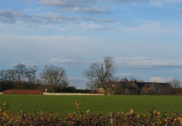
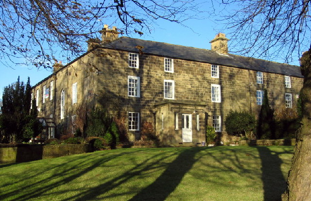
Netherton Moor is a picturesque expanse of downs and moorland located in the county of Northumberland, England. Situated in the northern part of the county, it covers an area of approximately 3 square miles and is renowned for its outstanding natural beauty and diverse wildlife.

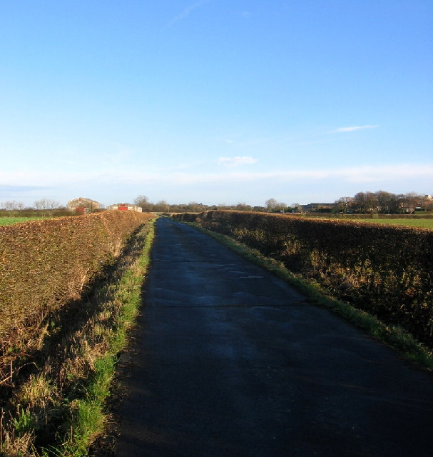
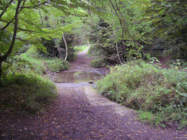
The moorland is characterized by its rolling hills, heather-clad slopes, and expansive open spaces, offering visitors breathtaking panoramic views of the surrounding countryside. The area is intersected by a network of walking trails, making it a popular destination for hikers, nature enthusiasts, and birdwatchers.

Netherton Moor is home to a variety of flora and fauna, including rare species such as curlews, lapwings, and black grouse, which thrive in the heather-rich environment. The moorland also supports a diverse range of plant life, including bilberry, cotton grass, and heath bedstraw.

The site has a rich historical heritage, with evidence of human activity dating back to prehistoric times. Archaeological remains, such as Bronze Age burial mounds and ancient settlements, can still be seen scattered across the moorland. These remnants offer a glimpse into the lives of the people who once inhabited the area.

Netherton Moor provides a tranquil escape from the hustle and bustle of modern life, allowing visitors to immerse themselves in the beauty of nature and experience the serenity of the Northumberland landscape. Whether exploring the walking trails, observing wildlife, or simply enjoying the breathtaking scenery, a visit to Netherton Moor is sure to leave a lasting impression on all who venture there.

If you have any feedback on the listing, please let us know in the comments section below.

Netherton Moor Images

Images are sourced within 2km of 55.122338/-1.6276487 or Grid Reference NZ2380. Thanks to Geograph Open Source API. All images are credited.

Briery Hill
Briery Hill
Hartford Bridge This old bridge, with its beautiful views to the north east and south west, still carries heavy traffic across the River Blyth near Plessey Woods.
Hartford Bridge
This old bridge, with its beautiful views to the north east and south west, still carries heavy traffic across the River Blyth near Plessey Woods.
Hartford Hall, near Bedlington Built in 1807 for a local mine owner it later became the "Northumberland Miners Rehabilitation Centre" and has now been converted into "luxury apartments".
Hartford Hall, near Bedlington
Built in 1807 for a local mine owner it later became the "Northumberland Miners Rehabilitation Centre" and has now been converted into "luxury apartments".
Bedlington, houses and trees As the A1068 enters Bedlington from the south this impressive row of trees comes into view on the left.
Bedlington, houses and trees
As the A1068 enters Bedlington from the south this impressive row of trees comes into view on the left.
St. Benet Biscop School, Bedlington For more information on St. Benet Biscop see:
<span class="nowrap"><a title="http://www.st-benetbiscop.org.uk/" rel="nofollow ugc noopener" href="http://www.st-benetbiscop.org.uk/">Link</a><img style="margin-left:2px;" alt="External link" title="External link - shift click to open in new window" src="https://s1.geograph.org.uk/img/external.png" width="10" height="10"/></span>
St. Benet Biscop School, Bedlington
For more information on St. Benet Biscop see: LinkExternal link
Westlea, Bedlington As the road turns right to join the B1331 these three very different houses can be seen, stuck together for no apparent reason. A fourth can just be made out on the far right: a bungalow with a tall chimney stack.
Westlea, Bedlington
As the road turns right to join the B1331 these three very different houses can be seen, stuck together for no apparent reason. A fourth can just be made out on the far right: a bungalow with a tall chimney stack.
Blue House Farm, near Bedlington Once surrounded by Coal Pits this farm now has a rather more picturesque setting
Blue House Farm, near Bedlington
Once surrounded by Coal Pits this farm now has a rather more picturesque setting
Netherton Hall, Nedderton A confusion of names for this grand house in a small village near Bedlington. Nedderton also boasts an impressive schoolhouse built in 1846 and funded by the Earl of Carlisle 
(see <a href="https://www.geograph.org.uk/gridref/NZ2381">NZ2381</a> for a photo). Pevsner, in his Buildings of England, is slightly less impressed by the house: "A tall rather plain house, now subdivided. The oldest part, at the E end, is probably C17; it was enlarged to the W in the early C18, heightened and refenestrated later in the same century, and enlarged to the rear in the C19."
Netherton Hall, Nedderton
A confusion of names for this grand house in a small village near Bedlington. Nedderton also boasts an impressive schoolhouse built in 1846 and funded by the Earl of Carlisle (see NZ2381 for a photo). Pevsner, in his Buildings of England, is slightly less impressed by the house: "A tall rather plain house, now subdivided. The oldest part, at the E end, is probably C17; it was enlarged to the W in the early C18, heightened and refenestrated later in the same century, and enlarged to the rear in the C19."
Road to West Farm The view is to the north east with West Farm just visible on the right.
Road to West Farm
The view is to the north east with West Farm just visible on the right.
Stannington Station Although the railway station (now disused) is in the next gridsquare (see: <a href="https://www.geograph.org.uk/gridref/NZ2181">NZ2181</a> ) this is the view back along the road (east) to the A192. Confusingly, although the village is called Stannington Station the station itself was originally called Netherton Station!
Stannington Station
Although the railway station (now disused) is in the next gridsquare (see: NZ2181 ) this is the view back along the road (east) to the A192. Confusingly, although the village is called Stannington Station the station itself was originally called Netherton Station!
Old School, Nedderton This is the school mentioned under 'Netherton Hall' in <a href="https://www.geograph.org.uk/gridref/NZ2381">NZ2381</a> The crest in the gable above the oriel window is that of the Earl of Carlisle.
Old School, Nedderton
This is the school mentioned under 'Netherton Hall' in NZ2381 The crest in the gable above the oriel window is that of the Earl of Carlisle.
The River Blyth from Hartford Bridge Looking north east towards Hartford Hall
The River Blyth from Hartford Bridge
Looking north east towards Hartford Hall
The River Blyth from Hartford Bridge Looking south west towards Plessey Woods
The River Blyth from Hartford Bridge
Looking south west towards Plessey Woods
Plessey Mill Farm, Northumberland Photograph taken from Plessey Woods Country Park.
The River Blyth in the foreground.
Plessey Mill Farm, Northumberland
Photograph taken from Plessey Woods Country Park. The River Blyth in the foreground.
Visitor Centre of Plessey Woods Country Park Between Cramlington and Bedlington in south east Northumberland
Visitor Centre of Plessey Woods Country Park
Between Cramlington and Bedlington in south east Northumberland
The Ridge Farm Bedlington
Ford The Ford at Entrance to Plessy Wood's
Ford
The Ford at Entrance to Plessy Wood's
Woodland path Woodland path in Plessey Woods
Woodland path
Woodland path in Plessey Woods
Show me another place!

Netherton Moor is located at Grid Ref: NZ2380 (Lat: 55.122338, Lng: -1.6276487)

Unitary Authority: Northumberland

Police Authority: Northumbria

What 3 Words

///achieving.sway.whisk. Near Bedlington, Northumberland

Nearby Locations

Netherton Moor

Related Wikis

Nedderton

Nedderton is a village in Northumberland, England about 4 miles (6 km) southeast of Morpeth, just off the A192 road. == History == In the early part of...

Plessey Woods Country Park

Plessey Woods is a country park situated on the north bank of the River Blyth, in Northumberland. The park is accessed from the A192 in the village of...

St Benet Biscop Catholic Academy

St. Benet Biscop Catholic Academy (formerly S. Benet Biscop Catholic High School) is a Roman Catholic high school in Bedlington, Northumberland, England...

Stannington railway station

Stannington railway station was a railway station which served the village of Stannington in Northumberland, England. It was located on the East Coast...

Nearby Amenities

Located within 500m of 55.122338,-1.6276487
Power: pole
Lat/Long: 55.1197724/-1.6307846
Power: pole
Lat/Long: 55.1204258/-1.6321303
Power: pole
Lat/Long: 55.1209884/-1.6333237
Power: pole
Lat/Long: 55.1214966/-1.6343711
Power: pole
Lat/Long: 55.1220157/-1.6354438
The data included in this document is from www.openstreetmap.org. The data is made available under ODbL.

Have you been to Netherton Moor?

Leave your review of Netherton Moor below (or comments, questions and feedback).