The Greens

Downs, Moorland in Yorkshire Harrogate

England

The Greens

Low Burn Bridge over the River Burn near Masham
Low Burn Bridge over the River Burn near Masham Credit: Rob Bainbridge

The requested URL returned error: 429 Too Many Requests

If you have any feedback on the listing, please let us know in the comments section below.
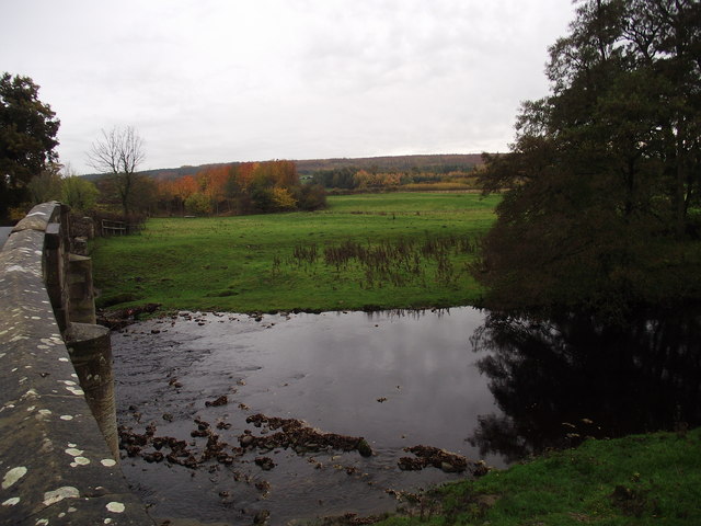
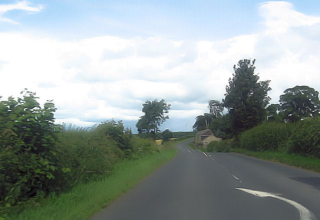
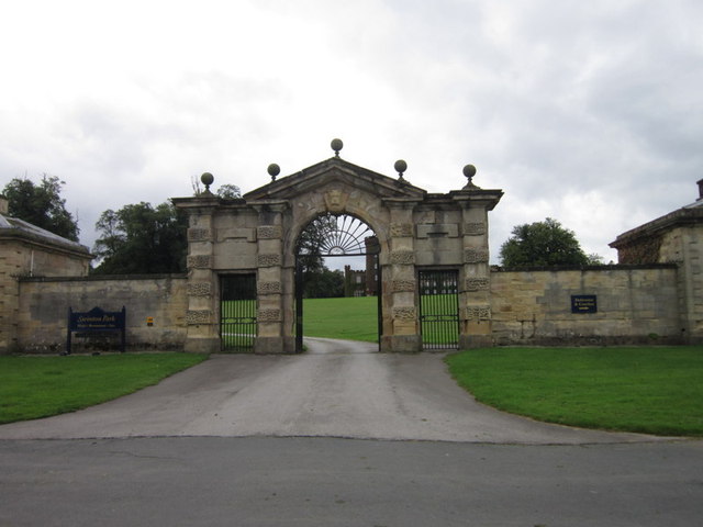
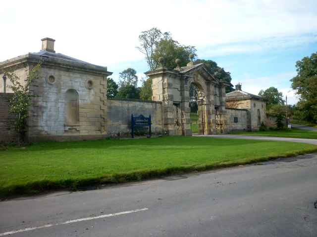
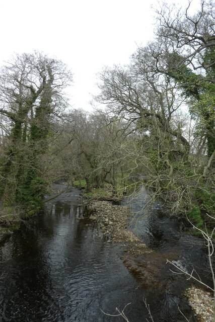
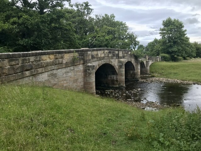
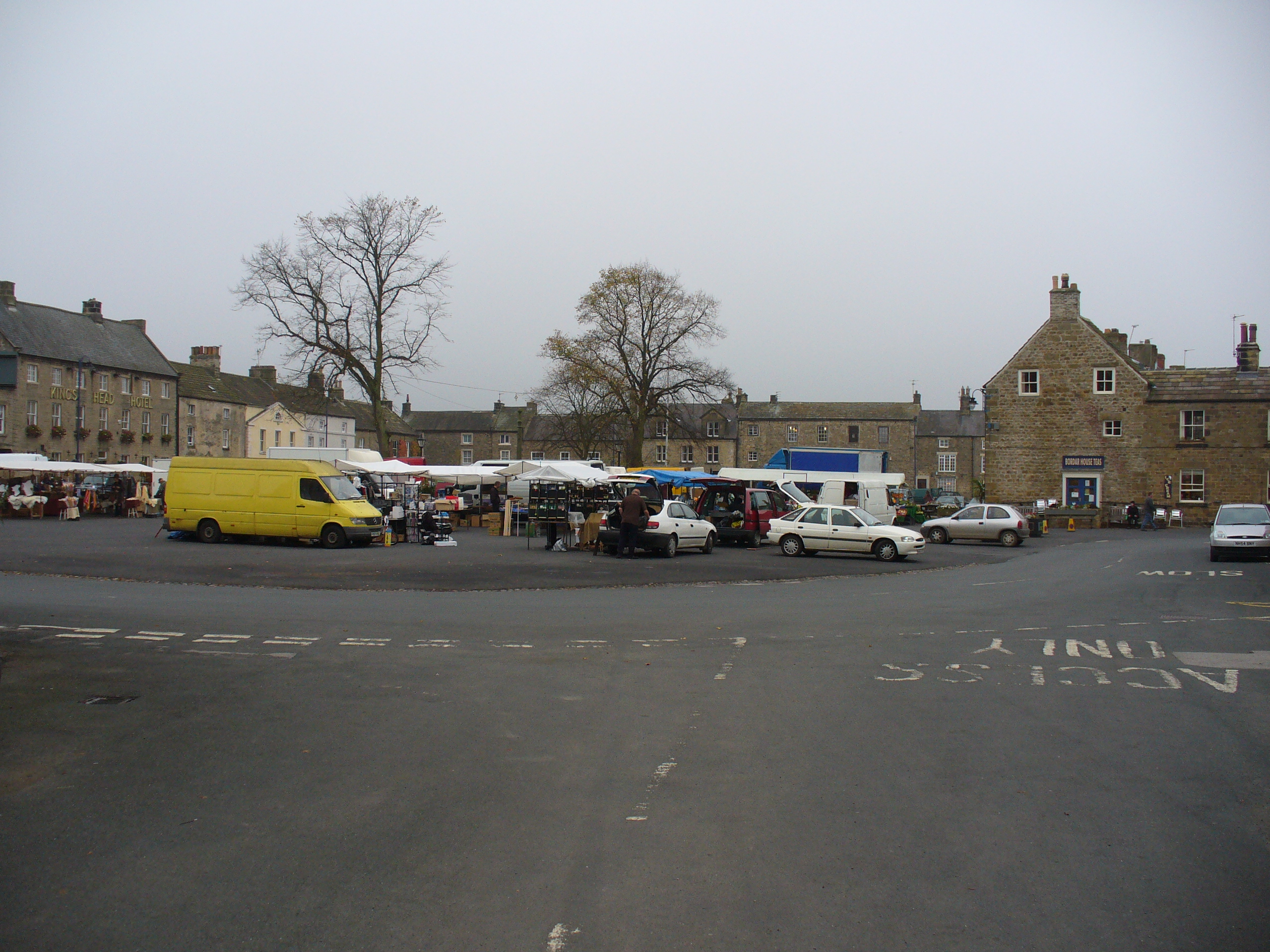
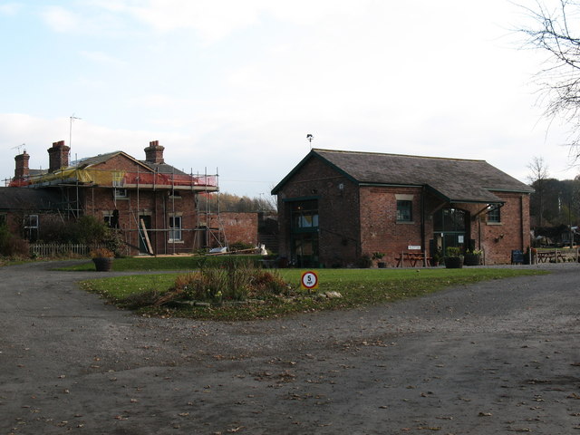
The Greens Images

Images are sourced within 2km of 54.224636/-1.6509666 or Grid Reference SE2281. Thanks to Geograph Open Source API. All images are credited.

Low Burn Bridge over the River Burn near Masham
A6108 at Lamb Hill
A6108 at Lamb Hill
The entrance to Swinton Park Hotel
Swinton Park Entrance Behind the gates is an Hotel, Restaurant and Spa.
Swinton Park Entrance
Behind the gates is an Hotel, Restaurant and Spa.
Low Burn Bridge, Masham Grade II listed and dated 1715 but with earlier origins.
Low Burn Bridge, Masham
Grade II listed and dated 1715 but with earlier origins.
River Burn joins the River Ure in an area known as Van Dieman's Plantation.
River Burn joins the River Ure
in an area known as Van Dieman's Plantation.
Bench Mark, Low Burn Bridge located on the upstream parapet and apparently not on the OS database.
According to old maps the height is 250.9 (feet).
Bench Mark, Low Burn Bridge
located on the upstream parapet and apparently not on the OS database. According to old maps the height is 250.9 (feet).
Den Beck meets the River Burn
Entrance to Swinton Park Formerly Swinton Park was the home of the Danby family and before 1882, the Cunliffe-Lister family.  Today it is a luxury hotel.
Entrance to Swinton Park
Formerly Swinton Park was the home of the Danby family and before 1882, the Cunliffe-Lister family. Today it is a luxury hotel.
River Burn viewed from Low Burn Bridge Looking upstream westward.
River Burn viewed from Low Burn Bridge
Looking upstream westward.
Ordnance Survey Cut Mark This mark can be found on the parapet of Low Burn Bridge.
For more detail see : <span class="nowrap"><a title="http://www.bench-marks.org.uk/bm51099" rel="nofollow ugc noopener" href="http://www.bench-marks.org.uk/bm51099">Link</a><img style="margin-left:2px;" alt="External link" title="External link - shift click to open in new window" src="https://s1.geograph.org.uk/img/external.png" width="10" height="10"/></span>
Ordnance Survey Cut Mark
This mark can be found on the parapet of Low Burn Bridge. For more detail see : LinkExternal link
Gateway  to  Swinton  Park The gateway is from 1740-50. The tower and castellations were only added to the house in 1821-24
Gateway to Swinton Park
The gateway is from 1740-50. The tower and castellations were only added to the house in 1821-24
The  East  Gates  to  Swinton  Park  c1740-50
The East Gates to Swinton Park c1740-50
The River Burn The River Burn is a significant tributary of the Ure, draining moors above Colsterdale and around Masham Moor. Seen here just about 300m above its confluence with the Ure.
The River Burn
The River Burn is a significant tributary of the Ure, draining moors above Colsterdale and around Masham Moor. Seen here just about 300m above its confluence with the Ure.
River Burn at Low Burn Bridge Looking downstream along the river from Thorpe Road.
River Burn at Low Burn Bridge
Looking downstream along the river from Thorpe Road.
Low Burn Bridge Bridge over the River Burn, south of Masham. Dating from 1715, it is a Grade II listed building (list entry number 1166868 <span class="nowrap"><a title="https://historicengland.org.uk/listing/the-list/list-entry/1166868?section=official-list-entry" rel="nofollow ugc noopener" href="https://historicengland.org.uk/listing/the-list/list-entry/1166868?section=official-list-entry">Link</a><img style="margin-left:2px;" alt="External link" title="External link - shift click to open in new window" src="https://s1.geograph.org.uk/img/external.png" width="10" height="10"/></span> Historic England).
Low Burn Bridge
Bridge over the River Burn, south of Masham. Dating from 1715, it is a Grade II listed building (list entry number 1166868 LinkExternal link Historic England).
Grewelthorpe Road, Low Burn Bridge Bridge over the River Burn, south of Masham. Dating from 1715, it is a Grade II listed building (list entry number 1166868 <span class="nowrap"><a title="https://historicengland.org.uk/listing/the-list/list-entry/1166868?section=official-list-entry" rel="nofollow ugc noopener" href="https://historicengland.org.uk/listing/the-list/list-entry/1166868?section=official-list-entry">Link</a><img style="margin-left:2px;" alt="External link" title="External link - shift click to open in new window" src="https://s1.geograph.org.uk/img/external.png" width="10" height="10"/></span> Historic England).
Grewelthorpe Road, Low Burn Bridge
Bridge over the River Burn, south of Masham. Dating from 1715, it is a Grade II listed building (list entry number 1166868 LinkExternal link Historic England).
Masham, Low Burn bridge The benchmark is cut into the west parapet and directly over the River Burn.
Masham, Low Burn bridge
The benchmark is cut into the west parapet and directly over the River Burn.
Show me another place!

The Greens is located at Grid Ref: SE2281 (Lat: 54.224636, Lng: -1.6509666)

Division: North Riding

Administrative County: North Yorkshire

District: Harrogate

Police Authority: North Yorkshire

What 3 Words

///greyhound.tests.shirtless. Near Masham, North Yorkshire

Nearby Locations

The Greens

Related Wikis

Masham

Masham ( MASS-əm) is a market town and civil parish in North Yorkshire, England. It had a population of 1,205 at the 2011 census. == Etymology == In Wensleydale...
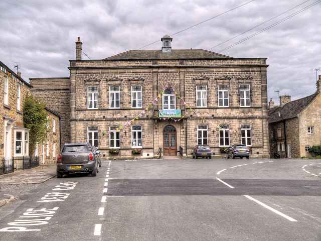
Masham Town Hall

Masham Town Hall is a municipal building in the Little Market Place, Masham, North Yorkshire, England. The structure, which is used as an events venue...

Church of St Mary the Virgin, Masham

The Church of St Mary the Virgin, Masham (also known as the Church of St Mary or St Mary's Church), is the parish church in the town of Masham, North Yorkshire...

Masham railway station

Masham railway station was the terminus of the Melmerby to Masham branch line serving the town of Masham in North Yorkshire, England. It was on the eastern...

Nearby Amenities

Located within 500m of 54.224636,-1.6509666
Masham
Place: town
Wikidata: Q2330678
Wikipedia: en:Masham
Lat/Long: 54.2220086/-1.6564736
Fuel
Wensleydale Garage
Brand: Jet
Mapillary: 529824495575068
Operator: Wensleydale Garage
Survey Date: 2022-09-07
Lat/Long: 54.2237806/-1.6582175
Car Wash
Wensleydale Garage
Operator: Wensleydale Garage
Lat/Long: 54.2238193/-1.658531
Toilets
Note: Camp site users only
Lat/Long: 54.2257317/-1.6447568
Restaurant
The Old Station Yard
Cuisine: Various
Lat/Long: 54.2260729/-1.6447583
The Old Station Yard
Shop: convenience
Lat/Long: 54.2261481/-1.6447879
Drinking Water
The Old Station Yard
Lat/Long: 54.2257033/-1.6447244
Old Name: Masham Post Office
Lat/Long: 54.2227851/-1.6569393
Masham
Railway: site
Lat/Long: 54.226137/-1.6442802
Post Box
Operator: Royal Mail
Post Box Type: lamp
Royal Cypher: EIIR
Royal Cypher Wikidata: Q33102113
Lat/Long: 54.2265944/-1.6442126
Cafe
Bordar House Teas
Addr City: Ripon
Addr Housenumber: 13
Addr Postcode: HG4 4DZ
Addr Street: Market Place
Addr Suburb: Masham
Source Addr: FHRS Open Data
Lat/Long: 54.2219138/-1.6557884
Toilets
Lat/Long: 54.222588/-1.6559936
Market Cross
HE Ref: 1012991
Designation: scheduled_monument
Historic: memorial
Wikidata: Q17662134
Lat/Long: 54.2215994/-1.6558701
Bus Stop
Naptan AtcoCode: 3200YNA90904
Naptan NaptanCode: 32090904
Shelter: yes
Lat/Long: 54.2220494/-1.6559075
King's Head Hotel
Addr City: Ripon
Addr Housenumber: 40
Addr Postcode: HG4 4EF
Addr Street: Market Place
Addr Suburb: Masham
Fhrs Id: 225082
Source Addr: FHRS Open Data
Tourism: hotel
Wikidata: Q26603146
Lat/Long: 54.2213153/-1.6559538
Bah Humbugs
Addr City: Ripon
Addr Housenumber: 2
Addr Postcode: HG4 4EB
Addr Street: Market Place
Addr Suburb: Masham
Note: traditional sweetshop
Shop: confectionery
Source: FHRS Open Data
Source Existenec: SpecialityFood Magazine article
Lat/Long: 54.2219367/-1.6569899
Information: office
Tourism: information
Lat/Long: 54.2222562/-1.6560266
Library
Mashamshire Community Library
Addr City: Ripon
Addr Postcode: HG4 4DY
Addr Street: Little Market Place
Addr Suburb: Masham
Phone: +44 1765 680204
Wifi: free
Lat/Long: 54.222266/-1.6559679
Post Box
Check Date: 2021-09-17
Post Box Type: pillar
Royal Cypher: EIIR
Royal Cypher Wikidata: Q33102113
Lat/Long: 54.2228085/-1.6568854
Reah's
Shop: newsagent
Lat/Long: 54.2226177/-1.656931
Post Box
Post Box Type: pillar
Ref: HG4 99
Lat/Long: 54.2218685/-1.6568666
Telephone
HE Ref: 1281536
Booth: K6
Covered: booth
Listed Status: Grade II
Wikidata: Q26570576
Lat/Long: 54.2221096/-1.6563244
Pharmacy
Healthcare: pharmacy
Lat/Long: 54.2218631/-1.6558593
Barrier: kissing_gate
Lat/Long: 54.2253184/-1.6533728
Barrier: kissing_gate
Lat/Long: 54.2207448/-1.6541498
Barrier: stile
Lat/Long: 54.223581/-1.6473378
Barrier: kissing_gate
Lat/Long: 54.2211336/-1.6528548
Veterinary
Forrest House
Lat/Long: 54.2222655/-1.6561655
Power: pole
Lat/Long: 54.2232025/-1.6442227
Power: pole
Lat/Long: 54.2229852/-1.6452962
Power: pole
Lat/Long: 54.2226769/-1.6469008
Power: pole
Lat/Long: 54.2224884/-1.6478073
Power: pole
Lat/Long: 54.2222778/-1.6488922
Power: pole
Lat/Long: 54.2220338/-1.6500795
Power: pole
Lat/Long: 54.2218072/-1.6512242
Atm
Source: survey
Lat/Long: 54.2220583/-1.655868
Through the Looking Glass
Addr City: Ripon
Addr Housenumber: 1
Addr Postcode: HG4 4DZ
Addr Street: Market Place
Addr Suburb: Masham
Clothes: women;fashion
Shop: clothes
Lat/Long: 54.222051/-1.6563416
Nearly New Cashmere Co.
Shop: clothes
Website: https://www.nearlynewcashmere.co.uk
Lat/Long: 54.223525/-1.6583983
Pub
The White Bear
Addr City: Masham
Website: https://www.whitebearmasham.co.uk
Lat/Long: 54.2248428/-1.6585154
Maltings
Addr City: Masham
Tourism: guest_house
Website: https://www.countryhideaways.co.uk/cottage/brid03-ch/BRID03
Lat/Long: 54.2246007/-1.6580865
Albion Craft Silversmith
Addr City: Masham
Shop: jewelry
Lat/Long: 54.2227755/-1.6569191
Beavers
Addr City: Masham
Shop: butcher
Lat/Long: 54.222475/-1.6568504
Restaurant
Vannells
Addr City: Masham
Lat/Long: 54.2223526/-1.6567551
Aura
Addr City: Masham
Shop: antiques
Lat/Long: 54.2221678/-1.6566826
Nolon Stacy Gallery
Addr City: Ripon
Addr Housenumber: 52
Addr Postcode: HG4 4EF
Addr Street: Market Place
Addr Suburb: Masham
Tourism: gallery
Website: https://www.nolonstacey.com
Lat/Long: 54.2212065/-1.65506
Uredale Glass
Addr City: Ripon
Addr Postcode: HG4 4EF
Addr Street: Market Place
Addr Suburb: Masham
Tourism: gallery
Website: https://www.uredale.co.uk
Lat/Long: 54.2211349/-1.6557361
Doctors
Masham Surgery
Addr City: Ripon
Addr Postcode: HG4 4DZ
Addr Street: Market Place
Addr Suburb: Masham
Healthcare: doctor
Phone: +44 1765 689317
Website: https://www.kirkbyandmashamsurgeries.co.uk
Lat/Long: 54.2219017/-1.6558402
Bench
Backrest: yes
Lat/Long: 54.2218602/-1.6556457
Bench
Backrest: yes
Lat/Long: 54.2218523/-1.6555827
Bench
Backrest: yes
Lat/Long: 54.2218415/-1.6555136
R F Broadley Insurance Brokers
Addr City: Ripon
Addr Postcode: HG4 4DZ
Addr Street: Market Place
Addr Suburb: Masham
Office: insurance
Website: https://www.rfbroadley.co.uk
Lat/Long: 54.2219596/-1.6563655
Tourism: artwork
Lat/Long: 54.2219089/-1.6564477
Joneva
Addr City: Masham
Addr Housenumber: 7
Addr Street: Market Place
Shop: confectionery
Lat/Long: 54.2218981/-1.6560791
Historic: monument
Lat/Long: 54.2214417/-1.6544714
Power: pole
Lat/Long: 54.2223277/-1.6532947
Corks&Cases Worldwide Wines
Addr City: Ripon
Addr Housenumber: 17
Addr Postcode: HG4 4DX
Addr Street: Silver Street
Addr Suburb: Masham
Check Date Opening Hours: 2022-06-16
Opening Hours: Mo,We,Th,Fr,Sa 09:30-18:00; Su 09:30-16:00
Payment Cash: yes
Payment Credit Cards: yes
Phone: +44 1765 688810
Shop: alcohol
Website: https://corksandcases.com/
Lat/Long: 54.222734/-1.6569145
Restaurant
Where There’s Smoke
Addr City: Ripon
Addr Housenumber: 7
Addr Postcode: HG4 4DX
Addr Street: Silver Street
Addr Suburb: Masham
Cuisine: regional
Email: info@wts.restaurant
Opening Hours: Th-Fr 19:00-23:00
Phone: +44 1765 689000
Website: https://www.wts.restaurant
Lat/Long: 54.2223445/-1.6567593
Waste Basket
Waste: mixed
Lat/Long: 54.2229754/-1.6527217
Waste Basket
Waste: dog_excrement
Lat/Long: 54.223072/-1.6557231
Waste Basket
Waste: dog_excrement
Lat/Long: 54.2243814/-1.656568
The data included in this document is from www.openstreetmap.org. The data is made available under ODbL.

Have you been to The Greens?

Leave your review of The Greens below (or comments, questions and feedback).