Beamish Park

Downs, Moorland in Durham

England

Beamish Park

Beware of trains At a foot crossing on the Tanfield Railway.
Beware of trains Credit: Craig Allan

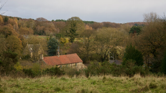
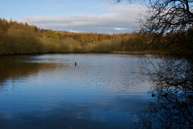
Beamish Park, located in Durham, England, is a picturesque park known for its stunning views and natural beauty. Situated on the outskirts of the town of Beamish, the park covers a vast area comprising of downs and moorland.

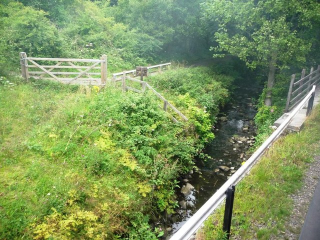
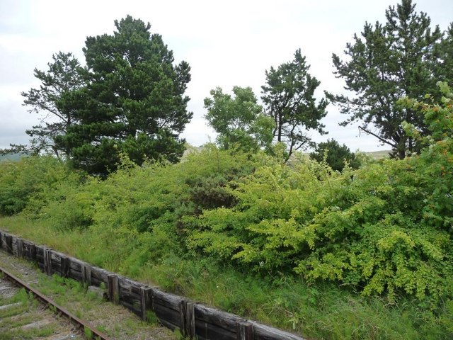
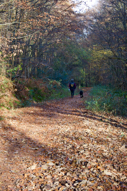
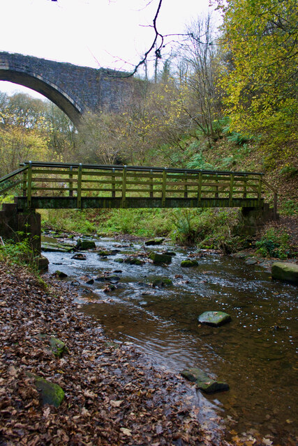
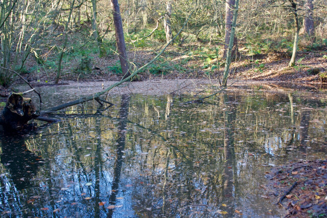
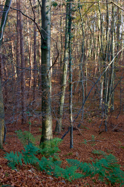
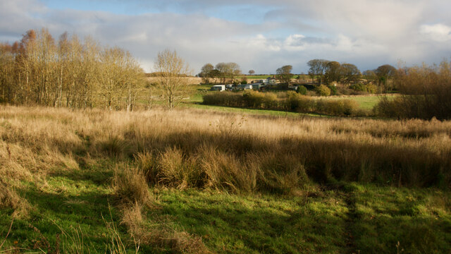
The downs in Beamish Park offer visitors a gentle, rolling landscape with lush green grass and scattered trees. The open expanse of the downs provides a serene environment, perfect for leisurely walks or picnics. The area is also home to a variety of wildlife, including rabbits, foxes, and a wide range of bird species, making it a popular spot for nature enthusiasts and birdwatchers.

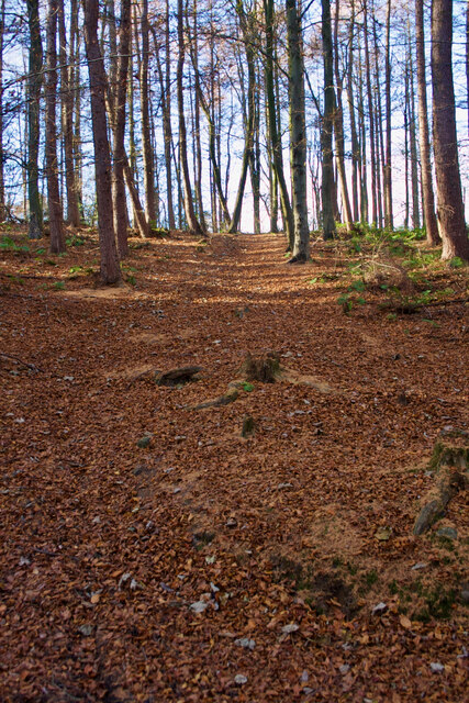
Adjacent to the downs, the moorland section of Beamish Park offers a contrasting landscape, characterized by rough terrain, heather-covered hills, and rocky outcrops. The moorland provides a challenging terrain for hikers and climbers, who can enjoy the panoramic views of the surrounding countryside from the hilltops. The area is also rich in flora and fauna, with wildflowers and ferns adding bursts of color to the landscape.

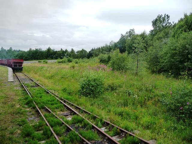
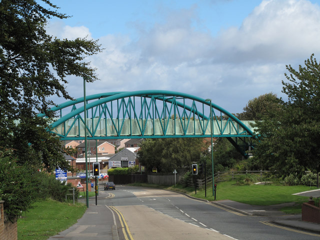
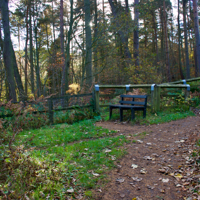
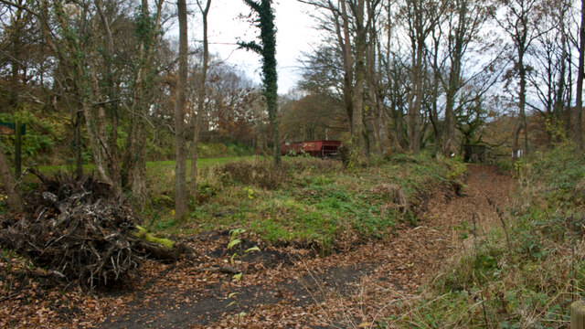
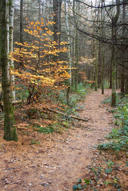
Throughout the park, visitors can find well-maintained footpaths and trails, allowing them to explore the different sections of the park at their own pace. Information boards and signposts are strategically placed, providing educational insights into the natural features and historical significance of the area.

Overall, Beamish Park offers a diverse range of natural landscapes, making it a popular destination for outdoor enthusiasts, families, and those seeking tranquility in the midst of nature. Whether one chooses to explore the downs or venture across the moorland, a visit to Beamish Park promises a memorable and immersive experience in the heart of Durham's countryside.

If you have any feedback on the listing, please let us know in the comments section below.

Beamish Park Images

Images are sourced within 2km of 54.884874/-1.6698382 or Grid Reference NZ2154. Thanks to Geograph Open Source API. All images are credited.

Beware of trains At a foot crossing on the Tanfield Railway.
Beware of trains
At a foot crossing on the Tanfield Railway.
East Tanfield Renishaw Ironworks No 6 backs onto a passenger train.
East Tanfield
Renishaw Ironworks No 6 backs onto a passenger train.
Tanfield Railway Tanfield Railway near East Tanfield Station. The steam engine is "Sir Cecil A Cochrane".
Tanfield Railway
Tanfield Railway near East Tanfield Station. The steam engine is "Sir Cecil A Cochrane".
Stream alongside railway Taken from an open window on a Tanfield Railway train.
Stream alongside railway
Taken from an open window on a Tanfield Railway train.
The approach to East Tanfield station Taken from an open window on a Tanfield Railway train.
The approach to East Tanfield station
Taken from an open window on a Tanfield Railway train.
Hedgerow alongside railway Taken from an open window on a Tanfield Railway train.
Hedgerow alongside railway
Taken from an open window on a Tanfield Railway train.
Bridge carrying railway path This bridge on the N. side of the County Durham town of Stanley now carries the Consett & Sunderland Railway Path. The structure replaced the original railway bridge.
Bridge carrying railway path
This bridge on the N. side of the County Durham town of Stanley now carries the Consett & Sunderland Railway Path. The structure replaced the original railway bridge.
A track through the delightfully named Hellhole Wood
Beech woodland, Hellhole Wood
Beamish Burn
Beamish Burn
Bench, Carrickshill Wood
The old Causey Arch station
Footbridge over the Causey Burn With some other bridge behind.
Footbridge over the Causey Burn
With some other bridge behind.
Small pond, Hellhole Wood
Beech woodland, Hellhole Wood
Hedley Hall Farm
Hedley Hall Farm
Mill Wood
Mill Wood
Pond, Mill Wood
Pond, Mill Wood
Show me another place!

Beamish Park is located at Grid Ref: NZ2154 (Lat: 54.884874, Lng: -1.6698382)

Unitary Authority: County Durham

Police Authority: Durham

What 3 Words

///ditching.assist.reflected. Near Tanfield, Co. Durham

Nearby Locations

Beamish Park

Related Wikis

Beamish Hall

Beamish Hall is a mid-18th-century country house, now converted to a hotel, which stands in 24 acres (97,000 m2) of grounds near the town of Stanley, County...

Beamish Museum

Beamish Museum is the first regional open-air museum, in England, located at Beamish, near the town of Stanley, in County Durham, England. Beamish pioneered...

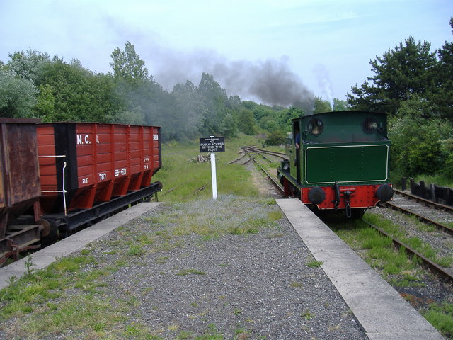
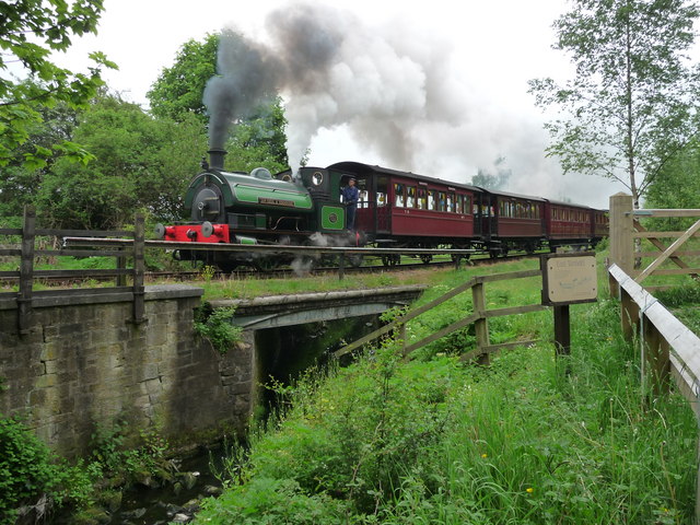
Beamish Museum transport collection

Beamish Museum contains much of transport interest, and the size of its site makes good internal transportation for visitors and staff purposes a necessity...

Kip Hill

Kip Hill is a village in County Durham, in England. It is situated directly to the north of Stanley, near Shield Row. It has two pubs, the Blue Bell Inn...

No Place

No Place is a small village near the town of Stanley in County Durham, England, east of Stanley and west of Beamish. Situated to the south of the A693...

Beamish railway station

Beamish was a railway station which served the village of Beamish in County Durham, North East England, from 1894 to 1953. The station was built by the...

High Forge

High Forge is a hamlet in County Durham, England. It is situated a short distance to the west of Urpeth, north of Beamish. == References ==

Beamish, County Durham

Beamish, previously named 'Pit Hill', is a village in County Durham, England, situated to the north east of Stanley. The village is contained within...

Nearby Amenities

Located within 500m of 54.884874,-1.6698382
Railway: switch
Lat/Long: 54.8846878/-1.6643713
Railway: tram_level_crossing
Lat/Long: 54.8852659/-1.6643104
Disused Tourism: attraction
Old Name: Beamish Wild Birds of Prey Conservation Centre
Lat/Long: 54.8878595/-1.6728191
Disused Tourism: attraction
Old Name: Beamish Wild Ropes Activity Centre
Lat/Long: 54.8884399/-1.6724683
Railway: tram_level_crossing
Lat/Long: 54.8839256/-1.664282
Railway: switch
Lat/Long: 54.8841043/-1.6621583
Railway: switch
Lat/Long: 54.888358/-1.6651385
Railway: switch
Lat/Long: 54.8839295/-1.6626631
Railway: switch
Lat/Long: 54.8839126/-1.6632516
Railway: buffer_stop
Lat/Long: 54.8837414/-1.6635122
Railway: buffer_stop
Lat/Long: 54.8838123/-1.6635868
Railway: buffer_stop
Lat/Long: 54.8837826/-1.6635664
Crossing Barrier: full
Railway: level_crossing
Lat/Long: 54.888302/-1.6652579
Crossing Barrier: full
Railway: level_crossing
Lat/Long: 54.8882779/-1.6652249
Home Farm
Operator: Beamish Museum - Transport Department
Railway: tram_stop
Shelter: no
Tram: yes
Lat/Long: 54.8843366/-1.6643409
Railway: switch
Lat/Long: 54.8843612/-1.6643429
Cafe
British Kitchen
Addr City: Stanley
Addr Housename: Beamish Museum
Addr Postcode: DH9 0RG
Addr Village: Beamish
Fhrs Id: 302706
Source Addr: FHRS Open Data
Lat/Long: 54.8832457/-1.6653795
Toilets
Lat/Long: 54.8832696/-1.6652197
Barrier: stile
Lat/Long: 54.8827358/-1.6665879
Foulbridge
Place: locality
Lat/Long: 54.8854244/-1.6659041
Dipwood Halt
Railway: station
Station: miniature
Usage: tourism
Lat/Long: 54.8862872/-1.6645975
Regional Resource Centre
Board Type: notice
Information: board
Tourism: information
Lat/Long: 54.886031/-1.6645042
Regional Resource Centre, Collections Study Room
Entrance: yes
Lat/Long: 54.8860435/-1.664519
Entrance: yes
Lat/Long: 54.8861918/-1.6645616
Bench
Lat/Long: 54.8869522/-1.6643218
Leisure: picnic_table
Lat/Long: 54.8873554/-1.6636253
Leisure: picnic_table
Lat/Long: 54.8873754/-1.6637359
Leisure: picnic_table
Lat/Long: 54.8873944/-1.6638515
Leisure: picnic_table
Lat/Long: 54.8874134/-1.6638648
Leisure: picnic_table
Lat/Long: 54.8874305/-1.663878
Leisure: picnic_table
Lat/Long: 54.8874751/-1.6640415
Image: https://www.geograph.org.uk/photo/3751734
Railway: turntable
Lat/Long: 54.8863159/-1.6644925
Entrance: main
Lat/Long: 54.883562/-1.6630968
Railway: tram_level_crossing
Lat/Long: 54.8845133/-1.6643605
Tourism: picnic_site
Lat/Long: 54.8831924/-1.66522
Fixme: Seems unlikely - OS map indicates a bridge
Ford: yes
Lat/Long: 54.8818651/-1.6646562
Toilets
Access: yes
Changing Table: yes
Toilets Disposal: flush
Unisex: yes
Wheelchair: yes
Lat/Long: 54.8861725/-1.6645786
Power: pole
Lat/Long: 54.8863507/-1.6670492
Power: pole
Lat/Long: 54.8863422/-1.6671042
Power: pole
Lat/Long: 54.8863171/-1.6672719
Power: pole
Lat/Long: 54.886147/-1.6683984
Power: pole
Lat/Long: 54.8859372/-1.6697046
Power: pole
Lat/Long: 54.8857397/-1.6710122
Power: pole
Lat/Long: 54.8851017/-1.6724834
Power: pole
Lat/Long: 54.8845795/-1.6736756
Power: pole
Lat/Long: 54.8840009/-1.6750167
Power: pole
Lat/Long: 54.8836136/-1.6759354
Bench
Backrest: yes
Mapillary: 1847833252072171
Lat/Long: 54.8862359/-1.6643969
Bench
Backrest: yes
Mapillary: 1847833252072171
Lat/Long: 54.8862024/-1.6643972
Ruston Bucyrus 25-RB excavator
Exhibit: excavator
Image: https://www.geograph.org.uk/photo/7269203
Outdoor: yes
Lat/Long: 54.8857142/-1.664764
Bench
Mapillary: 926307981303552
Lat/Long: 54.8851704/-1.6649437
Content: water
Man Made: storage_tank
Lat/Long: 54.8882687/-1.6654587
Information: map
Tourism: information
Lat/Long: 54.8861019/-1.6643943
1940's Farm
Place: neighbourhood
Website: https://www.beamish.org.uk/explore-discover/1940s-farm/
Lat/Long: 54.8831338/-1.6653836
Home Farm
Operator: Beamish Museum - Transport Museum
Railway: tram_stop
Shelter: no
Lat/Long: 54.8843177/-1.6642851
Railway: switch
Lat/Long: 54.8840781/-1.664305
Bus Stop
Home Farm
Bus: yes
Description: Usually used in an Anti-Clockwise direction only
Operator: Beamish Museum - Transport Department
Public Transport: platform
Shelter: yes
Lat/Long: 54.8843106/-1.6641888
The data included in this document is from www.openstreetmap.org. The data is made available under ODbL.

Have you been to Beamish Park?

Leave your review of Beamish Park below (or comments, questions and feedback).