Pegswood Moor

Downs, Moorland in Northumberland

England

Pegswood Moor

Road junction, West Shield Hill
Road junction, West Shield Hill Credit: Richard Webb

Pegswood Moor, located in Northumberland, England, is a scenic area characterized by its downs and moorland landscapes. Situated to the west of the village of Pegswood, the moor encompasses approximately 150 acres of diverse terrain and natural beauty.

The moorland of Pegswood Moor boasts an array of plant species, including heather, gorse, and bracken, which add vibrant colors to the landscape throughout the year. The open, rolling downs provide stunning panoramic views of the surrounding countryside, making it a popular destination for walkers, hikers, and nature enthusiasts.

One of the prominent features of the moor is its rich birdlife. Birdwatchers flock to Pegswood Moor to catch glimpses of various species, including red grouse, curlews, lapwings, and skylarks. The moorland habitat provides an ideal environment for these birds, making it a haven for birdwatchers and a valuable resource for conservation efforts.

Pegswood Moor also holds historical significance, with remnants of ancient settlements and archaeological sites scattered across the area. These remnants offer insight into the region's past, attracting history enthusiasts and researchers alike.

Access to Pegswood Moor is facilitated by well-maintained footpaths and trails, making it an easily navigable area for visitors. The moorland is a peaceful and tranquil location, providing a serene retreat for those seeking a break from the hustle and bustle of everyday life.

Overall, Pegswood Moor presents a captivating blend of natural beauty, biodiversity, and historical significance, making it a cherished destination for locals and tourists alike.

If you have any feedback on the listing, please let us know in the comments section below.

Pegswood Moor Images

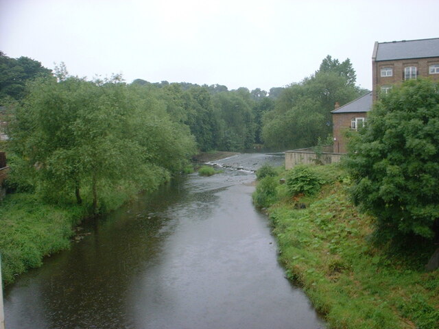
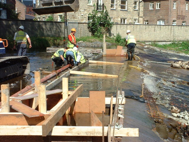
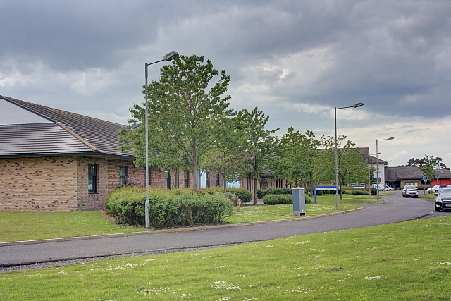
Images are sourced within 2km of 55.180847/-1.6718888 or Grid Reference NZ2087. Thanks to Geograph Open Source API. All images are credited.

Road junction, West Shield Hill
Farmland north of Morpeth Outside the new bypass.
Farmland north of Morpeth
Outside the new bypass.
Olivers Mill Weir, River Wansbeck, Morpeth Construction of a stone berm (working platform) across the river to provide a working platform for the piling rig.
<a href="https://www.geograph.org.uk/photo/7334204">NZ1985 : Olivers Mill Weir, River Wansbeck, Morpeth</a>
<a href="https://www.geograph.org.uk/photo/7334208">NZ1985 : Olivers Mill Weir, River Wansbeck, Morpeth</a>
Olivers Mill Weir, River Wansbeck, Morpeth
Construction of a stone berm (working platform) across the river to provide a working platform for the piling rig. NZ1985 : Olivers Mill Weir, River Wansbeck, Morpeth NZ1985 : Olivers Mill Weir, River Wansbeck, Morpeth
Olivers Mill Weir, River Wansbeck, Morpeth Piling rig installing inter-locking Larssen steel sheet piles to the crest of the southern half of the weir.
<a href="https://www.geograph.org.uk/photo/7334453">NZ1985 : Olivers Mill Weir, River Wansbeck, Morpeth</a>
<a href="https://www.geograph.org.uk/photo/7334208">NZ1985 : Olivers Mill Weir, River Wansbeck, Morpeth</a>
<a href="https://www.geograph.org.uk/photo/7334453">NZ1985 : Olivers Mill Weir, River Wansbeck, Morpeth</a>
Olivers Mill Weir, River Wansbeck, Morpeth
Piling rig installing inter-locking Larssen steel sheet piles to the crest of the southern half of the weir. NZ1985 : Olivers Mill Weir, River Wansbeck, Morpeth NZ1985 : Olivers Mill Weir, River Wansbeck, Morpeth NZ1985 : Olivers Mill Weir, River Wansbeck, Morpeth
Olivers Mill Weir, River Wansbeck, Morpeth Piling rig installing inter-locking Larssen steel sheet piles to the crest of the southern half of the weir.
<a href="https://www.geograph.org.uk/photo/7334453">NZ1985 : Olivers Mill Weir, River Wansbeck, Morpeth</a>
<a href="https://www.geograph.org.uk/photo/7334204">NZ1985 : Olivers Mill Weir, River Wansbeck, Morpeth</a>
<a href="https://www.geograph.org.uk/photo/7334453">NZ1985 : Olivers Mill Weir, River Wansbeck, Morpeth</a>
Olivers Mill Weir, River Wansbeck, Morpeth
Piling rig installing inter-locking Larssen steel sheet piles to the crest of the southern half of the weir. NZ1985 : Olivers Mill Weir, River Wansbeck, Morpeth NZ1985 : Olivers Mill Weir, River Wansbeck, Morpeth NZ1985 : Olivers Mill Weir, River Wansbeck, Morpeth
Olivers Mill Weir, River Wansbeck, Morpeth Piling rig installing inter-locking Larssen steel sheet piles to the crest of the southern half of the weir.
Olivers Mill Weir, River Wansbeck, Morpeth
Piling rig installing inter-locking Larssen steel sheet piles to the crest of the southern half of the weir.
Olivers Mill Weir, River Wansbeck, Morpeth Breaking out defective and loose brickwork on the face of the weir.
Olivers Mill Weir, River Wansbeck, Morpeth
Breaking out defective and loose brickwork on the face of the weir.
Olivers Mill Weir, River Wansbeck, Morpeth Formwork and concrete haunch to stainless steel fish pass.
<a href="https://www.geograph.org.uk/photo/7334520">NZ1985 : Olivers Mill Weir, River Wansbeck, Morpeth</a>
<a href="https://www.geograph.org.uk/photo/7334525">NZ1985 : Olivers Mill Weir, River Wansbeck, Morpeth</a>
Olivers Mill Weir, River Wansbeck, Morpeth
Olivers Mill Weir, River Wansbeck, Morpeth Piling rig installing inter-locking Larssen steel sheet piles to the crest of northern half of the weir.
<a href="https://www.geograph.org.uk/photo/7334621">NZ1985 : Olivers Mill Weir, River Wansbeck, Morpeth</a>
Olivers Mill Weir, River Wansbeck, Morpeth
Piling rig installing inter-locking Larssen steel sheet piles to the crest of northern half of the weir. NZ1985 : Olivers Mill Weir, River Wansbeck, Morpeth
Olivers Mill Weir, River Wansbeck, Morpeth Piling rig installing inter-locking Larssen steel sheet piles to the crest of northern half of the weir.
<a href="https://www.geograph.org.uk/photo/7334614">NZ1985 : Olivers Mill Weir, River Wansbeck, Morpeth</a>
Olivers Mill Weir, River Wansbeck, Morpeth
Piling rig installing inter-locking Larssen steel sheet piles to the crest of northern half of the weir. NZ1985 : Olivers Mill Weir, River Wansbeck, Morpeth
Olivers Mill Weir, River Wansbeck, Morpeth Preparing for a concrete pour to the capping beam to the new sheet piled wall at the crest of the southern half of the weir.
Olivers Mill Weir, River Wansbeck, Morpeth
Preparing for a concrete pour to the capping beam to the new sheet piled wall at the crest of the southern half of the weir.
Olivers Mill Weir, River Wansbeck, Morpeth Placing concrete to capping beam to the new sheet piled wall at the crest of the southern half of the weir.
Olivers Mill Weir, River Wansbeck, Morpeth
Placing concrete to capping beam to the new sheet piled wall at the crest of the southern half of the weir.
Bakehouse Steps In gentle spate, just deep enough to get your feet wet.
Bakehouse Steps
In gentle spate, just deep enough to get your feet wet.
St Thomas' Well The notice reads 'This is the site of St Thomas' Well which dates back to 1239.  It once provided one of the two principal sources of spring water in the town'.
Apparently in the 19th Century it had a pant built into it.
St Thomas' Well
The notice reads 'This is the site of St Thomas' Well which dates back to 1239. It once provided one of the two principal sources of spring water in the town'. Apparently in the 19th Century it had a pant built into it.
Newgate Street sundial The dial is in good condition apart from having lost any numerals it may once have had.  Age unknown.  It was showing an accurate time, providing the mark to which it points is 11am.  See also British Sundial Society entry SRN 1899.
Newgate Street sundial
The dial is in good condition apart from having lost any numerals it may once have had. Age unknown. It was showing an accurate time, providing the mark to which it points is 11am. See also British Sundial Society entry SRN 1899.
Show me another place!

Pegswood Moor is located at Grid Ref: NZ2087 (Lat: 55.180847, Lng: -1.6718888)

Unitary Authority: Northumberland

Police Authority: Northumbria

What 3 Words

///water.flickers.overgrown. Near Hebron, Northumberland

Nearby Locations

Pegswood Moor Howburn Wood

Related Wikis

St George's Park, Morpeth

St George's Park is a mental health facility in Morpeth, Northumberland. It is managed by Cumbria, Northumberland, Tyne and Wear NHS Foundation Trust....

St George's Hospital, Morpeth

St George's Hospital was a mental health facility in Morpeth, Northumberland. == History == The facility was designed by Henry Welch, the County Surveyor...

The King Edward VI School, Morpeth

King Edward VI School, Morpeth is a voluntary controlled academy high school in Morpeth, Northumberland, England. It was established by a royal charter...

St James the Great, Morpeth

St James the Great, or St James' Church, is a Grade II* listed church in Morpeth, Northumberland. The entrance screen which allows access to the churchyard...

Nearby Amenities

Located within 500m of 55.180847,-1.6718888
Sustrans NCN155
Bicycle: yes
Information: guidepost
Operator: Sustrans
Tourism: information
Lat/Long: 55.1796303/-1.6686581
Bus: yes
Bus Bay: right
Public Transport: stop_position
Lat/Long: 55.1779484/-1.6696608
Bus Stop
Bench: no
Bus: yes
Public Transport: platform
Shelter: no
Lat/Long: 55.1779491/-1.669529
Crossing
Crossing: unmarked
Crossing Island: yes
Tactile Paving: yes
Lat/Long: 55.1798926/-1.6688649
Crossing
Crossing: unmarked
Crossing Island: yes
Tactile Paving: yes
Lat/Long: 55.1799386/-1.6689354
Bus Stop
Bus: yes
Naptan AtcoCode: 3100Z212873
Naptan NaptanCode: nldgmtwm
Public Transport: platform
Lat/Long: 55.1804209/-1.6679348
Crossing
Crossing: unmarked
Crossing Island: no
Tactile Paving: no
Lat/Long: 55.1795258/-1.6698647
Crossing
Crossing: unmarked
Crossing Island: yes
Tactile Paving: yes
Lat/Long: 55.1795183/-1.6689581
Crossing
Crossing: unmarked
Crossing Island: yes
Tactile Paving: yes
Lat/Long: 55.1796007/-1.668864
Crossing
Crossing: unmarked
Crossing Island: yes
Tactile Paving: yes
Lat/Long: 55.1793929/-1.6695447
Crossing
Crossing: unmarked
Crossing Island: yes
Tactile Paving: yes
Lat/Long: 55.1793871/-1.6693809
Noexit: yes
Lat/Long: 55.1773307/-1.6712791
Noexit: yes
Lat/Long: 55.1773299/-1.6714843
Noexit: yes
Lat/Long: 55.1773307/-1.6721454
Pegswood Moor Country Park
Leisure: park
Lat/Long: 55.18333/-1.6716582
Generator Method: photovoltaic
Generator Source: solar
Location: roof
Power: generator
Lat/Long: 55.1787352/-1.6690072
The data included in this document is from www.openstreetmap.org. The data is made available under ODbL.

Have you been to Pegswood Moor?

Leave your review of Pegswood Moor below (or comments, questions and feedback).