Haselor

Settlement in Warwickshire Stratford-on-Avon

England

Haselor

Lay-by on the A46 Looking in the direction of Stratford upon Avaon.
Lay-by on the A46 Credit: Jonathan Thacker

Haselor is a small village located in the county of Warwickshire, in the West Midlands region of England. Situated approximately 4 miles northeast of Alcester and 10 miles south of Stratford-upon-Avon, Haselor is nestled in the picturesque countryside of the Arden Forest.

With a population of around 250 residents, Haselor boasts a close-knit community and a tranquil rural setting. The village is characterized by its charming thatched cottages, historic buildings, and well-manicured gardens, which lend it a quintessential English village atmosphere.

Haselor is home to the Grade II listed St. Mary's Church, a medieval place of worship that dates back to the 13th century. The church features a striking tower and notable stained glass windows, attracting visitors interested in architectural and historical heritage.

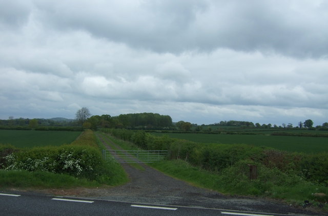
Nature enthusiasts will appreciate the surrounding countryside, as Haselor offers easy access to scenic walking paths and cycling routes. The village is encircled by rolling hills, lush meadows, and meandering streams, providing ample opportunities for outdoor recreation and exploration.

While Haselor lacks its own shops or amenities, it benefits from its proximity to nearby towns and villages, such as Alcester and Stratford-upon-Avon, where residents can find a range of services, including schools, shops, and healthcare facilities.

Overall, Haselor offers a quaint and idyllic village lifestyle, perfect for those seeking a peaceful retreat in the heart of Warwickshire's countryside.

If you have any feedback on the listing, please let us know in the comments section below.

Haselor Images

Images are sourced within 2km of 52.214944/-1.82288 or Grid Reference SP1257. Thanks to Geograph Open Source API. All images are credited.

Lay-by on the A46 Looking in the direction of Stratford upon Avaon.
Lay-by on the A46
Looking in the direction of Stratford upon Avaon.
Great Alne Road to Little Alne
A46 heading west  Near Haselor Lodge.
A46 heading west
Near Haselor Lodge.
A46 approaching crossroads Junctions to Haselor and Temple Grafton,
A46 approaching crossroads
Junctions to Haselor and Temple Grafton,
A46 Stratford Road Towards Alcester.
A46 Stratford Road
Towards Alcester.
A46 near Oversley Wood Towards Alcester.
A46 near Oversley Wood
Towards Alcester.
Crop field, Red Hill Looking south from Stratford Road (A46).
Crop field, Red Hill
Looking south from Stratford Road (A46).
Stratford Road (A46) Looking north west.
Stratford Road (A46)
Looking north west.
Gated track (bridleway) to Haselor Off Stratford Road (A46).
Gated track (bridleway) to Haselor
Off Stratford Road (A46).
Red Hill Wood View over a crop field near Barley Leys Farm.
Red Hill Wood
View over a crop field near Barley Leys Farm.
Minor road towards Binton Looking south near Barley Leys Farm.
Minor road towards Binton
Looking south near Barley Leys Farm.
Oilseed rape crop off Stratford Road (A46)
Junction of minor road with Stratford Road (A46)
Fields towards West Grove Wood
Stratford Road (A46) Looking north west - direction Alcester.
Stratford Road (A46)
Looking north west - direction Alcester.
Gated field entrance beside Alcock's Arbour (woodland) Off Stratford Road (A46).
Gated field entrance beside Alcock's Arbour (woodland)
Off Stratford Road (A46).
A46 towards Worcester Looking north west on Stratford Road (A46).
A46 towards Worcester
Looking north west on Stratford Road (A46).
Oversley Wood Woodland beside the A46.
Oversley Wood
Woodland beside the A46.
Show me another place!

Haselor is located at Grid Ref: SP1257 (Lat: 52.214944, Lng: -1.82288)

Administrative County: Warwickshire

District: Stratford-on-Avon

Police Authority: Warwickshire

What 3 Words

///lecturers.easygoing.lease. Near Alcester, Warwickshire

Nearby Locations

Haselor Upton Haselor

Related Wikis

Upton, Warwickshire

Upton is a village in south-west Warwickshire, England. It is just off the A46, between Alcester and Stratford-upon-Avon, about a mile east of Alcester...

Haselor

Haselor is a village in Warwickshire. It is by the River Alne, about one mile east of Alcester just off the A46 main road to Stratford-upon-Avon. The...

Walcote, Warwickshire

Walcote is a small village in Warwickshire, England, one mile south of the Ancient Roman market town of Alcester. It consists of just seventeen dwellings...

Great Alne railway station

Great Alne Railway Station was a station in the village of Great Alne in Warwickshire on the Great Western Railway line from Alcester, Warwickshire to...

Kinwarton Dovecote

Kinwarton Dovecote is circular 14th-century dovecote situated on the edge of the village of Kinwarton, near Alcester, Warwickshire, England. The dovecote...

Alne End

Alne End is a village in Warwickshire, England. Population details can be found under Great Alne.

Alcester Academy

Alcester Academy (formerly known as Alcester High School Technology College) is a state secondary school that educates girls and boys aged between 11 and...

Alcester Town F.C.

Alcester Town Football Club is a football club based in Alcester, Warwickshire, England. They are currently members of the Midland League Division Two...

Nearby Amenities

Located within 500m of 52.214944,-1.82288
Public Transport: stop_position
Source: Warwicks CC Aerial Imagery 2013
Lat/Long: 52.2187397/-1.8254856
Haselor
Note: Historically Haselor is the part to the north of Pelham Brook, with Walcote being part of Haselor (and both being in Haselor parish). Upton lies south of the brook.
Note2: Today road signs imply two villages - Haselor and Walcote - whilst the name Upton is not used
Place: village
Source: NPE
Wikidata: Q1933239
Wikipedia: en:Haselor
Lat/Long: 52.2170662/-1.8217515
Bus Stop
Crown Inn
Bus: yes
Naptan AtcoCode: 4200F026900
Naptan Bearing: N
Naptan CommonName: Crown Inn
Naptan Indicator: Adj
Naptan Landmark: Crown Inn
Naptan NaptanCode: wardgmtg
Naptan Street: Pelham Lane
Naptan Verified: no
Public Transport: platform
Source: naptan_import
Lat/Long: 52.2174923/-1.8242881
Haselor School
Naptan AtcoCode: 4200F164200
Naptan Bearing: S
Naptan BusStopType: CUS
Naptan CommonName: Haselor School
Naptan Indicator: Opp
Naptan Landmark: Haselor School
Naptan NaptanCode: wardgwpa
Naptan Street: Pelham Lane
Naptan Verified: no
Source: naptan_import
Lat/Long: 52.2187413/-1.825427
Bus Stop
Haselor School
Bus: yes
Naptan AtcoCode: 4200F164201
Naptan Bearing: N
Naptan CommonName: Haselor School
Naptan Indicator: Adj
Naptan Landmark: Haselor School
Naptan NaptanCode: warajpaw
Naptan Street: Pelham Lane
Naptan Verified: no
Public Transport: platform
Source: naptan_import
Lat/Long: 52.2187348/-1.8255319
Turning Circle
Lat/Long: 52.216777/-1.8194703
Barrier: stile
Lat/Long: 52.2174428/-1.8219954
Upton
Note: Historically Haselor is the part to the north of Pelham Brook, with Walcote being part of Haselor (and both being in Haselor parish). Upton lies south of the brook.
Note2: Today road signs imply two villages - Haselor and Walcote - whilst the name Upton is not used
Place: village
Wikidata: Q9366939
Wikipedia: en:Upton, Warwickshire
Lat/Long: 52.2163898/-1.8255049
Barrier: stile
Lat/Long: 52.2162637/-1.8202719
Bench
Backrest: yes
Material: wood
Lat/Long: 52.2168758/-1.8236643
Barrier: stile
Lat/Long: 52.218528/-1.8203498
Barrier: kissing_gate
Lat/Long: 52.2189673/-1.8203512
Entrance: yes
Lat/Long: 52.2190463/-1.8202104
Note: Sapling trees in this fenced off area.
Lat/Long: 52.2182281/-1.8199424
Bench
Source: survey
Lat/Long: 52.2168439/-1.8237767
Barrier: kissing_gate
Lat/Long: 52.216279/-1.8189869
Post Box
Collection Times: Mo-Fr 16:00; Sa 08:00
Operator: Royal Mail
Post Box Type: wall
Ref: B49 83
Royal Cypher: GVIR
Royal Cypher Wikidata: Q33102169
Source: survey
Lat/Long: 52.2170427/-1.8240576
Telephone
Defibrillator
Booth: K6
Covered: booth
Defibrillator Location: inside red phone box, Croft Lane, Haselor
Emergency: defibrillator
Man Made: telephone_box
Ref GB The Circuit: BFA71654-475F-4C45-935D-DCBEBB5B9371
Lat/Long: 52.2177802/-1.8244094
Power: pole
Ref: 773947
Transformer: distribution
Lat/Long: 52.2191215/-1.8249106
Power: pole
Source: bing
Lat/Long: 52.2190007/-1.8239182
Power: pole
Ref: 773955
Source: wpd_opendata
Transformer: distribution
Lat/Long: 52.2145292/-1.8218154
Power: pole
Source: bing
Lat/Long: 52.2149253/-1.8207479
Power: pole
Source: bing
Lat/Long: 52.2152589/-1.8198761
Power: pole
Source: bing
Lat/Long: 52.2156895/-1.8200746
Power: pole
Ref: 773954
Source: wpd_opendata
Transformer: distribution
Lat/Long: 52.216102/-1.8202731
Power: pole
Source: bing
Lat/Long: 52.2165358/-1.8209571
Power: pole
Source: bing
Lat/Long: 52.2169647/-1.8216705
Power: pole
Source: bing
Lat/Long: 52.2174199/-1.8223947
Power: pole
Source: bing
Lat/Long: 52.2178455/-1.8230277
Power: pole
Source: bing
Lat/Long: 52.2184404/-1.8229151
Power: pole
Source: bing
Lat/Long: 52.2190303/-1.8228292
The data included in this document is from www.openstreetmap.org. The data is made available under ODbL.

Have you been to Haselor?

Leave your review of Haselor below (or comments, questions and feedback).