The Common
Downs, Moorland in Gloucestershire Cotswold
England
The Common

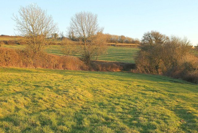
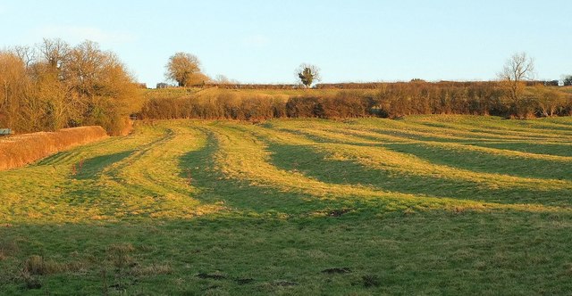
The Common, located in Gloucestershire, England, is a picturesque area known for its diverse landscape consisting of downs and moorland. Spanning approximately 500 acres, this vast expanse of natural beauty offers a unique blend of rolling hills, open grasslands, and heathland.
The downs of The Common are characterized by their gently sloping hills, covered in lush green grasses and scattered with wildflowers. These areas provide ideal grazing grounds for various livestock, such as sheep and cattle, which can often be seen peacefully grazing on the open fields.
In contrast, the moorland sections of The Common display a more rugged and wild terrain. Here, visitors can witness the spectacle of heather-covered hills, interspersed with patches of gorse and bracken. These areas are home to a rich variety of wildlife, including birds of prey, such as kestrels and buzzards, as well as various species of small mammals like rabbits and voles.
The Common offers a multitude of walking trails, providing visitors with the opportunity to explore the enchanting landscape at their own pace. The views from the higher points of The Common are particularly breathtaking, offering panoramic vistas of the surrounding countryside.
The Common, Gloucestershire, is a haven for nature lovers and outdoor enthusiasts alike, offering a serene and tranquil escape from the bustling city life. Whether it's a leisurely stroll, birdwatching, or simply enjoying the peaceful ambiance, The Common provides a truly idyllic setting for visitors to immerse themselves in the beauty of nature.
If you have any feedback on the listing, please let us know in the comments section below.
The Common Images
Images are sourced within 2km of 51.865448/-1.7311542 or Grid Reference SP1818. Thanks to Geograph Open Source API. All images are credited.


The Common is located at Grid Ref: SP1818 (Lat: 51.865448, Lng: -1.7311542)
Administrative County: Gloucestershire
District: Cotswold
Police Authority: Gloucestershire
What 3 Words
///fidgeted.reheat.responses. Near Bourton on the Water, Gloucestershire
Nearby Locations
Related Wikis

River Dikler
The River Dikler is a short river in the Cotswold District of Gloucestershire which flows for 12 kilometres (7.5 mi) through Upper Swell and to the west...

Great Rissington
Great Rissington is a village in the Cotswold district of Gloucestershire, England. The population taken at the 2011 census was 367. == History == In the...

Little Rissington
Little Rissington is a village and civil parish about 3+1⁄2 miles (6 km) south of Stow-on-the-Wold in the Cotswold District of Gloucestershire, England...

RAF Little Rissington
Royal Air Force Little Rissington or more simply RAF Little Rissington (ICAO: EGVL) is an Royal Air Force satellite station in Gloucestershire, England...

Upper Rissington
Upper Rissington is a village and civil parish in the Cotswold district of Gloucestershire, England. It is located about two-and-a-half miles east of Bourton...

Bourton Rovers F.C.
Bourton Rovers Football Club is a football club based in Bourton-on-the-Water, Gloucestershire, England. Affiliated to the Gloucestershire County Football...
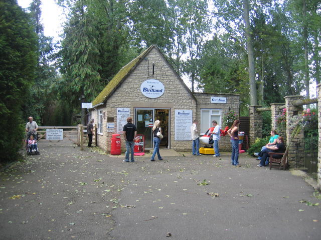
Birdland Park and Gardens
Birdland Park and Gardens, often called Birdland, is a wildlife park in Bourton-on-the-Water, Gloucestershire, England. First opened in 1957, the park...

River Eye, Gloucestershire
The River Eye is a short river in the Cotswold District of Gloucestershire which flows for 7.6 kilometres (4.7 mi) through the villages of Upper Slaughter...
Nearby Amenities
Located within 500m of 51.865448,-1.7311542Have you been to The Common?
Leave your review of The Common below (or comments, questions and feedback).