Saltwick Moor

Downs, Moorland in Northumberland

England

Saltwick Moor

Newly Built Housing, St Mary Lane Taken from the car park of St Mary's Inn
Newly Built Housing, St Mary Lane Credit: Philip Cornwall

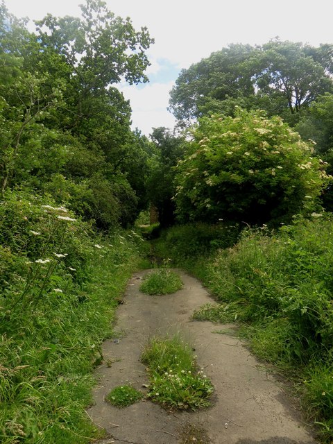
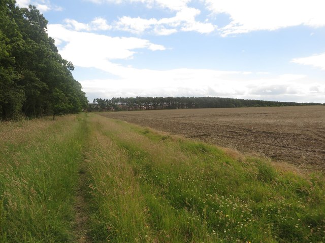
Saltwick Moor is a picturesque area located in the county of Northumberland, England. It is situated near the village of Saltwick, approximately 8 miles northeast of Alnwick. This expansive moorland covers an area of around 3 square kilometers and is characterized by its rolling hills, open grassland, and scattered patches of heather.

The landscape of Saltwick Moor is predominantly flat, with gentle slopes and a few small streams running through it. The soil is mainly peaty, which contributes to the unique flora found in the area. The moor is home to a diverse range of plant species, including cotton grass, bilberry, heather, and various sedges. These plants provide a vibrant splash of color during the summer months.

Saltwick Moor is also known for its rich birdlife. The open grassland and wetland areas attract a variety of species, including lapwings, curlews, skylarks, and meadow pipits. The moorland is an important breeding ground for many of these birds, and it is also a popular spot for birdwatching enthusiasts.

The moorland is intersected by several footpaths and tracks, making it accessible for walkers and hikers. The area offers stunning views of the surrounding Northumberland countryside, including the Cheviot Hills in the distance. Visitors can enjoy peaceful walks, picnics, or simply take in the tranquility of the moor.

Overall, Saltwick Moor is a beautiful and ecologically diverse area that showcases the natural beauty of Northumberland's countryside. Its open grassland, heather-covered hills, and abundant birdlife make it a must-visit destination for nature lovers and outdoor enthusiasts.

If you have any feedback on the listing, please let us know in the comments section below.

Saltwick Moor Images

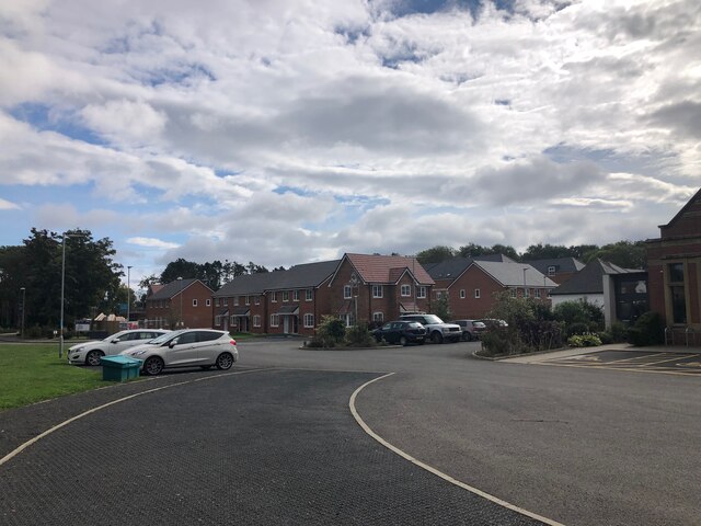
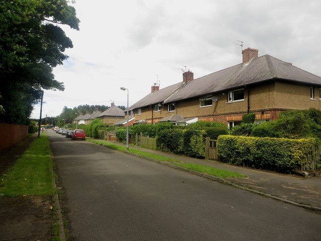
Images are sourced within 2km of 55.127265/-1.7268855 or Grid Reference NZ1781. Thanks to Geograph Open Source API. All images are credited.

Newly Built Housing, St Mary Lane Taken from the car park of St Mary's Inn
Newly Built Housing, St Mary Lane
Taken from the car park of St Mary's Inn
Arable field at West Duddo An arable field at West Duddo in which a field of wheat is ripening before harvest.
Arable field at West Duddo
An arable field at West Duddo in which a field of wheat is ripening before harvest.
Arable land close to Gubeon Farm Arable fields close to Gubeon Farm. In the middle of the field is a single tree, surrounded by a crop of wheat.
Arable land close to Gubeon Farm
Arable fields close to Gubeon Farm. In the middle of the field is a single tree, surrounded by a crop of wheat.
Postbox, Gubeon Plantations A postbox on the quiet section of road through Gubeon Plantations. Hidden in the plantations on either side of the road are a number of large houses, each with spacious grounds and most are hidden from the road.
Postbox, Gubeon Plantations
A postbox on the quiet section of road through Gubeon Plantations. Hidden in the plantations on either side of the road are a number of large houses, each with spacious grounds and most are hidden from the road.
Road through Gubeon Plantations A minor road passes through Gubeon Plantations. Hidden amongst the plantations are several large private dwellings.
Road through Gubeon Plantations
A minor road passes through Gubeon Plantations. Hidden amongst the plantations are several large private dwellings.
Public bridleway towards Stannington Looking along a public bridleway which starts well surfaced but quickly turns muddy.
Public bridleway towards Stannington
Looking along a public bridleway which starts well surfaced but quickly turns muddy.
Old wall, Tranwell Airfield Looking across the corner of an arable field at a section of old wall. The large scale of the section of wall suggests that it was once part of a larger structure, probably a building, which was associated with Tranwell Airfield.
Old wall, Tranwell Airfield
Looking across the corner of an arable field at a section of old wall. The large scale of the section of wall suggests that it was once part of a larger structure, probably a building, which was associated with Tranwell Airfield.
Field edge bridleway Looking along a public bridleway which follows the edge of an arable field (fallow in this photograph) towards Stannington.
Field edge bridleway
Looking along a public bridleway which follows the edge of an arable field (fallow in this photograph) towards Stannington.
Fallow arable field at North Saltwick A flat arable field at North Saltwick has been left uncropped this season.
Fallow arable field at North Saltwick
A flat arable field at North Saltwick has been left uncropped this season.
New homes, Stannington Park, Stannington New homes which have been built as part of a large housing development on the site of the former St Mary's Hospital, which was originally built as the Gateshead County Lunatic Asylum in the late 19th Century and closed as a hospital in 1996.
New homes, Stannington Park, Stannington
New homes which have been built as part of a large housing development on the site of the former St Mary's Hospital, which was originally built as the Gateshead County Lunatic Asylum in the late 19th Century and closed as a hospital in 1996.
New houses, Stannington Park Some of the new houses which have been built on the site of St Mary's Hospital near Stannington by developer Bellway.
New houses, Stannington Park
Some of the new houses which have been built on the site of St Mary's Hospital near Stannington by developer Bellway.
Public bridleway, Stannington Park A muddy public bridleway through a narrow wooded area on the edge of the Stannington Park housing development.
Public bridleway, Stannington Park
A muddy public bridleway through a narrow wooded area on the edge of the Stannington Park housing development.
New houses, Stannington Park development A few of the new houses recently completed as part of the Stannington Park housing development on the site of the former St Mary's Hospital.
New houses, Stannington Park development
A few of the new houses recently completed as part of the Stannington Park housing development on the site of the former St Mary's Hospital.
The Villas, Stannington A street of semi detached houses close to the site of the former St Mary's Hospital which is now being developed into a housing estate.
The Villas, Stannington
A street of semi detached houses close to the site of the former St Mary's Hospital which is now being developed into a housing estate.
Entrance into Stannington Park The main entrance into the Stannington Park housing development. The development is taking place on the site of the former St Mary's Hospital, which was originally built in the late 19th Century as the County Asylum for Gateshead. The house by the entrance appears to be the one in <a href="https://www.geograph.org.uk/photo/91273">NZ1881 : Entrance to St Mary's Hospital (disused), North Saltwick</a> which has been given a new lease of life.
Entrance into Stannington Park
The main entrance into the Stannington Park housing development. The development is taking place on the site of the former St Mary's Hospital, which was originally built in the late 19th Century as the County Asylum for Gateshead. The house by the entrance appears to be the one in NZ1881 : Entrance to St Mary's Hospital (disused), North Saltwick which has been given a new lease of life.
Bet's Lane between Stannington and Tranwell Looking north along the named country lane between Stannington and Tranwell.
Bet's Lane between Stannington and Tranwell
Looking north along the named country lane between Stannington and Tranwell.
Bus shelter, Well Hill farm A bus shelter at Well Hill Farm on the minor road between Stannington and Tranwell. The shelter is located near to the end of the road which leads to Whitehouse Farm Centre and also the site of a former children's sanatorium, latterly a hospital, which is perhaps when this shelter dates from.
Bus shelter, Well Hill farm
A bus shelter at Well Hill Farm on the minor road between Stannington and Tranwell. The shelter is located near to the end of the road which leads to Whitehouse Farm Centre and also the site of a former children's sanatorium, latterly a hospital, which is perhaps when this shelter dates from.
Water tower north of Well Hill A water tower stands beside the road to the north of Well Hill.
Water tower north of Well Hill
A water tower stands beside the road to the north of Well Hill.
Show me another place!

Saltwick Moor is located at Grid Ref: NZ1781 (Lat: 55.127265, Lng: -1.7268855)

Unitary Authority: Northumberland

Police Authority: Northumbria

What 3 Words

///stored.master.ballparks. Near Stannington, Northumberland

Related Wikis

Tranwell Airfield

Tranwell Airfield is a former airfield located 3.3 miles (5.3 km) southwest of Morpeth and 11.5 miles (18.5 km) north west of Newcastle upon Tyne, Tyne...

St. Mary's Park, Northumberland

St Mary’s Park is a housing estate which is being developed in the civil parish of Stannington near Morpeth, Northumberland, England. It is located about...

St Mary's Hospital, Stannington

St Mary's Hospital was a mental health facility near Stannington, Northumberland, England. It was opened in 1910 and closed permanently in 1995. It was...

Stannington Sanatorium

Stannington Sanatorium was the first purpose-built children's tuberculosis sanatorium in the UK which officially opened on 5 October 1907 near to the village...

Nearby Amenities

Located within 500m of 55.127265,-1.7268855
Noexit: yes
Lat/Long: 55.1272807/-1.7198436
Noexit: yes
Lat/Long: 55.1273365/-1.7199263
Noexit: yes
Lat/Long: 55.1266032/-1.7202188
Noexit: yes
Lat/Long: 55.1267117/-1.720085
Noexit: yes
Lat/Long: 55.1250275/-1.7201757
The data included in this document is from www.openstreetmap.org. The data is made available under ODbL.

Have you been to Saltwick Moor?

Leave your review of Saltwick Moor below (or comments, questions and feedback).