Aydon Forest (Outer)

Downs, Moorland in Northumberland

England

Aydon Forest (Outer)

Old Rugley The lane to the A1 passes a side lane to Rugley House and drops past Old Rugley to the valley of the Firth Burn, after which it passes the plantation on the right.
Old Rugley Credit: Derek Harper

Aydon Forest (Outer) is a charming area located in Northumberland, England. Situated in the Downs and Moorland region, it offers visitors a picturesque setting with its diverse landscape and natural beauty.

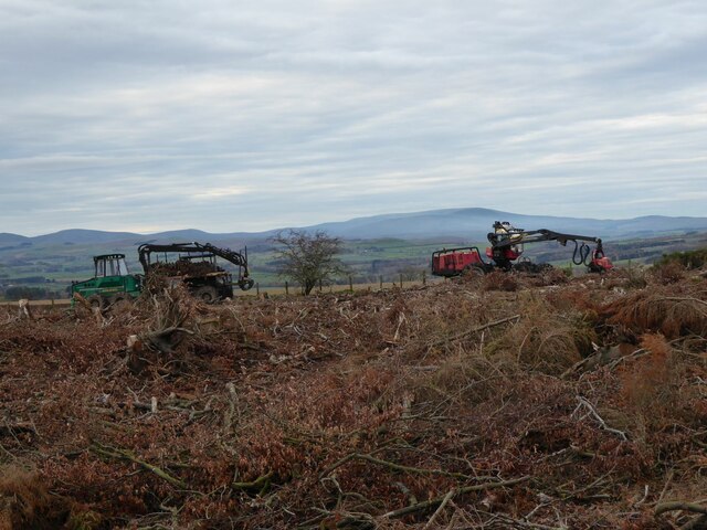
Covering an area of approximately 5 square miles, Aydon Forest showcases a variety of habitats, including woodlands, heathland, and open moorland. The forest is home to an array of flora and fauna, making it a haven for nature enthusiasts and wildlife lovers.

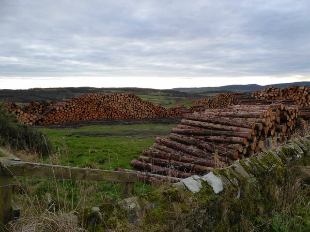
The woodland section of Aydon Forest is characterized by dense trees, predominantly oak and birch, which provide a sheltered environment for numerous bird species and small mammals. Walking through this section of the forest, visitors can enjoy the tranquility and peacefulness that nature has to offer.

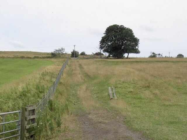
The heathland in Aydon Forest is a distinctive feature, with its open spaces and vibrant purple heather that blooms during the summer months. It is a perfect spot for a leisurely stroll or a picnic while taking in the breathtaking views of the surrounding countryside.

Aydon Forest's open moorland is a striking sight, with its vast expanses of rolling hills and rugged terrain. This area is known for its unique plant species, such as cotton grass and bilberries, which thrive in the acidic soil. The moorland also provides a habitat for a variety of bird species, including curlews and lapwings.

Overall, Aydon Forest (Outer) in Northumberland offers visitors a chance to immerse themselves in the beauty of nature. With its diverse landscapes and abundant wildlife, it is a destination that is sure to captivate and inspire all who venture into its enchanting surroundings.

If you have any feedback on the listing, please let us know in the comments section below.

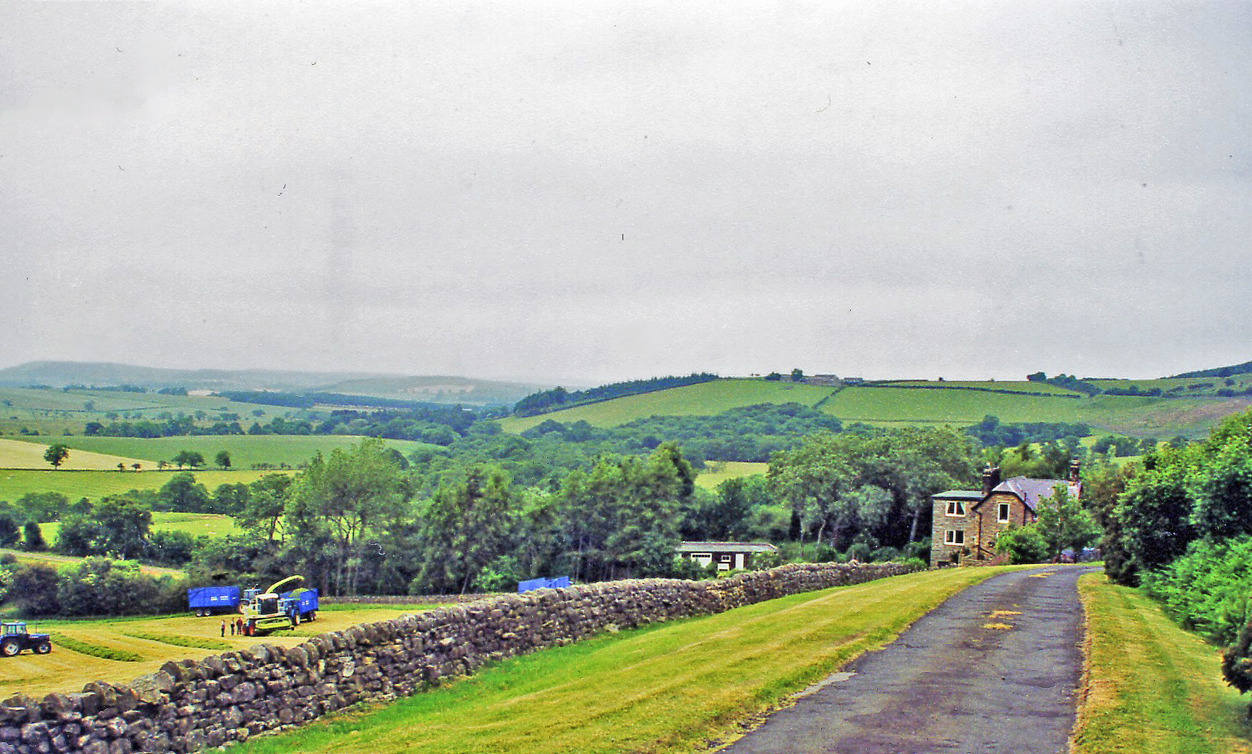
Aydon Forest (Outer) Images

Images are sourced within 2km of 55.395581/-1.7617319 or Grid Reference NU1511. Thanks to Geograph Open Source API. All images are credited.

Old Rugley The lane to the A1 passes a side lane to Rugley House and drops past Old Rugley to the valley of the Firth Burn, after which it passes the plantation on the right.
Old Rugley
The lane to the A1 passes a side lane to Rugley House and drops past Old Rugley to the valley of the Firth Burn, after which it passes the plantation on the right.
Farmland south of St Margaret's Farm
St Margaret's Farm This farmhouse occupies a commanding position on Alnwick Moor.
St Margaret's Farm
This farmhouse occupies a commanding position on Alnwick Moor.
Ruined barn at the top of Rugley Road This barn has lost its roof in the last five years - see <a href="https://www.geograph.org.uk/photo/3398706">NU1609 : Farm building / animal shelter</a>. Beyond the Northumbrian countryside stretches down to the sea.
Ruined barn at the top of Rugley Road
This barn has lost its roof in the last five years - see NU1609 : Farm building / animal shelter. Beyond the Northumbrian countryside stretches down to the sea.
Ruined Hemmel
Ruined Hemmel
St Margaret's Farmhouse Impressive extension being built. Now a house and not a farmhouse?
St Margaret's Farmhouse
Impressive extension being built. Now a house and not a farmhouse?
St Margaret's Farmhouse
Moor House
Moor House
Clear felling the triangle of wood The machine on the right, a Valmet 911 harvester, fells, strips and cuts the trees to length, the vehicle on the left loads the cut logs and takes them away. 
The Cheviot on the skyline.
Clear felling the triangle of wood
The machine on the right, a Valmet 911 harvester, fells, strips and cuts the trees to length, the vehicle on the left loads the cut logs and takes them away. The Cheviot on the skyline.
Timber from adjacent clear felling Ready for transportation by road.
We met a lorry and trailerful on the narrow road!
Timber from adjacent clear felling
Ready for transportation by road. We met a lorry and trailerful on the narrow road!
Storm Arwen takes down huge branch  Off a mature beech tree beside track to Cloudy Crags.
Storm Arwen takes down huge branch
Off a mature beech tree beside track to Cloudy Crags.
Timber!! Huge branch torn off solitary beech tree.
See side view <a title="https://www.geograph.org.uk/photo/7154282" href="https://www.geograph.org.uk/photo/7154282">Link</a>
Timber!!
Huge branch torn off solitary beech tree. See side view Link
Vegetated abutment of aqueduct Carrying a small stream over the trackbed of the Alnwick & Cornhill Railway.
To see the aqueduct see <a title="https://www.geograph.org.uk/photo/6325149" href="https://www.geograph.org.uk/photo/6325149">Link</a>
Vegetated abutment of aqueduct
Carrying a small stream over the trackbed of the Alnwick & Cornhill Railway. To see the aqueduct see Link
Fine dry stone wall (apart from the gap!) When the Alnwick & Cornhill Railway was built no expense was spared on the stone work: on bridges, the aqueduct and the walls alongside the track.
Fine dry stone wall (apart from the gap!)
When the Alnwick & Cornhill Railway was built no expense was spared on the stone work: on bridges, the aqueduct and the walls alongside the track.
Oxen Wood has been clear felled Exposing the rocky crags at the top of the slope.
Oxen Wood has been clear felled
Exposing the rocky crags at the top of the slope.
Huge heap of brash from clear felling Oxen Wood This will be 'chipped' and sent for combustion in a power station.
Huge heap of brash from clear felling Oxen Wood
This will be 'chipped' and sent for combustion in a power station.
Crags exposed by the clear felling of Oxen Wood They were not visible from the road before.
Crags exposed by the clear felling of Oxen Wood
They were not visible from the road before.
Farm track, Stouphill
Show me another place!

Aydon Forest (Outer) is located at Grid Ref: NU1511 (Lat: 55.395581, Lng: -1.7617319)

Unitary Authority: Northumberland

Police Authority: Northumbria

What 3 Words

///flock.funds.unstated. Near Alnwick, Northumberland

Nearby Locations

Aydon Forest (Outer)

Related Wikis

RRH Brizlee Wood

Remote Radar Head Brizlee Wood (or RRH Brizlee Wood), is an air defence radar station operated by the Royal Air Force located at Brizlee Wood, near Alnwick...

Lemmington Hall

Lemmington Hall is an 18th-century country mansion incorporating a 15th-century tower house, situated near Edlingham, Northumberland, England. It is a...

Camphill Column, Alnwick

The Camphill Column in Alnwick, Northumberland, is a stone column erected in 1814, celebrating a number of British victories over the French and others...

Abberwick

Abberwick is a hamlet and former civil parish near the River Aln, now in the parish of Edlingham, in the English county of Northumberland. In 1951 the...
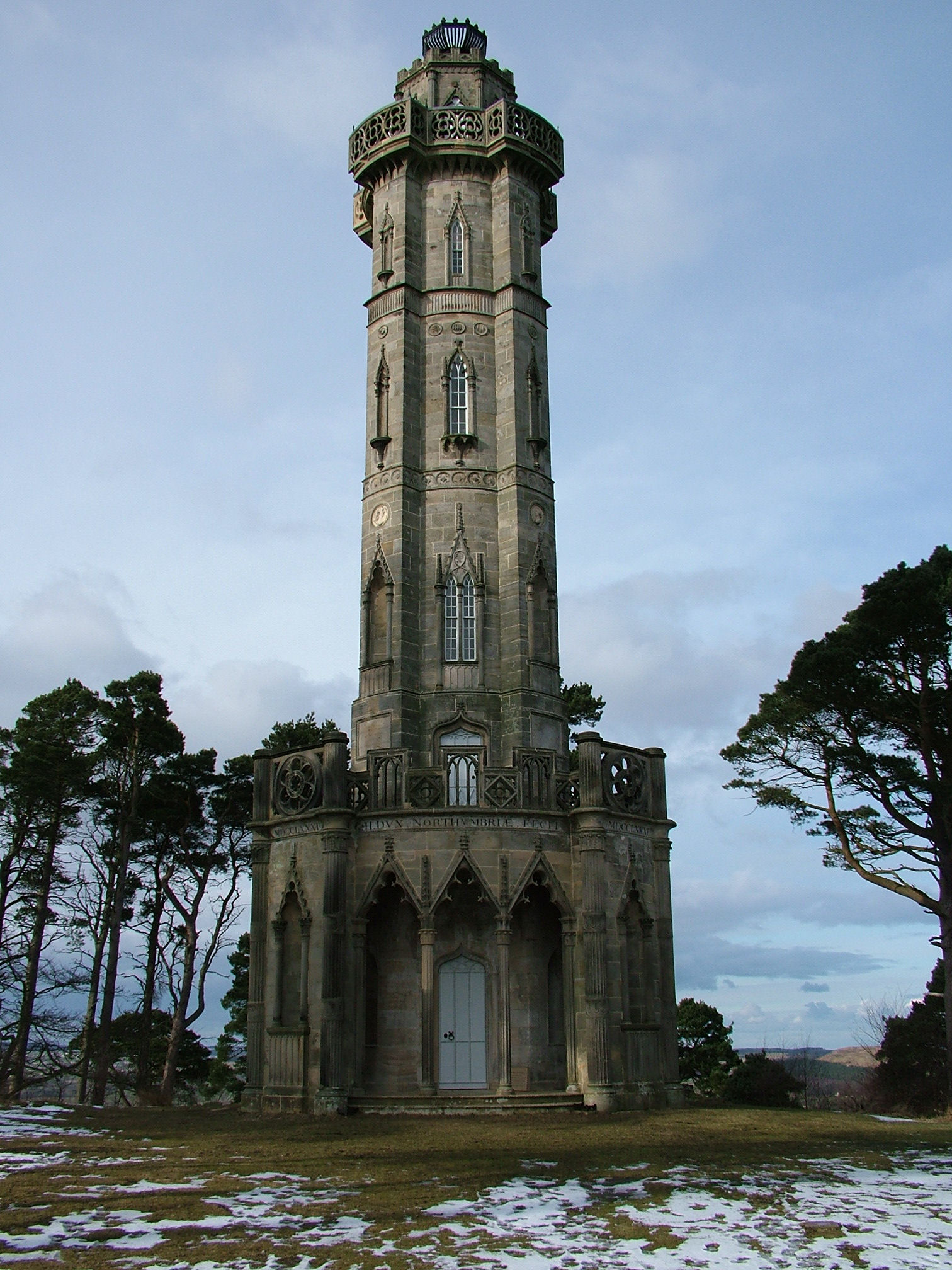
Brizlee Tower

Brizlee Tower (sometimes Brislee Tower) is a Grade 1 listed folly set atop a hill in Hulne Park, the walled home park of the Duke of Northumberland in...

Battle of Alnwick (1174)

The Battle of Alnwick (1174) is one of two battles fought near the town of Alnwick, in Northumberland, England. In the battle, which took place on 13 July...

Edlingham railway station

Edlingham railway station served the village of Edlingham, Northumberland, England from 1887 to 1953 on the Cornhill Branch. == History == The station...

Alnwick Abbey

Alnwick Abbey was founded as a Premonstratensian monastery in 1147 by Eustace fitz John near Alnwick, England, as a daughter house of Newhouse Abbey in...

Have you been to Aydon Forest (Outer)?

Leave your review of Aydon Forest (Outer) below (or comments, questions and feedback).