Rockley Down

Downs, Moorland in Wiltshire

England

Rockley Down

Preshute Down, Wiltshire Looking over farmland in the vicinity of Preshute Down.
Preshute Down, Wiltshire Credit: Rebecca A Wills

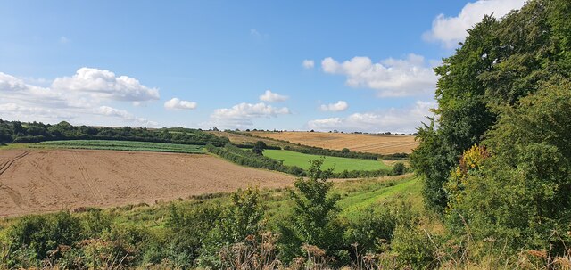
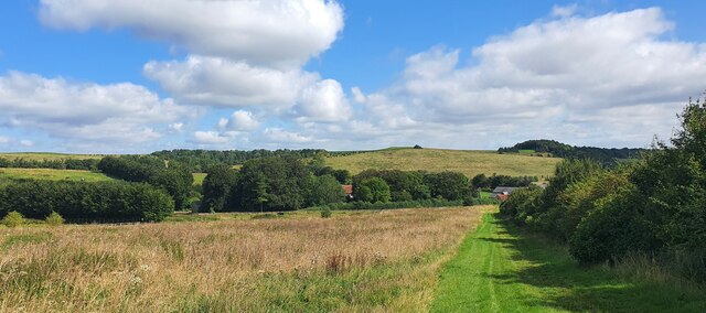
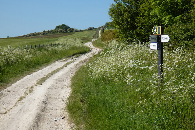
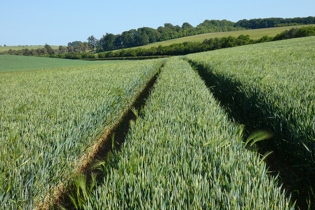
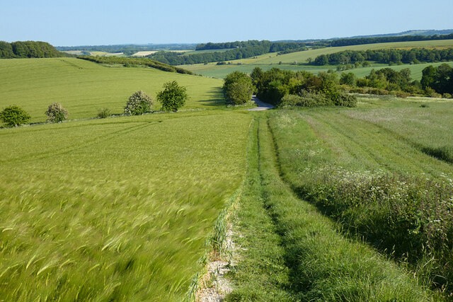
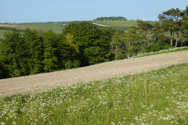
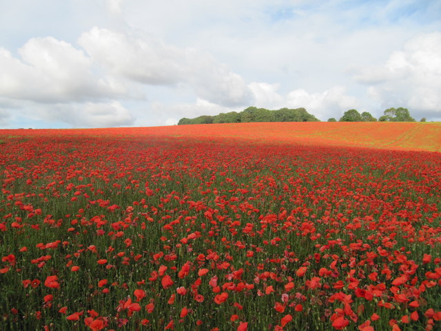
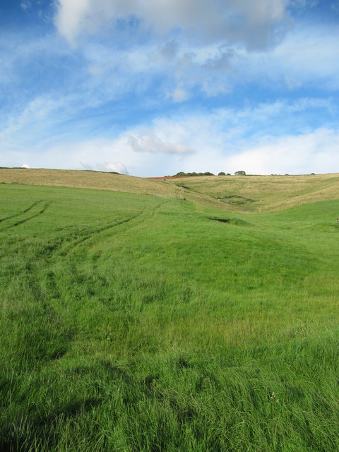
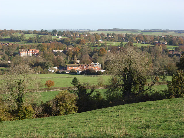
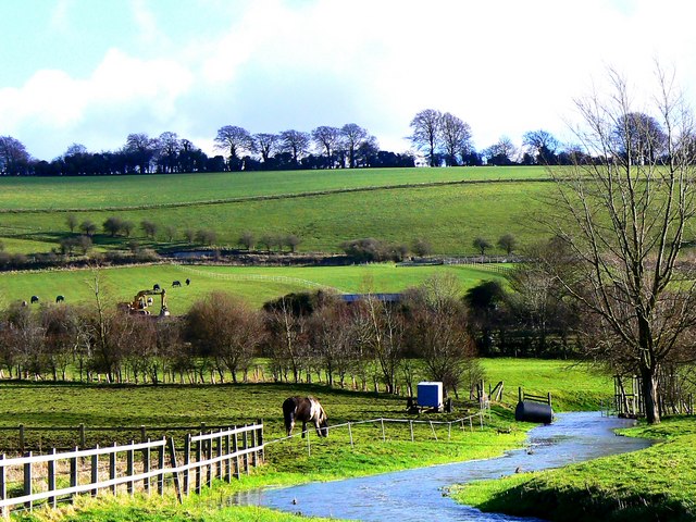
Rockley Down is a picturesque area located in the county of Wiltshire, England. Situated amidst the stunning landscapes of the Downs and Moorland, it is a popular destination for nature enthusiasts and hikers alike. The region is characterized by rolling hills, vast open spaces, and breathtaking views that stretch as far as the eye can see.

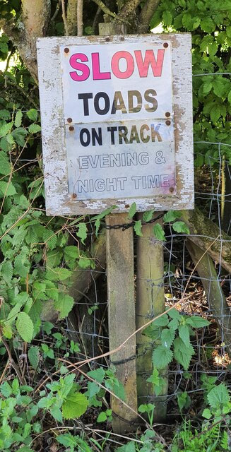
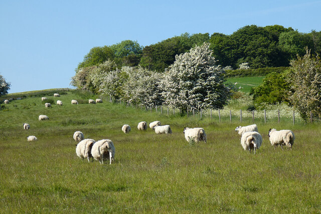
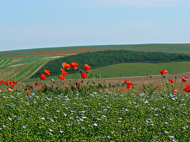
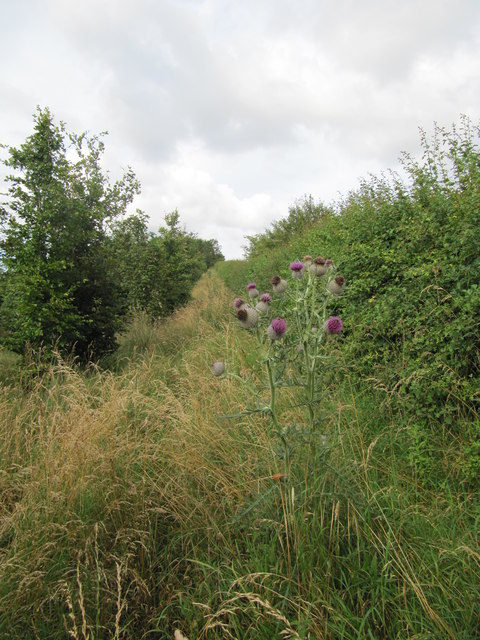
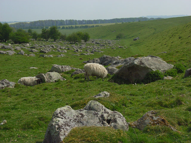
Covered in a patchwork of green fields, Rockley Down is known for its diverse flora and fauna. The area is home to a variety of plant species, including vibrant wildflowers, heather, and gorse bushes. The lush meadows attract an array of wildlife, such as rabbits, foxes, and a wide range of bird species.

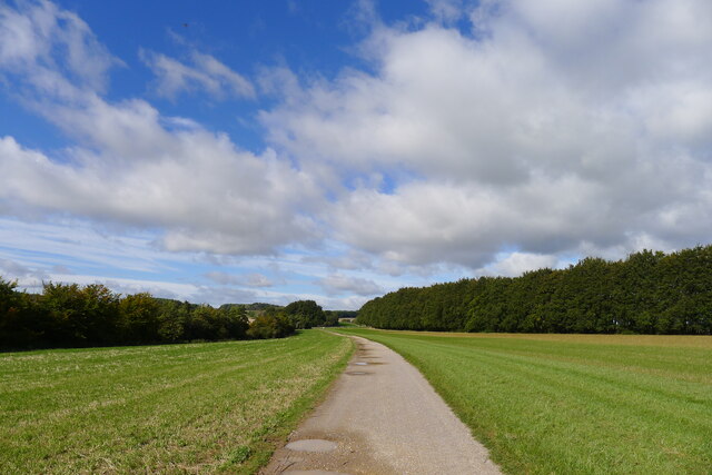
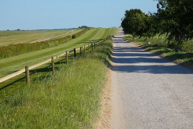
Visitors to Rockley Down can explore the numerous hiking trails that crisscross the area, offering opportunities for peaceful walks and invigorating treks. The downs and moorland provide an ideal setting for outdoor activities, including picnicking, horse riding, and kite flying.

One of the highlights of Rockley Down is its historical significance. The region boasts several ancient burial mounds, known as barrows, which date back to the Bronze Age. These fascinating structures offer glimpses into the area's rich past and provide a unique insight into the lives of its early inhabitants.

Overall, Rockley Down is a captivating destination that combines natural beauty with historical intrigue. Its idyllic landscapes, abundant wildlife, and ancient landmarks make it a must-visit location for those seeking an escape into the tranquility of the English countryside.

If you have any feedback on the listing, please let us know in the comments section below.

Rockley Down Images

Images are sourced within 2km of 51.458957/-1.7849739 or Grid Reference SU1573. Thanks to Geograph Open Source API. All images are credited.

Preshute Down, Wiltshire Looking over farmland in the vicinity of Preshute Down.
Preshute Down, Wiltshire
Looking over farmland in the vicinity of Preshute Down.
Wick Down, Wiltshire An interesting sign on the side of a bridleway on Wick Down.
Wick Down, Wiltshire
An interesting sign on the side of a bridleway on Wick Down.
Rough Hill, Wiltshire Looking over farmland towards Temple Bottom from Rough Hill.
Rough Hill, Wiltshire
Looking over farmland towards Temple Bottom from Rough Hill.
Wick Down Farm, Wiltshire Looking towards Wick Down Farm from Rough Hill.
Wick Down Farm, Wiltshire
Looking towards Wick Down Farm from Rough Hill.
Thames Water's Totterdown Reservoir A confusion of 'downs' in this area - Totterdown, Fyfield Down, Clatford Down, Manton Down
Thames Water's Totterdown Reservoir
A confusion of 'downs' in this area - Totterdown, Fyfield Down, Clatford Down, Manton Down
The Wessex Ridgeway path on Clatford Down This track is also known as 'Herepath' or 'Green Street'; the former an Old English term for a military road ('here' = army <span class="nowrap"><a title="https://www.st-andrews.ac.uk/~cr30/vocabulary/" rel="nofollow ugc noopener" href="https://www.st-andrews.ac.uk/~cr30/vocabulary/">Link</a><img style="margin-left:2px;" alt="External link" title="External link - shift click to open in new window" src="https://s1.geograph.org.uk/img/external.png" width="10" height="10"/></span> ).
The Wessex Ridgeway path on Clatford Down
This track is also known as 'Herepath' or 'Green Street'; the former an Old English term for a military road ('here' = army LinkExternal link ).
The Wessex Ridgeway path on Manton Down On the Manton Park racehorse training estate.
The Wessex Ridgeway path on Manton Down
On the Manton Park racehorse training estate.
Byway, Ogbourne St Andrew The route climbing to Barbury Castle from Marlborough,
Byway, Ogbourne St Andrew
The route climbing to Barbury Castle from Marlborough,
Pasture, Ogbourne St Andrew Sheep in a field below the Four Mile Clump (four miles from Marlborough).
Pasture, Ogbourne St Andrew
Sheep in a field below the Four Mile Clump (four miles from Marlborough).
Farmland, Ogbourne St Andrew A few barley volunteers in the crop of wheat.
Farmland, Ogbourne St Andrew
A few barley volunteers in the crop of wheat.
Farmland, Ogbourne St Andrew The route taken (in practice) by the bridleway east of Wick Bottom.
Farmland, Ogbourne St Andrew
The route taken (in practice) by the bridleway east of Wick Bottom.
Farmland, Preshute A narrow field and belts of woodland beside the road from Hackpen Hill to Marlborough.
Farmland, Preshute
A narrow field and belts of woodland beside the road from Hackpen Hill to Marlborough.
Byway, Ogbourne St Andrew With a gallop on the Barbury Castle Estate to its left.
Byway, Ogbourne St Andrew
With a gallop on the Barbury Castle Estate to its left.
Traffic on the road to Hackpen Hill, west of Rockley, Wiltshire A beautifully restored 1932 Austin struggles only a little on the incline on its way to Hackpen Hill and its white horse.
Traffic on the road to Hackpen Hill, west of Rockley, Wiltshire
A beautifully restored 1932 Austin struggles only a little on the incline on its way to Hackpen Hill and its white horse.
Poppies and linseed by the road to Hackpen Hill west of Rockley, Wiltshire The blue flowers are linseed. The seedpods they produce can be seen in amongst them. An archive shot of the pods close up: <a href="https://www.geograph.org.uk/photo/968706">SU1471 : Linseed pods, Clatford Down, near Marlborough</a>
Poppies and linseed by the road to Hackpen Hill west of Rockley, Wiltshire
The blue flowers are linseed. The seedpods they produce can be seen in amongst them. An archive shot of the pods close up: SU1471 : Linseed pods, Clatford Down, near Marlborough
Poppies Poppies growing in a field of flax, with Four Mile Clump in the background
Poppies
Poppies growing in a field of flax, with Four Mile Clump in the background
Overgrown footpath Looking north east along little used, and heavily overgrown footpath OSTA35.
Overgrown footpath
Looking north east along little used, and heavily overgrown footpath OSTA35.
View along footpath looking towards Four Mile Clump Looking northeast along the line of footpath OSTA35 from its lower end.  Four Mile Clump is just visible on the horizon.
View along footpath looking towards Four Mile Clump
Looking northeast along the line of footpath OSTA35 from its lower end. Four Mile Clump is just visible on the horizon.
Show me another place!

Rockley Down is located at Grid Ref: SU1573 (Lat: 51.458957, Lng: -1.7849739)

Unitary Authority: Wiltshire

Police Authority: Wiltshire

What 3 Words

///jukebox.sizes.posed. Near Fyfield, Wiltshire

Related Wikis

Fyfield Down

Fyfield Down (grid reference SU136709) is part of the Marlborough Downs, about 1.5 miles (2.4 km) north of the village of Fyfield, Wiltshire. The down...

Barbury Castle

Barbury Castle is a scheduled hillfort in Wiltshire, England. It is one of several such forts found along the ancient Ridgeway route. The site, which lies...

Battle of Beran Byrig

At the Battle of Beran Byrig or Beranburh the West Saxons are said to have defeated the Britons at Barbury Castle Hill Fort near Swindon in the year 556...

Preshute

Preshute is a civil parish immediately west and northwest of Marlborough in Wiltshire, England. Unusually for a Wiltshire parish, it does not take its...

Overton Down

Overton Down Experimental Earthwork (often referred to simply as Overton Down) is a long-term project in experimental archaeology in Wiltshire, England...

The Devil's Den

The Devil's Den or Devil's Den is a dolmen burial chamber on Fyfield Hill near Marlborough, Wiltshire, England. The chamber is part of a neolithic passage...

Ogbourne Maizey

Ogbourne Maizey is a hamlet in Wiltshire, England 1.6 miles (2.6 km) north of the town of Marlborough and 0.4 miles (0.64 km) south of the village of Ogbourne...

Ogbourne St Andrew

Ogbourne St Andrew is a civil parish and small village in Wiltshire, England, 2 miles (3.2 km) north of Marlborough. The parish is on the banks of the...

Nearby Amenities

Located within 500m of 51.458957,-1.7849739
Historic: milestone
Lat/Long: 51.4621332/-1.7833257
The data included in this document is from www.openstreetmap.org. The data is made available under ODbL.

Have you been to Rockley Down?

Leave your review of Rockley Down below (or comments, questions and feedback).