Bradwell Moor

Downs, Moorland in Derbyshire Derbyshire Dales

England

Bradwell Moor

Sheep on old mine workings At the western end of Moss Rake which historically gave up significant amounts of lead and later calcite.
Sheep on old mine workings Credit: Neil Theasby

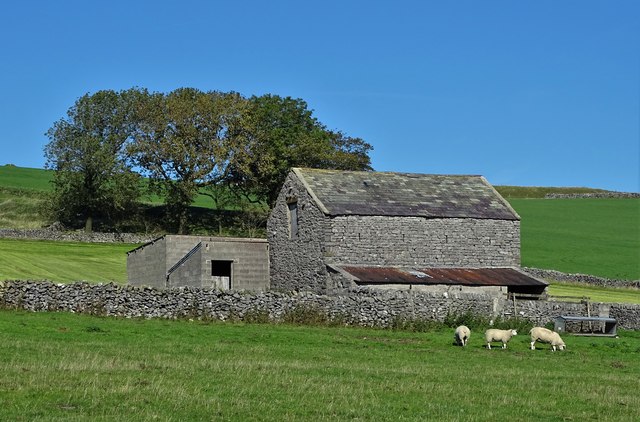
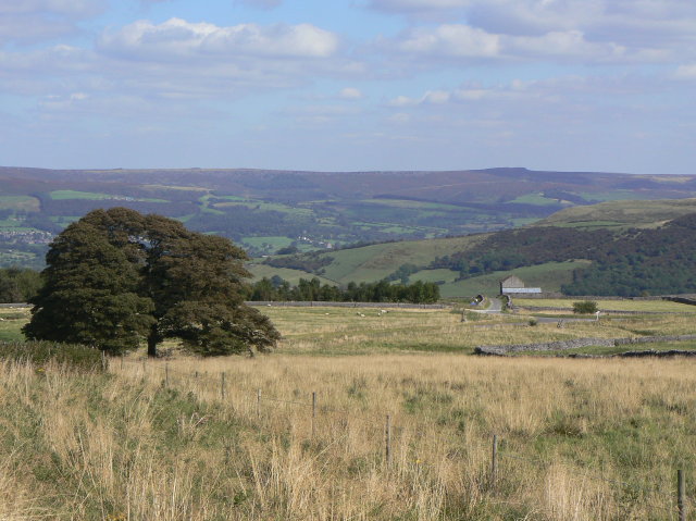
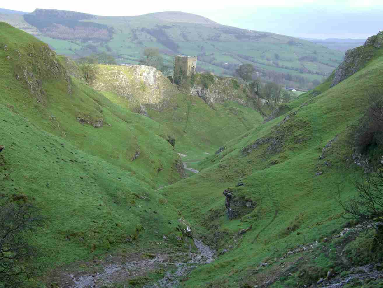
Bradwell Moor is a stunning expanse of moorland located in Derbyshire, England. Situated within the Peak District National Park, this area is known for its rugged beauty and diverse wildlife.

Covering an area of approximately 5 square kilometers, Bradwell Moor is characterized by its rolling hills, heather-covered slopes, and picturesque views of the surrounding countryside. The moor is home to a variety of plant and animal species, including red grouse, curlews, and mountain hares.

Visitors to Bradwell Moor can enjoy a range of outdoor activities, such as hiking, birdwatching, and photography. There are several walking trails that wind their way through the moor, offering opportunities to explore the landscape and spot wildlife.

In addition to its natural beauty, Bradwell Moor also has a rich cultural history. The area is dotted with ancient stone circles, burial mounds, and other archaeological sites, providing a glimpse into the lives of the people who once inhabited this remote corner of Derbyshire.

Overall, Bradwell Moor is a peaceful and scenic destination that offers visitors a chance to escape the hustle and bustle of modern life and immerse themselves in the beauty of the natural world.

If you have any feedback on the listing, please let us know in the comments section below.

Bradwell Moor Images

Images are sourced within 2km of 53.320288/-1.7847525 or Grid Reference SK1480. Thanks to Geograph Open Source API. All images are credited.

Sheep on old mine workings At the western end of Moss Rake which historically gave up significant amounts of lead and later calcite.
Sheep on old mine workings
At the western end of Moss Rake which historically gave up significant amounts of lead and later calcite.
Barn near Wheston House Farm
Limestone Way leaving Cop Farm No doubt this track was familiar to lead miners of the past heading to Cop Mine.
Limestone Way leaving Cop Farm
No doubt this track was familiar to lead miners of the past heading to Cop Mine.
Fresh silage bales near Cop Farm Cop Farm was once simply known as The Cop - and that is how it still appears in OS mapping.
Fresh silage bales near Cop Farm
Cop Farm was once simply known as The Cop - and that is how it still appears in OS mapping.
Moss Rake Track leading to Moss Rake.
Moss Rake
Track leading to Moss Rake.
Wheston House Wheston House Farm.
Wheston House
Wheston House Farm.
The south side of Bradwell Moor Looking down on limestone farmland between Tideswell and Eyam.
The south side of Bradwell Moor
Looking down on limestone farmland between Tideswell and Eyam.
Path up to Bradwell Moor There were once several mines in this area.
Path up to Bradwell Moor
There were once several mines in this area.
The Limestone Way descending to The Cop Part of a descent from Bradwell Moor. The base of the path is quite slippery mud, exacerbated by the effect of mountain bike tyres.
The Limestone Way descending to The Cop
Part of a descent from Bradwell Moor. The base of the path is quite slippery mud, exacerbated by the effect of mountain bike tyres.
Footpath across Tideswell Moor Misty day for a walk.
Footpath across Tideswell Moor
Misty day for a walk.
Batham Gate Along the line of the old Roman road.
Batham Gate
Along the line of the old Roman road.
Shuttle Rake Even at noon, the frozen ground on the north-facing slope of the depression remains untouched by the sun. Looking west up Shuttle Rake towards the old open cast workings.
Shuttle Rake
Even at noon, the frozen ground on the north-facing slope of the depression remains untouched by the sun. Looking west up Shuttle Rake towards the old open cast workings.
Wheston House on Batham Gate Wheston House stands at a sharp bend in the lane which criss-crosses Batham Gate - the course of the old Roman road which runs straight up from near Buxton. The electricity poles behind the house march in a straight line down the course of the old road.
Wheston House on Batham Gate
Wheston House stands at a sharp bend in the lane which criss-crosses Batham Gate - the course of the old Roman road which runs straight up from near Buxton. The electricity poles behind the house march in a straight line down the course of the old road.
Enclosure on Batham Gate. The O/S map indicates an enclosure at this grid reference. Looking into what I expected to be a sheepfold, I discovered this contraption, which I take to be a slurry tank. Storage for liquid manure until it is required for spreading on the fields. Any farming folk out there help me out with this supposition?
Enclosure on Batham Gate.
The O/S map indicates an enclosure at this grid reference. Looking into what I expected to be a sheepfold, I discovered this contraption, which I take to be a slurry tank. Storage for liquid manure until it is required for spreading on the fields. Any farming folk out there help me out with this supposition?
Old workings near Batham Gate Probable lead-mining remains, on the path from Bradwell Moor to The Cop.
Old workings near Batham Gate
Probable lead-mining remains, on the path from Bradwell Moor to The Cop.
Peacocks on Creeping Thistle This plant seems to be very attractive to butterflies (see also <a href="https://www.geograph.org.uk/photo/210511">SK1681 : Painted Lady on Creeping Thistle</a>).
Peacocks on Creeping Thistle
This plant seems to be very attractive to butterflies (see also SK1681 : Painted Lady on Creeping Thistle).
Barn above Wheston House A typical Peak District scene, with traditional limestone barn, dry-stone walls and sheep grazing.
Barn above Wheston House
A typical Peak District scene, with traditional limestone barn, dry-stone walls and sheep grazing.
Old rake, near Wheston House The public footpath, probably not coincidentally, follows a "rake" (a line of pits along a vein of metallic ore) between The Cop and Bradwell Moor.
Old rake, near Wheston House
The public footpath, probably not coincidentally, follows a "rake" (a line of pits along a vein of metallic ore) between The Cop and Bradwell Moor.
Show me another place!

Bradwell Moor is located at Grid Ref: SK1480 (Lat: 53.320288, Lng: -1.7847525)

Administrative County: Derbyshire

District: Derbyshire Dales

Police Authority: Derbyshire

What 3 Words

///pretty.squeezed.hammocks. Near Hope Valley, Derbyshire

Nearby Locations

Bradwell Moor

Related Wikis

Bradwell Moor

Bradwell Moor is a moorland hill above the village of Bradwell, Derbyshire in the Peak District. The summit is 471 metres (1,545 ft) above sea level.Batham...

Titan (cave)

Titan is a natural cavern near Castleton in the Derbyshire Peak District, and is the deepest shaft of any known cave in Britain, at 141.5 metres (464 ft...

Cave Dale

Cave Dale (sometimes spelt Cavedale) is a dry limestone valley in the Derbyshire Peak District, England. It is located at grid reference SK149824. The...

Peak Cavern

The Peak Cavern, also known as the Devil's Arse, is one of the four show caves in Castleton, Derbyshire, England. Peakshole Water flows through and out...

Nearby Amenities

Located within 500m of 53.320288,-1.7847525
Ele: 425
Ele Recorded: 425.2656250
Lat/Long: 53.3171123/-1.7861312
Ele: 423.1027832
Lat/Long: 53.3176879/-1.7824417
Ele: 421.1801758
Lat/Long: 53.3178861/-1.7817755
Ele: 413.9703369
Lat/Long: 53.3192866/-1.7837296
Note: sign for footpath is here and points NE
Lat/Long: 53.3187315/-1.784678
Ele: 415.8929443
Lat/Long: 53.3181676/-1.7803485
Ele: 410.6055908
Lat/Long: 53.3184266/-1.7793495
Ele: 407.0007324
Lat/Long: 53.3185726/-1.7785989
Barrier: stile
Ele: 403.6362305
Note: there is no fence and this sits in isolation. Most poeple follow the track.
Steps: 2
Stile: stepover
Lat/Long: 53.3207797/-1.7792572
Barrier: stile
Material: wood
Source: survey;gps
Stile: stepover
Lat/Long: 53.3208475/-1.778935
The data included in this document is from www.openstreetmap.org. The data is made available under ODbL.

Have you been to Bradwell Moor?

Leave your review of Bradwell Moor below (or comments, questions and feedback).