Covill House Moor
Downs, Moorland in Yorkshire Harrogate
England
Covill House Moor

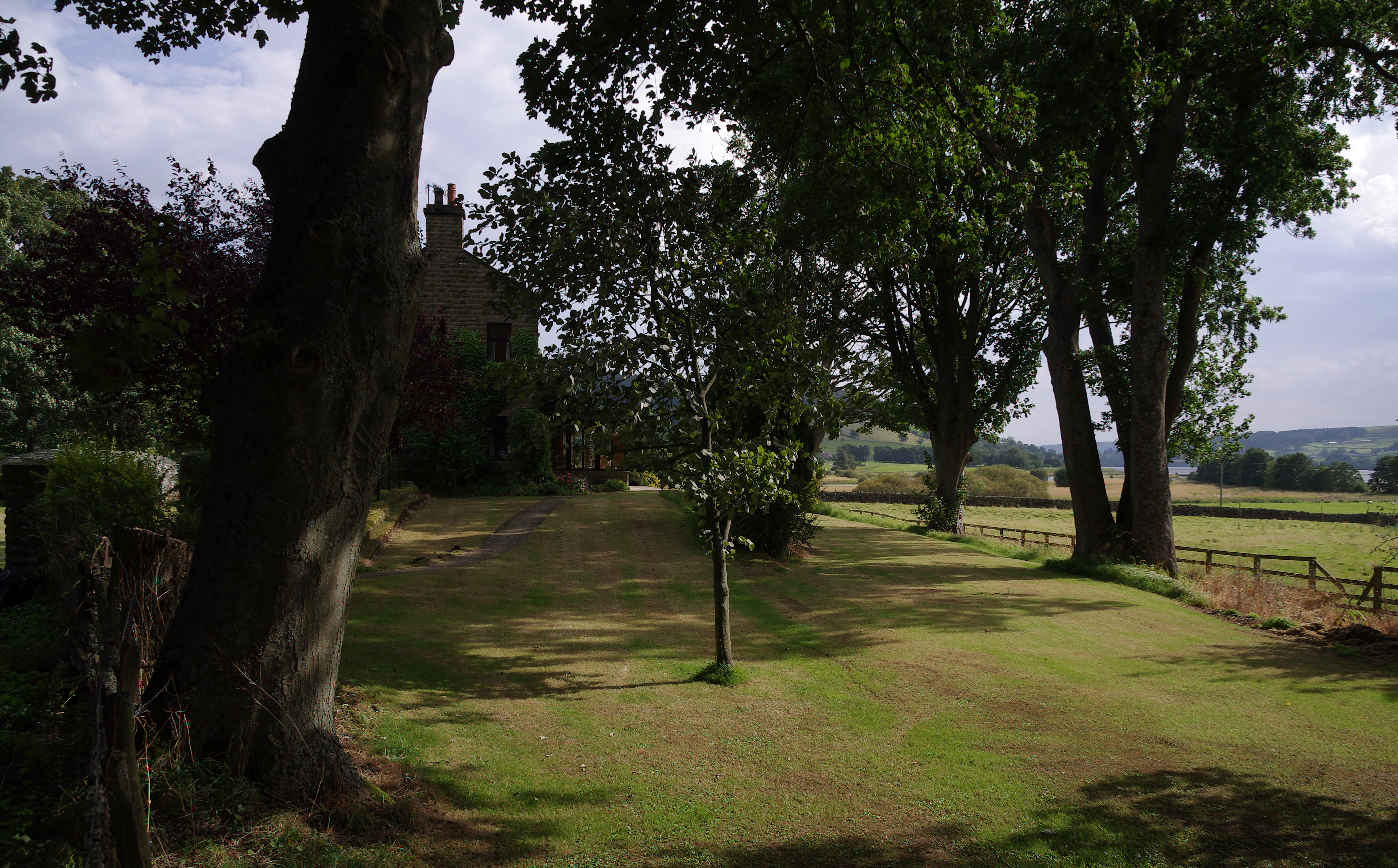
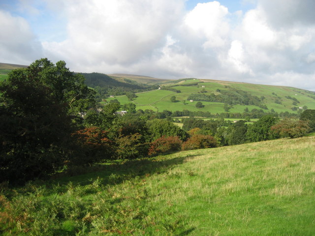
Covill House Moor is a picturesque expanse of moorland located in the county of Yorkshire, England. Situated on the Yorkshire Downs, this vast, open landscape stretches across approximately 10 square miles, offering breathtaking views and a serene escape from the hustle and bustle of city life.
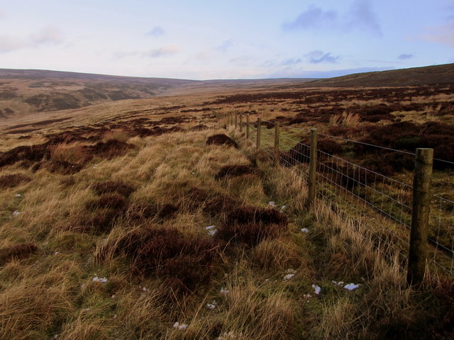
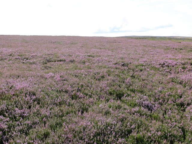
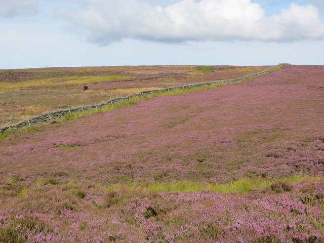
The moorland is characterized by its undulating terrain, covered in heather, bracken, and grasses that create a patchwork of vibrant colors throughout the year. It is home to a diverse range of wildlife, including various species of birds, such as curlews, lapwings, and red grouse, which can be spotted darting across the moor. The occasional sighting of a majestic red deer adds to the area's natural beauty.
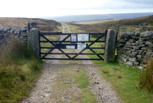
Covill House Moor provides an idyllic setting for outdoor enthusiasts, with numerous walking trails and paths that meander through the rugged landscape. There are also designated areas for camping and picnicking, allowing visitors to fully immerse themselves in the tranquility of the moor.
Historically, the moorland has served as a grazing ground for local farmers' livestock, particularly sheep, and evidence of old sheepfolds can still be found scattered across the area. The rich history of human habitation in the region is also evident in the presence of ancient burial mounds and stone circles, adding an air of mystique to the landscape.
Overall, Covill House Moor's natural beauty, diverse wildlife, and historical significance make it a popular destination for nature lovers, hikers, and those seeking a peaceful retreat in the heart of Yorkshire's stunning countryside.
If you have any feedback on the listing, please let us know in the comments section below.
Covill House Moor Images
Images are sourced within 2km of 54.145505/-1.7820466 or Grid Reference SE1472. Thanks to Geograph Open Source API. All images are credited.


Covill House Moor is located at Grid Ref: SE1472 (Lat: 54.145505, Lng: -1.7820466)
Division: West Riding
Administrative County: North Yorkshire
District: Harrogate
Police Authority: North Yorkshire
What 3 Words
///announced.tangling.stopwatch. Near Pateley Bridge, North Yorkshire
Nearby Locations
Related Wikis
Ramsgill railway station
Ramsgill railway station was a station on the Nidd Valley Light Railway in Nidderdale in Yorkshire, England. It opened in 1907 and closed in 1930. It was...
Bouthwaite
Bouthwaite is a hamlet in the Harrogate district of North Yorkshire, England. It is situated in Nidderdale, to the north of Pateley Bridge, close to the...

Ramsgill
Ramsgill is a small village in Nidderdale, North Yorkshire, England, about 2 miles (3.2 km) south-east of Lofthouse, located near Gouthwaite Reservoir...

Yorke Arms
The Yorke Arms is a luxury events venue in Ramsgill, Nidderdale, in the Yorkshire Dales in northern England.The building began life as a shooting lodge...

Six Dales Trail
The Six Dales Trail is a long distance footpath in North Yorkshire, England, with a short section in West Yorkshire. It is 38 miles (61 km) long and connects...

Gouthwaite Reservoir
Gouthwaite Reservoir is in Nidderdale, North Yorkshire, England. It is one of many reservoirs in the area, others include Roundhill Reservoir and Angram...

Skipton and Ripon (UK Parliament constituency)
Skipton and Ripon is a constituency in North Yorkshire represented in the House of Commons of the UK Parliament since 2010 by Julian Smith, a Conservative...
Lofthouse, North Yorkshire
Lofthouse is a small village in Nidderdale in the Harrogate district of North Yorkshire, England about a mile south of Middlesmoor. It is the principal...
Nearby Amenities
Located within 500m of 54.145505,-1.7820466Have you been to Covill House Moor?
Leave your review of Covill House Moor below (or comments, questions and feedback).