Blubberhouses Moor

Downs, Moorland in Yorkshire Harrogate

England

Blubberhouses Moor

Spittal Ings House A farm on the Dales Way link near Thruscross reservoir
Spittal Ings House Credit: Mick Melvin

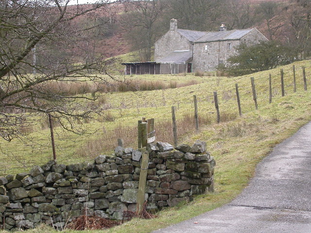
Blubberhouses Moor is a vast expanse of moorland located in the county of Yorkshire, England. Situated in the picturesque Yorkshire Dales, this area covers an estimated 13 square kilometers and sits at an elevation of approximately 300 meters. The moor is part of the Nidderdale Area of Outstanding Natural Beauty and is renowned for its stunning views and rugged terrain.

Characterized by its heather-covered hills and rocky outcrops, Blubberhouses Moor offers a unique and diverse habitat for flora and fauna. The moorland is home to various bird species, including the iconic red grouse, as well as curlews, lapwings, and golden plovers. Visitors may also catch a glimpse of mammals such as hares, stoats, and even the occasional deer.

A network of footpaths crisscrosses the moor, making it an ideal location for hikers and walkers seeking to explore the area's natural beauty. The paths lead visitors through heather-clad slopes, peat bogs, and streams, providing an opportunity to immerse themselves in the tranquility of the moorland.

Blubberhouses Moor boasts a rich history, with evidence of human activity dating back to prehistoric times. Archaeological sites, including ancient burial mounds and stone circles, can be found scattered across the moor. The area also played a crucial role during World War II, serving as a training ground for the British Army.

In addition to its natural and historical significance, Blubberhouses Moor offers breathtaking panoramic views of the surrounding countryside. On a clear day, visitors can enjoy vistas stretching as far as the eye can see, encompassing the rolling hills of the Yorkshire Dales and the nearby reservoirs of Fewston and Thruscross.

Overall, Blubberhouses Moor is a haven for nature enthusiasts, history lovers, and those seeking tranquility amidst the stunning landscapes of Yorkshire.

If you have any feedback on the listing, please let us know in the comments section below.

Blubberhouses Moor Images

Images are sourced within 2km of 53.989098/-1.7842815 or Grid Reference SE1454. Thanks to Geograph Open Source API. All images are credited.

Spittal Ings House A farm on the Dales Way link near Thruscross reservoir
Spittal Ings House
A farm on the Dales Way link near Thruscross reservoir
Brandrith crags Blubberhouses A view to Brandrith Crags across Redshaw gill, prior to the CRoW act it was difficult to get permission to climb here
Brandrith crags Blubberhouses
A view to Brandrith Crags across Redshaw gill, prior to the CRoW act it was difficult to get permission to climb here
Blubberhouses Quarry Processing Plant. This quarry opened in the mid 1980's and less than 20 years later it is closed.
Blubberhouses Quarry
Processing Plant. This quarry opened in the mid 1980's and less than 20 years later it is closed.
Blubberhouses Quarry The quarry itself. This quarry opened in the mid 1980's and less than 20 years later it is closed.
Blubberhouses Quarry
The quarry itself. This quarry opened in the mid 1980's and less than 20 years later it is closed.
A59 on Kex Gill Moor
Kexgill Farm
Kexgill Farm
Bothams Farm Bothams Farm faces North-East and looks across the valley towards Blubberhouses on the opposite side of the A59. The track leading up to the farm is marked "Private" and barking dogs reinforce the fact!
Bothams Farm
Bothams Farm faces North-East and looks across the valley towards Blubberhouses on the opposite side of the A59. The track leading up to the farm is marked "Private" and barking dogs reinforce the fact!
Roman Road, Blubberhouses Moor This footpath follows the course of a Roman Road across the wilderness of Blubberhouses Moor
Roman Road, Blubberhouses Moor
This footpath follows the course of a Roman Road across the wilderness of Blubberhouses Moor
Plantation on Back Allotment Large Plantation seen from Blubberhouses Moor
Plantation on Back Allotment
Large Plantation seen from Blubberhouses Moor
Part of Blubberhouses Moor A corner of a large tract of wilderness south of the A59 and north of Ilkley
Part of Blubberhouses Moor
A corner of a large tract of wilderness south of the A59 and north of Ilkley
Sun Bank Gill Walking along the course of the Roman Road to cross this small watercourse on Blubberhouses Moor
Sun Bank Gill
Walking along the course of the Roman Road to cross this small watercourse on Blubberhouses Moor
Sug Marsh Perhaps more appropriately should have been christened "Suck Marsh".  This is particularly juicy portion of Blubberhouses Moor
Sug Marsh
Perhaps more appropriately should have been christened "Suck Marsh". This is particularly juicy portion of Blubberhouses Moor
Old road across the moor This track and bridleway marks the original line of the 1777 Skipton to Harrogate turnpike across Kex Moor. The route was abandoned around 1827 when a new line along the valley of Hall Beck [now A59] was constructed. This new road is still closed by the occasional rock fall or landslip. The Menwith Hill 'golf balls' can be seen in the distance.
Old road across the moor
This track and bridleway marks the original line of the 1777 Skipton to Harrogate turnpike across Kex Moor. The route was abandoned around 1827 when a new line along the valley of Hall Beck [now A59] was constructed. This new road is still closed by the occasional rock fall or landslip. The Menwith Hill 'golf balls' can be seen in the distance.
Golf Balls & Wind Turbines Part of the Old Turnpike Road across Blubbehouses Moor. This is a similar view to Gordon Hatton's photograph, SE1455; Old road across the moor, showing Menwith Hill in the distance but including the four recently erected wind turbines at Knabs Ridge. Eventually there will be eight turbines on this site.
Golf Balls & Wind Turbines
Part of the Old Turnpike Road across Blubbehouses Moor. This is a similar view to Gordon Hatton's photograph, SE1455; Old road across the moor, showing Menwith Hill in the distance but including the four recently erected wind turbines at Knabs Ridge. Eventually there will be eight turbines on this site.
Crag near Blubberhouses Quarry This crag overlooks the A59 west of Blubberhouses.
Crag near Blubberhouses Quarry
This crag overlooks the A59 west of Blubberhouses.
The Kex Gill road Until around 1980, this was a minor road leading from the A59 towards Thruscross, but the opening of the nearby silica sand quarry also meant the construction of a new road link to the A59 and the closure of this stretch.  The road is on the line of the original York to Lancaster turnpike, but is now slowly being reclaimed by nature.
The Kex Gill road
Until around 1980, this was a minor road leading from the A59 towards Thruscross, but the opening of the nearby silica sand quarry also meant the construction of a new road link to the A59 and the closure of this stretch. The road is on the line of the original York to Lancaster turnpike, but is now slowly being reclaimed by nature.
Kexgill Farm The farm stands close to the moor edge at 285m, and is just within the Wharfe catchment. The first photo of the farm taken from within the square.
Kexgill Farm
The farm stands close to the moor edge at 285m, and is just within the Wharfe catchment. The first photo of the farm taken from within the square.
A59 summit At the watershed between the Wharfe and the Washburn, the A59 reaches the highest point on its route from Liverpool to York at just over 300m above sea level.
A59 summit
At the watershed between the Wharfe and the Washburn, the A59 reaches the highest point on its route from Liverpool to York at just over 300m above sea level.
Show me another place!

Blubberhouses Moor is located at Grid Ref: SE1454 (Lat: 53.989098, Lng: -1.7842815)

Division: West Riding

Administrative County: North Yorkshire

District: Harrogate

Police Authority: North Yorkshire

What 3 Words

///ghost.pointer.birthdays. Near Ilkley, West Yorkshire

Nearby Locations

Blubberhouses Moor

Related Wikis

Kex Gill Bypass

The Kex Gill Bypass is a future stretch of A-road across Kex Gill Moor to Blubberhouses in North Yorkshire, England. The route is part of the A59 road...

Blubberhouses

Blubberhouses is a small village and civil parish in the Washburn Valley in North Yorkshire, England. The population as at the 2011 Census was less than...

Thruscross Reservoir

Thruscross Reservoir is the northernmost of four reservoirs in the Washburn valley, lying north of Otley and west of Harrogate in North Yorkshire, England...

Thruscross

Thruscross is a small settlement and civil parish in the Harrogate district of North Yorkshire, England. It lies in the Washburn Valley, 11 miles (18...

Fewston Reservoir

Fewston Reservoir is located in the Washburn valley north of Otley and west of Harrogate in Yorkshire, England. It was built in 1879. The capacity is about...

Fewston

Fewston is a village and civil parish in the Harrogate district of North Yorkshire, England. It is situated north of Otley and close to Swinsty and Fewston...

Timble

Timble is a village in the Harrogate district of North Yorkshire, England. It is situated on the slopes of the Washburn valley, north of Otley and close...

Hazlewood with Storiths

Hazlewood with Storiths is a civil parish in the Craven district of North Yorkshire, England. The population of the civil parish as of the 2011 census...

Nearby Amenities

Located within 500m of 53.989098,-1.7842815
Blubberhouses Moor
Natural: moor
Source: NPE
Lat/Long: 53.9871176/-1.7813251
Knots
Place: locality
Source: OS-OpenData_StreetView_2016_04
Lat/Long: 53.9890568/-1.7848749
Slade
Place: locality
Source: OS-OpenData_StreetView_2016_04
Lat/Long: 53.9858403/-1.7793388
Raven's Peak
Place: locality
Source: OS-OpenData_StreetView_2016_04
Lat/Long: 53.9928041/-1.7884583
The data included in this document is from www.openstreetmap.org. The data is made available under ODbL.

Have you been to Blubberhouses Moor?

Leave your review of Blubberhouses Moor below (or comments, questions and feedback).