Combs Fell

Downs, Moorland in Yorkshire Harrogate

England

Combs Fell

Sypeland crags. View from track.
Sypeland crags. Credit: steven ruffles

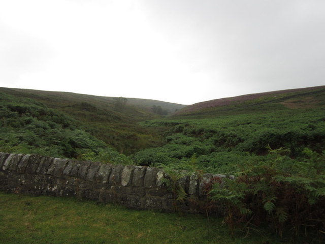
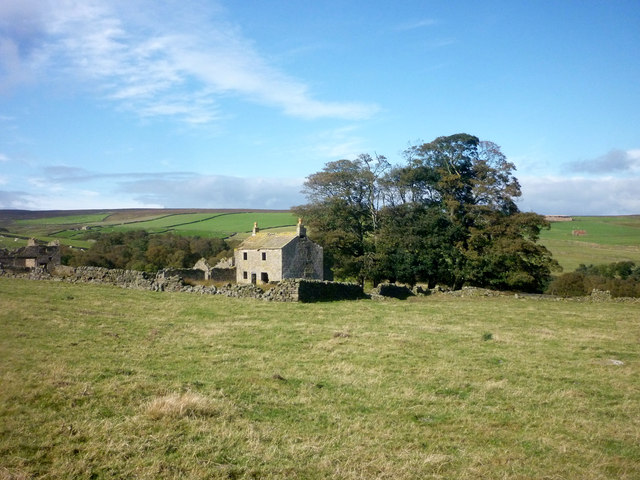
Combs Fell is a picturesque area located in Yorkshire, England. It is characterized by its stunning combination of rolling downs and expansive moorland. Situated within the Peak District National Park, Combs Fell offers visitors a unique opportunity to immerse themselves in the beauty of the British countryside.

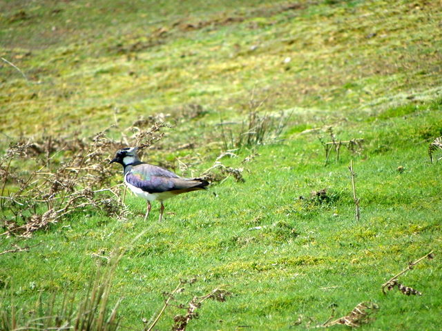
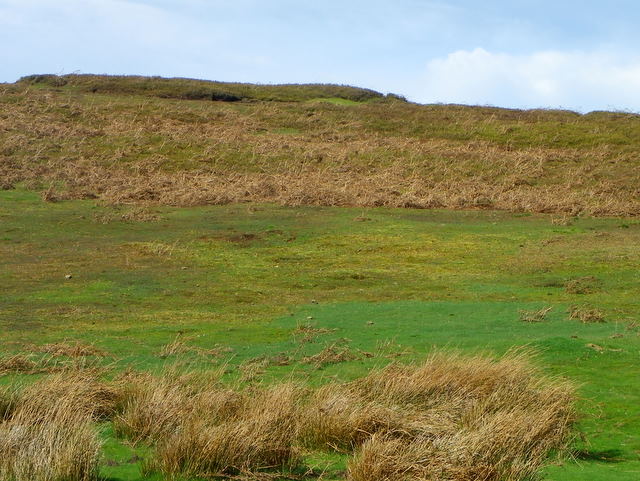
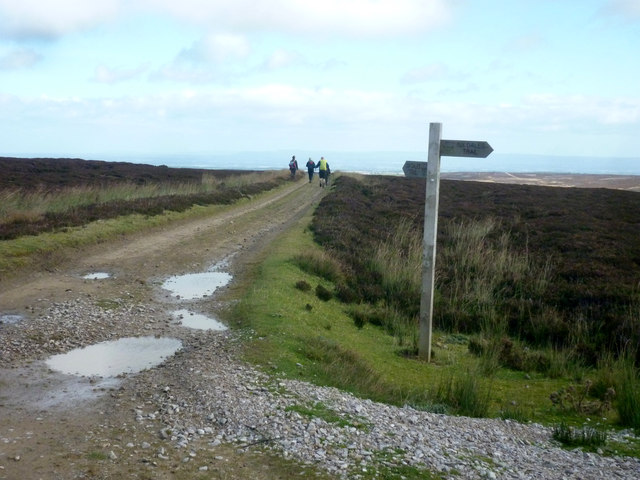
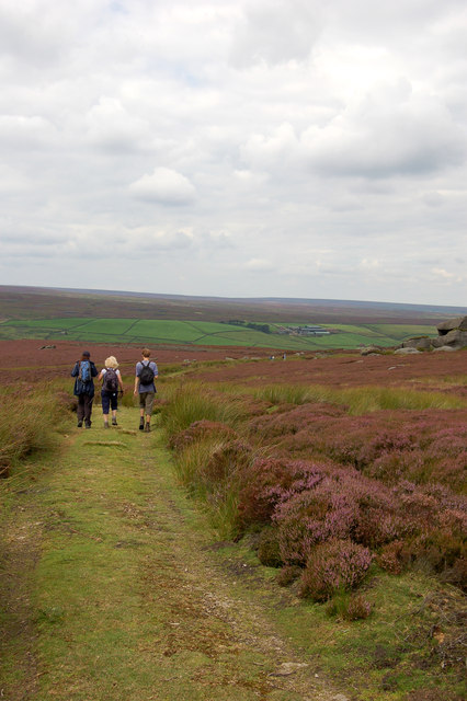
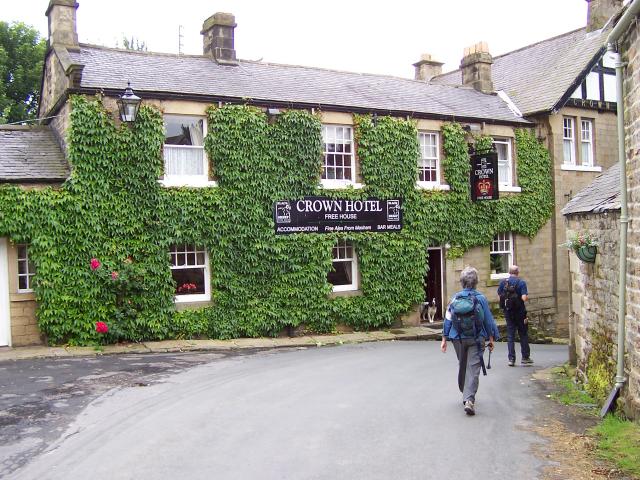
The downs of Combs Fell are known for their gently sloping hills, covered in lush green grass and dotted with vibrant wildflowers during the warmer months. These provide a serene backdrop for leisurely walks and hikes, offering breathtaking views of the surrounding landscape. The area is also home to a variety of wildlife, including birds of prey, sheep, and rabbits, making it a haven for nature enthusiasts and birdwatchers.

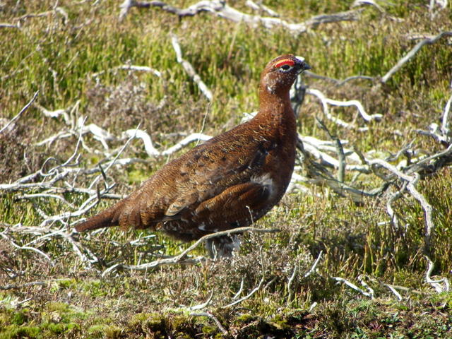
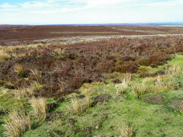
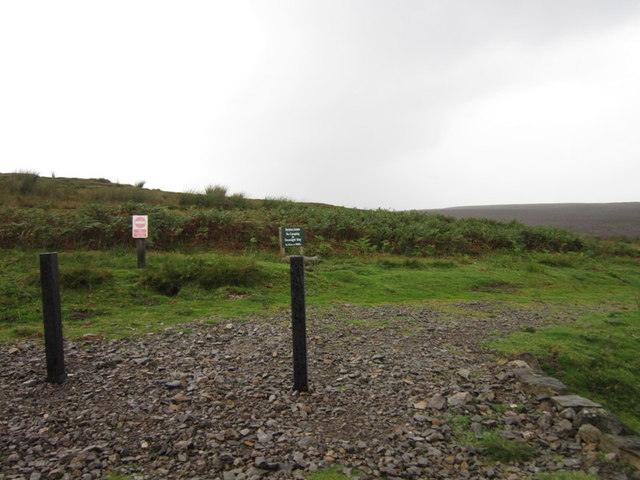
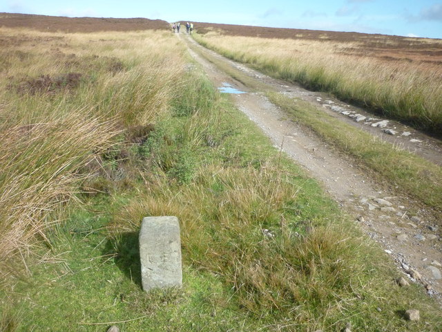
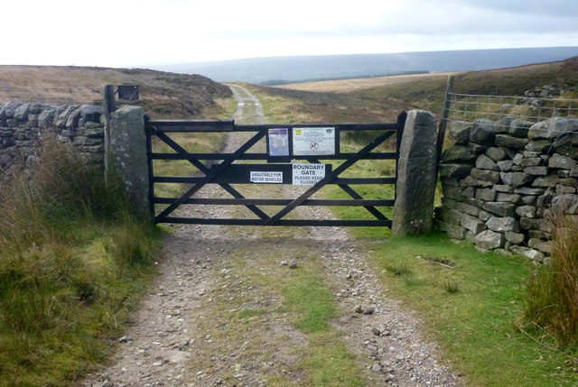
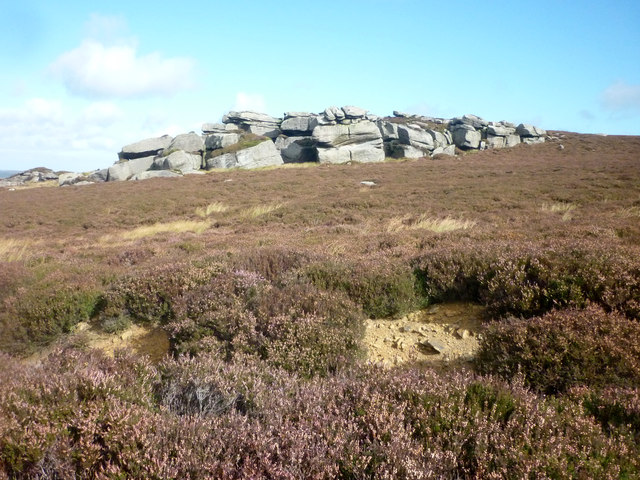
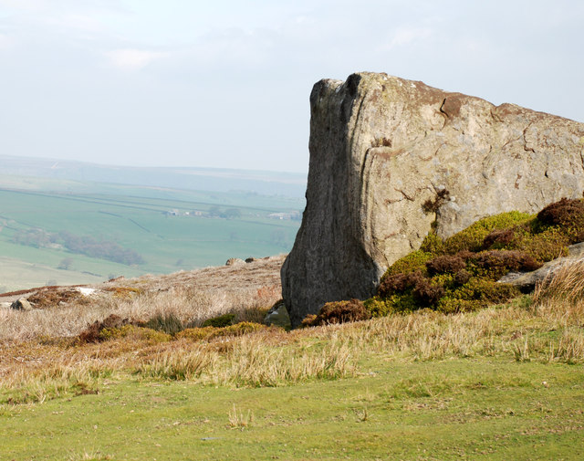
The moorland of Combs Fell, on the other hand, showcases a more rugged and wild terrain. Here, visitors can explore vast expanses of heather-covered hills, interspersed with rocky outcrops and hidden valleys. The moorland is home to a rich diversity of plant and animal species, including the iconic red grouse, which is native to the region.

Combs Fell is also steeped in history, with remnants of ancient settlements and burial mounds scattered throughout the area. These archaeological sites provide a fascinating glimpse into the past, allowing visitors to imagine what life was like for the people who once inhabited this land.

Overall, Combs Fell is a captivating destination that offers a diverse range of natural beauty and historical significance. Whether it is for a leisurely stroll, a challenging hike, or a peaceful retreat, this idyllic location is sure to leave a lasting impression on all who visit.

If you have any feedback on the listing, please let us know in the comments section below.

Combs Fell Images

Images are sourced within 2km of 54.168861/-1.791099 or Grid Reference SE1374. Thanks to Geograph Open Source API. All images are credited.

Sypeland crags. View from track.
Sypeland crags.
View from track.
Sypeland. Track across the moorland.
Sypeland.
Track across the moorland.
Ouster bank. Trig pillar.
Ouster bank.
Trig pillar.
Grouse, Pott Moor The red grouse, which grows to about 15 inches, is the prime target of sporting guns. Yet research shows that shooting does not permanently threaten its numbers, since there is usually a surplus population doomed to starve through being unable to obtain individual territories. The red grouse feeds on young heather. They nest on the ground, where the dull plumage of the hen camouflages her. The chicks - up to a dozen are able to walk and feed themselves soon after hatching.
Grouse, Pott Moor
The red grouse, which grows to about 15 inches, is the prime target of sporting guns. Yet research shows that shooting does not permanently threaten its numbers, since there is usually a surplus population doomed to starve through being unable to obtain individual territories. The red grouse feeds on young heather. They nest on the ground, where the dull plumage of the hen camouflages her. The chicks - up to a dozen are able to walk and feed themselves soon after hatching.
Lapwing, Pott Moor The wader has a long crest and is apparently black and white, but on closer inspection the black is metallic green with black markings, and the legs are reddish. It has a relatively slow flapping flight but is capable of great aerobatics particularly in breeding season.
Lapwing, Pott Moor
The wader has a long crest and is apparently black and white, but on closer inspection the black is metallic green with black markings, and the legs are reddish. It has a relatively slow flapping flight but is capable of great aerobatics particularly in breeding season.
Rough moorland, Pott Moor This area of moorland is a mixture of rough grasses and heather.
Rough moorland, Pott Moor
This area of moorland is a mixture of rough grasses and heather.
Managed moorland, Lofthouse Moor The moorland in the area is very damp, but on the higher ground grouse were seen. Further afield heather burning is taking place.
 
Rotational heather burning is essential for good moorland management. If not managed, heather grows into a dense mass of long woody stems, which supports very little wildlife and has reduced nutritional value for livestock and birds.
Heather burning is a very old method of controlling and prolonging the life cycle of heather. It is a very skilled operation and must be carried out with extreme caution. There are strict guidelines that must be adhered to for a successful and safe burn.
 
By law the 'muir burn' must take place between 1st October and 15th April each season.
Managed moorland, Lofthouse Moor
The moorland in the area is very damp, but on the higher ground grouse were seen. Further afield heather burning is taking place. Rotational heather burning is essential for good moorland management. If not managed, heather grows into a dense mass of long woody stems, which supports very little wildlife and has reduced nutritional value for livestock and birds. Heather burning is a very old method of controlling and prolonging the life cycle of heather. It is a very skilled operation and must be carried out with extreme caution. There are strict guidelines that must be adhered to for a successful and safe burn. By law the 'muir burn' must take place between 1st October and 15th April each season.
Pott Moor from Agill Bridge
A private track towards Pott Moor
A cattle grid on Lofthouse Moor
Boundary Stone on Lulbeck Head This ancient boundary stone is marked 'EE'. The track is part of the Six Dales Trail over Fountains Earth Moor and shows walkers going north.
Boundary Stone on Lulbeck Head
This ancient boundary stone is marked 'EE'. The track is part of the Six Dales Trail over Fountains Earth Moor and shows walkers going north.
Boundary Gate to Longside Moor Boundary Gate to a SSSI. A special protection area for rare ground nesting birds. This track is part of the Six Dales Trail long distance path.
Boundary Gate to Longside Moor
Boundary Gate to a SSSI. A special protection area for rare ground nesting birds. This track is part of the Six Dales Trail long distance path.
Combs Crags on Low Ash Head Moor Outcrop of rocks on Low Ash Head Moor. The Six Dales Trail long distance path passes close to these rocks.
Combs Crags on Low Ash Head Moor
Outcrop of rocks on Low Ash Head Moor. The Six Dales Trail long distance path passes close to these rocks.
Low Ash Head This former farmhouse is now empty and derelict. The route of the Six Dales Trail long distance path passes to the west of the house.
Low Ash Head
This former farmhouse is now empty and derelict. The route of the Six Dales Trail long distance path passes to the west of the house.
Fingerpost on Lulbeck Head Fingerpost indicating the route of the Six Dales Trail long distance footpath on the summit of Lulbeck Head.
Fingerpost on Lulbeck Head
Fingerpost indicating the route of the Six Dales Trail long distance footpath on the summit of Lulbeck Head.
Wedge shaped Rock at Combs Crags This wedge shaped rock at Combs Crag is on the route of the Six Dales Trail long distance path.
Wedge shaped Rock at Combs Crags
This wedge shaped rock at Combs Crag is on the route of the Six Dales Trail long distance path.
Track leading to Shooting House at Combs Crag Track on route of Six Dales Trail long distance path
Track leading to Shooting House at Combs Crag
Track on route of Six Dales Trail long distance path
The Road on Pott Moor looking North East This is the Lofthouse/Masham Road crossing Pott Moor as it starts to descend towards the valley of Pott Beck.
A wintery scene - on the first day of Spring.
The Road on Pott Moor looking North East
This is the Lofthouse/Masham Road crossing Pott Moor as it starts to descend towards the valley of Pott Beck. A wintery scene - on the first day of Spring.
Show me another place!

Combs Fell is located at Grid Ref: SE1374 (Lat: 54.168861, Lng: -1.791099)

Division: North Riding

Administrative County: North Yorkshire

District: Harrogate

Police Authority: North Yorkshire

What 3 Words

///coins.nudge.toolkit. Near Pateley Bridge, North Yorkshire

Nearby Locations

Combs Fell Birky Bank Top

Related Wikis

Roundhill Reservoir

Roundhill Reservoir is situated near Leighton Reservoir in North Yorkshire, England. It was constructed by Harrogate Corporation early in the 20th century...

Skipton and Ripon (UK Parliament constituency)

Skipton and Ripon is a constituency in North Yorkshire represented in the House of Commons of the UK Parliament since 2010 by Julian Smith, a Conservative...

Lofthouse, North Yorkshire

Lofthouse is a small village in Nidderdale in the Harrogate district of North Yorkshire, England about a mile south of Middlesmoor. It is the principal...

Lofthouse-in-Nidderdale railway station

Lofthouse-in-Nidderdale railway station was the northernmost regular passenger terminus on the Nidd Valley Light Railway (NVLR), in Lofthouse, then in...

Nidderdale Caves

The Nidderdale Caves are a series of caves in Upper Nidderdale in North Yorkshire, England. There are two cave systems and most of the caves are in some...

Ramsgill railway station

Ramsgill railway station was a station on the Nidd Valley Light Railway in Nidderdale in Yorkshire, England. It opened in 1907 and closed in 1930. It was...

Ramsgill

Ramsgill is a small village in Nidderdale, North Yorkshire, England, about 2 miles (3.2 km) south-east of Lofthouse, located near Gouthwaite Reservoir...

Yorke Arms

The Yorke Arms is a luxury events venue in Ramsgill, Nidderdale, in the Yorkshire Dales in northern England.The building began life as a shooting lodge...

Have you been to Combs Fell?

Leave your review of Combs Fell below (or comments, questions and feedback).