Aske Moor

Downs, Moorland in Yorkshire Richmondshire

England

Aske Moor

Whitcliffe Scar Bridleway beneath Whitcliffe Scar.
Whitcliffe Scar Credit: Peter McDermott

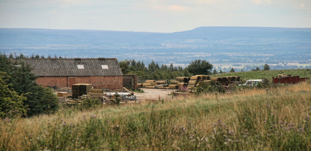
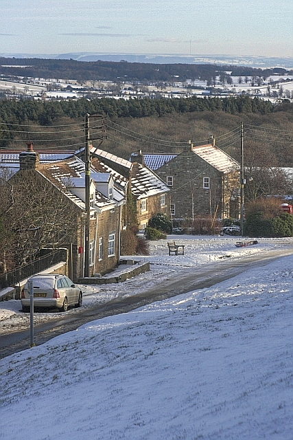
Aske Moor is a picturesque area located in the county of Yorkshire, England. It is nestled within the beautiful Yorkshire Dales National Park and covers an extensive expanse of land characterized by rolling hills, open moorland, and stunning views. The moor is situated in the northern part of the park, near the village of Aske.

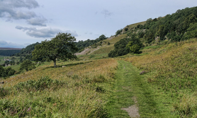
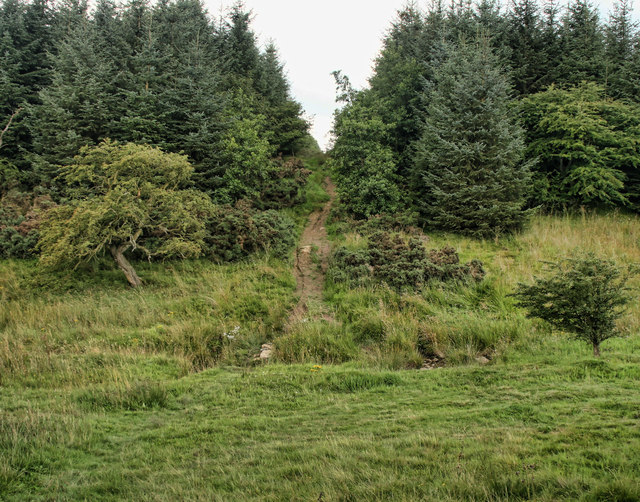
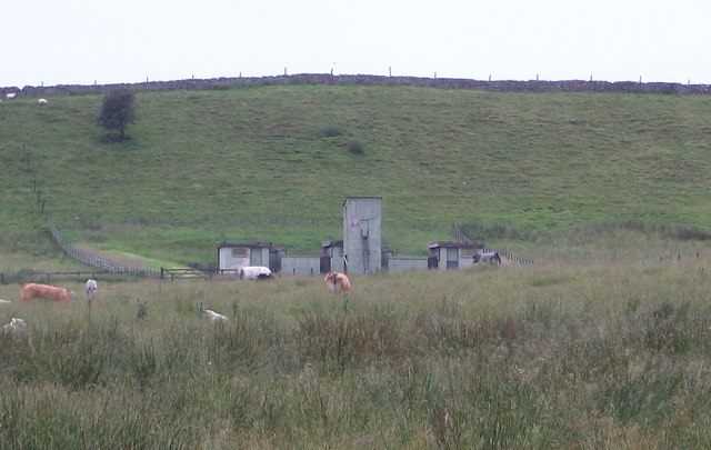
The landscape of Aske Moor is predominantly composed of undulating hills and heather-covered moorland, creating a unique and captivating scenery. The moorland is interspersed with scattered trees and patches of woodland, adding to its natural charm. The area is renowned for its diverse wildlife, including various bird species such as curlews, lapwings, and golden plovers, which can often be spotted among the heather and grasses.

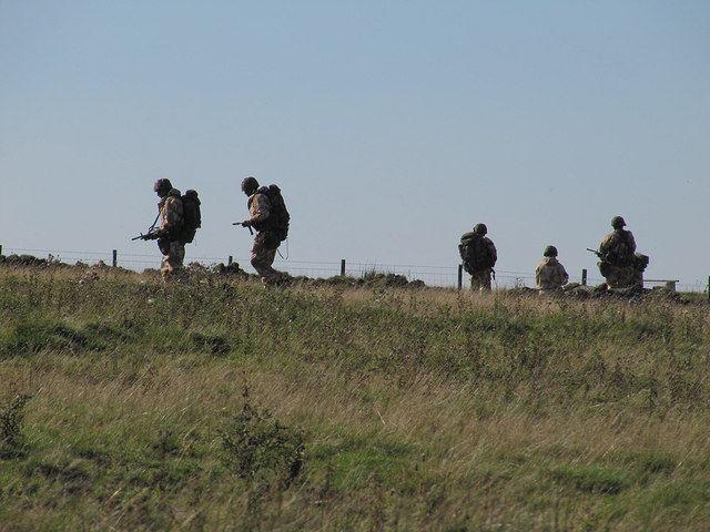
Aske Moor provides an ideal setting for outdoor enthusiasts and nature lovers alike. It offers numerous opportunities for walking, hiking, and birdwatching, with a network of footpaths and trails crisscrossing the moor. The views from the high points of the moor are truly breathtaking, showcasing the surrounding countryside and distant hills.

In addition to its natural beauty, Aske Moor also holds historical significance. It is home to ancient remains, including burial mounds and stone circles, which are evidence of human presence in the area dating back thousands of years.

Overall, Aske Moor is a captivating and tranquil destination, offering visitors a chance to immerse themselves in the stunning scenery and rich history of Yorkshire's moorland landscape.

If you have any feedback on the listing, please let us know in the comments section below.

Aske Moor Images

Images are sourced within 2km of 54.428638/-1.7916158 or Grid Reference NZ1303. Thanks to Geograph Open Source API. All images are credited.

Whitcliffe Scar Bridleway beneath Whitcliffe Scar.
Whitcliffe Scar
Bridleway beneath Whitcliffe Scar.
Richmond Out Moor North Yorkshire Police communications masts at Richmond Out Moor.
Richmond Out Moor
North Yorkshire Police communications masts at Richmond Out Moor.
Hurgill Road Hurgill Road beneath Beacon Hill.
Hurgill Road
Hurgill Road beneath Beacon Hill.
Richmond Out Moor Track crossing Aske beck in the plantation on Richmond Out Moor.
Richmond Out Moor
Track crossing Aske beck in the plantation on Richmond Out Moor.
Black Plantation Bridleway alongside Black Plantation on Aske Moor.
Black Plantation
Bridleway alongside Black Plantation on Aske Moor.
Aske Moor Farm Aske Moor Farm seen from Black Plantation on Aske Moor.
Aske Moor Farm
Aske Moor Farm seen from Black Plantation on Aske Moor.
Aske Moor
Aske Moor
Trainee soldiers The rather startling sight of armed soldiers on Feldom Ranges.
Trainee soldiers
The rather startling sight of armed soldiers on Feldom Ranges.
Military Exercises By the road, Feldom Ranges.
Military Exercises
By the road, Feldom Ranges.
Lime Kiln on High Moor Shown in use up to 1884. But was marked as disused on the 1895 map.
Lime Kiln on High Moor
Shown in use up to 1884. But was marked as disused on the 1895 map.
MOD Buildings on High Hag Moor Eastern edge of the Feldom Ranges, an area of Ministry of Defence land with live firing on days when the red flags are flying.
MOD Buildings on High Hag Moor
Eastern edge of the Feldom Ranges, an area of Ministry of Defence land with live firing on days when the red flags are flying.
Lumps, Bumps and Foxgloves It might not look like much now but this is the site of Whashton Copper Mill. POST MEDIEVAL SMELT MILL 1600 to 1799 it is a scheduled site.
Lumps, Bumps and Foxgloves
It might not look like much now but this is the site of Whashton Copper Mill. POST MEDIEVAL SMELT MILL 1600 to 1799 it is a scheduled site.
Bridleway NW of Black Plantation, in fog The gnarly sycamores lean over the wall from a narrow strip of trees extending southwest from the westernmost corner of Black Plantation, like fingers seeking to grab passing walkers in the eerie light and thickening fog, reminiscent of something from a fantasy novel harking back to the medieval wildwood. In reality, sinking up to the knees, getting stuck and dying of exposure was a more likely fate...
Bridleway NW of Black Plantation, in fog
The gnarly sycamores lean over the wall from a narrow strip of trees extending southwest from the westernmost corner of Black Plantation, like fingers seeking to grab passing walkers in the eerie light and thickening fog, reminiscent of something from a fantasy novel harking back to the medieval wildwood. In reality, sinking up to the knees, getting stuck and dying of exposure was a more likely fate...
Death on Jagger Lane The boggy bridleway of Jagger Lane passing the clawing sycamore fingers of Black Plantation in the fog (<a href="https://www.geograph.org.uk/photo/3379896">NZ1404 : Bridleway NW of Black Plantation, in fog</a>) was already eerie enough, but finding this dead sheep in a pool across the track definitely added to the 'Lord of the Rings' atmosphere. Whatever evil lay ahead, there were more gridsquares somewhere in the roiling fog, so onwards I pressed - a GPS giving some definite advantages compared to hobbits lost in Middle Earth...
Death on Jagger Lane
The boggy bridleway of Jagger Lane passing the clawing sycamore fingers of Black Plantation in the fog (NZ1404 : Bridleway NW of Black Plantation, in fog) was already eerie enough, but finding this dead sheep in a pool across the track definitely added to the 'Lord of the Rings' atmosphere. Whatever evil lay ahead, there were more gridsquares somewhere in the roiling fog, so onwards I pressed - a GPS giving some definite advantages compared to hobbits lost in Middle Earth...
Very muddy footpath in the woods, Richmond Out Moor The definitive rights-of-way map shows a bridleway some way west of this path, while this muddy horror show is also shown on OS maps with the old black dotted line symbol. However, in reality, only this route exists on (or should I say rapidly sinking into) the ground. At least it is easy enough to follow in the fog !
Very muddy footpath in the woods, Richmond Out Moor
The definitive rights-of-way map shows a bridleway some way west of this path, while this muddy horror show is also shown on OS maps with the old black dotted line symbol. However, in reality, only this route exists on (or should I say rapidly sinking into) the ground. At least it is easy enough to follow in the fog !
Mossy wall in the forest, Richmond Out Moor The weather on the day of this photograph does much to explain the amount of moss on the old wall as the humidity was high enough to keep it all very moist, even where not being dripped on by the overhanging trees. The forest will also protect it from all but late evening sun, too, in the summer when weather is less favourable (for aquatic life).
Mossy wall in the forest, Richmond Out Moor
The weather on the day of this photograph does much to explain the amount of moss on the old wall as the humidity was high enough to keep it all very moist, even where not being dripped on by the overhanging trees. The forest will also protect it from all but late evening sun, too, in the summer when weather is less favourable (for aquatic life).
Tarn and tree in the fog above Whitcliffe Scar Various boggy patches, pools and ponds dot the landscape above Whitcliffe Scar. This one had a tree growing in the wall-line behind it to add something to reflect.
Tarn and tree in the fog above Whitcliffe Scar
Various boggy patches, pools and ponds dot the landscape above Whitcliffe Scar. This one had a tree growing in the wall-line behind it to add something to reflect.
Hey Gill
Hey Gill
Show me another place!

Aske Moor is located at Grid Ref: NZ1303 (Lat: 54.428638, Lng: -1.7916158)

Division: North Riding

Administrative County: North Yorkshire

District: Richmondshire

Police Authority: North Yorkshire

What 3 Words

///bookmark.remodel.magnum. Near Richmond, North Yorkshire

Nearby Locations

Aske Moor Silver Hill

Related Wikis

Applegarth, North Yorkshire

Applegarth is a historic settlement located north of the River Swale in Yorkshire, England. It lies about three-quarters of a mile north-east of the village...

Scott Trial

The Scott Trial is a British motorcycle trials competition dating from 1914 run over an off-road course of approximately 70 miles. One of the most challenging...

Kirby Hill, Richmondshire

Kirby Hill, historically also known as Kirby-on-the-Hill, is a village and civil parish in the Richmondshire district of North Yorkshire, England. The...

Whashton

Whashton is a village and civil parish in the Richmondshire district of North Yorkshire, England. == History == The name is of an uncertain origin and...

Richmond Racecourse

Richmond Racecourse was a British horse racing track situated at Richmond, North Yorkshire at first High Moor, then Low Moor, from 1765 to 1776. It was...

Ravensworth Castle (North Yorkshire)

Ravensworth Castle is a ruined 14th-century castle in the village of Ravensworth, North Yorkshire, England. It has been designated a Grade I listed building...

Hudswell, North Yorkshire

Hudswell is a village and civil parish on the border of the Yorkshire Dales, in North Yorkshire, England. The population at the ONS Census 2011 was 353...

Gayles, North Yorkshire

Gayles is a village and civil parish in the Richmondshire district of North Yorkshire, England. Gayles is established in the district ward of Gilling West...

Have you been to Aske Moor?

Leave your review of Aske Moor below (or comments, questions and feedback).