Ashop Moor

Downs, Moorland in Derbyshire High Peak

England

Ashop Moor

Ruins of house in Alport Valley
Ruins of house in Alport Valley Credit: Neil Theasby

Ashop Moor, located in Derbyshire, England, is a captivating area that encompasses both downs and moorland landscapes. Situated in the Peak District National Park, it offers a stunning and diverse natural environment for visitors to explore. Covering an extensive area, Ashop Moor is a haven for outdoor enthusiasts and nature lovers.

The downs of Ashop Moor are characterized by their gently rolling hills and vast open spaces. These grassy uplands provide breathtaking panoramic views of the surrounding countryside. Visitors can enjoy leisurely walks or challenging hikes, taking in the beauty of the moorland and its diverse flora and fauna.

The moorland of Ashop Moor is a unique ecosystem, with its heather-covered expanses and peat bogs. This habitat supports a variety of wildlife, including birds such as curlews, golden plovers, and red grouse. The moorland is also home to several rare and protected plant species, making it an important conservation area.

Ashop Moor offers a range of activities for visitors to enjoy. It is a popular destination for birdwatching, with its diverse avian population. The area is also ideal for walking, hiking, and cycling, with numerous trails and paths to explore. Additionally, Ashop Moor provides opportunities for horse riding and fishing, adding to its appeal for outdoor enthusiasts.

With its stunning natural beauty and rich biodiversity, Ashop Moor is a must-visit destination for those seeking a peaceful and picturesque escape in Derbyshire. Whether you're a nature lover, a keen hiker, or simply looking to relax in a tranquil setting, Ashop Moor offers something for everyone.

If you have any feedback on the listing, please let us know in the comments section below.
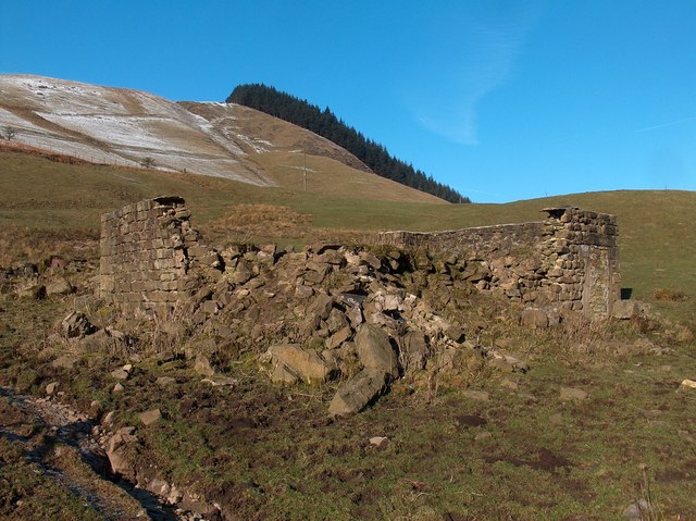
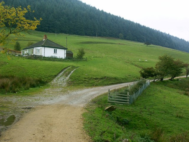
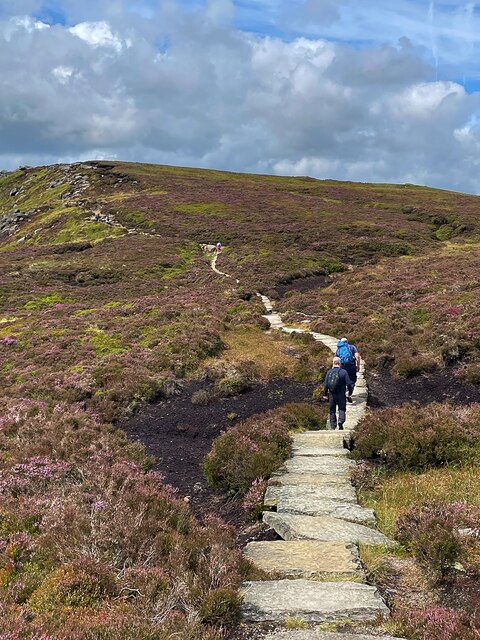
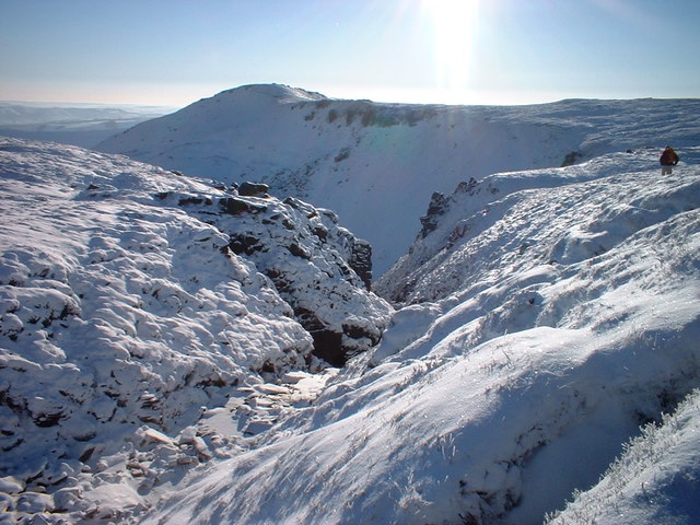
Ashop Moor Images

Images are sourced within 2km of 53.393202/-1.7991219 or Grid Reference SK1388. Thanks to Geograph Open Source API. All images are credited.

Ruins of house in Alport Valley
Ruined farm building, Alport Valley Two stone troughs in a gap in the dry stone wall, a rusting harrow,the ruins of the barn or house, and behind on the hillside a conifer plantation. The National Trust own most of the land are intending to remove conifers from the slopes and replant with native trees.
Ruined farm building, Alport Valley
Two stone troughs in a gap in the dry stone wall, a rusting harrow,the ruins of the barn or house, and behind on the hillside a conifer plantation. The National Trust own most of the land are intending to remove conifers from the slopes and replant with native trees.
Isolated cottage in Alport Valley Not looking much different from <a href="https://www.geograph.org.uk/photo/262480">SK1390 : Isolated house in the Alport Valley</a> taken in 2006.
Isolated cottage in Alport Valley
Not looking much different from SK1390 : Isolated house in the Alport Valley taken in 2006.
View north to Alport Dale from Blackley Hey
Alport Dale Looking up and across the valley from the farm track towards Alport Castles.
Alport Dale
Looking up and across the valley from the farm track towards Alport Castles.
Farm track and cottage, Alport Dale Even a wet November day does not detract from the great location.
Farm track and cottage, Alport Dale
Even a wet November day does not detract from the great location.
Alport Bridge from Ashton Tor Pictured on a slightly murky Saturday in early October. The Mountain Weather Information Service was predicting 'superb' visibility and sunshine on this day but it just wasn't happening at least in this part of the Peak District.
Alport Bridge from Ashton Tor
Pictured on a slightly murky Saturday in early October. The Mountain Weather Information Service was predicting 'superb' visibility and sunshine on this day but it just wasn't happening at least in this part of the Peak District.
Track and small cottage in Alport Dale Lovely walking area.
Track and small cottage in Alport Dale
Lovely walking area.
Isolated house in the Alport Valley An isolated house in the Alport Valley close to the farm road which leads from the A57 (Snake Pass) road to Alport Farm.
Isolated house in the Alport Valley
An isolated house in the Alport Valley close to the farm road which leads from the A57 (Snake Pass) road to Alport Farm.
Ashton Tor
Ashton Tor
Low Barn
Low Barn
Ford on the Roman road This farm track, thought to be on the line of the Roman road from Brough to Glossop, fords the stream in a narrow unnamed clough, here.
Ford on the Roman road
This farm track, thought to be on the line of the Roman road from Brough to Glossop, fords the stream in a narrow unnamed clough, here.
Tree planting in the Woodlands Valley The banks of the River Ashop have been extensively planted with young trees, to ensure that the Woodlands Valley lives up to its name in the future.
Tree planting in the Woodlands Valley
The banks of the River Ashop have been extensively planted with young trees, to ensure that the Woodlands Valley lives up to its name in the future.
Air Ambulance  Air Ambulance attending an RTC on the Snake Road.
Air Ambulance
Air Ambulance attending an RTC on the Snake Road.
The view from Ringing Roger Looking south west from this dramatic rock outcrop over Grindsbrook Clough
The view from Ringing Roger
Looking south west from this dramatic rock outcrop over Grindsbrook Clough
Rock outcrop on Kinder Edge  With a view over Edale.
Rock outcrop on Kinder Edge
With a view over Edale.
Walkiers on Kinder Edge
Blackden Brook
Blackden Brook
Show me another place!

Ashop Moor is located at Grid Ref: SK1388 (Lat: 53.393202, Lng: -1.7991219)

Administrative County: Derbyshire

District: High Peak

Police Authority: Derbyshire

What 3 Words

///comic.dries.crisps. Near High Peak, Derbyshire

Nearby Locations

Dean Hill Ashop Moor

Related Wikis

Dark Peak

The Dark Peak is the higher and wilder part of the Peak District in England, mostly forming the northern section but also extending south into its eastern...

Hope Woodlands

Hope Woodlands is an extensive civil parish in the High Peak district of Derbyshire in England. The parish covers the Woodlands Valley, the western Upper...

River Alport

The River Alport flows for 5.6 miles (9 km) in the Dark Peak of the Peak District in Derbyshire, England. Its source is on Bleaklow, 3 miles (4.8 km)...

The Church of the Holy and Undivided Trinity, Edale

The Church of the Holy and Undivided Trinity, Edale, is a Grade II listed parish church in the Church of England in Edale, Derbyshire. == History == The...

Grindslow Knoll

Grindslow Knoll is a hill in the Dark Peak area of the Peak District National Park in Derbyshire, England. It is joined to Kinder Scout by a high col though...

Alport Castles

The Alport Castles are a landslip feature in the Peak District National Park in Derbyshire. At over half a mile long, it is thought to be the largest landslide...

Edale

Edale is a village and civil parish in the Peak District, Derbyshire, England, whose population was 353 at the 2011 Census. Edale, with an area of 7,030...
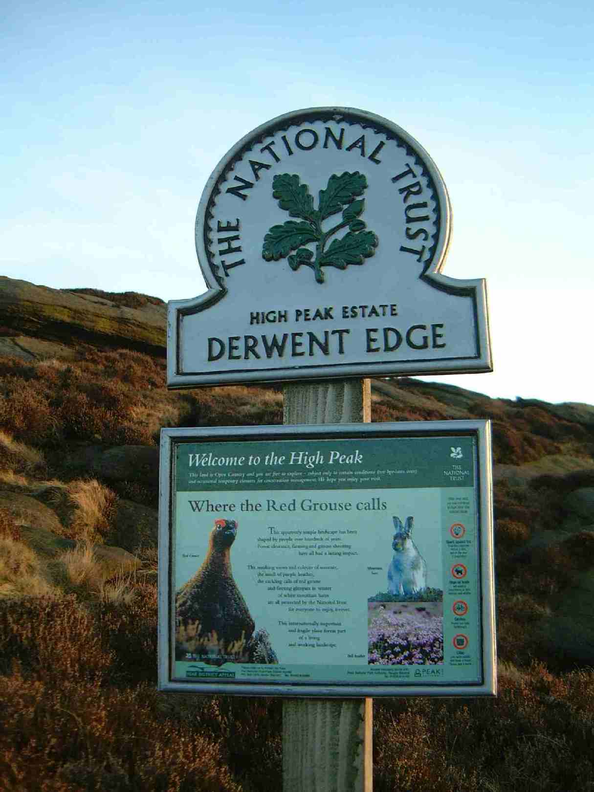
High Peak Estate

The High Peak Estate is an area of Pennine moorland in the ownership of the National Trust in the Dark Peak area of Derbyshire, England. The National...

Nearby Amenities

Located within 500m of 53.393202,-1.7991219
Ashop Moor
Place: locality
Source: Bing
Lat/Long: 53.3939274/-1.7998689
Madwoman's Stones
Place: locality
Source: Bing
Lat/Long: 53.3891354/-1.7962407
The data included in this document is from www.openstreetmap.org. The data is made available under ODbL.

Have you been to Ashop Moor?

Leave your review of Ashop Moor below (or comments, questions and feedback).