Braithwaite Moor
Downs, Moorland in Yorkshire Richmondshire
England
Braithwaite Moor

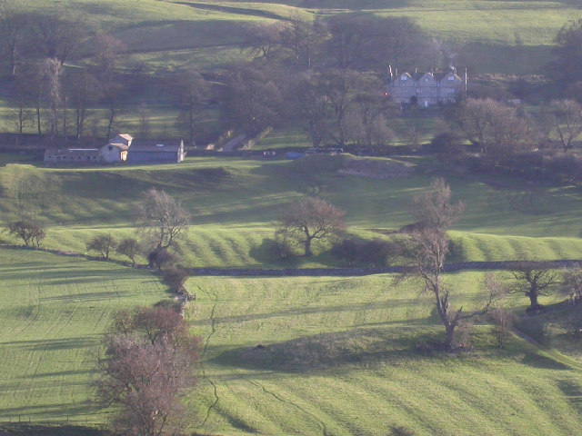
Braithwaite Moor, situated in the county of Yorkshire, England, is a stunning expanse of rolling hills and open moorland. Located in the northern part of the county, this area is renowned for its natural beauty and diverse ecosystem. Covering a vast area of approximately 5,000 acres, Braithwaite Moor offers visitors a unique and picturesque landscape to explore.
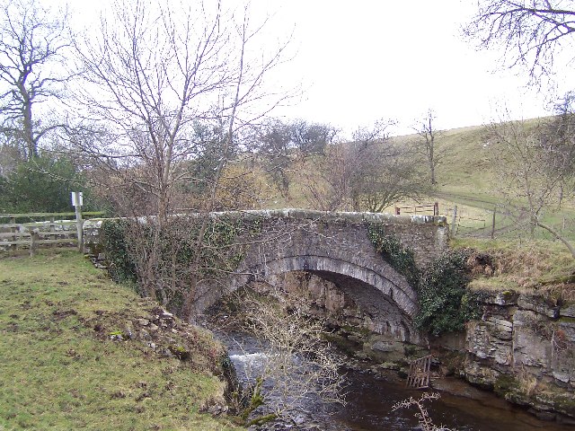
The moorland is characterized by its heather-covered hillsides, which create a purple-hued blanket during the warmer months. The terrain is undulating, with gentle slopes and shallow valleys. As visitors traverse the moor, they may come across small streams and ponds, adding to the charm and tranquility of the area.
Braithwaite Moor is home to a rich variety of wildlife, including several species of birds, such as curlews, lapwings, and red grouse. The moorland also supports a healthy population of small mammals, including hares, foxes, and the occasional roe deer.
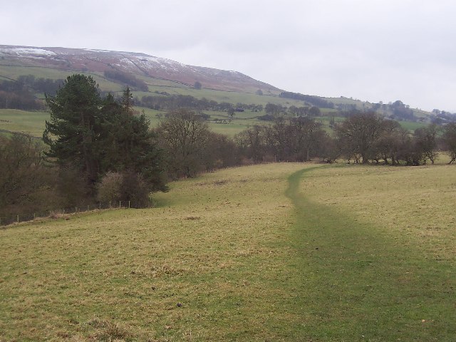
For outdoor enthusiasts, the moor offers ample opportunities for walking, hiking, and birdwatching. Several well-marked trails crisscross the landscape, allowing visitors to fully immerse themselves in the natural surroundings. The panoramic vistas from the higher points of the moor are truly breathtaking, offering sweeping views of the Yorkshire countryside.
Braithwaite Moor, with its unspoiled beauty and diverse wildlife, is a haven for nature lovers and a prime example of the stunning landscapes that Yorkshire has to offer. It is a place where visitors can escape the hustle and bustle of everyday life and reconnect with the natural world.
If you have any feedback on the listing, please let us know in the comments section below.
Braithwaite Moor Images
Images are sourced within 2km of 54.258922/-1.8243239 or Grid Reference SE1184. Thanks to Geograph Open Source API. All images are credited.


Braithwaite Moor is located at Grid Ref: SE1184 (Lat: 54.258922, Lng: -1.8243239)
Division: North Riding
Administrative County: North Yorkshire
District: Richmondshire
Police Authority: North Yorkshire
What 3 Words
///mouth.juggles.settled. Near Leyburn, North Yorkshire
Nearby Locations
Related Wikis
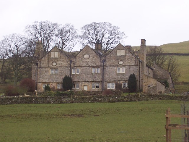
Braithwaite Hall
Braithwaite Hall is a 17th-century manor house in Coverdale in the Yorkshire Dales in England. It lies 1.8 miles (2.9 km) west of the village of East...

Coverham
Coverham is a village in Coverdale in the Yorkshire Dales in North Yorkshire, England. It lies 2 miles (3.2 km) west of the town of Middleham. == History... ==
Coverham Abbey
Coverham Abbey, North Yorkshire, England, was a Premonstratensian monastery that was founded at Swainby in 1190 by Helewisia, daughter of the Chief Justiciar...

Holy Trinity Church, Coverham
Holy Trinity Church is a redundant Anglican church in the village of Coverham, North Yorkshire, England. It is recorded in the National Heritage List...

Caldbergh with East Scrafton
Caldbergh with East Scrafton is a civil parish in the Richmondshire district of North Yorkshire, England. The parish includes the settlements of Caldbergh...

Caldbergh
Caldbergh (Caldeber in the Domesday Book) is a hamlet within the Yorkshire Dales, North Yorkshire, England. It lies about four miles south of Leyburn....
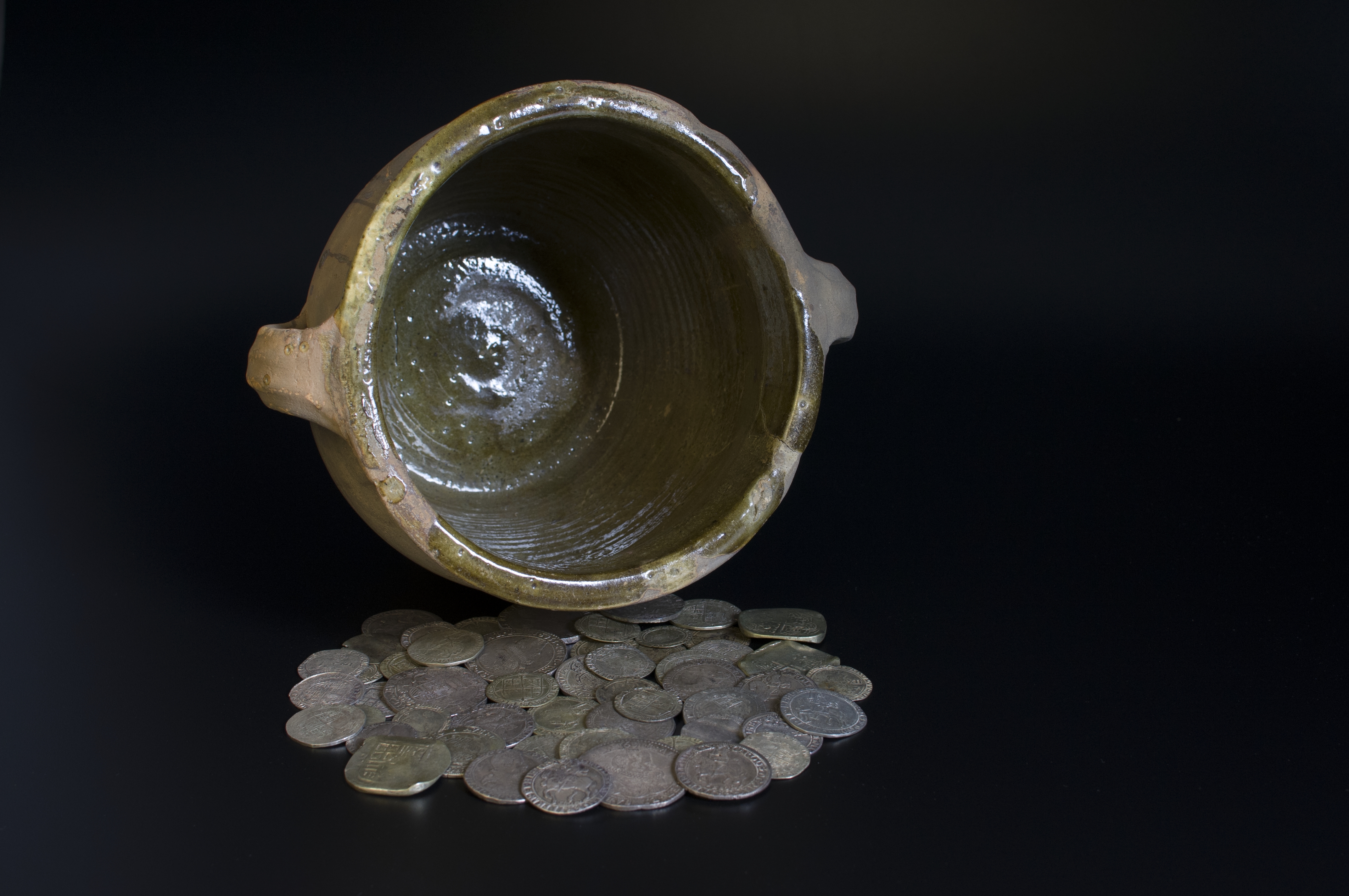
Middleham Hoard
The Middleham Hoard is a coin hoard found near Middleham, North Yorkshire in England. It dates from the period of the English Civil War, and consists of...

East Scrafton
East Scrafton is a hamlet in the Yorkshire Dales in the Richmondshire district of North Yorkshire, England. It is about 3 miles (5 km) south-west of Leyburn...
Nearby Amenities
Located within 500m of 54.258922,-1.8243239Have you been to Braithwaite Moor?
Leave your review of Braithwaite Moor below (or comments, questions and feedback).