Beanley Moor

Downs, Moorland in Northumberland

England

Beanley Moor

Titlington Mount Surrounded by Titlington Wood and overlooking Titlington Burn.
Titlington Mount Credit: Russel Wills

Beanley Moor is a vast and picturesque expanse of moorland located in the county of Northumberland, England. Situated in the northern part of the county, it covers an area of approximately 3,000 hectares. The moor is characterized by its rolling hills, expansive open spaces, and heather-clad landscapes, offering breathtaking views of the surrounding countryside.

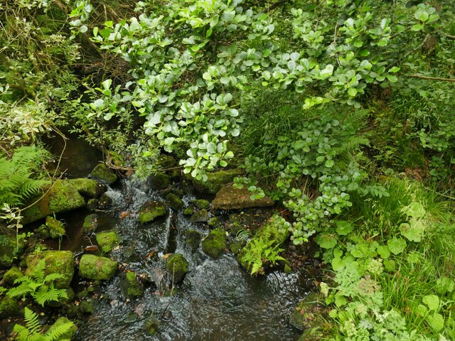
Beanley Moor is an important habitat for a diverse range of flora and fauna. The moorland is dominated by heather, which blankets the hillsides in vibrant shades of purple during the summer months. This provides a vital habitat for numerous bird species, including the elusive merlin, golden plover, and curlew. The moor is also home to a variety of small mammals, such as red squirrels, hares, and rabbits.

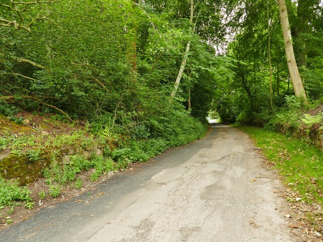
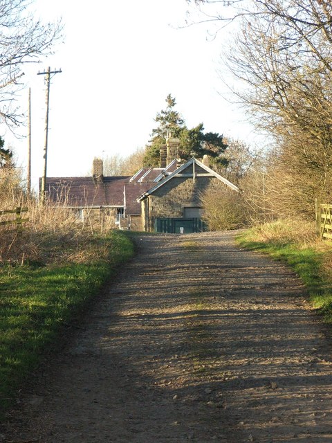
The moorland is crisscrossed by a network of footpaths and tracks, making it a popular destination for walkers, hikers, and nature enthusiasts. These paths offer visitors the opportunity to explore the rich biodiversity of the area and enjoy the tranquility of the moorland. Additionally, the moor is intersected by a number of streams and small rivers, adding to its natural beauty.

Beanley Moor is part of the Northumberland National Park, a protected area known for its outstanding natural beauty. The moor is managed by the National Park Authority, which works to preserve and enhance its unique characteristics. As a result, it provides a valuable recreational resource, offering visitors the chance to connect with nature and experience the peacefulness of the Northumberland countryside.

If you have any feedback on the listing, please let us know in the comments section below.

Beanley Moor Images

Images are sourced within 2km of 55.455414/-1.8371106 or Grid Reference NU1017. Thanks to Geograph Open Source API. All images are credited.

Titlington Mount Surrounded by Titlington Wood and overlooking Titlington Burn.
Titlington Mount
Surrounded by Titlington Wood and overlooking Titlington Burn.
Thorntree and pasture, Beanley
Beanley - Eglingham road
Eglingham village and valley of Eglingham Burn Viewed from Cloudy Crags Drive.
Edlingham church in the centre.
Eglingham village and valley of Eglingham Burn
Viewed from Cloudy Crags Drive. Edlingham church in the centre.
Tarry Lane, Eglingham Named after a property on the other side of the valley.
Tarry Lane, Eglingham
Named after a property on the other side of the valley.
Old pillbox adjacent to Tarry Lane, Eglingham Apparently it was feared in the Second World War that enemy troops might land on Northumberland's beaches and push inland. This was intended as part of the defences.
Old pillbox adjacent to Tarry Lane, Eglingham
Apparently it was feared in the Second World War that enemy troops might land on Northumberland's beaches and push inland. This was intended as part of the defences.
Storm damage on Tarry Lane Despite being near the bottom of a valley, these trees were felled in Storm Arwen in November 2021. So many trees were lost in Northumberland in that storm that many had not been dealt with eight months later.
Storm damage on Tarry Lane
Despite being near the bottom of a valley, these trees were felled in Storm Arwen in November 2021. So many trees were lost in Northumberland in that storm that many had not been dealt with eight months later.
The Eglingham Burn Viewed from Tarry Lane; there is (or was) a mill pond just upstream of here to refulate the flow in the burn, but it is long disused, inaccessible in the woods and probably silted up.
The Eglingham Burn
Viewed from Tarry Lane; there is (or was) a mill pond just upstream of here to refulate the flow in the burn, but it is long disused, inaccessible in the woods and probably silted up.
Eglingham Passing the Tankerville Arms.
Eglingham
Passing the Tankerville Arms.
Field by Eglingham
Field by Eglingham
Field by Eglingham There was some building activity at the far end.
Field by Eglingham
There was some building activity at the far end.
More chaos from Storm Arwen A year on and still finding more areas of storm damage.  This Beech tree might not have been in the best of health but was snapped in half like a twig.
More chaos from Storm Arwen
A year on and still finding more areas of storm damage. This Beech tree might not have been in the best of health but was snapped in half like a twig.
Byway crossing Eglingham Burn The road, now classified as a byway crosses the burn at the fencing where there's a bridge. It reaches the village, Eglingham just beyond the rise after the bridge.
Byway crossing Eglingham Burn
The road, now classified as a byway crosses the burn at the fencing where there's a bridge. It reaches the village, Eglingham just beyond the rise after the bridge.
Trees and Road near Eglingham
Trees and Road between Eglingham and Beanley
Titlington Mount A small off the beaten track development overlooking the village of Titlington
Titlington Mount
A small off the beaten track development overlooking the village of Titlington
Oilseed rape field By a minor road to the west of Beanley Plantation.
Oilseed rape field
By a minor road to the west of Beanley Plantation.
Sheep pasture
Sheep pasture
Show me another place!

Beanley Moor is located at Grid Ref: NU1017 (Lat: 55.455414, Lng: -1.8371106)

Unitary Authority: Northumberland

Police Authority: Northumbria

What 3 Words

///hitters.dwell.reclaimed. Near Whittingham, Northumberland

Nearby Locations

Beanley Moor

Related Wikis

Eglingham

Eglingham is a village in Northumberland, England, situated about 7 miles (11 km) north-west of Alnwick and 10 miles (16 km) from Wooler. It lies in the...

Eglingham Hall

Eglingham Hall (grid reference NU10421954) is a former mansion house and a Grade II* listed building situated at Eglingham, near Alnwick, Northumberland...

Hunterheugh Crags

Hunterheugh Crags are part of the Fellsandstone escarpment, 5 miles (8 km) north west of Alnwick, Northumberland, England and 9 miles (14 km) from the...

Beanley

Beanley is a village and former civil parish, now in the parish of Hedgeley in the county of Northumberland, England. It is situated to the north-west...

Jenny's Lantern

Jenny's Lantern is an area of moorland in north Northumberland, England, taking its name from an 18th-century 'eye-catcher' folly sited towards the top...

Hedgeley Hall

Hedgeley Hall is a privately owned late 18th-century country house situated near Powburn, Northumberland, 8 miles (13 km) northwest of Alnwick. It is a...

Shawdon Hall

Shawdon Hall is a privately owned 18th-century country house located between Bolton and Hedgeley, near Alnwick, Northumberland, in North East England....

Glanton railway station

Glanton railway station served the village of Glanton, Northumberland, England from 1887 to 1953 on the Cornhill Branch. == History == The station opened...

Nearby Amenities

Located within 500m of 55.455414,-1.8371106
Beanley Moor
Place: locality
Lat/Long: 55.4583625/-1.8391043
The data included in this document is from www.openstreetmap.org. The data is made available under ODbL.

Have you been to Beanley Moor?

Leave your review of Beanley Moor below (or comments, questions and feedback).