Hartley Mauditt

Settlement in Hampshire East Hampshire

England

Hartley Mauditt

Farmland, Worldham Potatoes occupied fields to the north and south of Hartley Park Farm.
Farmland, Worldham Credit: Andrew Smith

Hartley Mauditt is a picturesque village located in Hampshire, England. Situated in the eastern part of the county, it lies amidst rolling green hills and serene countryside. The village is small in size, with a population of around 300 residents, creating a close-knit community atmosphere.

Historically, Hartley Mauditt has deep roots dating back to the medieval period. Many of the buildings in the village showcase timeless architecture, with charming thatched cottages and traditional English houses adding to its timeless appeal. St. Mary's Church, a striking Norman structure, stands proudly as a reminder of the village's rich history.

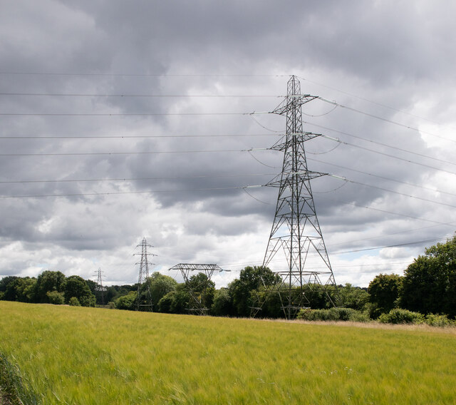
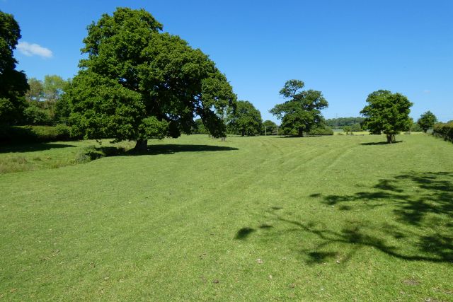
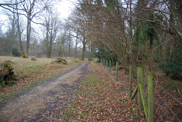
Surrounded by an abundance of natural beauty, Hartley Mauditt is an ideal destination for nature enthusiasts. The village is enveloped by lush meadows, woodlands, and scenic walking trails, offering residents and visitors alike the opportunity to explore the great outdoors and enjoy the tranquility of the countryside.

Despite its rural setting, Hartley Mauditt benefits from its proximity to nearby towns and cities. The village is located just a short drive away from the bustling market town of Alton, known for its quaint shops and historic charm. Additionally, the city of Winchester, with its renowned cathedral and cultural attractions, is within easy reach.

Hartley Mauditt is a peaceful and idyllic village, perfect for those seeking a retreat from the fast-paced urban lifestyle. Its historic charm, natural beauty, and welcoming community make it a truly special place to call home.

If you have any feedback on the listing, please let us know in the comments section below.

Hartley Mauditt Images

Images are sourced within 2km of 51.122852/-0.942583 or Grid Reference SU7436. Thanks to Geograph Open Source API. All images are credited.

Farmland, Worldham Potatoes occupied fields to the north and south of Hartley Park Farm.
Farmland, Worldham
Potatoes occupied fields to the north and south of Hartley Park Farm.
Farmland, Selborne A crop of beans to the north of the bridleway to Wick Hill.
Farmland, Selborne
A crop of beans to the north of the bridleway to Wick Hill.
132kV electricity lines passing beneath 400kV ones The pylon in the foreground carries power at 400kV between the national grid substations at Nursling and Fleet. The smaller pylons crossing beneath it carry power at 132kV between Fleet and the SSE 132/33kV substation at Fernhurst. To cross over the 400kV lines the 132kV lines both dip down and split, one circuit passing south of the big pylon and one passing north of it.
132kV electricity lines passing beneath 400kV ones
The pylon in the foreground carries power at 400kV between the national grid substations at Nursling and Fleet. The smaller pylons crossing beneath it carry power at 132kV between Fleet and the SSE 132/33kV substation at Fernhurst. To cross over the 400kV lines the 132kV lines both dip down and split, one circuit passing south of the big pylon and one passing north of it.
Farmland, Worldham
Farmland, Worldham
Pasture, Worldham
Pasture, Worldham
Farmland and cottages, Worldham
Farmland, Worldham
Farmland, Worldham
Farmland, Worldham
Farmland, Worldham
Pasture, Chawton
Pasture, Chawton
Bend on Selborne Road, just before Caker Stream
Junction on Selborne Road Junction of Selborne Road (B3006) with road to West Worldham. The Round House is visible on the right.
Junction on Selborne Road
Junction of Selborne Road (B3006) with road to West Worldham. The Round House is visible on the right.
Hilltop junction The third way, down the hill with a falling rock hazard, is signed to Oakhanger and Blackmoor.
Hilltop junction
The third way, down the hill with a falling rock hazard, is signed to Oakhanger and Blackmoor.
Lane to Hartley Maunditt Pedestrians need not hazard this narrow defile (not there is much traffic), there is a path along the field edge up to the right.
Lane to Hartley Maunditt
Pedestrians need not hazard this narrow defile (not there is much traffic), there is a path along the field edge up to the right.
Hartley Maunditt church St. Leonard's is the only building of the village proper left, a field to the north is mapped as site of the old village, but nothing obvious is to be seen.
Hartley Maunditt church
St. Leonard's is the only building of the village proper left, a field to the north is mapped as site of the old village, but nothing obvious is to be seen.
Lane to Farringdon Quite a stream was running down the road.
Lane to Farringdon
Quite a stream was running down the road.
Trees in old pit A small pit, mapped as 'Old Chalk Pit' in late Victorian times.
Trees in old pit
A small pit, mapped as 'Old Chalk Pit' in late Victorian times.
Tree by Hall Lane Looking towards Norton Farm and Selborne Road.
Tree by Hall Lane
Looking towards Norton Farm and Selborne Road.
Hartley Pond Across the road from the church, with nothing else around.
Hartley Pond
Across the road from the church, with nothing else around.
Show me another place!

Hartley Mauditt is located at Grid Ref: SU7436 (Lat: 51.122852, Lng: -0.942583)

Administrative County: Hampshire

District: East Hampshire

Police Authority: Hampshire

What 3 Words

///threading.steadily.doubts. Near Alton, Hampshire

Related Wikis

Worldham

Worldham is a civil parish in Hampshire, England. East Worldham is the main settlement in Worldham Parish, a civil parish with a population of approximately...

Hartley Mauditt

Hartley Mauditt is 2.6 miles (4.2 km) southeast of the town of Alton, and 1.2 miles (1.9 km) south of the village of East Worldham. The nearest railway...

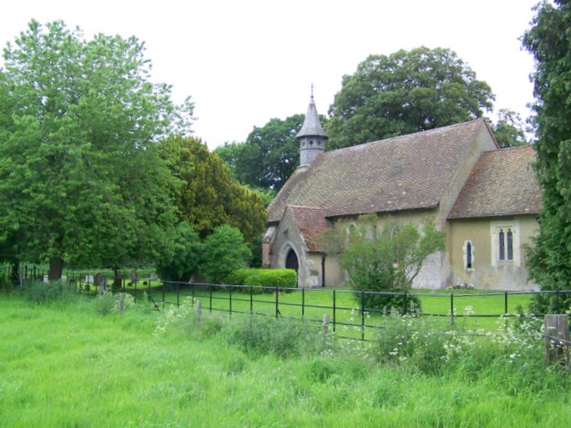
St Leonard's Church, Hartley Mauditt

St Leonard's Church is a Church of England parish church in the hamlet of Hartley Mauditt, East Hampshire district of Hampshire, England. All that is left...

West Worldham

West Worldham is a small village and former civil parish, now in the parish of Worldham, in the East Hampshire district of Hampshire, England. It is 2...

Wick Wood and Worldham Hangers

Wick Wood and Worldham Hangers is a 91.8-hectare (227-acre) biological Site of Special Scientific Interest west of Bordon in Hampshire. It is part of the...

East Worldham

East Worldham is a village and former civil parish, now in the parish of Worldham, in the East Hampshire district of Hampshire, England. It is 1.9 miles...

King John's Hill

King John's Hill is the site of an Iron Age hillfort located in Hampshire, in southeast England. The hill is situated in the parish of Worldham, in East...

Coombe Wood and The Lythe

Coombe Wood and The Lythe is a 44-hectare (110-acre) biological Site of Special Scientific Interest west of Bordon in Hampshire. It is part of East Hampshire...

Related Videos

WALKS IN HAMPSHIRE at SELBORNE & THE ZIG ZAG PATH (SOUTH DOWNS NATIONAL PARK) [4K]

This is another video in my series “Walks in Hampshire” accompanied by my Whippet (Logan). In this episode, I visit the village of ...

Have you ever been to Hartley Mauditt? | Haunted & Ghosts? | Travel to England GB UK | January 2021

In this video I take you on a trip to the abandoned village Hartley Mauditt in Hampshire. This is one of the places where you can go ...

Nearby Amenities

Located within 500m of 51.122852,-0.942583
Barrier: stile
Lat/Long: 51.126215/-0.9404039
West Worldham
Old Name: Little Worldham
Place: hamlet
Wikidata: Q7987019
Lat/Long: 51.1270149/-0.9420256
Note: Gate no longer in use - wealded shut as part of fence
Lat/Long: 51.1192344/-0.9397659
Barrier: stile
Lat/Long: 51.1191508/-0.9421809
Barrier: stile
Lat/Long: 51.1187721/-0.9429612
Little Wood Cottage
Place: isolated_dwelling
Source: Bing
Lat/Long: 51.1260482/-0.9465417
Hartley Mauditt House
Place: isolated_dwelling
Source: Bing
Lat/Long: 51.1234229/-0.9406123
Hartley Mauditt
Place: hamlet
Source: Bing
Lat/Long: 51.1207121/-0.9395768
Jeffries Cottage
Place: isolated_dwelling
Source: Bing
Lat/Long: 51.1224568/-0.9406721
West Worldham Farm
Place: farm
Source: Bing
Lat/Long: 51.1256034/-0.9405896
Material: wood
Power: pole
Lat/Long: 51.1225378/-0.9450371
Material: wood
Power: pole
Lat/Long: 51.1233052/-0.944643
Material: wood
Power: pole
Lat/Long: 51.124109/-0.944175
Material: wood
Power: pole
Lat/Long: 51.1248753/-0.9437514
Material: wood
Power: pole
Lat/Long: 51.1257516/-0.9432765
Material: wood
Power: pole
Lat/Long: 51.1266079/-0.9428084
Material: wood
Power: pole
Lat/Long: 51.1198356/-0.9465301
Material: wood
Power: pole
Lat/Long: 51.1207818/-0.9460312
Material: wood
Power: pole
Lat/Long: 51.121701/-0.9454894
Deserted Medieval Village of Hartley Mauditt (site of)
Historic: archaeological_site
Lat/Long: 51.120299/-0.941569
Post Box
Collection Plate: CP5
Collection Times: Mo-Fr 16:00; Sa 09:00
Last Checked: 2021-08-08
Operator: Royal Mail
Operator Wikidata: Q638098
Post Box Type: wall
Ref: GU34 17
Royal Cypher: VR
Royal Cypher Wikidata: Q33102356
Source: survey
Lat/Long: 51.1259996/-0.9406792
Give Way
Lat/Long: 51.1272934/-0.9421675
Give Way
Lat/Long: 51.1272586/-0.9418584
The data included in this document is from www.openstreetmap.org. The data is made available under ODbL.

Have you been to Hartley Mauditt?

Leave your review of Hartley Mauditt below (or comments, questions and feedback).