All Cannings Down
Downs, Moorland in Wiltshire
England
All Cannings Down
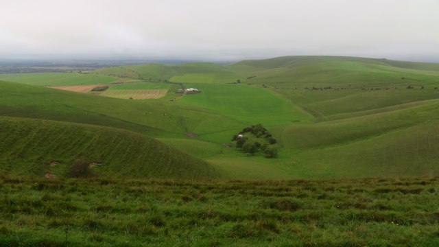
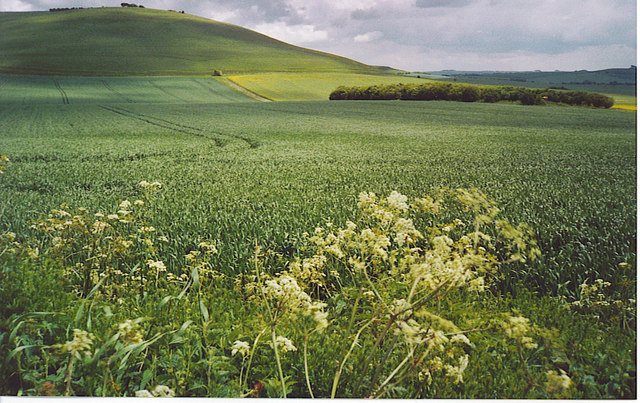
![A walk from Allington to the Wansdyke and back [17] Seen from Rybury, atop Clifford's Hill, is this sweeping view of downland. Hill Barn is in the distance with Milk Hill on the right.
The walk leaves Allington and goes south to run along the towpath of the Kennet and Avon Canal before turning north to cross the minor road at Cannings Cross. Ascending steeply, the path leads to the causewayed enclosure and hillfort of Rybury atop Clifford’s Hill. After a short descent, there is a long climb up Tan Hill to the Wansdyke. A short way along the dyke, the return journey starts, a long descent down a well surfaced track, a public bridleway, to Allington. Just over 4½ miles.](https://s1.geograph.org.uk/geophotos/07/36/45/7364557_c6c3eb1a.jpg)
All Cannings Down is a picturesque area located in the county of Wiltshire, England. It is situated within the village of All Cannings, which lies on the northern edge of Salisbury Plain. The Down is a prominent feature of the local landscape, offering stunning views of the surrounding countryside.
Covering an area of approximately 500 acres, All Cannings Down is characterized by its gentle slopes and rolling hills. The landscape is predominantly composed of open grassland, interspersed with patches of heather and gorse. This combination of vegetation creates a diverse habitat that supports a variety of wildlife, including numerous bird species and small mammals.
The Down is a popular spot for outdoor enthusiasts, offering ample opportunities for walking, hiking, and birdwatching. There are several well-maintained footpaths and trails that provide access to the area, allowing visitors to explore its natural beauty at their own pace. The panoramic views from the highest points of the Down are particularly breathtaking, showcasing the expansive countryside and distant hills.
In addition to its natural beauty, All Cannings Down holds historical significance. The area has been inhabited for thousands of years, with evidence of Bronze Age settlements and burial mounds found in the vicinity. These archaeological remnants further enhance the allure of the Down, inviting visitors to delve into its rich past.
Overall, All Cannings Down in Wiltshire offers a tranquil and picturesque setting, perfect for those seeking a peaceful retreat amidst the natural wonders of the English countryside.
If you have any feedback on the listing, please let us know in the comments section below.
All Cannings Down Images
Images are sourced within 2km of 51.389182/-1.8624316 or Grid Reference SU0965. Thanks to Geograph Open Source API. All images are credited.
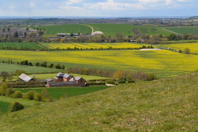
![A walk from Allington to the Wansdyke and back [21] Seen, from the bridleway, is this view of the downs. Hill Barn is just right of centre with Milk Hill beyond.
The walk leaves Allington and goes south to run along the towpath of the Kennet and Avon Canal before turning north to cross the minor road at Cannings Cross. Ascending steeply, the path leads to the causewayed enclosure and hillfort of Rybury atop Clifford’s Hill. After a short descent, there is a long climb up Tan Hill to the Wansdyke. A short way along the dyke, the return journey starts, a long descent down a well surfaced track, a public bridleway, to Allington. Just over 4½ miles.](https://s0.geograph.org.uk/geophotos/07/36/51/7365172_470b9b54.jpg)
![A walk from Allington to the Wansdyke and back [22] Alongside the bridleway is this covered reservoir.
The walk leaves Allington and goes south to run along the towpath of the Kennet and Avon Canal before turning north to cross the minor road at Cannings Cross. Ascending steeply, the path leads to the causewayed enclosure and hillfort of Rybury atop Clifford’s Hill. After a short descent, there is a long climb up Tan Hill to the Wansdyke. A short way along the dyke, the return journey starts, a long descent down a well surfaced track, a public bridleway, to Allington. Just over 4½ miles.](https://s1.geograph.org.uk/geophotos/07/36/51/7365173_3c57a845.jpg)
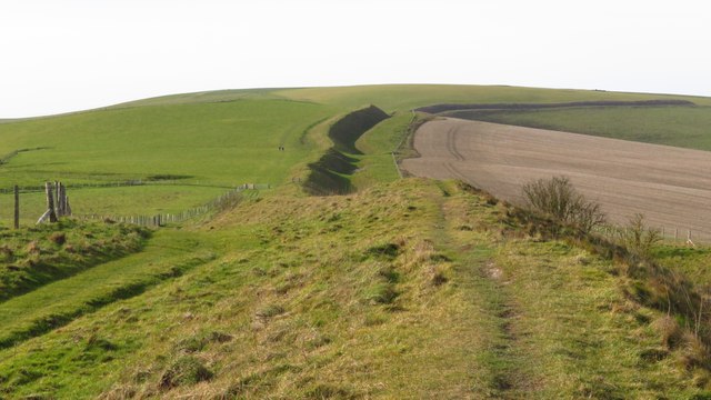
![A walk from Allington to the Wansdyke and back [24] The bridleway climbs Tan Hill. The ascent is fairly gentle, but very long.
The walk leaves Allington and goes south to run along the towpath of the Kennet and Avon Canal before turning north to cross the minor road at Cannings Cross. Ascending steeply, the path leads to the causewayed enclosure and hillfort of Rybury atop Clifford’s Hill. After a short descent, there is a long climb up Tan Hill to the Wansdyke. A short way along the dyke, the return journey starts, a long descent down a well surfaced track, a public bridleway, to Allington. Just over 4½ miles.](https://s3.geograph.org.uk/geophotos/07/36/51/7365175_50b3db3c.jpg)
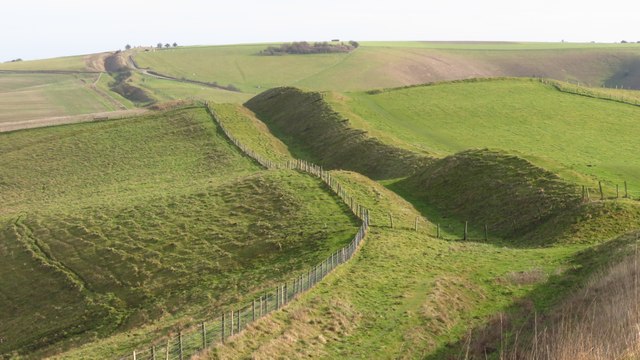
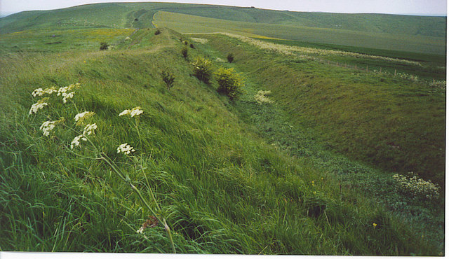
![A walk from Allington to the Wansdyke and back [26] Having descended slightly from the crest of Tan Hill, Wansdyke is reached.
The walk leaves Allington and goes south to run along the towpath of the Kennet and Avon Canal before turning north to cross the minor road at Cannings Cross. Ascending steeply, the path leads to the causewayed enclosure and hillfort of Rybury atop Clifford’s Hill. After a short descent, there is a long climb up Tan Hill to the Wansdyke. A short way along the dyke, the return journey starts, a long descent down a well surfaced track, a public bridleway, to Allington. Just over 4½ miles.](https://s1.geograph.org.uk/geophotos/07/36/51/7365177_965051ec.jpg)
![A walk from Allington to the Wansdyke and back [27] At this junction of tracks, there are three ways to go. This way, after crossing Wansdyke, leads to Allington.
The walk leaves Allington and goes south to run along the towpath of the Kennet and Avon Canal before turning north to cross the minor road at Cannings Cross. Ascending steeply, the path leads to the causewayed enclosure and hillfort of Rybury atop Clifford’s Hill. After a short descent, there is a long climb up Tan Hill to the Wansdyke. A short way along the dyke, the return journey starts, a long descent down a well surfaced track, a public bridleway, to Allington. Just over 4½ miles.](https://s2.geograph.org.uk/geophotos/07/36/51/7365178_fcbdc269.jpg)
![A walk from Allington to the Wansdyke and back [28] At this junction of tracks, there are three ways to go. This way, leads across Allington Down to Beckhampton.
The walk leaves Allington and goes south to run along the towpath of the Kennet and Avon Canal before turning north to cross the minor road at Cannings Cross. Ascending steeply, the path leads to the causewayed enclosure and hillfort of Rybury atop Clifford’s Hill. After a short descent, there is a long climb up Tan Hill to the Wansdyke. A short way along the dyke, the return journey starts, a long descent down a well surfaced track, a public bridleway, to Allington. Just over 4½ miles.](https://s3.geograph.org.uk/geophotos/07/36/51/7365179_099f31f9.jpg)
![A walk from Allington to the Wansdyke and back [29] At this junction of tracks, there are three ways to go. This way follows Wansdyke eastwards.
The walk leaves Allington and goes south to run along the towpath of the Kennet and Avon Canal before turning north to cross the minor road at Cannings Cross. Ascending steeply, the path leads to the causewayed enclosure and hillfort of Rybury atop Clifford’s Hill. After a short descent, there is a long climb up Tan Hill to the Wansdyke. A short way along the dyke, the return journey starts, a long descent down a well surfaced track, a public bridleway, to Allington. Just over 4½ miles.](https://s0.geograph.org.uk/geophotos/07/36/51/7365180_91d3f97a.jpg)
![A walk from Allington to the Wansdyke and back [32] The well surfaced track, a public bridleway, rises slightly before descending to Allington.
The walk leaves Allington and goes south to run along the towpath of the Kennet and Avon Canal before turning north to cross the minor road at Cannings Cross. Ascending steeply, the path leads to the causewayed enclosure and hillfort of Rybury atop Clifford’s Hill. After a short descent, there is a long climb up Tan Hill to the Wansdyke. A short way along the dyke, the return journey starts, a long descent down a well surfaced track, a public bridleway, to Allington. Just over 4½ miles.](https://s3.geograph.org.uk/geophotos/07/36/51/7365183_03be8ec5.jpg)


All Cannings Down is located at Grid Ref: SU0965 (Lat: 51.389182, Lng: -1.8624316)
Unitary Authority: Wiltshire
Police Authority: Wiltshire
What 3 Words
///polar.central.hulk. Near Avebury, Wiltshire
Nearby Locations
Related Wikis


Nearby Amenities
Located within 500m of 51.389182,-1.8624316Have you been to All Cannings Down?
Leave your review of All Cannings Down below (or comments, questions and feedback).