Caygill Moss

Downs, Moorland in Yorkshire Harrogate

England

Caygill Moss

Surveying Tower, Hardcastle Moor The surveying tower was used in the driving of the aqueduct tunnel under Greenhow Hill abt 1900. The tunnel is part of a long aqueduct from Scar House Reservoir to Bradford. In the foreground is No1 Well Shaft, one of 3 access points in the tunnel which is 3.5 miles long and reaches its greatest depth below the ground surface at No2 Shaft, Craven Cross, Greenhow, where it is 600 feet down. This is deeper than any of the mines reached. For further information see <span class="nowrap"><a title="http://www.greenhow-hill.org.uk/mining/bcww.html" rel="nofollow ugc noopener" href="http://www.greenhow-hill.org.uk/mining/bcww.html">Link</a><img style="margin-left:2px;" alt="External link" title="External link - shift click to open in new window" src="https://s1.geograph.org.uk/img/external.png" width="10" height="10"/></span>
Surveying Tower, Hardcastle Moor Credit: Malcolm Street

Caygill Moss is a picturesque region located in the heart of Yorkshire, England. Nestled amidst the stunning natural beauty of the Yorkshire Downs and Moorland, it offers breathtaking views and a tranquil ambiance.

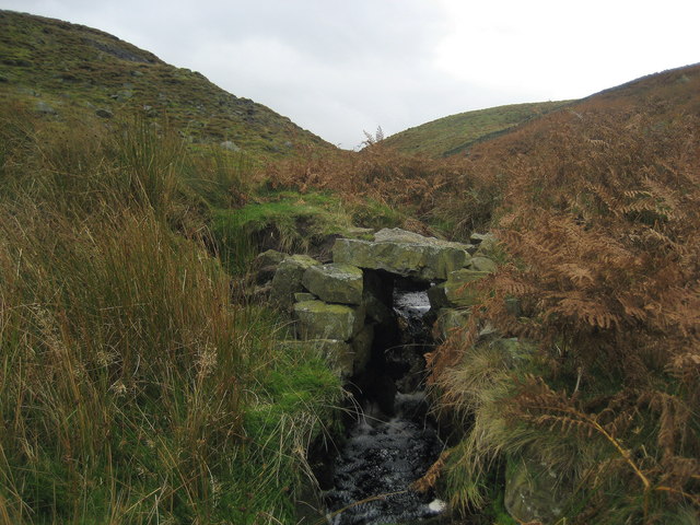
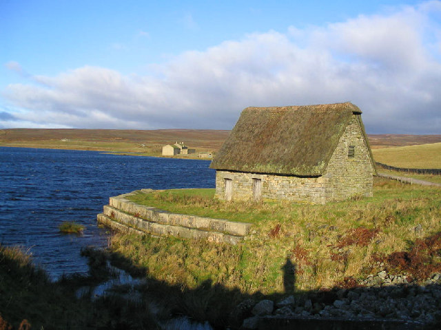
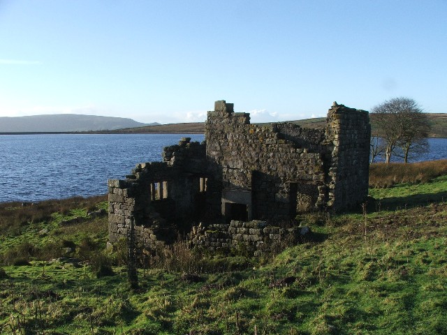
The landscape of Caygill Moss is characterized by rolling hills, expansive meadows, and vast stretches of moss-covered moorland. The area is known for its diverse ecosystem, with an abundance of flora and fauna. Visitors can expect to encounter an array of wildflowers, heather, and ferns, providing a vibrant tapestry of colors throughout the seasons. The moorland is home to various bird species, including kestrels, curlews, and grouse, making it a haven for birdwatchers and nature enthusiasts.

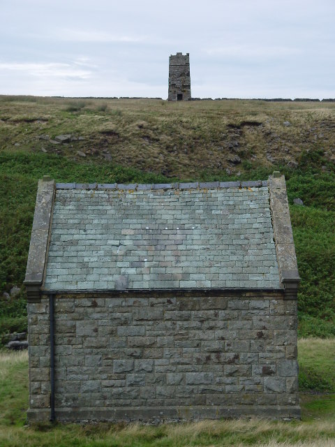
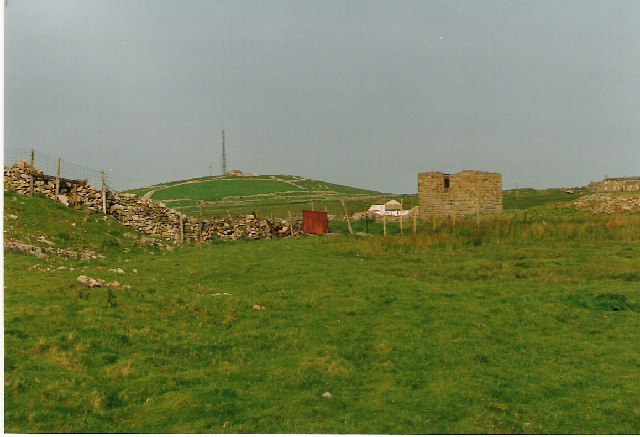
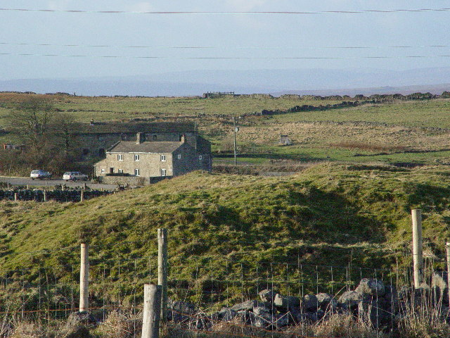
The region also boasts an intriguing historical heritage. Ancient stone circles and burial mounds can be found scattered across the landscape, offering a glimpse into the area's rich past. The nearby village of Caygill is steeped in history, with charming traditional cottages and a quaint village church that dates back centuries.

Outdoor enthusiasts flock to Caygill Moss for its excellent hiking and walking opportunities. The expansive network of trails offers something for all levels of ability, from gentle strolls to challenging hikes. The famous Pennine Way, a long-distance footpath that stretches across the north of England, passes through this region, attracting avid hikers from far and wide.

Overall, Caygill Moss is a haven for nature lovers and those seeking a peaceful retreat in the heart of Yorkshire's stunning countryside.

If you have any feedback on the listing, please let us know in the comments section below.

Caygill Moss Images

Images are sourced within 2km of 54.084119/-1.8599599 or Grid Reference SE0965. Thanks to Geograph Open Source API. All images are credited.

Surveying Tower, Hardcastle Moor The surveying tower was used in the driving of the aqueduct tunnel under Greenhow Hill abt 1900. The tunnel is part of a long aqueduct from Scar House Reservoir to Bradford. In the foreground is No1 Well Shaft, one of 3 access points in the tunnel which is 3.5 miles long and reaches its greatest depth below the ground surface at No2 Shaft, Craven Cross, Greenhow, where it is 600 feet down. This is deeper than any of the mines reached. For further information see <span class="nowrap"><a title="http://www.greenhow-hill.org.uk/mining/bcww.html" rel="nofollow ugc noopener" href="http://www.greenhow-hill.org.uk/mining/bcww.html">Link</a><img style="margin-left:2px;" alt="External link" title="External link - shift click to open in new window" src="https://s1.geograph.org.uk/img/external.png" width="10" height="10"/></span>
Surveying Tower, Hardcastle Moor
The surveying tower was used in the driving of the aqueduct tunnel under Greenhow Hill abt 1900. The tunnel is part of a long aqueduct from Scar House Reservoir to Bradford. In the foreground is No1 Well Shaft, one of 3 access points in the tunnel which is 3.5 miles long and reaches its greatest depth below the ground surface at No2 Shaft, Craven Cross, Greenhow, where it is 600 feet down. This is deeper than any of the mines reached. For further information see LinkExternal link
Craven Cross, Greenhow The square building in the middle surrounds No2 Shaft, sunk by Bradford Corporation Water Works abt 1900 as they drove the 3.5 mile long aqueduct tunnel under the hill. The depth to the tunnel from the surface is about 400 feet at this point
Craven Cross, Greenhow
The square building in the middle surrounds No2 Shaft, sunk by Bradford Corporation Water Works abt 1900 as they drove the 3.5 mile long aqueduct tunnel under the hill. The depth to the tunnel from the surface is about 400 feet at this point
New Shaft Engine House at Merryfield Hole This housed a steam engine which was used to pump water out of the mine shaft surrounded by a fence to the left of it.
New Shaft Engine House at Merryfield Hole
This housed a steam engine which was used to pump water out of the mine shaft surrounded by a fence to the left of it.
Lily Green, Greenhow The mound in the foreground is an old mine shaft for the Prim or Prime Gap Vein which was worked for lead.
Lily Green, Greenhow
The mound in the foreground is an old mine shaft for the Prim or Prime Gap Vein which was worked for lead.
Round Hill Shooting Box
Round Hill Swamp from Hollin Crags
Hollin Crags gritstone outcrop
Ravenstone Moor Snow is approaching from the north.
Ravenstone Moor
Snow is approaching from the north.
New Shaft at Lower Stoney Grooves The elegant arched portal in the foreground is the outlet from a water wheel. The keystone is beautifully carved. Apparently such craftsmanship was not uncommon for such mundane edifices. The lead mine expert M C Gill tells me that the outlets at Grimwith had similar "Gothic" arches
New Shaft at Lower Stoney Grooves
The elegant arched portal in the foreground is the outlet from a water wheel. The keystone is beautifully carved. Apparently such craftsmanship was not uncommon for such mundane edifices. The lead mine expert M C Gill tells me that the outlets at Grimwith had similar "Gothic" arches
Ruins of Tower on Hardcastle Moor Built during the construction of underground tunnel that transports water from the reservoirs in Upper Nidderdale to Bradford, which makes this survey tower over 100 years old.  It occupies a lonely windswept position, but acts as an excellent landmark.
Ruins of Tower on Hardcastle Moor
Built during the construction of underground tunnel that transports water from the reservoirs in Upper Nidderdale to Bradford, which makes this survey tower over 100 years old. It occupies a lonely windswept position, but acts as an excellent landmark.
On Hardcastle Moor above Brandstone Beck The upper reaches of Brandstone Beck are in a narrow valley below this stretch on the northern fringes of Hardcastle Moor.
On Hardcastle Moor above Brandstone Beck
The upper reaches of Brandstone Beck are in a narrow valley below this stretch on the northern fringes of Hardcastle Moor.
Round Hill Gill Moorland watercourse that adds its strength to Brandstone Beck, finally entering the River Nidd just north of Pateley Bridge.
Round Hill Gill
Moorland watercourse that adds its strength to Brandstone Beck, finally entering the River Nidd just north of Pateley Bridge.
Water related Building on Ravenstone Moor I believe there is a shaft housed within this building that gives access to an underground tunnel that conveys water from the Upper Nidderdale Reservoirs to the City of Bradford.
Water related Building on Ravenstone Moor
I believe there is a shaft housed within this building that gives access to an underground tunnel that conveys water from the Upper Nidderdale Reservoirs to the City of Bradford.
Approaching Far Side This green lane has been given the grand title of Greenhow Industrial Heritage Trail.
Approaching Far Side
This green lane has been given the grand title of Greenhow Industrial Heritage Trail.
Gate and ladder stile near Keld Houses This photograph shows a view of the gate and ladder stile that provides access to the public footpath to Forest Road from the B6265 road near Keld Houses. The picture was taken looking in a south-south-westerly direction towards Blow Tarn.
Gate and ladder stile near Keld Houses
This photograph shows a view of the gate and ladder stile that provides access to the public footpath to Forest Road from the B6265 road near Keld Houses. The picture was taken looking in a south-south-westerly direction towards Blow Tarn.
Turf Walls and Rushy Moorland The remains of Old Merryfield Dams, constructed to retain water for the Merryfield Smelt Mill that was located nearby in the Mid 18thC.
Turf Walls and Rushy Moorland
The remains of Old Merryfield Dams, constructed to retain water for the Merryfield Smelt Mill that was located nearby in the Mid 18thC.
Barn & broken walls at Merryfield Marked as a considerably sized building named as Merryfield Hall here in 1849 all that remains is this small stone barn. This was probably a lead miners property and when the mines closed it was demolished.
Barn & broken walls at Merryfield
Marked as a considerably sized building named as Merryfield Hall here in 1849 all that remains is this small stone barn. This was probably a lead miners property and when the mines closed it was demolished.
Grimwith Reservoir The ling thatched building at Rough Hill on Grimwith reservoir Grassington
Grimwith Reservoir
The ling thatched building at Rough Hill on Grimwith reservoir Grassington
Show me another place!

Caygill Moss is located at Grid Ref: SE0965 (Lat: 54.084119, Lng: -1.8599599)

Division: West Riding

Administrative County: North Yorkshire

District: Harrogate

Police Authority: North Yorkshire

What 3 Words

///cold.transcribes.surveyed. Near Pateley Bridge, North Yorkshire

Nearby Locations

Caygill Moss

Related Wikis

Stump Cross Caverns

Stump Cross Caverns is a limestone cave system between Wharfedale and Nidderdale in North Yorkshire, England. == Geography == The caverns at Stump Cross...

Greenhow

Greenhow is a village in North Yorkshire, England, often referred to as Greenhow Hill. The term how derives from the Old Norse word haugr meaning a hill...

Grimwith Reservoir

Grimwith Reservoir is located in the Yorkshire Dales in North Yorkshire, England. It was originally built by the Bradford Corporation as one of eleven...

Trollers Gill

Trollers Gill is a limestone gill or gorge in North Yorkshire, England, close to the village of Skyreholme and 4.7 miles (7.5 km) south-east of Grassington...

Nearby Amenities

Located within 500m of 54.084119,-1.8599599
Man Made: shooting_butt
Source: Bing
Lat/Long: 54.0813514/-1.8553305
Man Made: shooting_butt
Source: Bing
Lat/Long: 54.0816882/-1.8577439
Man Made: shooting_butt
Source: Bing
Lat/Long: 54.081899/-1.859364
Man Made: shooting_butt
Source: Bing
Lat/Long: 54.0817857/-1.8585379
Man Made: shooting_butt
Source: Bing
Lat/Long: 54.0814647/-1.8561298
Man Made: shooting_butt
Source: Bing
Lat/Long: 54.0812696/-1.8545097
Man Made: shooting_butt
Source: Bing
Lat/Long: 54.0815654/-1.8569184
The data included in this document is from www.openstreetmap.org. The data is made available under ODbL.

Have you been to Caygill Moss?

Leave your review of Caygill Moss below (or comments, questions and feedback).