Hartlebury

Settlement in Worcestershire Wychavon

England

Hartlebury

Concrete Milestone, A449, Crossway Green North of the Mitre Oak pub (<a href="https://www.geograph.org.uk/photo/2974109">SO8468 : The Mitre Oak near Crossway Green, Worcestershire</a>) and almost opposite the oak-framed church of St Bishop's Wood. On the verge of the South bound carriageway of the trunk road. The contextual view showing the reverse of the milestone is <a href="https://www.geograph.org.uk/photo/4427744">SO8468 : Milestone on the A449 south of Hartlebury</a>.

Inscription: A449 / Worcester 9 / 5 Kidderminster / C. C. W.

Milestone Society National ID: WO_WOKD09
Concrete Milestone, A449, Crossway Green Credit: Mr Red

Hartlebury is a charming village located in the county of Worcestershire, England. Situated approximately four miles south of the historic city of Kidderminster, Hartlebury boasts a rich history and a thriving community.

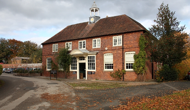
The village is perhaps best known for its impressive Hartlebury Castle, which dates back to the 13th century. Once the residence of the Bishops of Worcester, the castle now houses the Worcestershire County Museum, showcasing the region's extensive collection of art, archaeology, and social history. The castle's stunning gardens are also a popular attraction, offering visitors a tranquil escape.

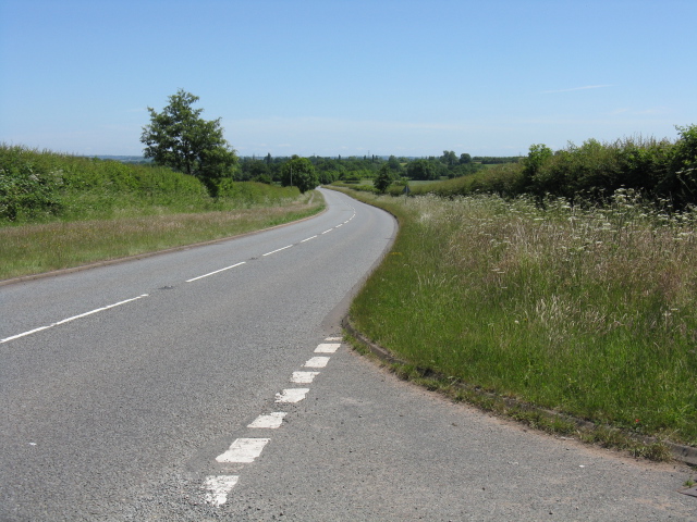
Hartlebury is renowned for its picturesque countryside, with rolling hills and scenic landscapes. The village sits on the banks of the River Severn, providing opportunities for leisurely walks and boat trips. Additionally, the Worcestershire Way, a long-distance footpath, passes through the village, attracting hikers and nature enthusiasts.

Despite its small size, Hartlebury has a vibrant community with a range of amenities. The village offers a variety of local shops, pubs, and restaurants, providing residents and visitors with essential services and a taste of traditional English hospitality.

Transport links in Hartlebury are well-developed, with regular bus services connecting the village to neighboring towns and cities. The nearby Kidderminster train station also offers direct links to Birmingham, making Hartlebury an attractive location for commuters.

Overall, Hartlebury is a captivating village that seamlessly blends its historical heritage with modern amenities, making it an appealing destination for tourists and a delightful place to call home.

If you have any feedback on the listing, please let us know in the comments section below.
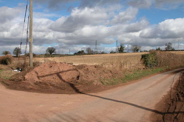
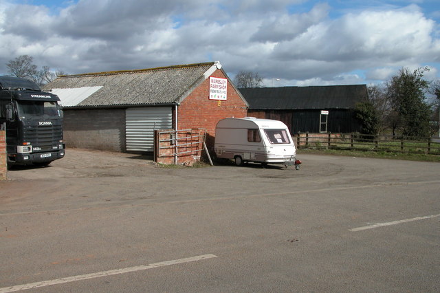
Hartlebury Images

Images are sourced within 2km of 52.334481/-2.2275028 or Grid Reference SO8470. Thanks to Geograph Open Source API. All images are credited.

Concrete Milestone, A449, Crossway Green North of the Mitre Oak pub (<a href="https://www.geograph.org.uk/photo/2974109">SO8468 : The Mitre Oak near Crossway Green, Worcestershire</a>) and almost opposite the oak-framed church of St Bishop's Wood. On the verge of the South bound carriageway of the trunk road. The contextual view showing the reverse of the milestone is <a href="https://www.geograph.org.uk/photo/4427744">SO8468 : Milestone on the A449 south of Hartlebury</a>.

Inscription: A449 / Worcester 9 / 5 Kidderminster / C. C. W.

Milestone Society National ID: WO_WOKD09
Concrete Milestone, A449, Crossway Green
North of the Mitre Oak pub (SO8468 : The Mitre Oak near Crossway Green, Worcestershire) and almost opposite the oak-framed church of St Bishop's Wood. On the verge of the South bound carriageway of the trunk road. The contextual view showing the reverse of the milestone is SO8468 : Milestone on the A449 south of Hartlebury. Inscription: A449 / Worcester 9 / 5 Kidderminster / C. C. W. Milestone Society National ID: WO_WOKD09
Stourport Road, Chadwick Bank Passing Bell's Farm Shop.
Stourport Road, Chadwick Bank
Passing Bell's Farm Shop.
Parsons Lane and Crown Lane crossroads, near Crossway Green
Waresley Farm Shop, Waresley This farm shop is situated by a round-about on the A449 between Worcester and Kidderminster.
Waresley Farm Shop, Waresley
This farm shop is situated by a round-about on the A449 between Worcester and Kidderminster.
Entrance to Hartlebury Trading estate
On the Run Roadside cafe by the junction of the A449 and a minor road, south of Waresley
On the Run
Roadside cafe by the junction of the A449 and a minor road, south of Waresley
Lane from Norchard to Crown Lane This narrow lane has come from the hamlet of Norchard, and joins Crown Lane at a cross roads, which can be glimpsed in the distance.
Lane from Norchard to Crown Lane
This narrow lane has come from the hamlet of Norchard, and joins Crown Lane at a cross roads, which can be glimpsed in the distance.
Lane from Crown Lane to Norchard Looking in the direction of the hamlet of Norchard. This lane is typical of those in the area, being single-track and with hedges on both sides.

<a href="https://www.geograph.org.uk/photo/1848474">SO8469 : Lane from Norchard to Crown Lane</a>.
Lane from Crown Lane to Norchard
Looking in the direction of the hamlet of Norchard. This lane is typical of those in the area, being single-track and with hedges on both sides. SO8469 : Lane from Norchard to Crown Lane.
Ploughed field The field is adjacent to the lane from Crown Lane to the hamlet of Norchard.
Ploughed field
The field is adjacent to the lane from Crown Lane to the hamlet of Norchard.
Fields near Crown Lane The fields in the far distance have cattle in them.
Fields near Crown Lane
The fields in the far distance have cattle in them.
Parsons Lane meets Crown Lane A rural crossroads in the middle of not much at all.
Parsons Lane meets Crown Lane
A rural crossroads in the middle of not much at all.
Wheatfield off Parsons Lane
Crown Lane crossroads
Crown Lane, looking east from the crossroads
Fields near Crown Lane
Crown Lane railway overbridge
Crown Lane at the trading estate
A449 at Crossway Green village boundary
Show me another place!

Hartlebury is located at Grid Ref: SO8470 (Lat: 52.334481, Lng: -2.2275028)

Administrative County: Worcestershire

District: Wychavon

Police Authority: West Mercia

What 3 Words

///excuse.bring.scare. Near Hartlebury, Worcestershire

Nearby Locations

Hartlebury Waresley

Related Wikis

Hartlebury railway station

Hartlebury railway station serves the village of Hartlebury in Worcestershire, England. All trains serving the station are operated by West Midlands Trains...

Hartlebury

Hartlebury is a village and civil parish in the Wychavon district of Worcestershire, England. It is 4 miles (6.4 km) south of Kidderminster. The village...
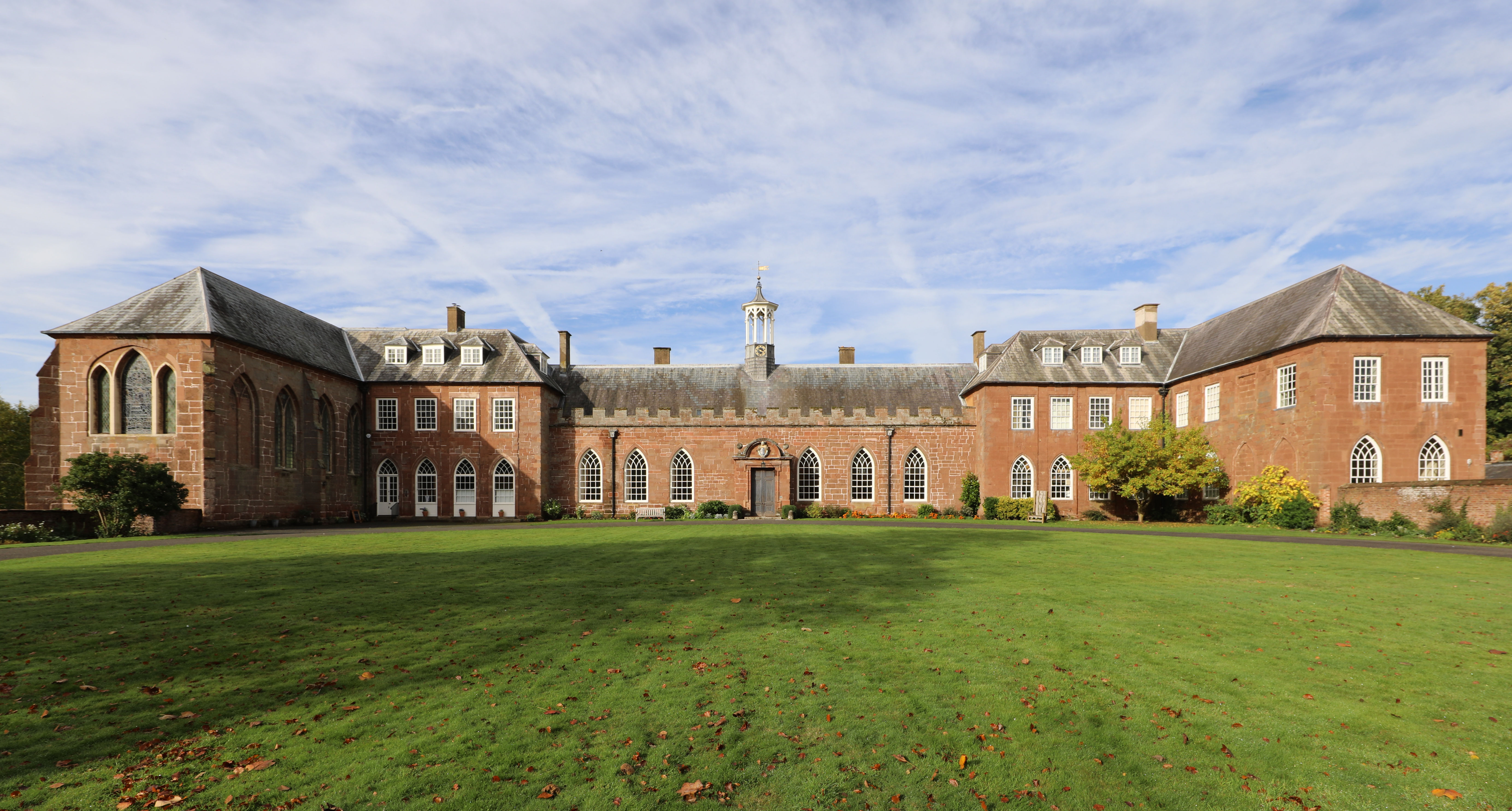
Hartlebury Castle

Hartlebury Castle, a Grade I listed building, near Hartlebury in Worcestershire, central England, was built in the mid-13th century as a fortified manor...

Worcestershire County Museum

Worcestershire County Museum is a local museum located within Hartlebury Castle in Hartlebury, Worcestershire, England, near the City of Worcester. The...

Hartlebury Common

Hartlebury Common is an area of lowland heath in north Worcestershire, England, situated just outside the town of Stourport-on-Severn. Hartlebury Common...

Crossway Green

Crossway Green is a village in Worcestershire, England.

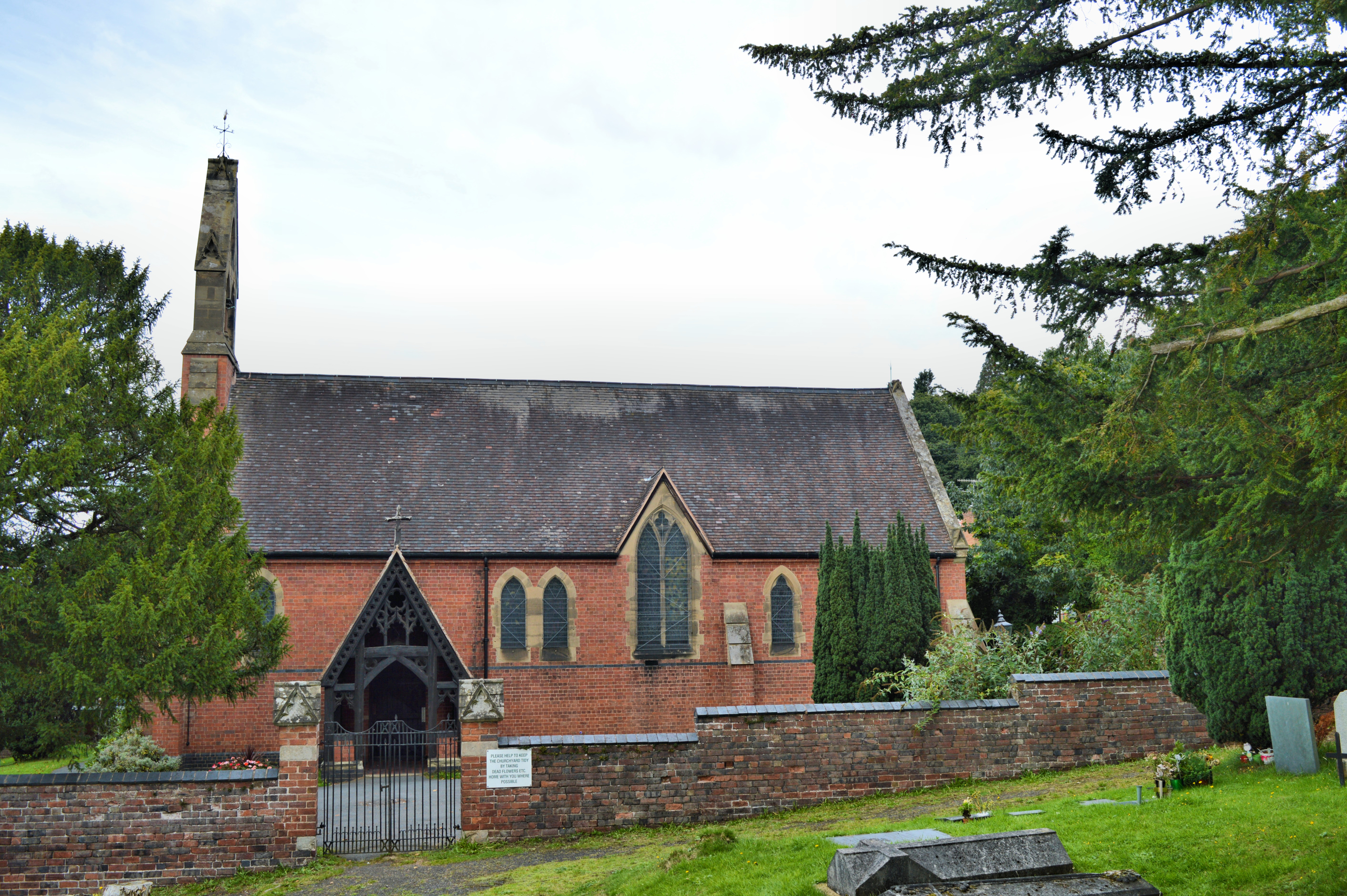
Church of All Saints, Wilden

All Saints Church in Wilden, Worcestershire about one mile to the north east of Stourport. It was designed by William Hopkins with funds provided by Alfred...

Wilden, Worcestershire

Wilden is a small village about 1 mile north east of Stourport-on-Severn, Worcestershire. It is in the Stour valley and both the River Stour and the Staffordshire...

Nearby Amenities

Located within 500m of 52.334481,-2.2275028
Hartlebury
Place: village
Source: NPE
Wikidata: Q2256121
Lat/Long: 52.3357637/-2.2343446
Hartlebury
Public Transport: stop_position
Railway: stop
Train: yes
Lat/Long: 52.3343387/-2.2210254
Bus Stop
The Birches
Bus: yes
Naptan AtcoCode: 2000G048400
Naptan Bearing: N
Naptan CommonName: The Birches
Naptan Indicator: adj
Naptan NaptanCode: wocdpawp
Naptan PlusbusZoneRef: KDRMNST
Naptan Street: Worcester Road
Naptan Verified: no
Public Transport: platform
Shelter: yes
Source: naptan_import
Lat/Long: 52.3351632/-2.2275491
Bus Stop
The Birches
Bus: yes
Naptan AtcoCode: 2000G048401
Naptan Bearing: S
Naptan CommonName: The Birches
Naptan Indicator: opp
Naptan NaptanCode: wocdpawt
Naptan PlusbusZoneRef: KDRMNST
Naptan Street: Worcester Road
Naptan Verified: no
Public Transport: platform
Source: naptan_import
Lat/Long: 52.3356048/-2.2272784
Rail Station
Naptan AtcoCode: 2000G167900
Naptan Bearing: W
Naptan BusStopType: CUS
Naptan CommonName: Rail Station
Naptan Indicator: adj
Naptan NaptanCode: wocdjdpm
Naptan PlusbusZoneRef: KDRMNST
Naptan Street: Station Road
Naptan Verified: no
Source: naptan_import
Lat/Long: 52.3347475/-2.2210657
Bus Stop
Hartlebury- A449 South Bound
Bus: yes
Naptan AtcoCode: 2000G502434
Naptan Bearing: S
Naptan CommonName: Hartlebury- A449 South Bound
Naptan Indicator: Adj
Naptan Landmark: Hartlebury
Naptan NaptanCode: wocgmgtw
Naptan PlusbusZoneRef: KDRMNST
Naptan Street: Worcester Road
Naptan Verified: no
Public Transport: platform
Source: naptan_import
Lat/Long: 52.3353991/-2.2260468
Bus Stop
Elmfield Road
Bus: yes
Naptan AtcoCode: 2000G782345
Naptan Bearing: N
Naptan CommonName: Elmfield Road
Naptan Crossing: Elmfield Road
Naptan Indicator: adj
Naptan NaptanCode: wocdjadj
Naptan PlusbusZoneRef: KDRMNST
Naptan Street: Old Worcester Road
Naptan Verified: no
Public Transport: platform
Source: naptan_import
Lat/Long: 52.3313452/-2.2302966
Bus Stop
Elmfield Road
Bus: yes
Naptan AtcoCode: 2000G782347
Naptan Bearing: S
Naptan CommonName: Elmfield Road
Naptan Crossing: Elmfield Road
Naptan Indicator: opp
Naptan NaptanCode: wocgmwtm
Naptan PlusbusZoneRef: KDRMNST
Naptan Street: Old Worcester Road
Naptan Verified: no
Public Transport: platform
Source: naptan_import
Lat/Long: 52.331021/-2.2305443
Hartlebury
Railway: level_crossing
Lat/Long: 52.3347793/-2.2211711
Hartlebury Stores
Shop: convenience
Source: OS OpenData StreetView
Lat/Long: 52.3343928/-2.2276867
Post Box
Collection Plate: CP1
Collection Times: Mo-Fr 18:30; Sa 09:00
Historic Operator: Post Office
Post Box Type: pillar
Ref: DY11 51
Royal Cypher: EIIR
Royal Cypher Wikidata: Q33102113
Source: survey;gps
Lat/Long: 52.3344428/-2.2276396
Post Box
Collection Plate: CP1
Collection Times: Mo-Fr 18:30; Sa 09:00
Historic Operator: Post Office
Post Box Type: wall
Ref: DY11 46
Royal Cypher: EIIR
Royal Cypher Wikidata: Q33102113
Source: survey;gps
Lat/Long: 52.3345937/-2.2213055
Hartlebury
Public Transport: stop_position
Railway: stop
Train: yes
Lat/Long: 52.3343369/-2.221076
Hartlebury
Railway: level_crossing
Lat/Long: 52.3347766/-2.2212187
Post Office
Hartlebury Post Office
Addr City: Kidderminster
Addr Housename: Hartlebury Stores
Addr Postcode: DY11 7TA
Addr Street: Inn Lane
Addr Village: Hartlebury
Brand: Post Office
Brand Wikidata: Q1783168
Opening Hours Post Office: Mo-Fr 08:30-18:00; Sa 08:30-12:30
Ref Pol Id: 9783
Source: pol_branch_list_2018-02
Website: https://www.postoffice.co.uk/branch-finder/2492083/hartlebury
Lat/Long: 52.3344105/-2.2276873
Hartlebury
Naptan AtcoCode: 9100HBRY
Network: National Rail
Network Website: https://www.nationalrail.co.uk/stations/hby/
Network Wikidata: Q26334
Public Transport: station
Railway: station
Ref Crs: HBY
Source: NPE
Wikidata: Q3403532
Wikipedia: en:Hartlebury railway station
Lat/Long: 52.3344413/-2.2210855
Generator Method: photovoltaic
Generator Output Electricity: yes
Generator Source: solar
Generator Type: solar_photovoltaic_panel
Location: roof
Power: generator
Lat/Long: 52.3315726/-2.2329524
Generator Method: photovoltaic
Generator Output Electricity: yes
Generator Source: solar
Generator Type: solar_photovoltaic_panel
Location: roof
Power: generator
Lat/Long: 52.3322168/-2.2333333
Generator Method: photovoltaic
Generator Output Electricity: yes
Generator Source: solar
Generator Type: solar_photovoltaic_panel
Location: roof
Power: generator
Lat/Long: 52.3350015/-2.2304311
Barrier: lift_gate
Lat/Long: 52.3347814/-2.2211159
Barrier: lift_gate
Lat/Long: 52.3347738/-2.2212653
Bench
Lat/Long: 52.3350749/-2.2272851
Bench
Lat/Long: 52.3324213/-2.2287356
The data included in this document is from www.openstreetmap.org. The data is made available under ODbL.

Have you been to Hartlebury?

Leave your review of Hartlebury below (or comments, questions and feedback).