Bull Brae

Downs, Moorland in Yorkshire Harrogate

England

Bull Brae

Lofthouse, Haver Close Haver Close is an upland farm near Lofthouse in Nidderdale. This south-east facing wall of a stone barn is situated on the east of the farm track. There is a very clear bench mark cut into the gable end of the barn.
Lofthouse, Haver Close Credit: Mel Towler

Bull Brae is a picturesque area located in the county of Yorkshire, England. Situated amidst the stunning landscapes of the Yorkshire Downs and Moorland, it offers visitors a unique blend of natural beauty and rural charm.

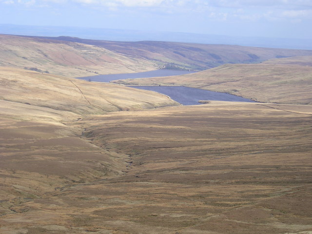
The area is known for its rolling hills, expansive moors, and breathtaking vistas. The Yorkshire Downs, with their lush green meadows and scattered grazing livestock, create a serene and idyllic setting for those who enjoy exploring the great outdoors. Hikers and nature enthusiasts are drawn to the numerous walking trails that meander through the Downs, offering opportunities to discover hidden valleys, ancient woodlands, and babbling brooks.

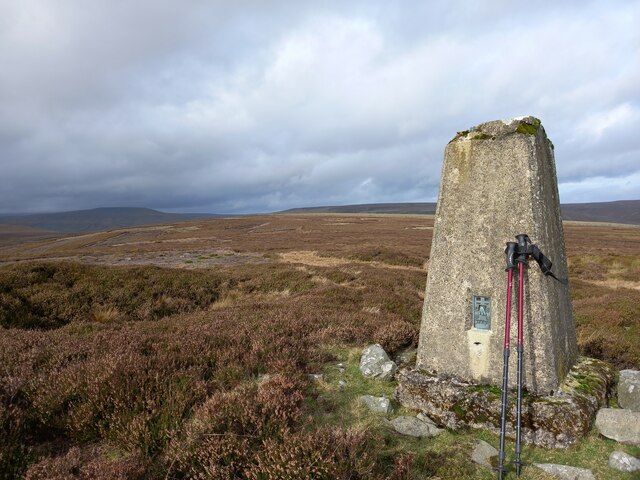
In contrast to the Downs, the Moorland of Bull Brae presents a more rugged and wild landscape. Here, visitors can witness the untamed beauty of heather-covered hills and vast expanses of open moor, dotted with stone ruins and remnants of the area's rich history. The Moorland is home to various wildlife species, including the iconic Yorkshire grouse, adding to the area's natural allure.

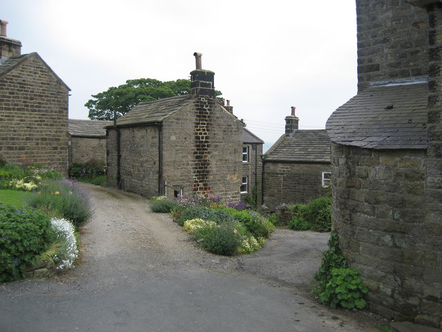
Aside from its natural wonders, Bull Brae also offers a glimpse into the region's heritage. The surrounding villages and hamlets boast charming stone cottages, quaint country pubs, and quaint tea rooms. Visitors can immerse themselves in the local culture, enjoying traditional Yorkshire fare and engaging in friendly conversations with the welcoming locals.

In conclusion, Bull Brae in Yorkshire is a captivating destination that showcases the best of England's countryside. With its stunning landscapes, rich history, and warm hospitality, it beckons visitors to explore its hidden treasures and create lasting memories.

If you have any feedback on the listing, please let us know in the comments section below.
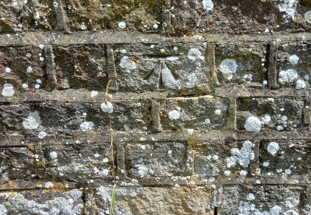
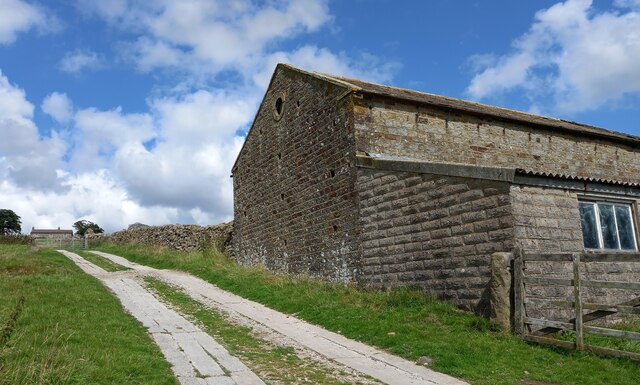
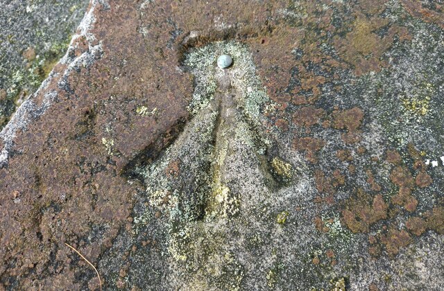
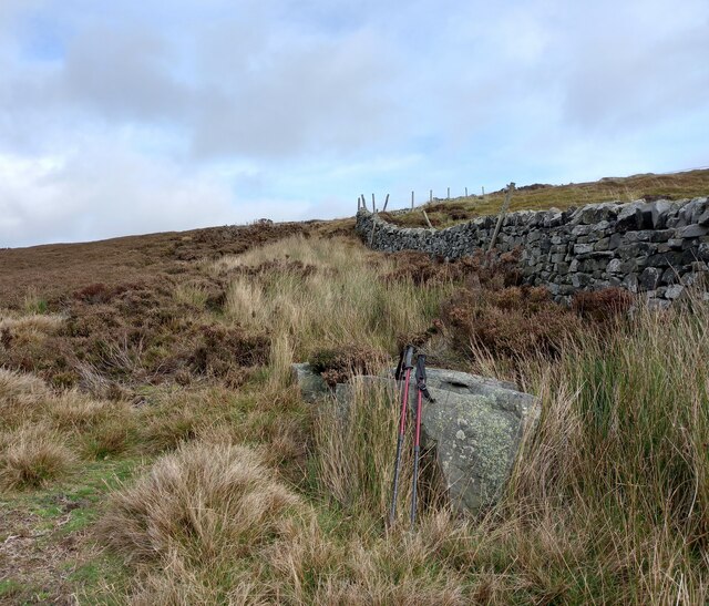
Bull Brae Images

Images are sourced within 2km of 54.193813/-1.8695676 or Grid Reference SE0877. Thanks to Geograph Open Source API. All images are credited.

Lofthouse, Haver Close Haver Close is an upland farm near Lofthouse in Nidderdale. This south-east facing wall of a stone barn is situated on the east of the farm track. There is a very clear bench mark cut into the gable end of the barn.
Lofthouse, Haver Close
Haver Close is an upland farm near Lofthouse in Nidderdale. This south-east facing wall of a stone barn is situated on the east of the farm track. There is a very clear bench mark cut into the gable end of the barn.
Lofthouse, Haver Close A wider angle showing the farm Haver Close in the distance, at the top of the farm track. This stone barn is on the eastern side of the farm track. Cut into the gable end of the barn is a very clear benchmark. It is between 2 and 3 feet from ground level.
Lofthouse, Haver Close
A wider angle showing the farm Haver Close in the distance, at the top of the farm track. This stone barn is on the eastern side of the farm track. Cut into the gable end of the barn is a very clear benchmark. It is between 2 and 3 feet from ground level.
Nidderdale, track to Rain Stang trig point The rivet benchmark is cut into a boulder which is on the right of a poorly defined path from the bridleway to the trig point at Rain Stang.
Nidderdale, track to Rain Stang trig point
The rivet benchmark is cut into a boulder which is on the right of a poorly defined path from the bridleway to the trig point at Rain Stang.
Nidderdale, path to trig point at Rain Stang There is a rivet benchmark cut into a boulder which is on the right of a poorly defined path from the bridleway to the trig point at Rain Stang.
Nidderdale, path to trig point at Rain Stang
There is a rivet benchmark cut into a boulder which is on the right of a poorly defined path from the bridleway to the trig point at Rain Stang.
Middlesmoor, Rain Stang Trig Point The OS Flush Bracket S7707 is embedded into the Rain Stang Trig Point above Middlesmoor at the top of Nidderdale.
Middlesmoor, Rain Stang Trig Point
The OS Flush Bracket S7707 is embedded into the Rain Stang Trig Point above Middlesmoor at the top of Nidderdale.
Nidderdale, Rain Stang Trig Point There is some damage to the trig point. In the far distance is Gowthwaite Reservoir.
Nidderdale, Rain Stang Trig Point
There is some damage to the trig point. In the far distance is Gowthwaite Reservoir.
Nidderdale, Rain Stang Trig Point The OS Flush Bracket S7707 is embedded into the Rain Stang Trig Point above Middlesmoor at the top of Nidderdale. There is some damage to the top of the trig point. Excellent views, N, S, E and W across the heather moorlands.
Nidderdale, Rain Stang Trig Point
The OS Flush Bracket S7707 is embedded into the Rain Stang Trig Point above Middlesmoor at the top of Nidderdale. There is some damage to the top of the trig point. Excellent views, N, S, E and W across the heather moorlands.
Woo Gill Woo Gill joins the River Nidd below Scar House Dam having flowed down from Woogill Tarn on the Nidderdale / Coverdale watershed. In fact the O.S. map seem to show that Woogill Tarn is the source of streams which flow into both valleys from outlets to the North (to Coverdale) and South (to Nidderdale)
Woo Gill
Woo Gill joins the River Nidd below Scar House Dam having flowed down from Woogill Tarn on the Nidderdale / Coverdale watershed. In fact the O.S. map seem to show that Woogill Tarn is the source of streams which flow into both valleys from outlets to the North (to Coverdale) and South (to Nidderdale)
Stone Pillar This Stone Pillar overlooks Woo Gill and is a fine viewpoint for Upper Nidderdale.
The Hill in the background is Great Haw on the ridge of high ground separating Coverdale and Nidderdale.
Stone Pillar
This Stone Pillar overlooks Woo Gill and is a fine viewpoint for Upper Nidderdale. The Hill in the background is Great Haw on the ridge of high ground separating Coverdale and Nidderdale.
Pillar on Rain stang. Summit of In moor.
Pillar on Rain stang.
Summit of In moor.
Shooting box. Great shelter in bad weather.
Shooting box.
Great shelter in bad weather.
Heather moorland above Nidderdale. Looking back to Scarhouse reservoir.
Heather moorland above Nidderdale.
Looking back to Scarhouse reservoir.
Trig point on Rain Stang Hill Rain Stang Hill is part of In Moor in upper Nidderdale. The heather moor beyond the trig point gives way to the gulf occupied by Scar House Reservoir; further on and left of the pillar is the hill, Little Whernside.
Trig point on Rain Stang Hill
Rain Stang Hill is part of In Moor in upper Nidderdale. The heather moor beyond the trig point gives way to the gulf occupied by Scar House Reservoir; further on and left of the pillar is the hill, Little Whernside.
Ordnance Survey Cut Mark This mark can be found on a bridge over the River Nidd near New Houses.
For more detail see : <span class="nowrap"><a title="http://www.bench-marks.org.uk/bm43137" rel="nofollow ugc noopener" href="http://www.bench-marks.org.uk/bm43137">Link</a><img style="margin-left:2px;" alt="External link" title="External link - shift click to open in new window" src="https://s1.geograph.org.uk/img/external.png" width="10" height="10"/></span>
Ordnance Survey Cut Mark
This mark can be found on a bridge over the River Nidd near New Houses. For more detail see : LinkExternal link
Ordnance Survey Cut Mark with Pivot This mark can be found on a boulder near Turnacar.
For more detail see : <span class="nowrap"><a title="http://www.bench-marks.org.uk/bm43138" rel="nofollow ugc noopener" href="http://www.bench-marks.org.uk/bm43138">Link</a><img style="margin-left:2px;" alt="External link" title="External link - shift click to open in new window" src="https://s1.geograph.org.uk/img/external.png" width="10" height="10"/></span>
Ordnance Survey Cut Mark with Pivot
This mark can be found on a boulder near Turnacar. For more detail see : LinkExternal link
Ordnance Survey Cut Mark This mark can be found on a gatepost near Firth Plantation.
For more detail see : <span class="nowrap"><a title="http://www.bench-marks.org.uk/bm43139" rel="nofollow ugc noopener" href="http://www.bench-marks.org.uk/bm43139">Link</a><img style="margin-left:2px;" alt="External link" title="External link - shift click to open in new window" src="https://s1.geograph.org.uk/img/external.png" width="10" height="10"/></span>
Ordnance Survey Cut Mark
This mark can be found on a gatepost near Firth Plantation. For more detail see : LinkExternal link
Ordnance Survey Cut Mark This mark can be found on the wall of a barn near High Woodale.
For more detail see : <span class="nowrap"><a title="http://www.bench-marks.org.uk/bm43140" rel="nofollow ugc noopener" href="http://www.bench-marks.org.uk/bm43140">Link</a><img style="margin-left:2px;" alt="External link" title="External link - shift click to open in new window" src="https://s1.geograph.org.uk/img/external.png" width="10" height="10"/></span>
Ordnance Survey Cut Mark
This mark can be found on the wall of a barn near High Woodale. For more detail see : LinkExternal link
Road to the reservoirs Heading along the water board road towards Scar House and Angram reservoirs.
Road to the reservoirs
Heading along the water board road towards Scar House and Angram reservoirs.
Show me another place!

Bull Brae is located at Grid Ref: SE0877 (Lat: 54.193813, Lng: -1.8695676)

Division: West Riding

Administrative County: North Yorkshire

District: Harrogate

Police Authority: North Yorkshire

What 3 Words

///plodding.sailor.inversion. Near Leyburn, North Yorkshire

Related Wikis

Nidderdale Caves

The Nidderdale Caves are a series of caves in Upper Nidderdale in North Yorkshire, England. There are two cave systems and most of the caves are in some...

Nidd Aqueduct

The Nidd Aqueduct is an aqueduct or man-made watercourse in North Yorkshire, England. It feeds water from Angram and Scar House reservoirs in upper Nidderdale...

Scar House Reservoir

Scar House Reservoir is the second of the three reservoirs in Upper Nidderdale, North Yorkshire, England, the others are Angram Reservoir and Gouthwaite...

Middlesmoor

Middlesmoor is a small hill village at the head of Nidderdale in the Harrogate district of North Yorkshire, England. Middlesmoor is the principal settlement...

How Stean Gorge

How Stean Gorge is a limestone gorge in Nidderdale in North Yorkshire, England. It forms a unit of the Upper Nidderdale Site of Special Scientific Interest...

Stean

Stean is a small village in upper Nidderdale in North Yorkshire, England. It is 8 miles (13 km) north of Pateley Bridge. The village is located on Stean...

Skipton and Ripon (UK Parliament constituency)

Skipton and Ripon is a constituency in North Yorkshire represented in the House of Commons of the UK Parliament since 2010 by Julian Smith, a Conservative...

Stonebeck Up

Stonebeck Up is a civil parish in Harrogate district, North Yorkshire, England. The only village in the parish is Middlesmoor. The population of the...

Nearby Amenities

Located within 500m of 54.193813,-1.8695676
Access: yes
Barrier: entrance
Lat/Long: 54.1942226/-1.8625917
old coal pit level
Historic: mine_level
Mineral: coal
Source: OS sheet 100,1856
Source Mineral: OS sheet 100,1856
Lat/Long: 54.1942113/-1.8719107
Hunting Stand
Source: Bing
Lat/Long: 54.1968286/-1.8721521
Hunting Stand
Source: Bing
Lat/Long: 54.1962761/-1.8722218
Hunting Stand
Source: Bing
Lat/Long: 54.1973778/-1.8720877
Hunting Stand
Source: Bing
Lat/Long: 54.1979456/-1.8720072
Woogill Colliery
Historic: mine_shaft
Mineral: coal
Source: OS sheet 100,1856;Bing
Source Mineral: OS sheet 100,1856
Lat/Long: 54.1979052/-1.8708917
old coal pit level
Historic: mine_level
Mineral: coal
Source: OS sheet 100,1856
Source Mineral: OS sheet 100,1856
Lat/Long: 54.1934945/-1.8645756
Access: no
Note: Stone wall blockes Public Bridleway
Lat/Long: 54.1936595/-1.8754175
Information: route_marker
Material: wood
Tourism: information
Lat/Long: 54.1936373/-1.8753126
Power: pole
Lat/Long: 54.189519/-1.8702149
Power: pole
Lat/Long: 54.19004/-1.8700918
Power: pole
Lat/Long: 54.190417/-1.8691306
Power: pole
Lat/Long: 54.1909303/-1.8679312
Power: pole
Lat/Long: 54.1913149/-1.8669936
Power: pole
Lat/Long: 54.1917623/-1.8658911
Power: pole
Lat/Long: 54.1920994/-1.865163
Power: pole
Lat/Long: 54.1921408/-1.8639217
Power: pole
Lat/Long: 54.1921837/-1.8627327
The data included in this document is from www.openstreetmap.org. The data is made available under ODbL.

Have you been to Bull Brae?

Leave your review of Bull Brae below (or comments, questions and feedback).