Carle Fell

Downs, Moorland in Yorkshire Harrogate

England

Carle Fell

Snowed heather tussocks on Great Haw The view east from Great Haw over moorland with the undulating ground of the North Yorks Moors in the distance. The stream groove to the right in the image will be of a tributary of Steel House Gill.
Snowed heather tussocks on Great Haw Credit: Trevor Littlewood

Carle Fell is a picturesque area located in the region of Yorkshire, England. It is situated between the Downs and Moorland, offering a diverse and captivating landscape to visitors.

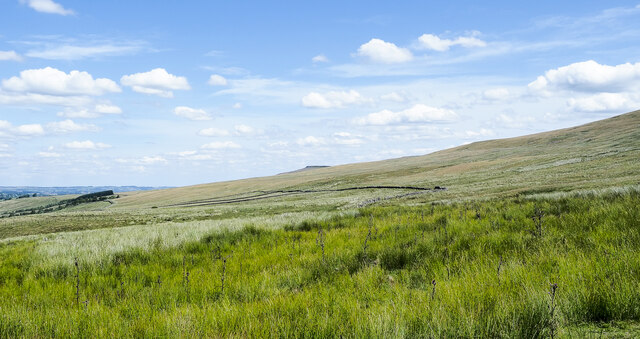
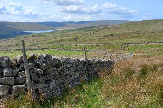
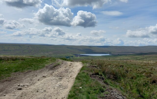
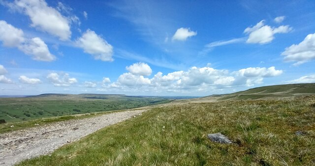
Covering an expanse of rolling hills, Carle Fell is known for its stunning vistas and natural beauty. The area is characterized by lush green meadows, dotted with vibrant wildflowers during the summer months. The Downs, with their gentle slopes, provide an ideal setting for leisurely walks and hikes, offering breathtaking views of the surrounding countryside.

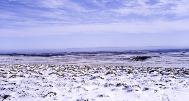
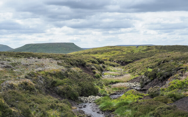
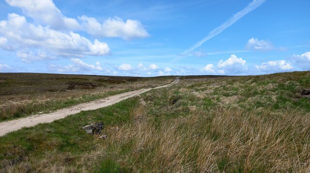
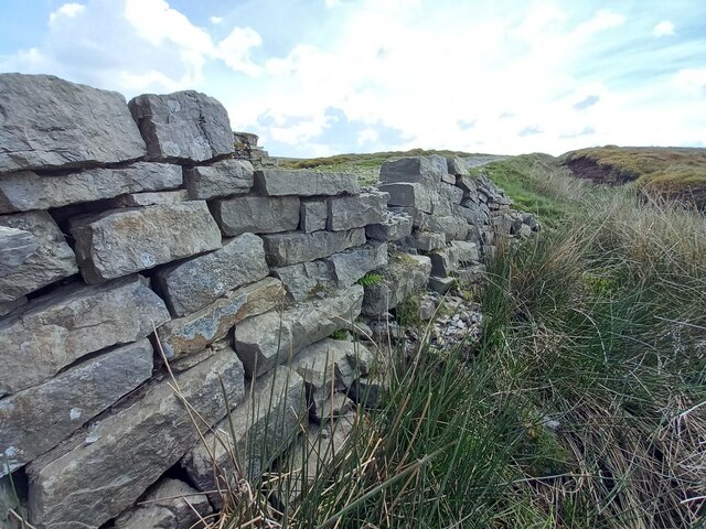
Carle Fell is also renowned for its Moorland, which offers a more rugged and untamed terrain. Here, visitors can explore vast expanses of heather-covered moors, interspersed with rocky outcrops and babbling streams. This unique landscape provides a habitat for various wildlife, including birds of prey, such as kestrels and peregrine falcons, as well as wild grouse.

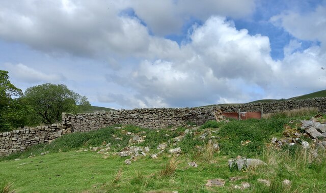
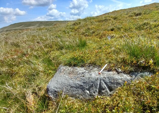
In addition to its natural beauty, Carle Fell boasts a rich history. Ancient stone circles and burial mounds dot the landscape, serving as reminders of the area's past inhabitants. Visitors can immerse themselves in the region's history by exploring these archaeological sites and learning about the people who once called this place home.

For those seeking outdoor adventures, Carle Fell offers a range of activities. From hiking and cycling to birdwatching and photography, there is something for everyone to enjoy. The area is also popular for its camping and caravan sites, providing an opportunity to experience the tranquility of the countryside.

Overall, Carle Fell in Yorkshire is a haven for nature lovers, history enthusiasts, and outdoor adventurers alike. With its breathtaking landscapes and rich cultural heritage, it is a destination that promises a memorable and rewarding experience.

If you have any feedback on the listing, please let us know in the comments section below.
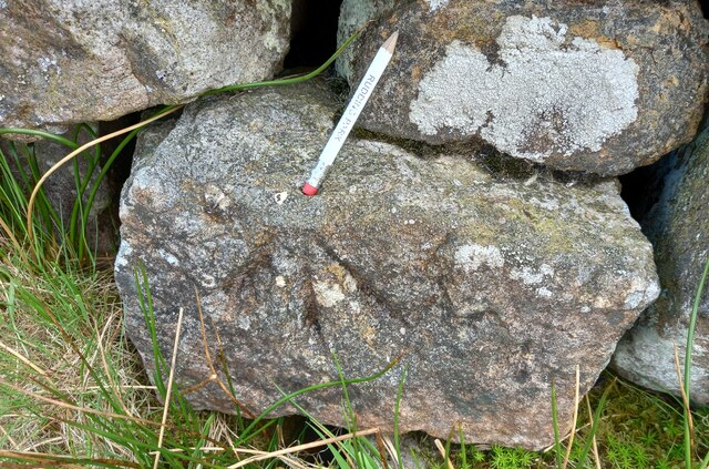
Carle Fell Images

Images are sourced within 2km of 54.205745/-1.905527 or Grid Reference SE0678. Thanks to Geograph Open Source API. All images are credited.

Snowed heather tussocks on Great Haw The view east from Great Haw over moorland with the undulating ground of the North Yorks Moors in the distance. The stream groove to the right in the image will be of a tributary of Steel House Gill.
Snowed heather tussocks on Great Haw
The view east from Great Haw over moorland with the undulating ground of the North Yorks Moors in the distance. The stream groove to the right in the image will be of a tributary of Steel House Gill.
Moorland with Arkleside Pasture Arkleside Pasture is an area of enclosed, marginal farmland on the south side of Coverdale above the small settlement of Arkleside; it lies beyond the rough vegetation in the foreground and the groove of Arkleside Gill which can just be discerned in the image.
Moorland with Arkleside Pasture
Arkleside Pasture is an area of enclosed, marginal farmland on the south side of Coverdale above the small settlement of Arkleside; it lies beyond the rough vegetation in the foreground and the groove of Arkleside Gill which can just be discerned in the image.
Erosion prevention measure on Dead Man's Hill The piles of stones in the peaty gully restrict the flow of water and will retain loosened peat so limiting further erosion. The immediate gully doesn't appear to have been eroded badly but near the centre of the image, beyond the stones, this branch enters a larger and more badly affected channel which should now be defended.
The flat-topped hill in the distance is Little Whernside.
Erosion prevention measure on Dead Man's Hill
The piles of stones in the peaty gully restrict the flow of water and will retain loosened peat so limiting further erosion. The immediate gully doesn't appear to have been eroded badly but near the centre of the image, beyond the stones, this branch enters a larger and more badly affected channel which should now be defended. The flat-topped hill in the distance is Little Whernside.
Benchmark cut into Scar House reservoir parapet The benchmark is cut into the west parapet, at the north end, and the mark faces west. Wider view <a href="https://www.geograph.org.uk/photo/7555639">SE0677 : North end of dam of Scar House Reservoir, Nidderdale</a>
Benchmark cut into Scar House reservoir parapet
The benchmark is cut into the west parapet, at the north end, and the mark faces west. Wider view SE0677 : North end of dam of Scar House Reservoir, Nidderdale
North end of dam of Scar House Reservoir, Nidderdale There is a benchmark cut into the west parapet, at the north end, and the mark faces west. Closer view <a href="https://www.geograph.org.uk/photo/7555637">SE0677 : Benchmark cut into Scar House reservoir parapet</a>
North end of dam of Scar House Reservoir, Nidderdale
There is a benchmark cut into the west parapet, at the north end, and the mark faces west. Closer view SE0677 : Benchmark cut into Scar House reservoir parapet
Carle Fell Road, Scar House Reservoir According to the OS benchmark database there is a benchmark cut into a wall on the north side of the track at this location. The wall has gone, and the benchmark.
Carle Fell Road, Scar House Reservoir
According to the OS benchmark database there is a benchmark cut into a wall on the north side of the track at this location. The wall has gone, and the benchmark.
Carle Fell Road, Scar House Reservoir According to the OS benchmark database there is a benchmark cut into a gatepost to the north of the track at this location. The gatepost and most of the wall has gone.
Carle Fell Road, Scar House Reservoir
According to the OS benchmark database there is a benchmark cut into a gatepost to the north of the track at this location. The gatepost and most of the wall has gone.
Carle Fell Road and Scar House Reservoir According to the OS benchmark database there is a benchmark with a rivet cut into the wall on the north side of the track at this location. Nothing was found.
Carle Fell Road and Scar House Reservoir
According to the OS benchmark database there is a benchmark with a rivet cut into the wall on the north side of the track at this location. Nothing was found.
Benchmark cut into gatepost, Scar House Reservoir The benchmark is cut into a disused stone gatepost on the north side of the reservoir. Wider view <a href="https://www.geograph.org.uk/photo/7556048">SE0577 : Carle Fell Road, Scar House Reservoir</a>
Benchmark cut into gatepost, Scar House Reservoir
The benchmark is cut into a disused stone gatepost on the north side of the reservoir. Wider view SE0577 : Carle Fell Road, Scar House Reservoir
Carle Fell Road, Scar House Reservoir There is a benchmark cut into the disused stone gatepost on the north side of the reservoir. Closer view <a href="https://www.geograph.org.uk/photo/7556045">SE0577 : Benchmark cut into gatepost, Scar House Reservoir</a>
Carle Fell Road, Scar House Reservoir
There is a benchmark cut into the disused stone gatepost on the north side of the reservoir. Closer view SE0577 : Benchmark cut into gatepost, Scar House Reservoir
Remains of demolished barn, Scar House Reservoir According to the 1910 map there was a benchmark cut into a field barn at this location. Today only the tumbled remains of the building are left.
Remains of demolished barn, Scar House Reservoir
According to the 1910 map there was a benchmark cut into a field barn at this location. Today only the tumbled remains of the building are left.
Benchmark cut into drystone wall, Nidderdale The pivot benchmark is cut into the drystone wall on the north side of the track which leads from Scar House Reservoir to Horsehouse. Wider view <a href="https://www.geograph.org.uk/photo/7556212">SE0477 : Across the moorland to Angram Reservoir</a>
Benchmark cut into drystone wall, Nidderdale
The pivot benchmark is cut into the drystone wall on the north side of the track which leads from Scar House Reservoir to Horsehouse. Wider view SE0477 : Across the moorland to Angram Reservoir
Across the moorland to Angram Reservoir There is a pivot benchmark cut into the drystone wall on the north side of the track which leads from Scar House Reservoir to Horsehouse. In the distance is Angram Reservoir. Closer view <a href="https://www.geograph.org.uk/photo/7556211">SE0477 : Benchmark cut into drystone wall, Nidderdale</a>
Across the moorland to Angram Reservoir
There is a pivot benchmark cut into the drystone wall on the north side of the track which leads from Scar House Reservoir to Horsehouse. In the distance is Angram Reservoir. Closer view SE0477 : Benchmark cut into drystone wall, Nidderdale
Track leading from Scar House to Horsehouse According to the 1910 map there was a benchmark at this location, and likely cut into a boulder or stone alongside the track. Nothing was found.
Track leading from Scar House to Horsehouse
According to the 1910 map there was a benchmark at this location, and likely cut into a boulder or stone alongside the track. Nothing was found.
Track leading from Scar House to Horsehouse, Nidderdale According to the 1910 map there was a benchmark cut at this location. No suitable features were found for a benchmark.
Track leading from Scar House to Horsehouse, Nidderdale
According to the 1910 map there was a benchmark cut at this location. No suitable features were found for a benchmark.
West parapet of bridge near Little Whernside According to the OS benchmark database there is a benchmark cut into the west face of the bridge, and on the north side of the stream. The bridge has gone through several repairs and refits, and nothing was found.
West parapet of bridge near Little Whernside
According to the OS benchmark database there is a benchmark cut into the west face of the bridge, and on the north side of the stream. The bridge has gone through several repairs and refits, and nothing was found.
Pivot benchmark cut into boulder on moorland, Nidderdale The pivot benchmark is cut into a large boulder on the east side of the track which leads from Scar House reservoir to Horsehouse in Coverdale. Wider view <a href="https://www.geograph.org.uk/photo/7557646">SE0478 : Views to Coverdale</a>
Pivot benchmark cut into boulder on moorland, Nidderdale
The pivot benchmark is cut into a large boulder on the east side of the track which leads from Scar House reservoir to Horsehouse in Coverdale. Wider view SE0478 : Views to Coverdale
Views to Coverdale There is a pivot benchmark cut into the large boulder on the east side of the track which leads from Scar House reservoir to Horsehouse in Coverdale. Closer view <a href="https://www.geograph.org.uk/photo/7557645">SE0478 : Pivot benchmark cut into boulder on moorland, Nidderdale</a>
Views to Coverdale
There is a pivot benchmark cut into the large boulder on the east side of the track which leads from Scar House reservoir to Horsehouse in Coverdale. Closer view SE0478 : Pivot benchmark cut into boulder on moorland, Nidderdale
Show me another place!

Carle Fell is located at Grid Ref: SE0678 (Lat: 54.205745, Lng: -1.905527)

Division: West Riding

Administrative County: North Yorkshire

District: Harrogate

Police Authority: North Yorkshire

What 3 Words

///dialects.pound.stripped. Near Leyburn, North Yorkshire

Nearby Locations

Carle Fell

Related Wikis

Scar House Reservoir

Scar House Reservoir is the second of the three reservoirs in Upper Nidderdale, North Yorkshire, England, the others are Angram Reservoir and Gouthwaite...

Nidd Aqueduct

The Nidd Aqueduct is an aqueduct or man-made watercourse in North Yorkshire, England. It feeds water from Angram and Scar House reservoirs in upper Nidderdale...

Horsehouse

Horsehouse is a village in Coverdale in the Yorkshire Dales, North Yorkshire, England. It is listed as a hamlet in many texts, but the presence of the...

Braidley

Braidley is a hamlet in Coverdale in the Yorkshire Dales, England. It lies in the civil parish of Carlton Highdale in the Richmondshire district of North...

Have you been to Carle Fell?

Leave your review of Carle Fell below (or comments, questions and feedback).